English II 2020
The Ministry of Environment created a national land cover map to encourage effective land management and environment-friendly land usage. The map is constructed with data collected from satellites and aircrafts; in particular, information compiled by the Korea Multi-Purpose Satellite (KOMPSAT) has widely been used for mapping land cover types.
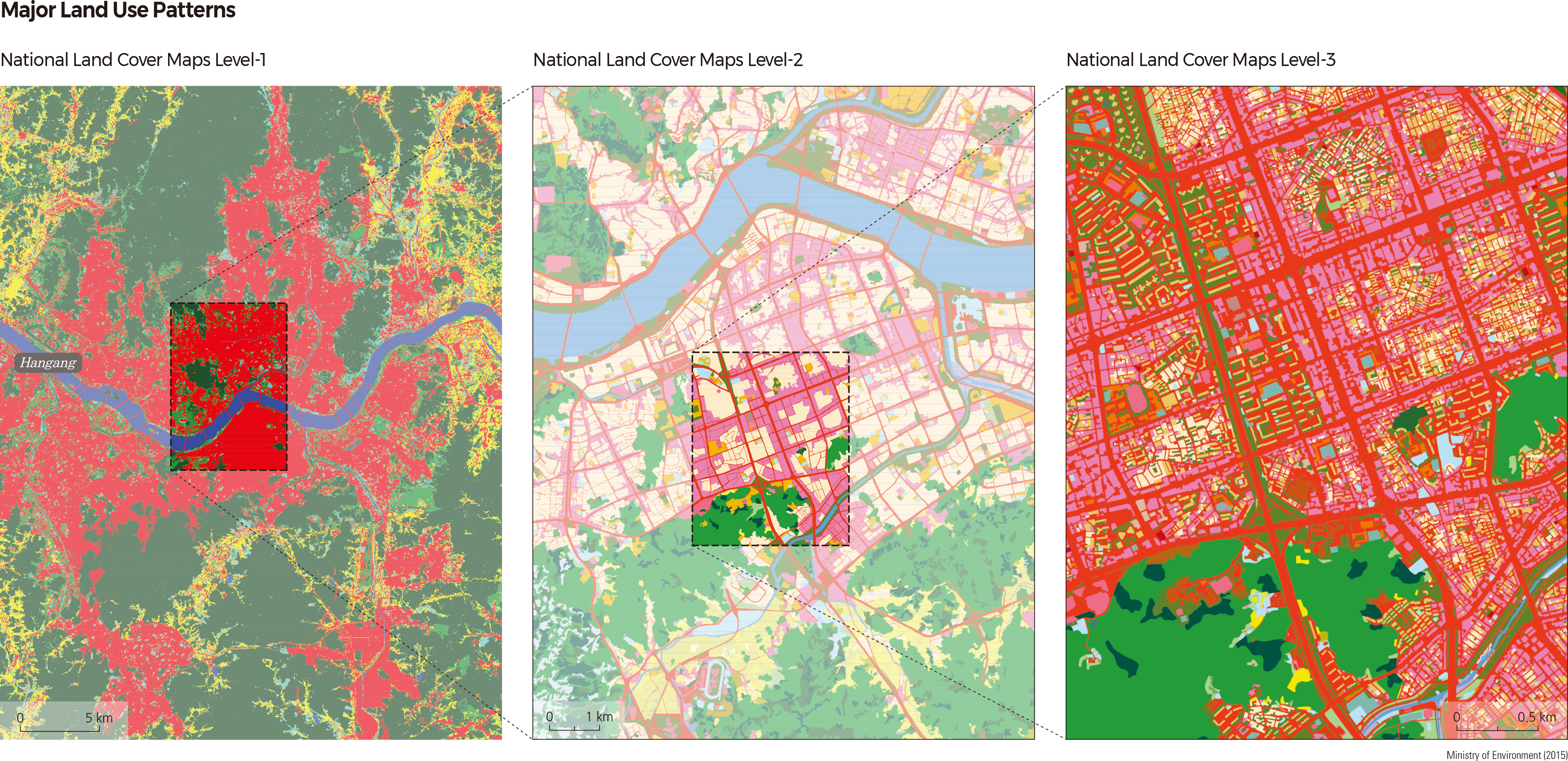
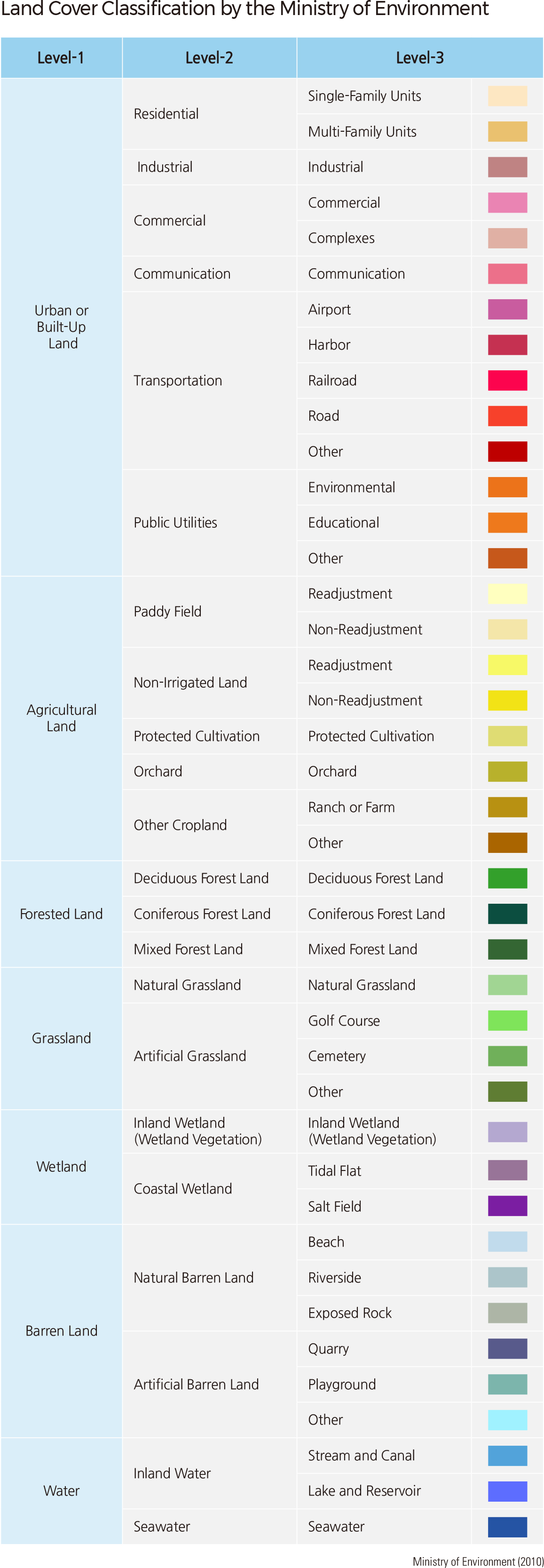
The national land cover map consists of three levels. The national land cover map is available to the public through the Environmental Geographic Information Service (http://egis.me.go.kr). The levelone land cover map includes the entirety of the Korean Peninsula and incorporates seven land cover types. The level-two land cover map consists of 22 land cover types. The level-two map is useful for identifying the status of land use at a regional scale. It is also utilized for calculating the size of impervious areas and canopies to estimate streamflow. Additionally, it contributes to research for urban development and expansion, location selection for various facilities, and evaluation of potential natural hazards.
The level-three land cover map includes 41 types of land cover. This map analyzes land use at a local level within cities, districts, and provinces, and is particularly useful for biotope evaluation, assessment of green space in cities, and community mapping.
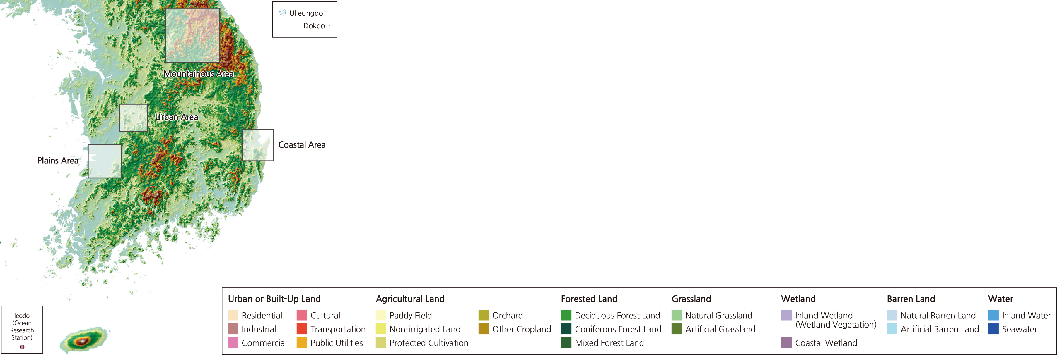
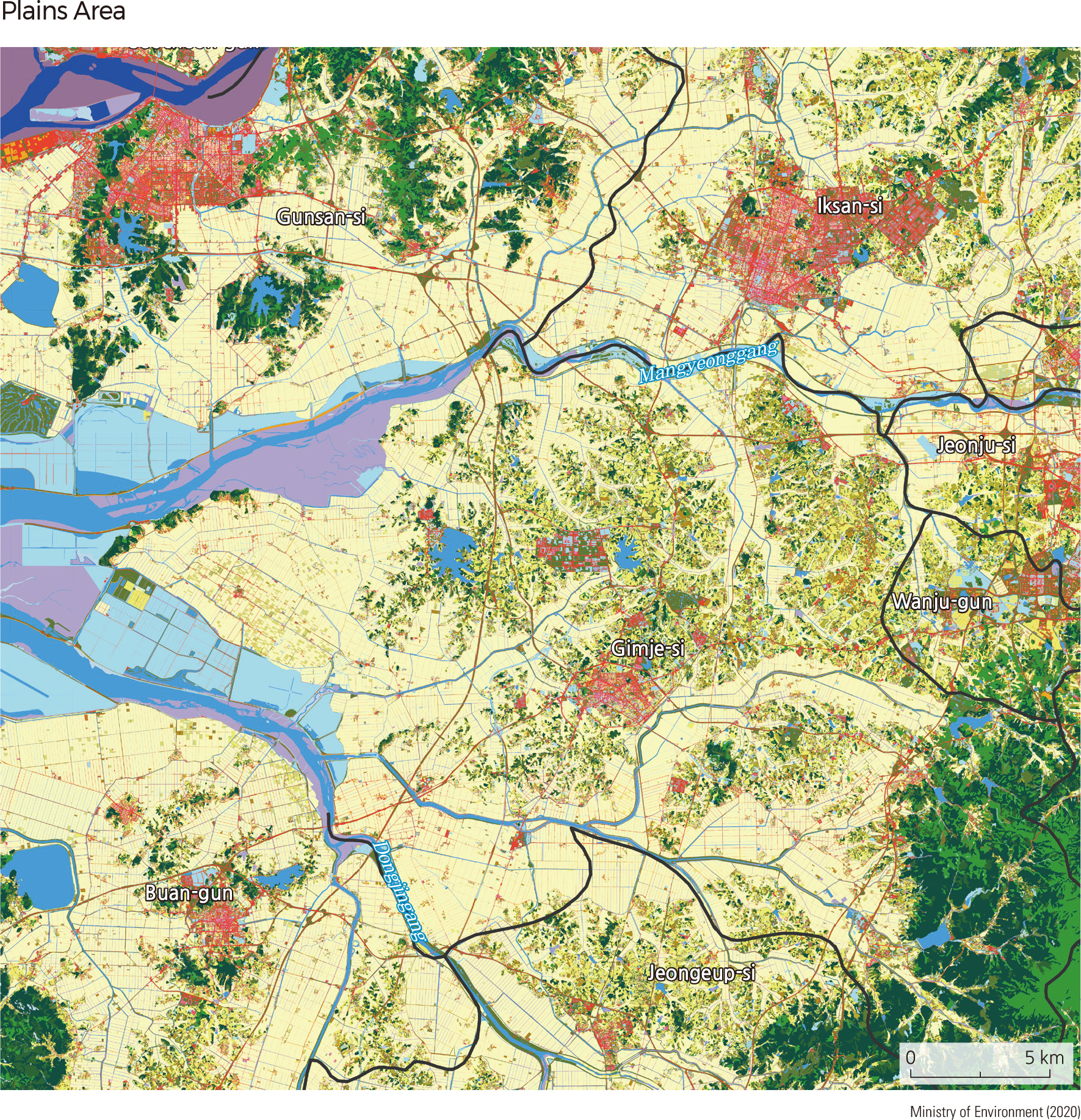
Korea's major grain belts can be found across Mangyeong-pyeongya and Gimjepyeongya. Collectively known as Honam-pyeongya, these alluvial plains are located in the lower regions of Mangyeonggang and Dongjingang. Located at the center of the plains is Gimje-si, which has the highest ratio of agricultural area among all local governments of Korea. Plains situated near streams or rivers are usually used as rice paddies, while forests and urban or developed areas are located on the hills.
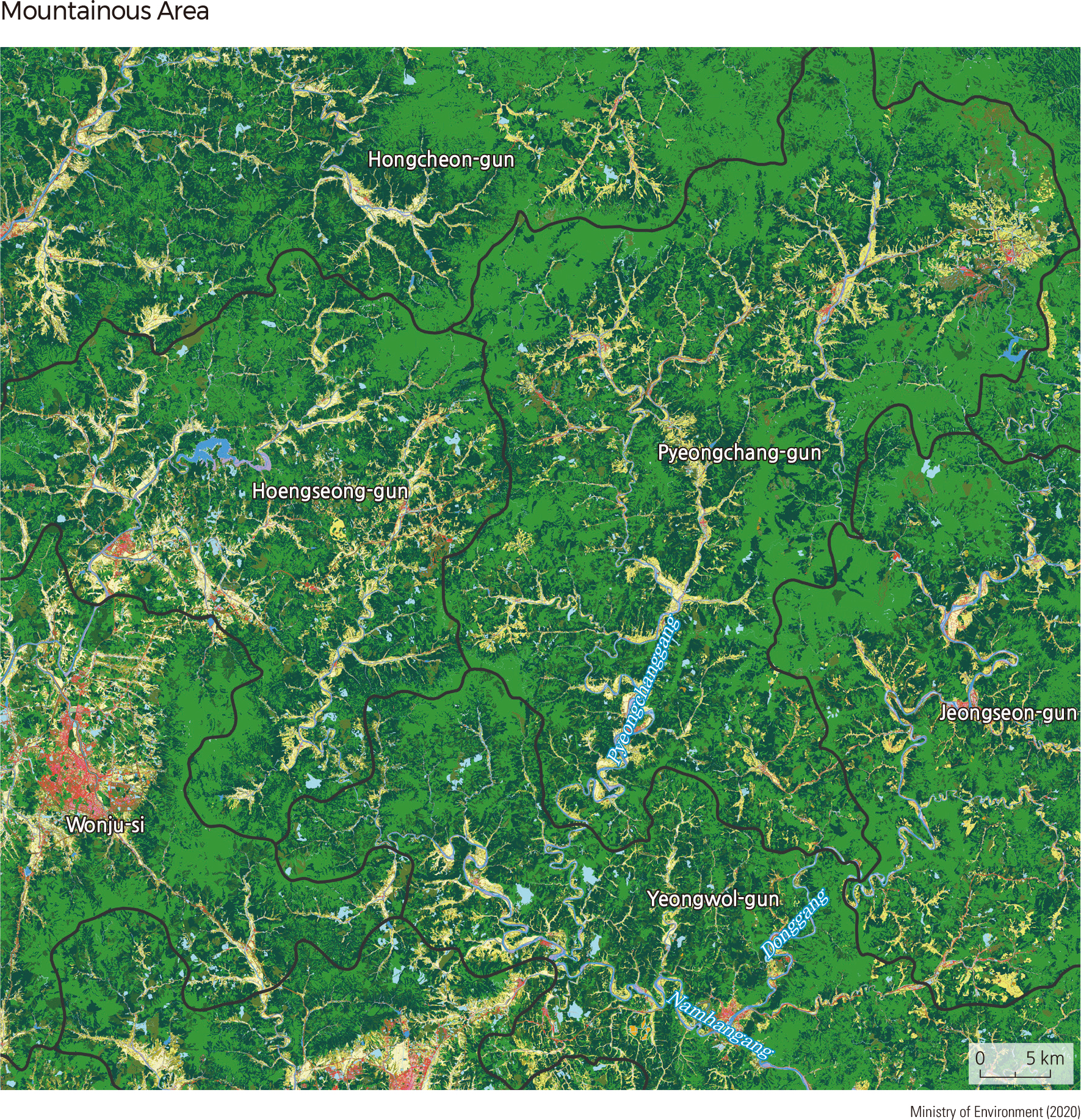
The northeastern part of South Korea consists of Taebaek-sanmaek and its surrounding mountainous areas. Cropland and roads have been developed along the many streams that run between the mountains. Although such geomorphological features make these areas difficult to access, they are also considered ideal vacation destinations due to their clean mountains and creeks. Furthermore, high plantation surfaces located 1,000 m above sea level are widely used for vegetable fields and pastures.
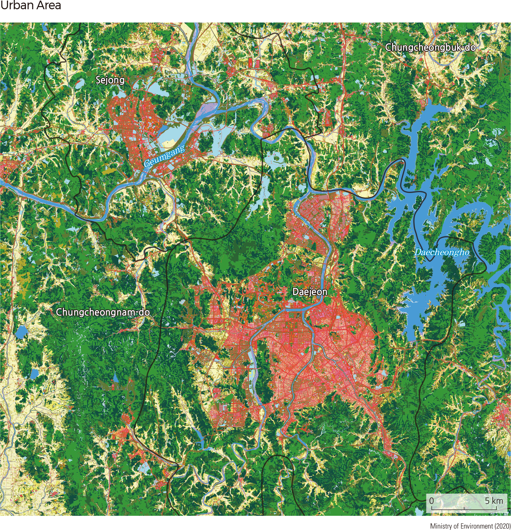
Many cities such as Seoul, Chuncheon-si, Hongcheon-gun, Wonju-si, and Daejeon developed in erosional basins near large, flowing rivers. Due to the availability of water from rivers and underground sources along with a natural drainage system, these regions are typically seen as suitable locations for human habitation. Alluvial plains are also highly populated, as they possess fertile soil that is advantageous for farming.
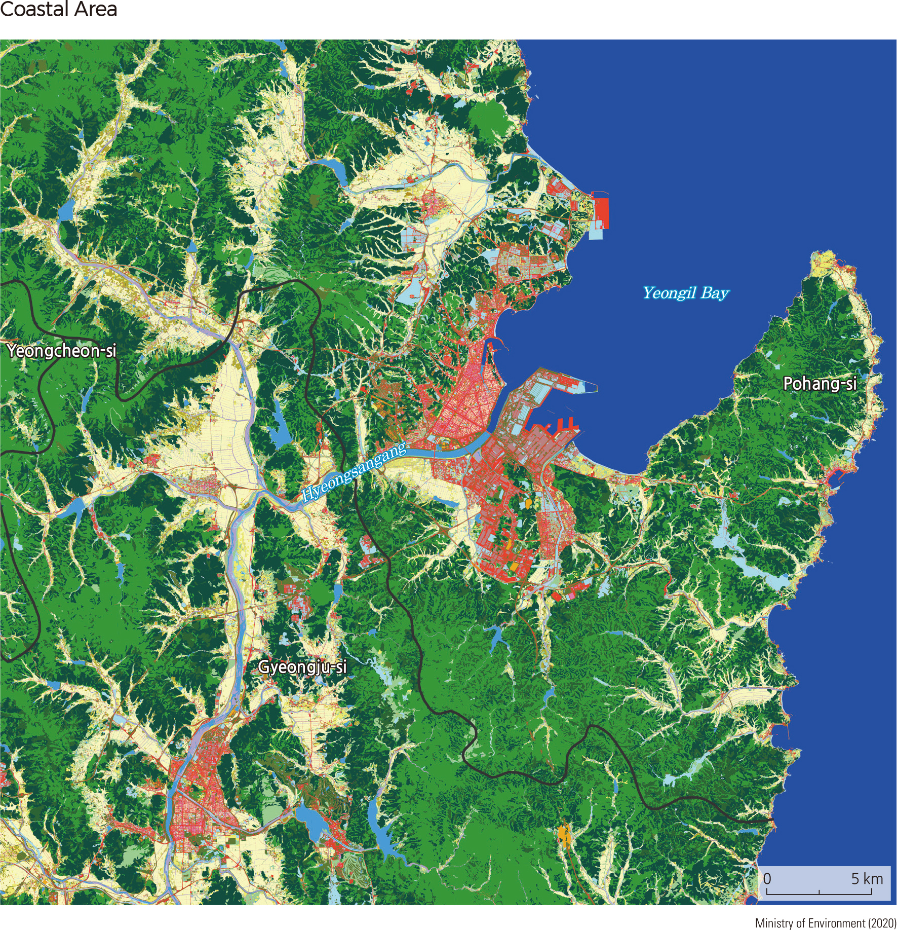
Taebaeksanmaek runs parallel to the east coast, resulting in narrow coastal plains and small-scale ports. Wider plains can be found in areas where rivers flow into the sea. Since the 1970s, Pohang-si—a relatively wide urban area near Yeongil Bay—has been one of Korea's major steel industrial centers. |