English II 2020
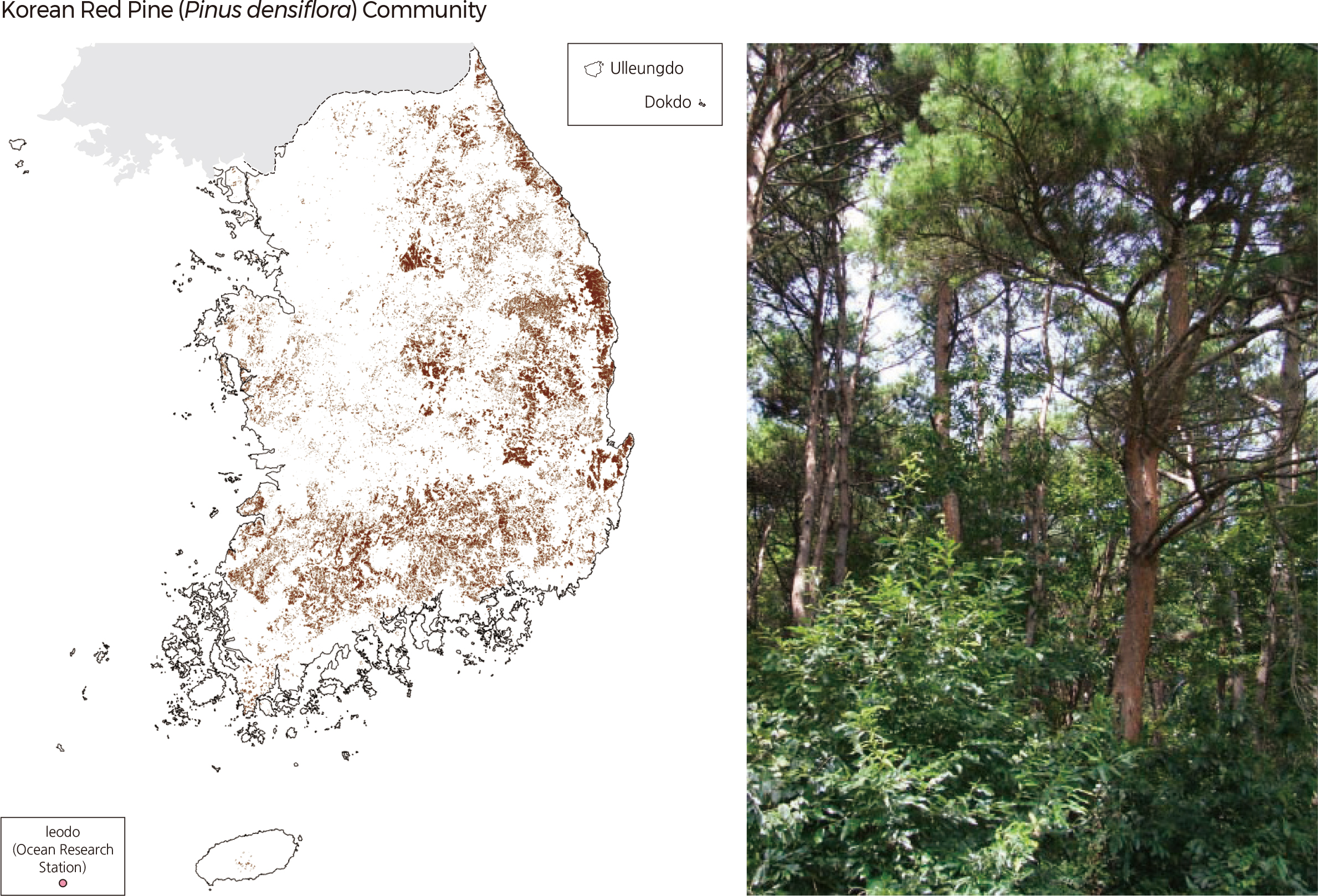
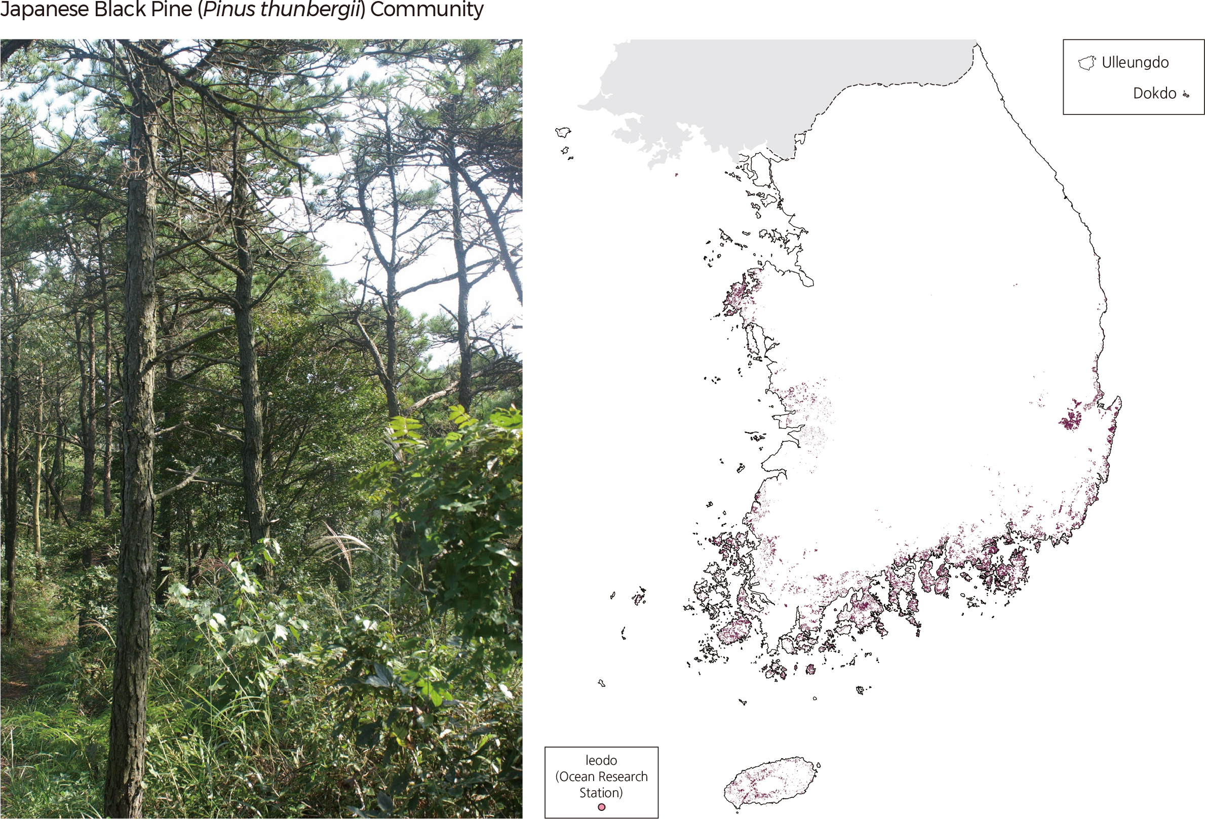
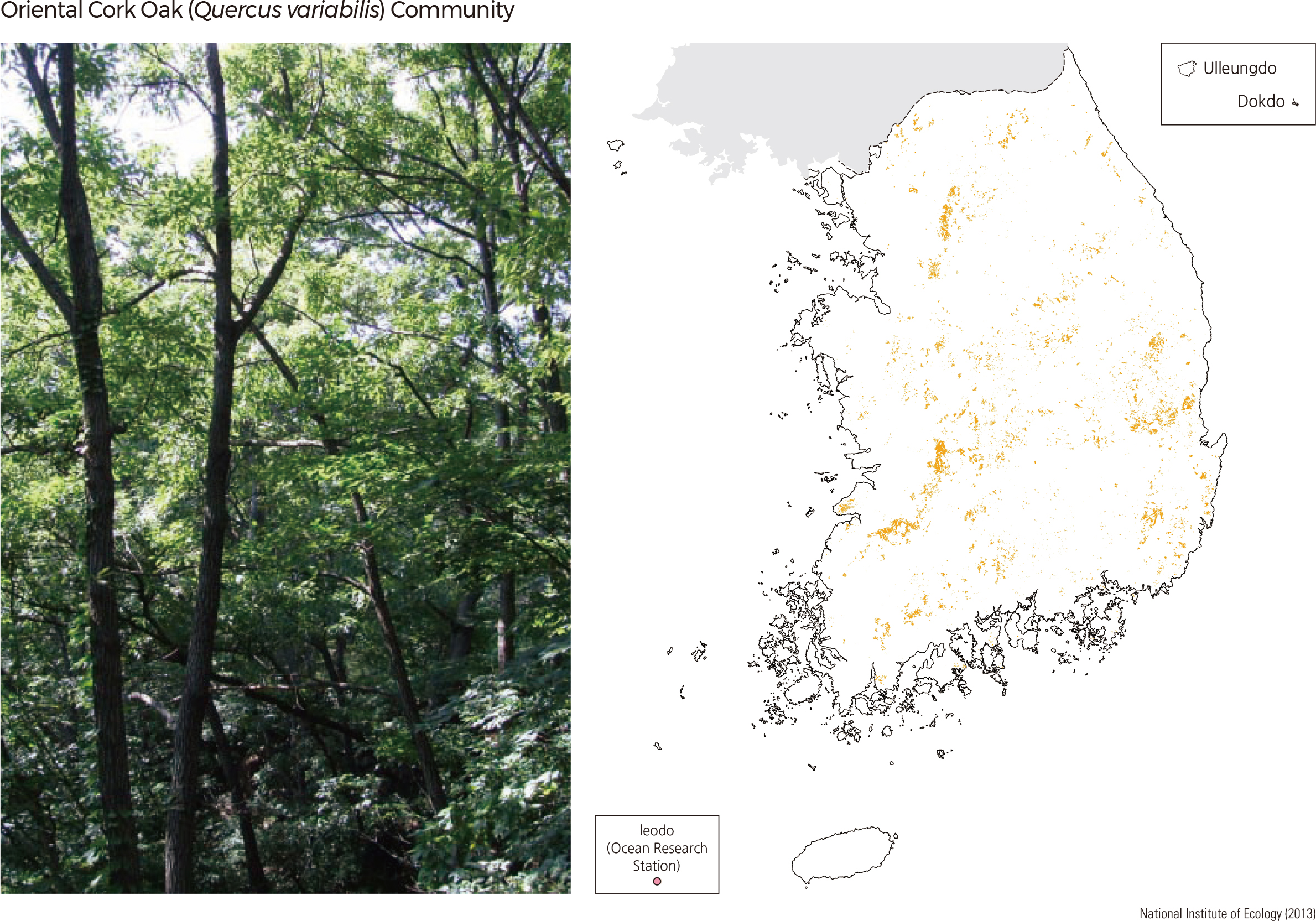
The actual vegetation map illustrates the spatial distribution of vegetation and provides baseline data for better management and proper use of the natural environment. The National Environmental Survey analyzed the status of the vegetation distribution, including all natural forests and plantations. The National Institute of Ecology produced the actual vegetation map based on recent satellite images and results of previous actual vegetation maps, maps of forest type, and ecology and nature maps from the second, third, and fourth National Natural Environmental Survey. The Korean Red Pine (Pinus densiflora) community is the most common and representative forest type that can be found from Jejudo to Hamgyeongbuk-do. Traditionally Korean Red Pine forests have been protected and managed. Thus, they are broadly distributed in the whole country. However, the forests were severely damaged due to resin and wood collection during the Japanese colonial period. After 1970, pine forests had to be cut because of the rampant spread of pine leaf gall midge or Thecodiplosis japonensis and natural succession of broadleaf trees such as Mongolian oak (Quercus mongolica), which made Korean Red Pine dominant areas even smaller.
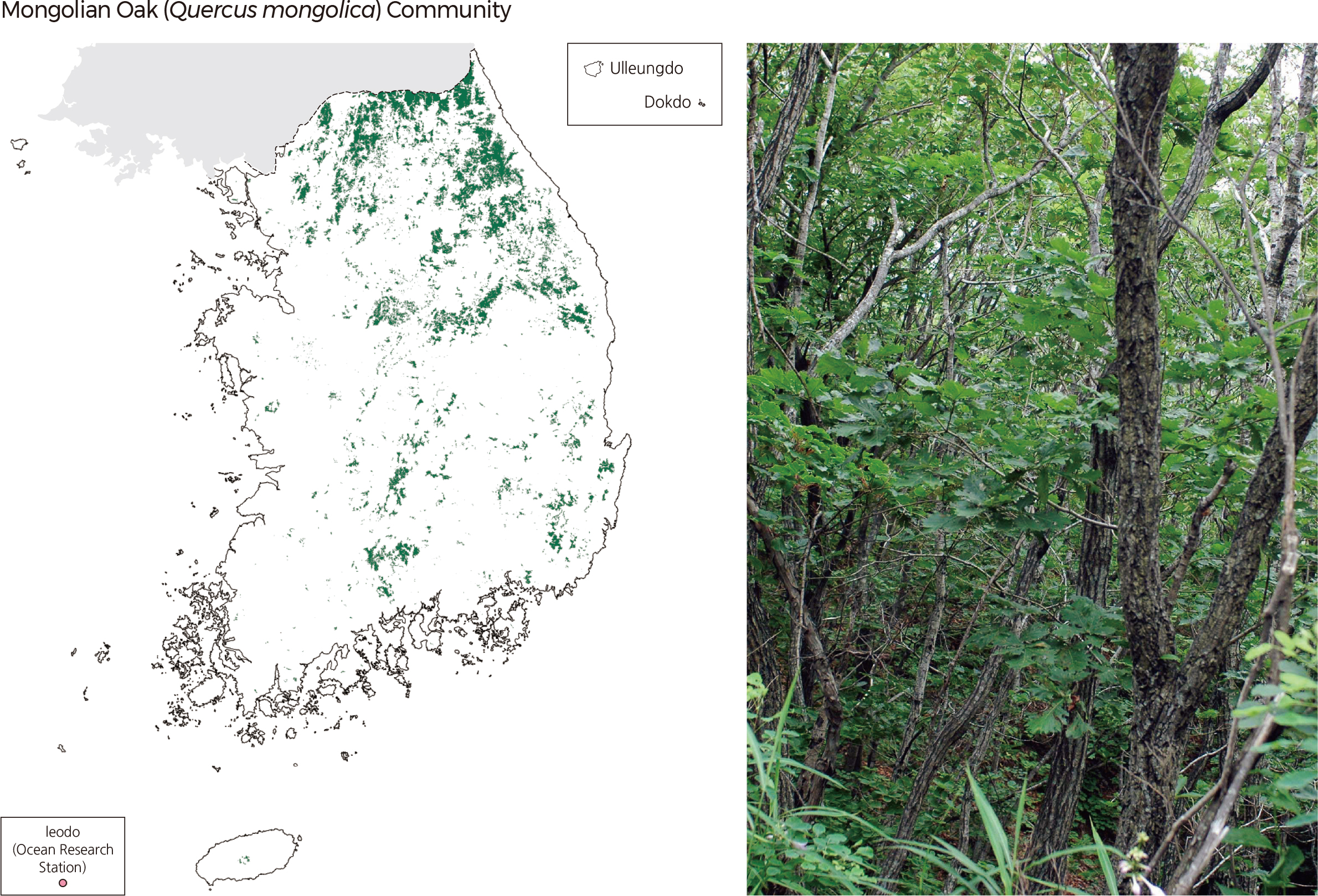
Mongolian oak (Quercus mongolica), which belongs to the family Fagaceae, is a deciduous broadleaf tree growing at high altitudes. It is distributed in the middle and southern parts of the country. South Korean forests are typically characterized by Mongolian oak communities. The species even covers 33.5% of the Baekdudaegan area. Mongolian oak is also a characteristic species of the boreal and temperate broadleaf forests of central Korea. It is known to have covered the southern lowlands 17,000–15,000 years ago, the central area (including the highlands) 10,000–4,500 years ago, and almost the entire country (excluding the Gaemagowon and Baekdusan) for the past 4,500 years. |