English II 2020
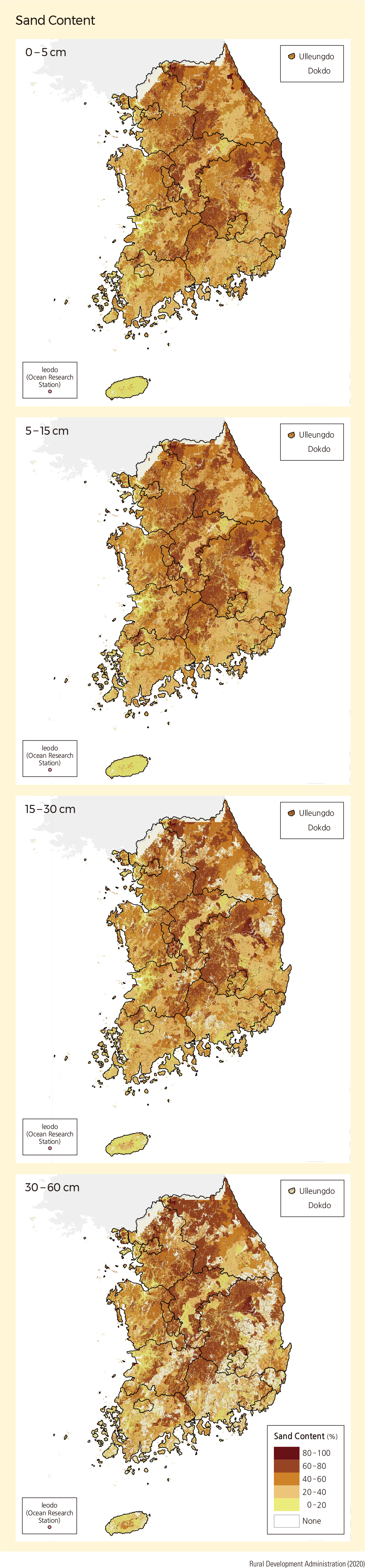
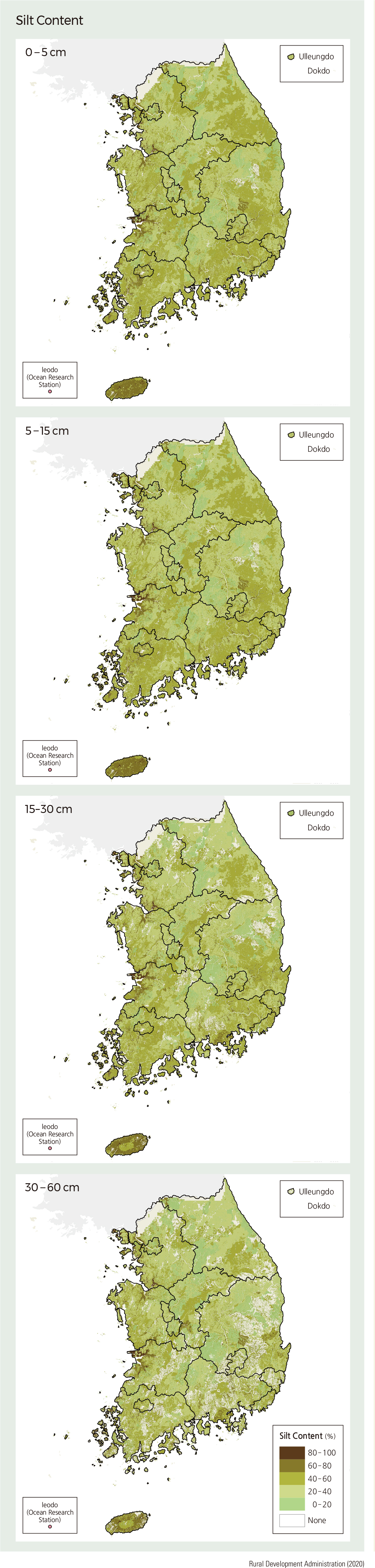
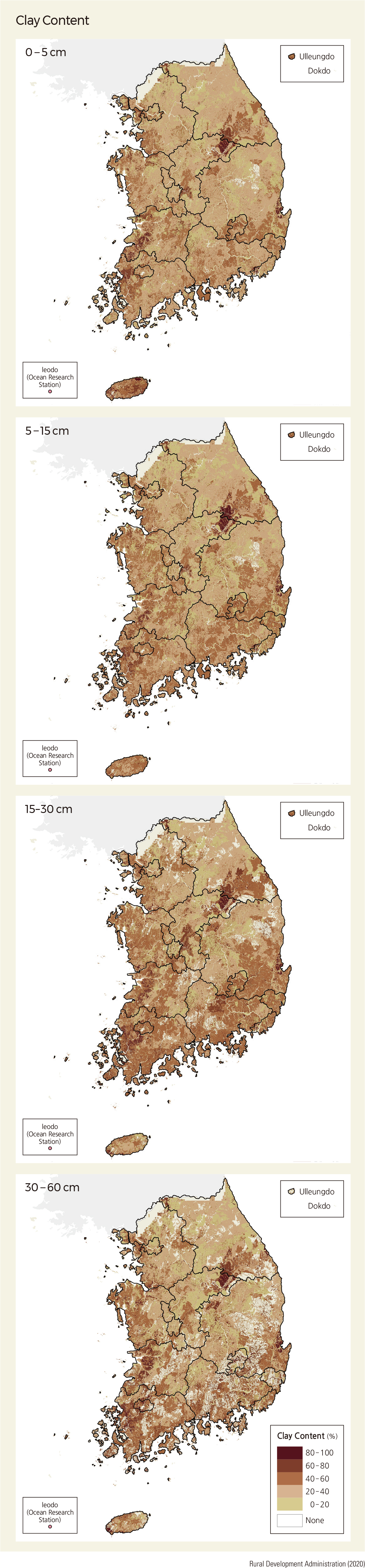
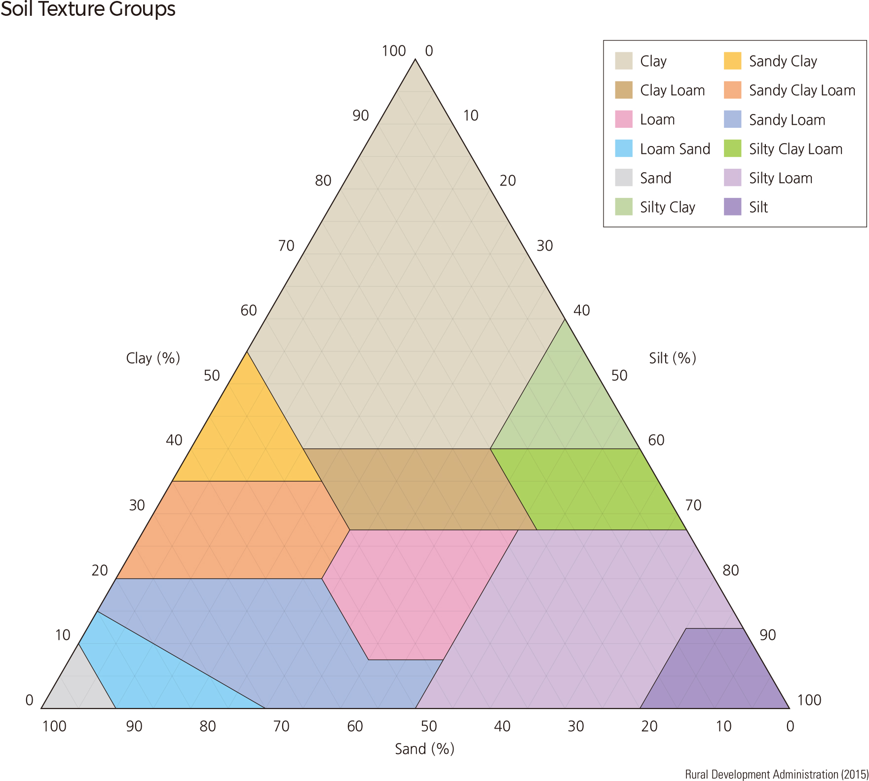
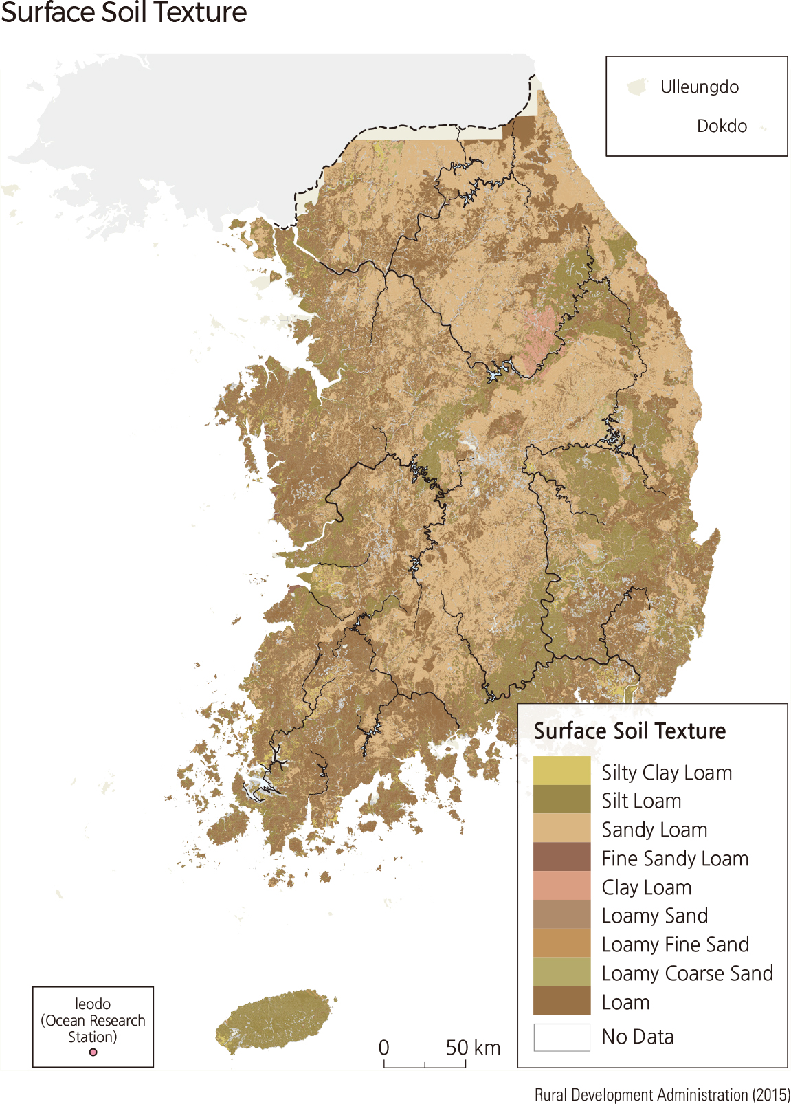
Soil texture is determined by the relative proportion of three kinds of soil mineral particles: sand (0.05–2 mm), silt (0.002–0.05 mm), and clay (particles smaller than 0.002 mm). Soil texture is often considered to be one of the most important attributes that control the physical and chemical characteristics of the soil.
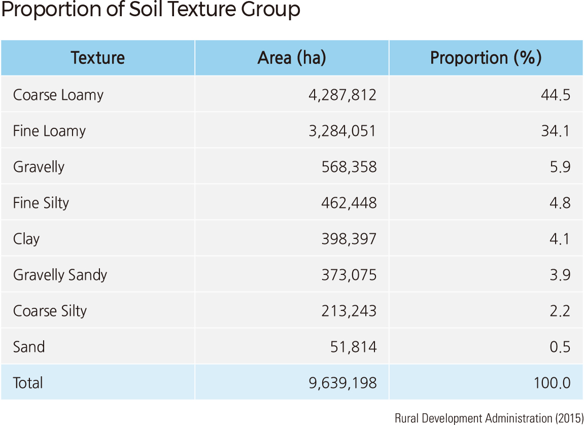
On average, the soil in the paddy/farm areas of Korea is composed of 41.7% sand, 41.5% silt, and 16.8% clay. Major soil textures are moderate coarse sandy loam (44.5%) and fine-textured clay-rich loam (34.1%), and these soils cover up to 78.6% of the total land area. Gravelly soils are also observed in 5.9% of the total area. Because Korean soils have high porosity and show good water drainage, the possible leaching of nutrients and organic matter may result in less productivity.
Paddies have the lowest percentage of sand in the soil, followed by farms and forests. Silt and clay content decrease in the same order. While paddy soils have higher silt content, farm and forest soils are sandier. Soils with higher sand content are distributed throughout the mountainous regions from southern Gyeonggi-do to Chungcheongnam-do and Chungcheongbuk-do. On the other hand, the amount of silt in the soil is high in coastal regions, the limestone areas of the Okcheon System from southern Gangwon-do to Jeollanam-do and Jeollabuk-do, and the sedimentary rock areas of the Gyeongsang System in Gyeongsangnam-do and Gyeongsangbuk-do.
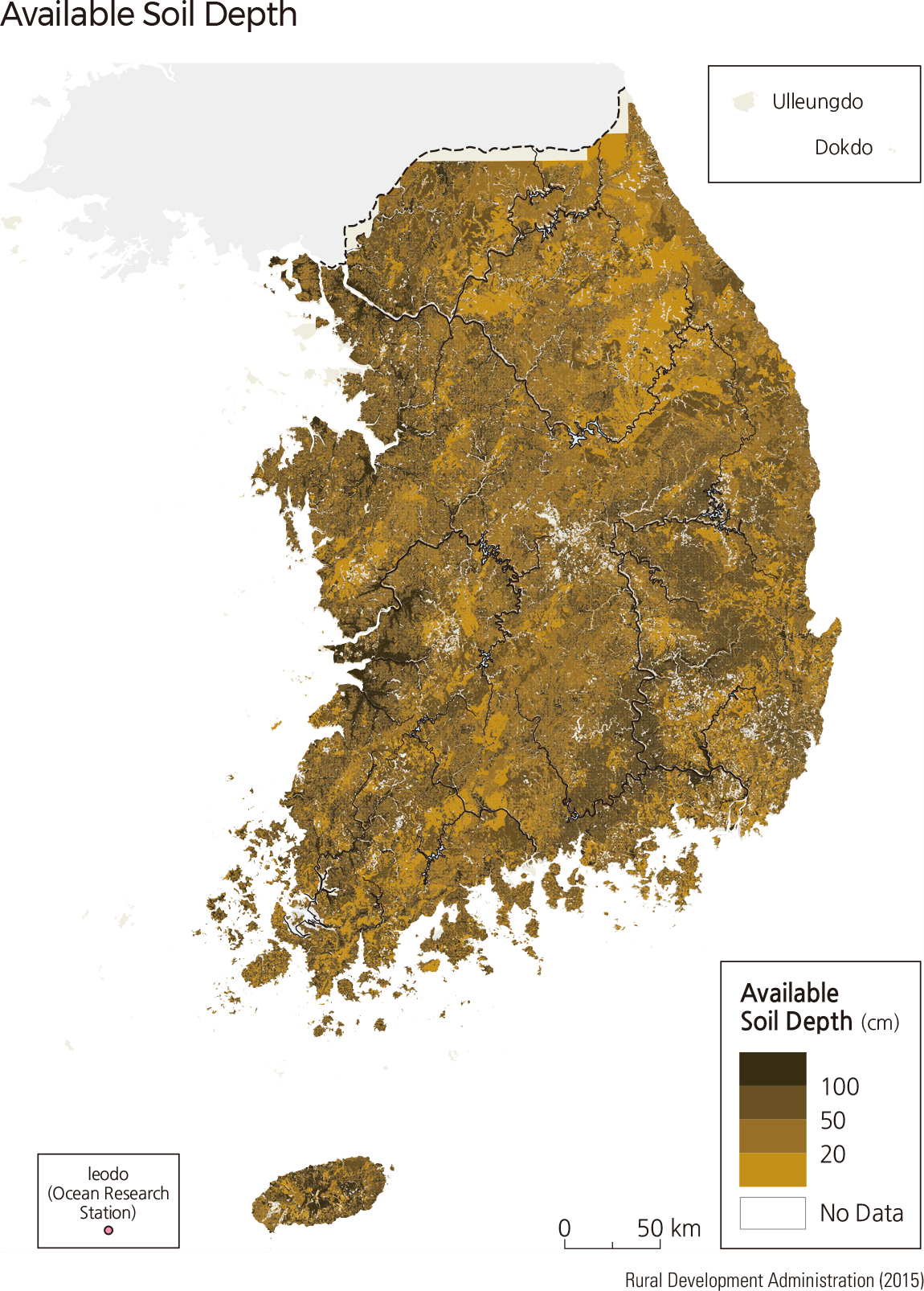
Available soil depth represents the depth of soil horizons. Available soil depth is the depth of soil that meets the conditions necessary for plants to grow. Areas with deep soil are often found in areas with well-weathered bedrock or areas where sediments are deposited. In contrast, areas with shallow soil represent poor soil formation or soil removal by erosion. It is recommended that available soil depth be at least 50 cm to be used as rice paddies or farmlands.
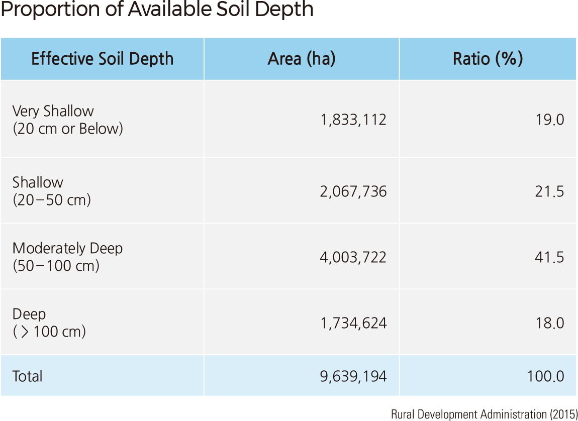
Available soil depth is divided into four levels: very shallow (< 20 cm), shallow (20–50 cm), moderately deep (50–100 cm), and deep (> 100 cm). In South Korea, soils with moderately deep soil depth constitute the largest area at 41.5%, followed by shallow (21.5%), very shallow (19.0%), and deep (18.0%).
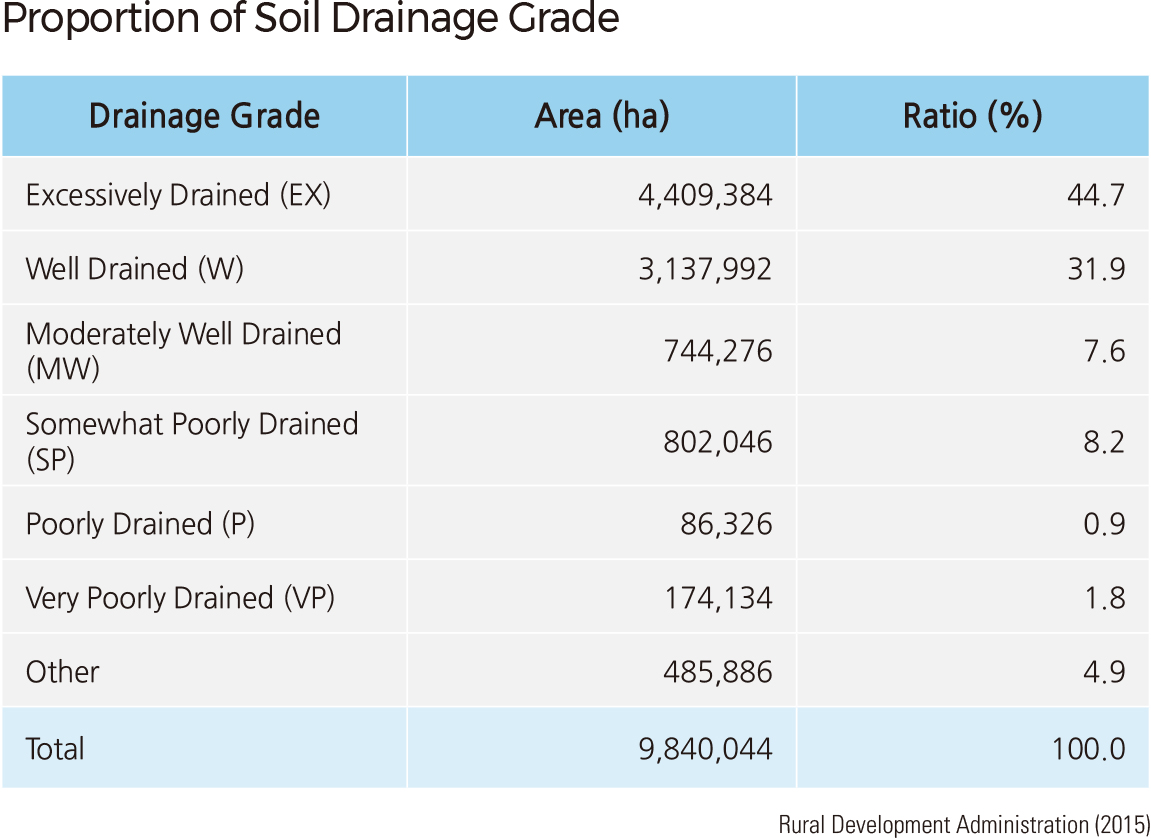
Soil drainage grades indicate the type of drainage found within a soil profile and are determined by factors such as the amount of runoff, permeability, and groundwater level. Drainage classes are defined as follows: excessively drained (EX), well-drained (W), moderately well-drained (MW), somewhat poorly drained (SP), poorly drained (P), and very poorly drained (VP). Most farm field soils are classified as W, while soils in two-crop farming paddies, semi ill-drained paddy fields, and poorly drained paddies are classified as MW, SP, and P and VP, respectively. Lithosols of steep slopes and sandy-gravelly soils of riverbanks are excessively drained.
Excessively drained soils comprise 44.7% (4,409,384 ha) of the total area, and well-drained soils make up 31.9% (3,137,992 ha) of the total area. The combined area of these two classes constitutes 76.7% of the total area. Most of the soil in Korea is well-drained soil.
The percentages of the total area that other drainage classes hold are as follows: MW, which could be used for both paddy and farm field soils (7.6%); SP, mostly paddy soils (8.2%); P (0.9%); and VP (1.8%). These last three classes cover 10.9% of total soils. |