English II 2020
Compiled during the King Sejong era (Reigned, 1418 – 1450), Nongsa jikseol is Korea's first agricultural text that organized traditional agricultural practices and techniques. Before its publication, Korean farmers sought information from Chinese agricultural books, most notably Nongsang jibyo (農桑輯要). However, as Nongsang jibyo specifically referred to farming experience in China’s northern region, it had limitations when applied to Korean climate and soil. In 1428, King Sejong ordered the governors of Gyeongsang-do, Chungcheong-do, and Jeolla-do to survey and record the agricultural technology of each region. Using this data, Jeong Cho (鄭招, ? – 1434) and Byeon Hyomun (卞孝文, 1396 – ?) constructed a viable agricultural system and published it as Nongsa jikseol. The book first contains general information on managing soil and seeds, and then elaborates on the cultivation methods of various crops.
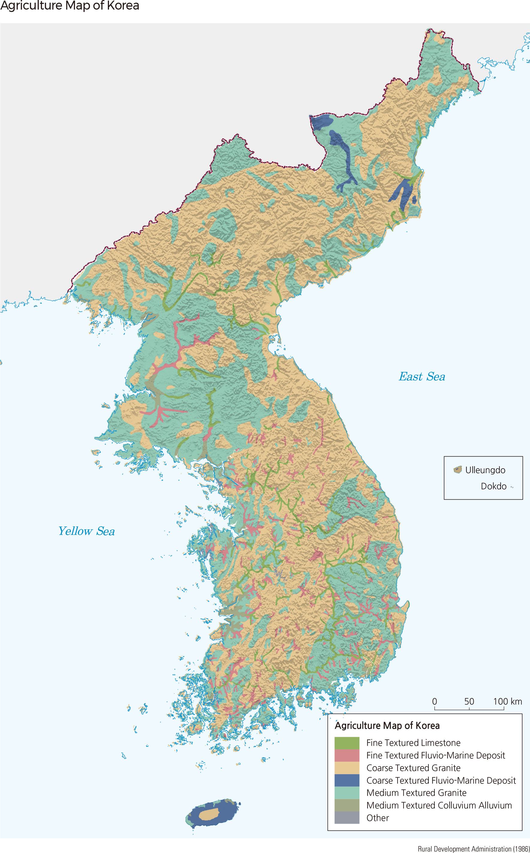
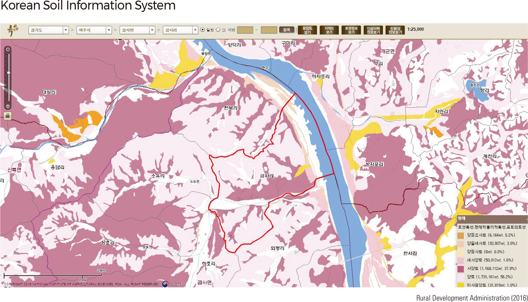
Korea's mountainous topography and high population density have led the country to have the highest social demand for soil resources. In response to this, Korea carried out an extremely detailed and sophisticated soil survey, the results of which have been made available to the public through a digitalized soil information system.
According to Nongsa jikseol (the agricultural text written by Jeong Cho and Byeon Hyomun in 1429), the taste of the soil served as the standard for soil classification at the time. Records state that the fertility of soil differs according to its taste; sour-tasting soil indicates barrenness, while sweet-tasting soil refers to richness.
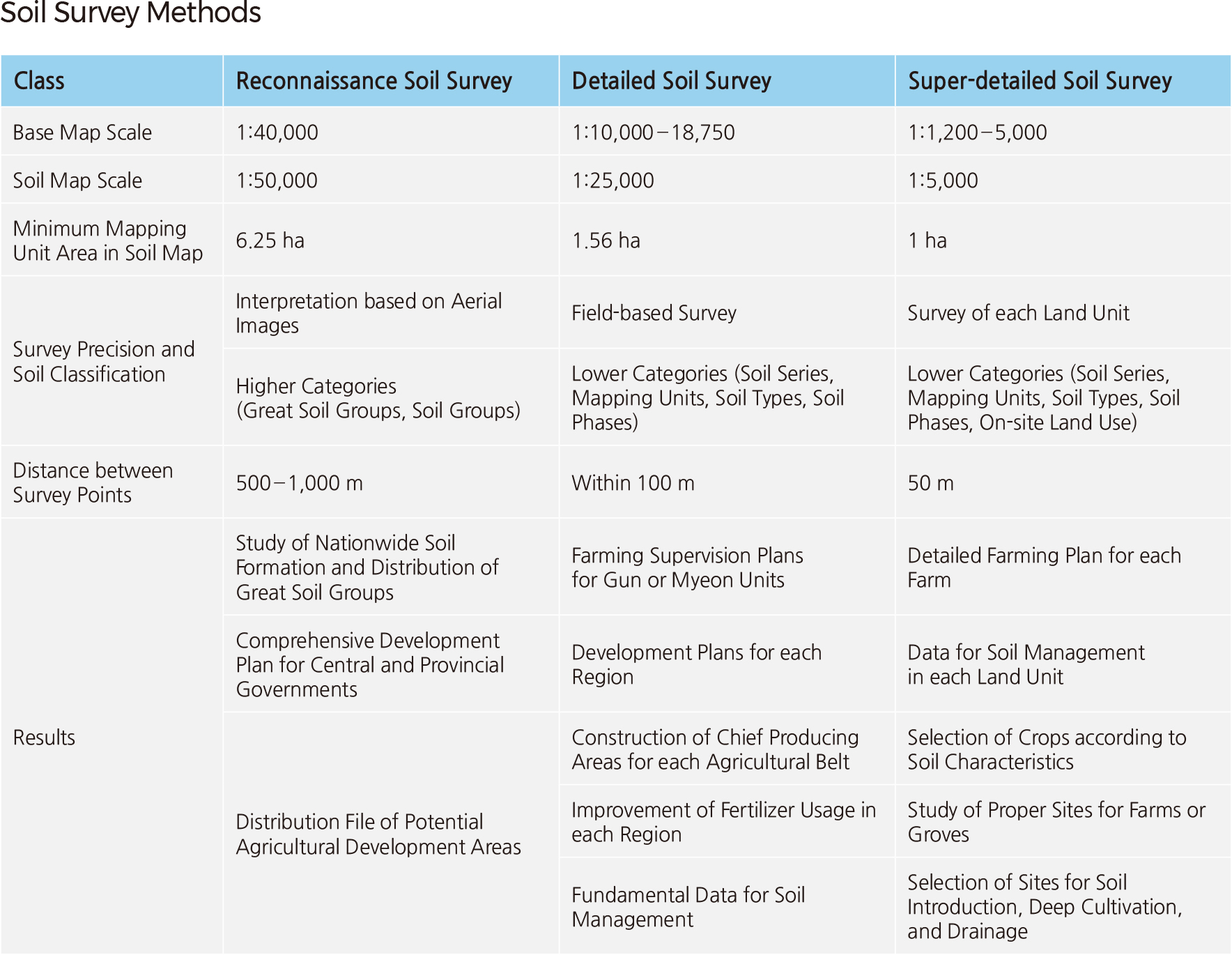
Modern soil surveys were first conducted in 1905. In 1930, an irrigation association conducted a survey to set a standard for fertilizer usage. The first planned soil survey project was launched in 1936 with a decade-long plan to study cultivated land. However, it was halted due to the outbreak of World War II and the Korean War. Advanced scientific soil survey methods under the USDA soil classification system were introduced in 1959. Between 1964 and 1999, extensive national soil survey projects were carried out. There are three types of soil surveys: reconnaissance, detailed, and super-detailed. The categorization depends on the survey's objectives, base map scales, and precision. Reconnaissance soil surveys were carried out from 1965 to 1967 over relatively wide areas. The printed soil map resulting from these surveys was provided at a 1: 50,000 scale. It is being used for various policies, such as comprehensive land development plans.
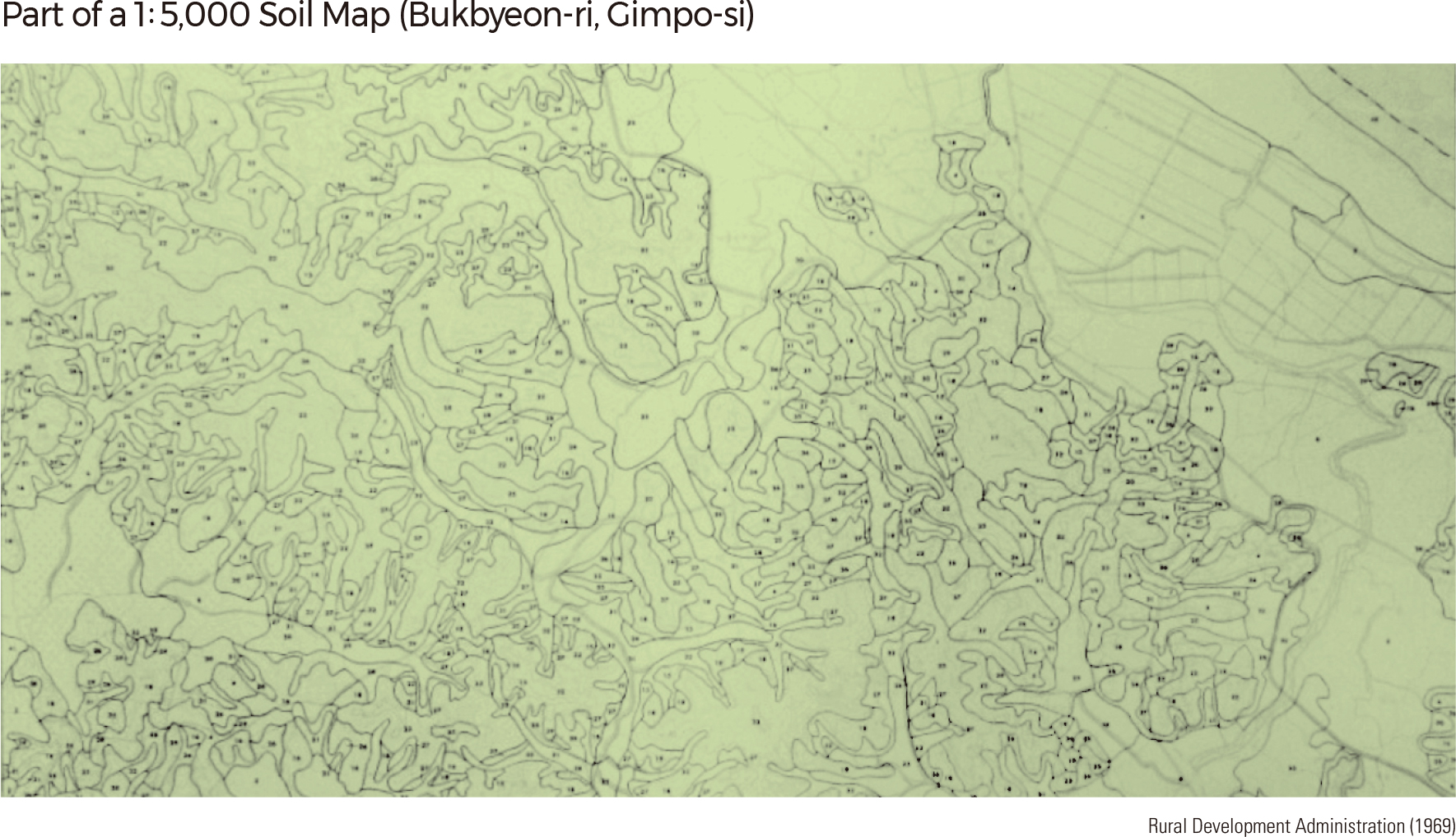
Detailed surveys began in November 1964 to examine potential areas for future cultivation. The projects surveyed a total of 9,586,407 ha or 96.6% of Korea's total area. As of now, only the areas surrounding the Military Demarcation Line and newly reclaimed lands have yet to be surveyed.
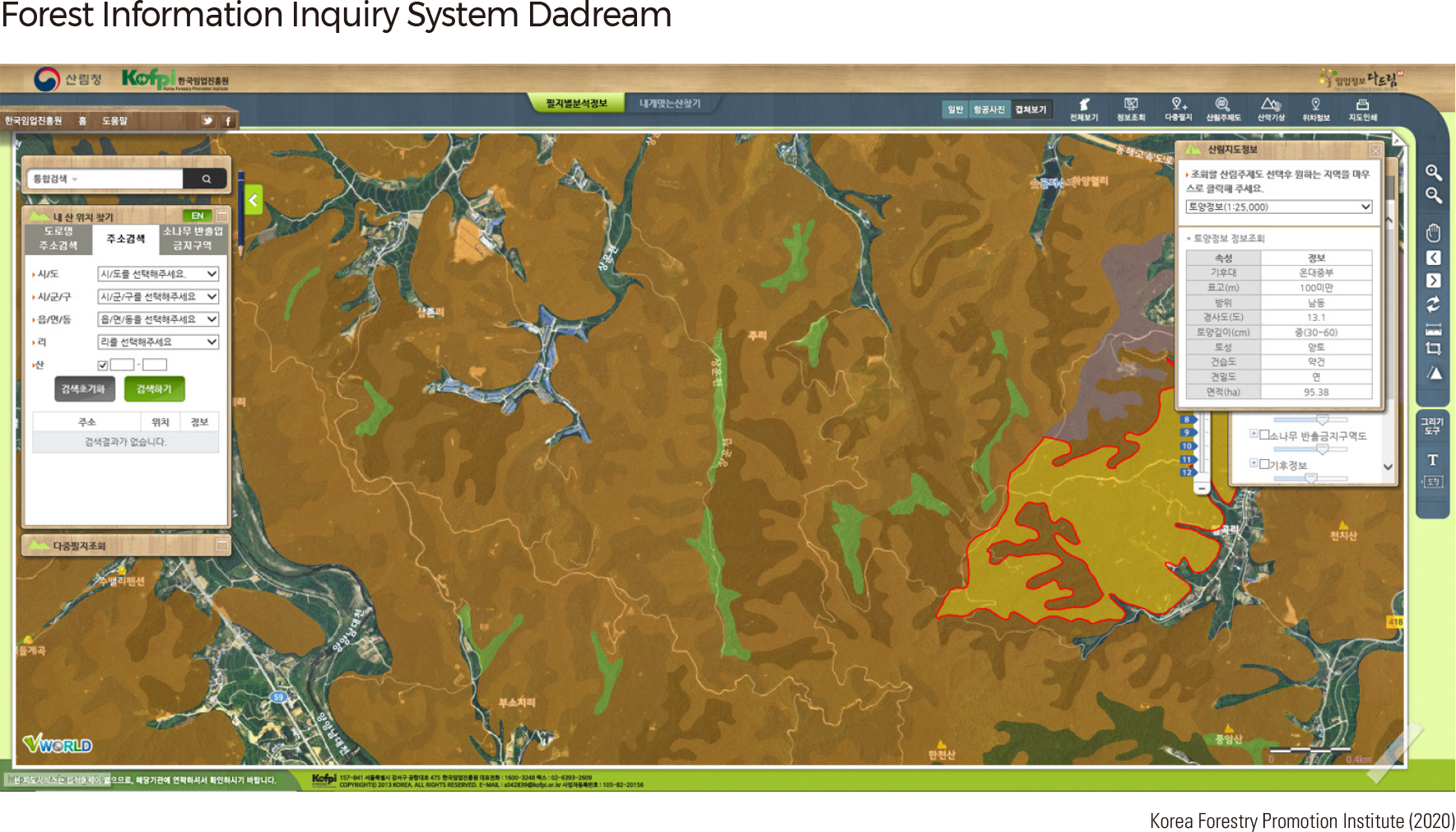
The Forest Service first launched a government-led survey of forest soil in 1968 to find suitable areas to plant trees in the river basins of Anseongcheon, Dongjingang, and Sangjucheon. Since 1995, annual soil surveys have been conducted to achieve systematic development and management of forest resources. A 1: 25,000 scale national forest soil map was completed in 2003. Current projects aim to enhance this map to a scale of 1: 5,000 to invigorate sustainable forest and ecosystem management, particularly for private forests. |