English II 2020
Sandy soils make up the majority of soils in Korea due to the large distribution of granite and granite gneiss. Most Korean soils are coarse, clastic soils that result from topographic and climate factors such as the large proportion of mountainous areas, seasonal temperature changes, concentrated precipitation in summer, and freezing in winter. These factors cause soils to have low pH values, low organic content, rapid nutrient leaching, and low possible yield.
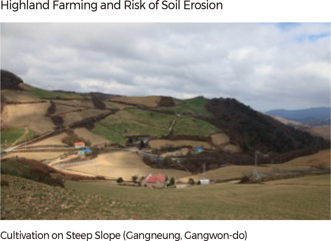
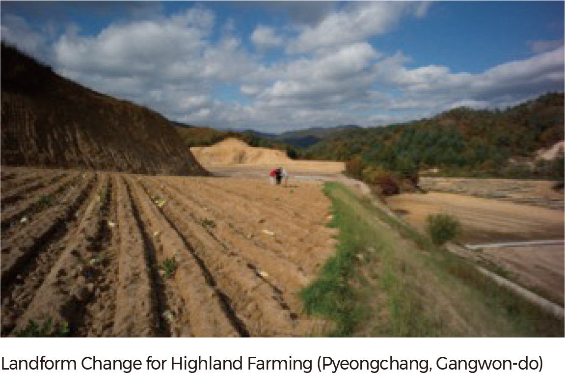
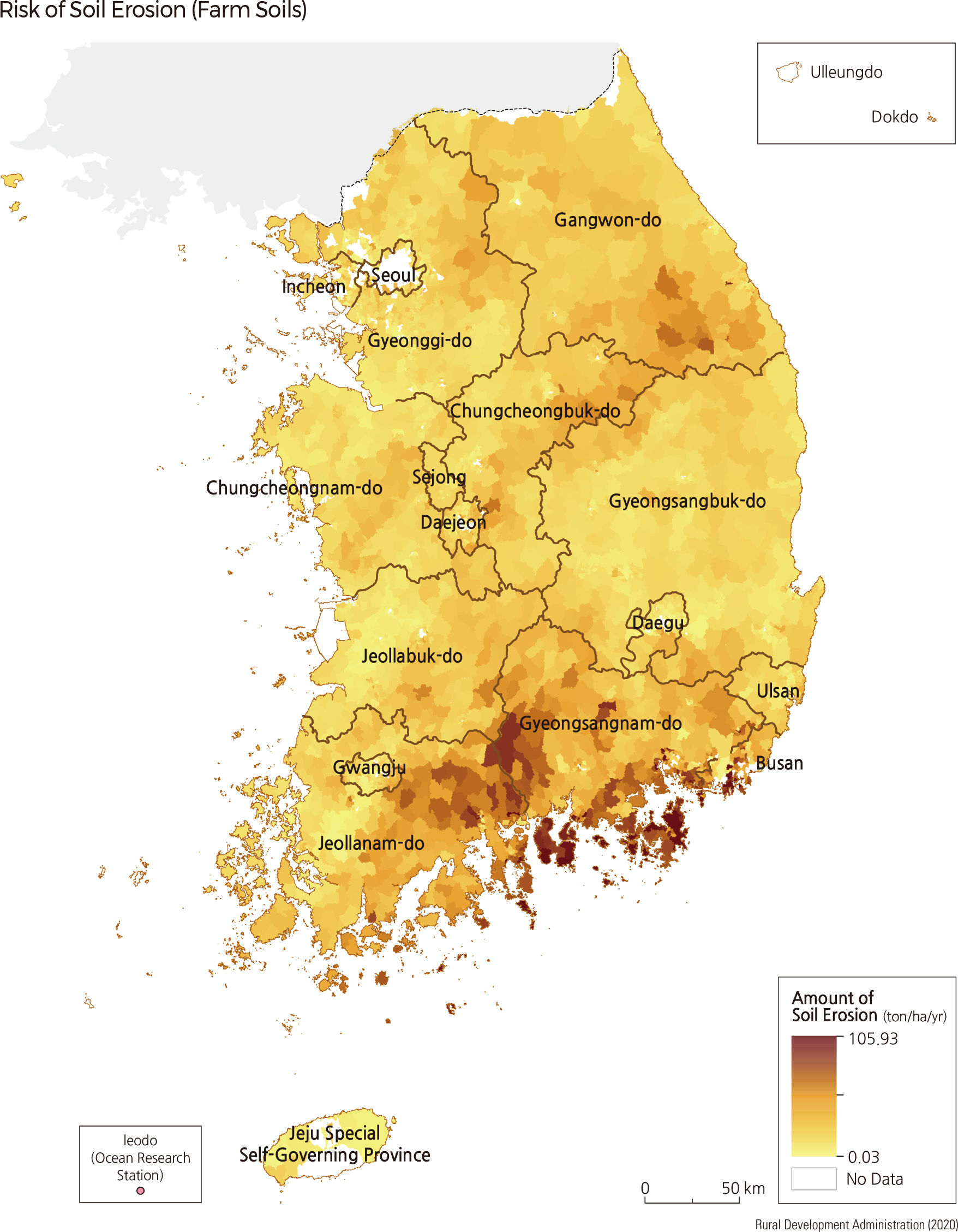
One of Korea's main soil management issues is erosion. Currently, the annual net loss of soil is estimated to be more than 50 million tons, with the most damage occurring on cultivated lands. Total loss of soil from farm fields is estimated to be 37.7 tons/ha on average, while it is 3.5 tons/ha in forests and under 0.3ton/ha in paddy fields. Ultimately, as much as 27 million tons of soil are lost over a mere 10% of cultivated land. The loss is severe, particularly in the mountainous areas of Gangwon-do, Yeongnam, and Honam, and regions of high precipitation such as Namhaegun, Geoje-si, and Goseong-gun. The recent expansion of highland farming is another reason for rapid soil loss. Eroded soil from these farms eventually flows into nearby rivers, causing a destructive effect on the river and riparian ecosystem.
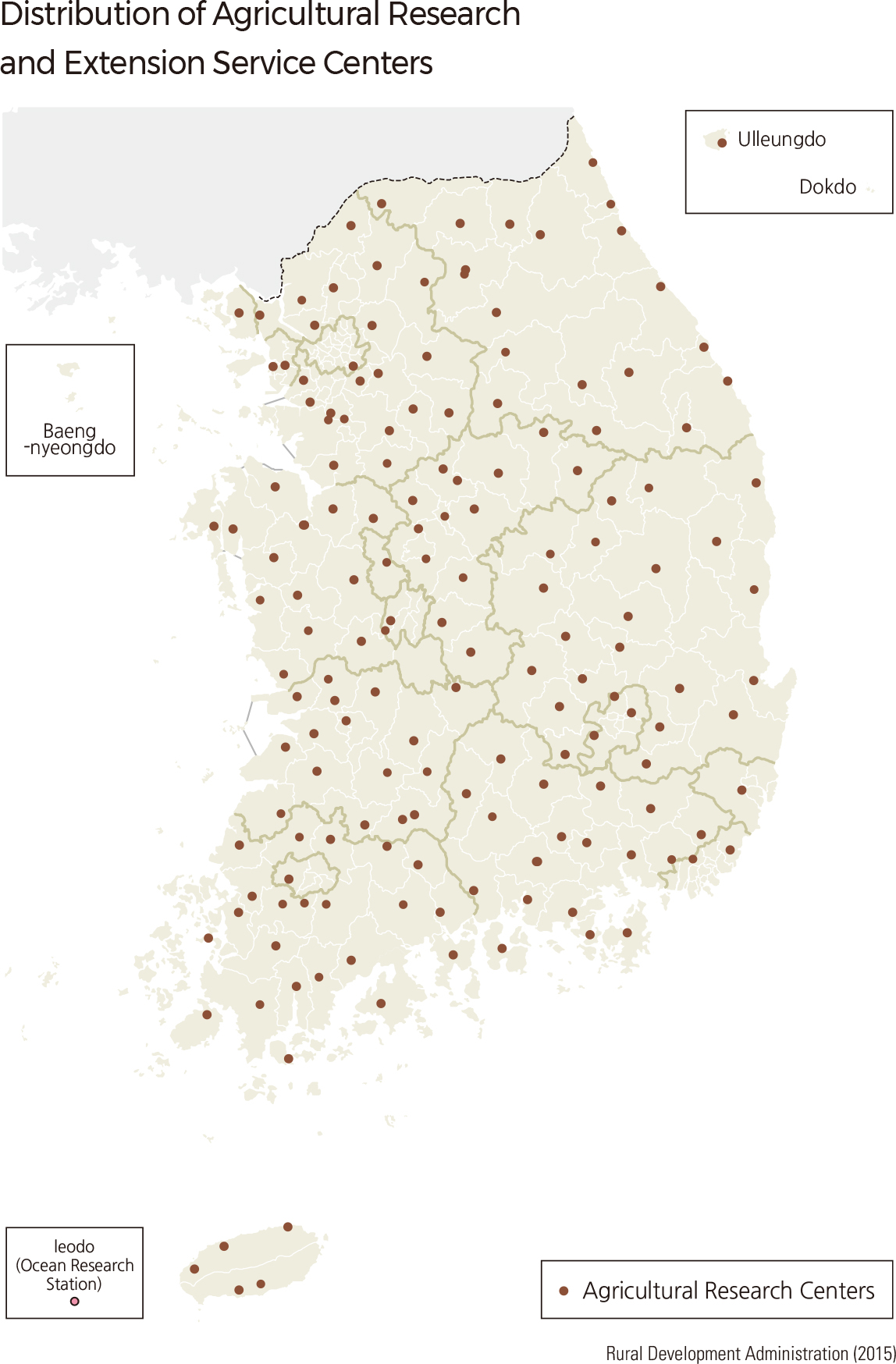
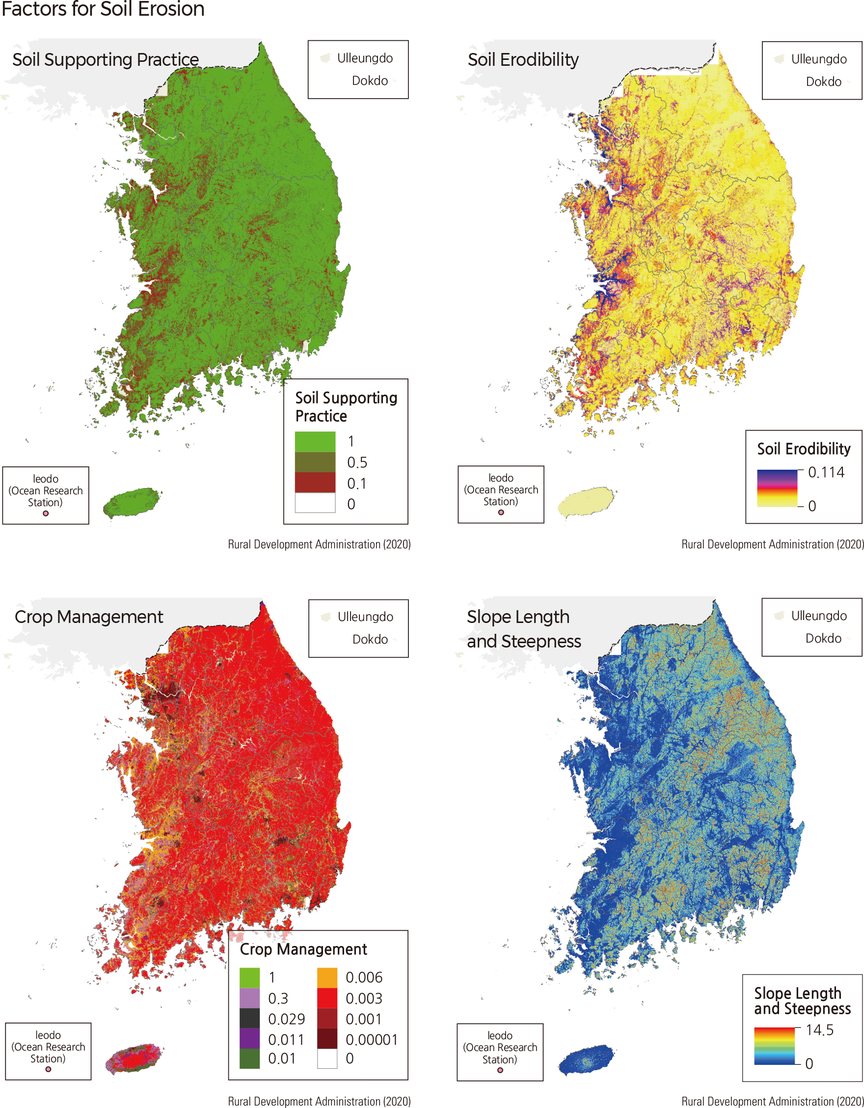
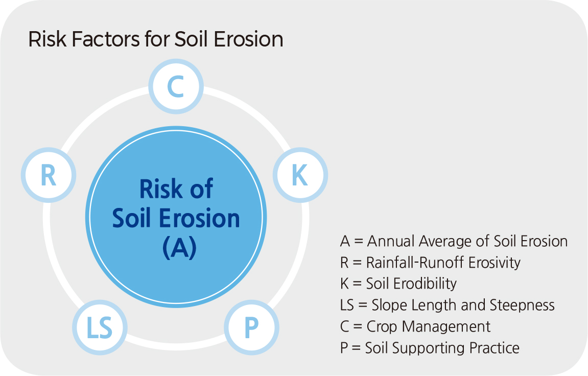
To prevent further worsening of the situation, Korea has been establishing agricultural technology centers in every province to assist with active soil management. Some major functions performed by these centers are as follows: developing and disseminating new crop breeds, educating people on proper crop selection and cultivation, and evaluating and treating for certain soils to enhance productivity. The majority of soil erosion in Korea can be identified as surface runoff erosion, while wind erosion occurs locally in coastal areas, islands, and high mountains. Soil erosion is produced by surface runoff generated by rainfall, and its rate depends on the following five variables: rainfall-runoff erosivity (R), soil erodibility (K), slope length and steepness (LS), crop-management (C), and soil supporting practice (P).
Land use in Korea can be divided into four main categories: forest, paddy field, farmland, and developed land. Soil loss associated with paddy fields is expected to be less than loss associated with other types of land use since the area is covered with water during the heavy rainy season in the summer, and its ridges act as barriers preventing runoff. Even on slopes, a staircase-formed paddy terrace has little chance of erosion. Forests and grasslands also have low erosion rates due to the vegetation on the surface. On the other hand, there is a risk of intensive soil erosion in farmlands, as these areas are mainly located on slopes and are exposed or bare during the fallow season. The risk of erosion due to rainfall and runoff is high in the part of south/west coastal areas like Goseong-gun. The risk of erosion due to slope length and steepness is high in the mountainous areas of Gangwon-do like Pyongchang. Soil erodibility is higher in the southwest plains than in the mountain areas in the eastern part of the country because light soil particles are carried by rainwater flow. |