English II 2020
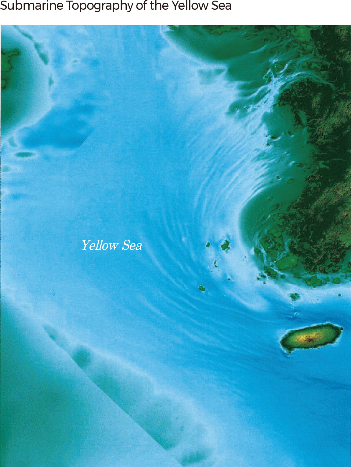
The Yellow Sea, South Sea, and East Sea of the Korean Peninsula show different submarine topographies. The Yellow Sea, which is entirely connected to the continental shelf, is characterized by a shallow water depth (an average of 45 m and a maximum of 103 m) and a gentle slope.
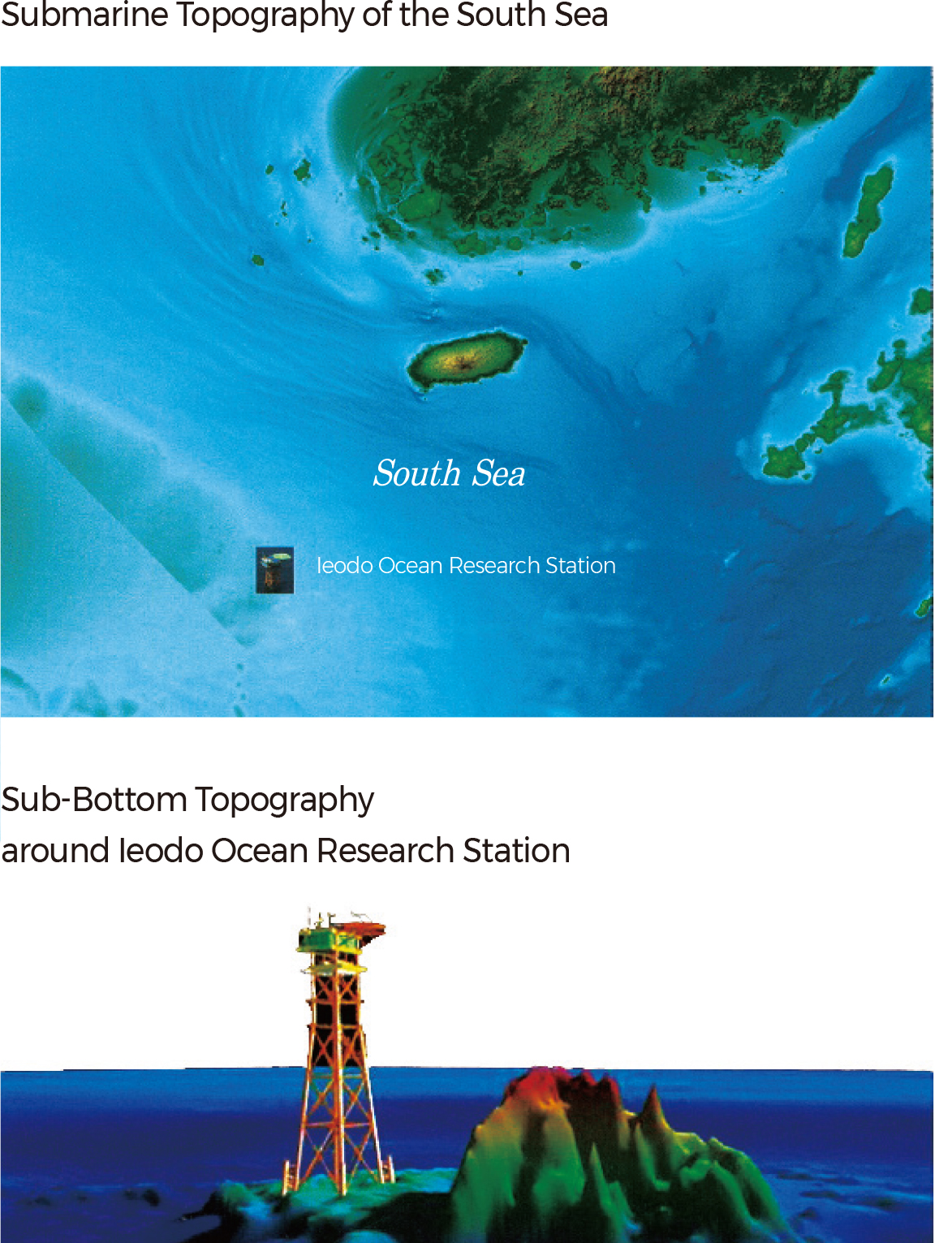
The South Sea is geographically connected to the Yellow Sea. It generally displays flat topography in the southwestern region around the East China Sea but becomes deeper from Jejudo to the southeast. It shows a maximum water depth of 198 m and an average water depth of 71m. The Ieodo Ocean Research Station is established on Ieodo, which is an island surrounded by rocks located on the south end of Korea's exclusive economic zone. It allows for the observation of various marine and atmospheric environments.
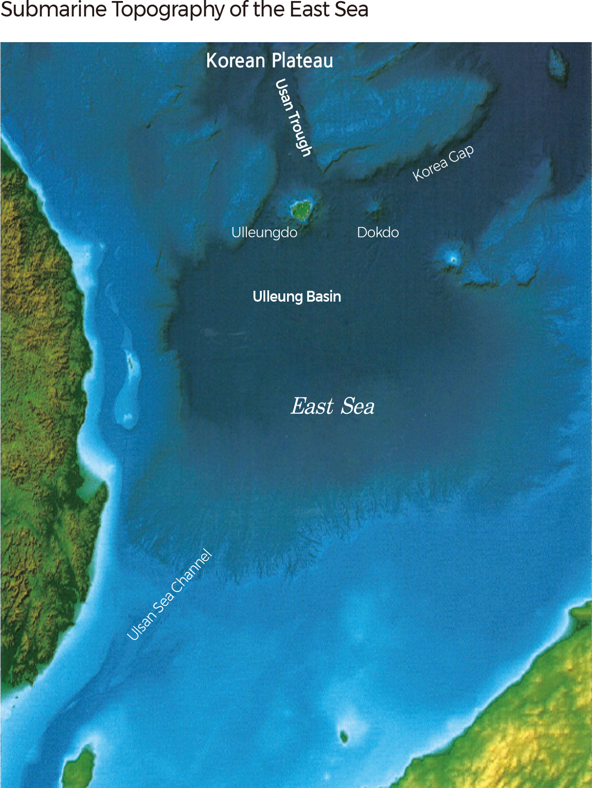
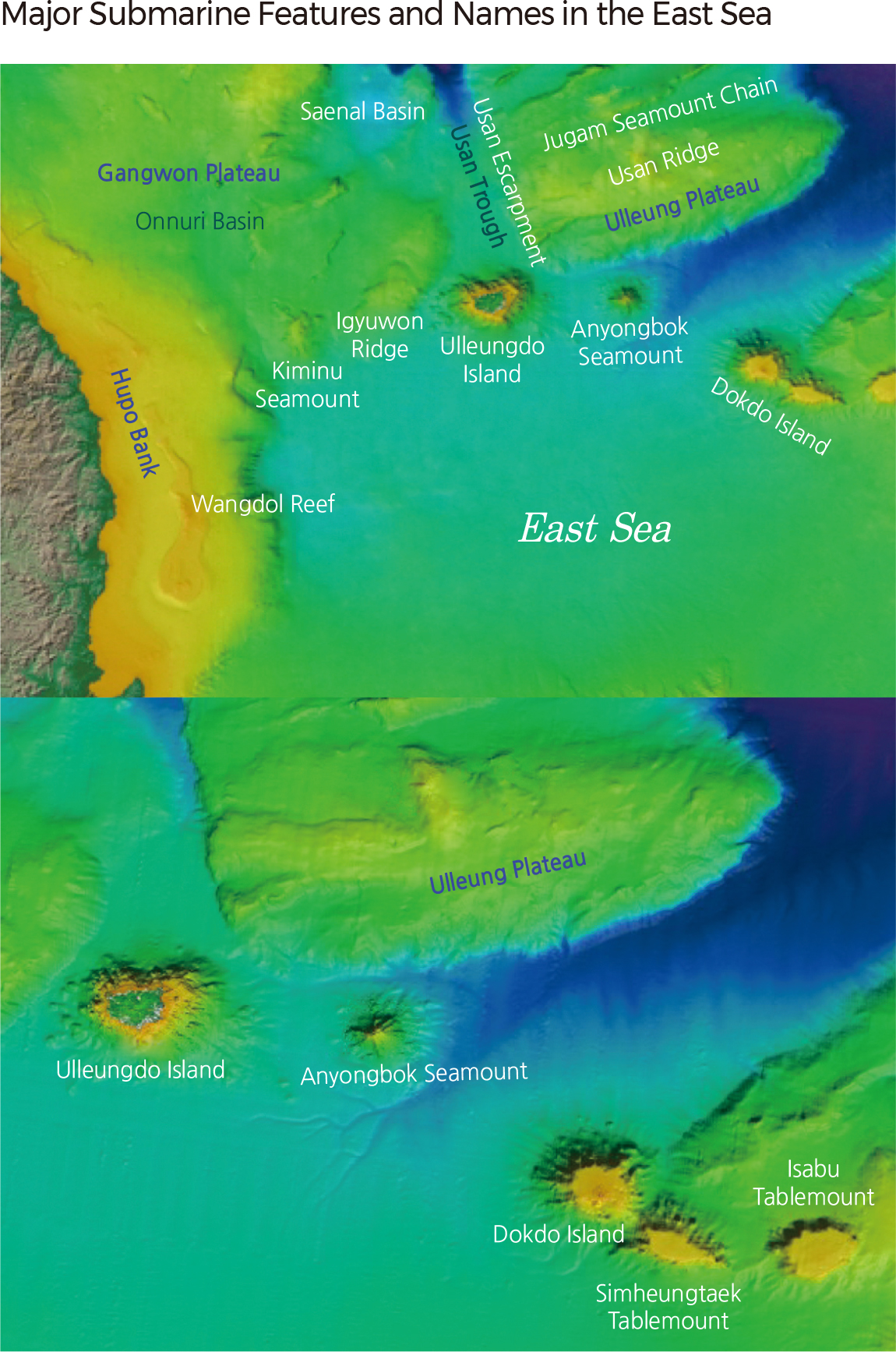
Unlike the Yellow Sea and the South Sea, the East Sea is characterized by very deep water and steep slopes in the coastal area. The flat terrain of the Ulleung Basin exists at a depth of 2,000 m near Ulleung Island, and the Korea Plateau is located to the north of the basin. The Usan Trough, a submarine canyon, is located to the north of Ulleung Island.
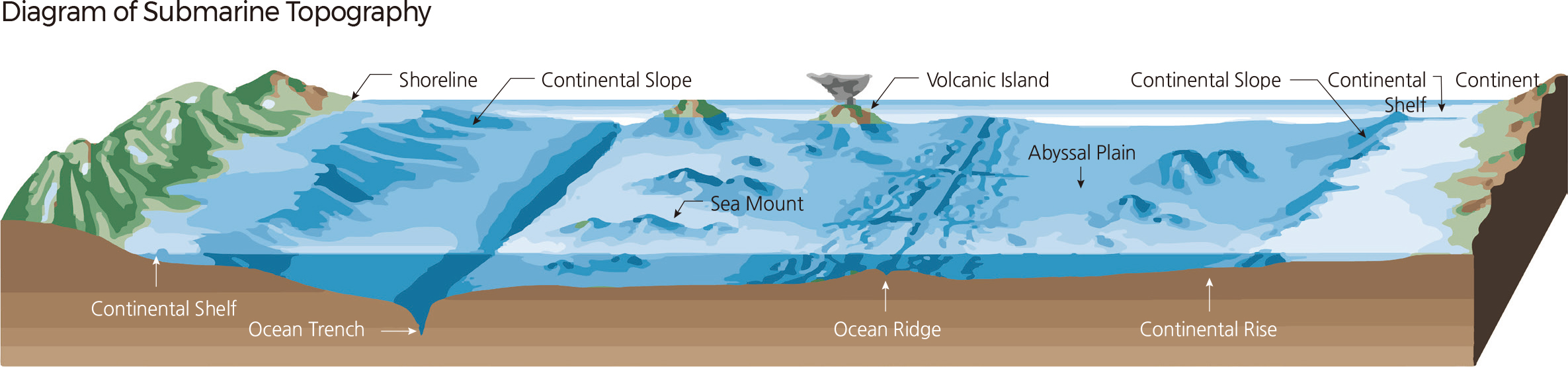
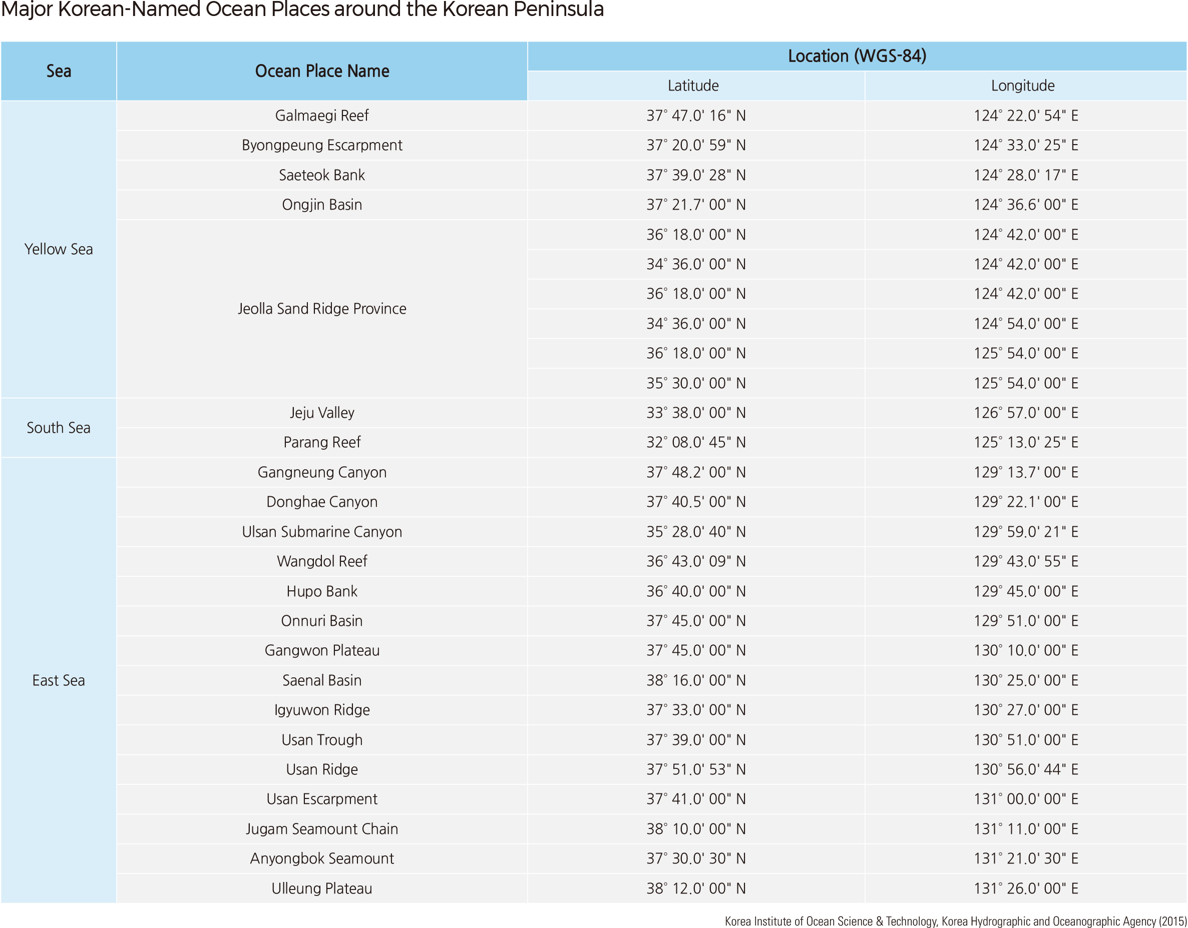
Marine geographical names are largely divided into sea surface names and undersea feature names. They are adopted as official names by the announcement of the Minister of Oceans and Fisheries. Sea surface names include the titles of topographic features above the sea surface, such as oceans, straits, bays, inlets, and waterways. Undersea feature names refer to sub-bottom topographic features, such as reefs, banks, submarine canyons, basins, seamounts, ridges, and trenches. The "Standardization of Undersea Feature Names" from the International Hydrographic Organization-Intergovernmental Oceanographic Commission (IHO-IOC) classifies undersea features into 52 types, but the "Ocean Place Name Standardization Manual" of Korea categorizes them into 42 types.
The main undersea features in Korea are the Gageo Reef and Ongjin Basin in the Yellow Sea, the Jeju Sea Valley in the South Sea, and the Gangwon Plateau, Usan Trough, and Ulleung Plateau in the East Sea. There are also some Korean-named undersea features in overseas areas, such as the Boreumdal Guyot, Changpogo Seamount, and Kkotsin Knoll. These features enhance the nation's position in the marine field and serve as indicators of the development of marine survey technology in Korea. |