English II 2020
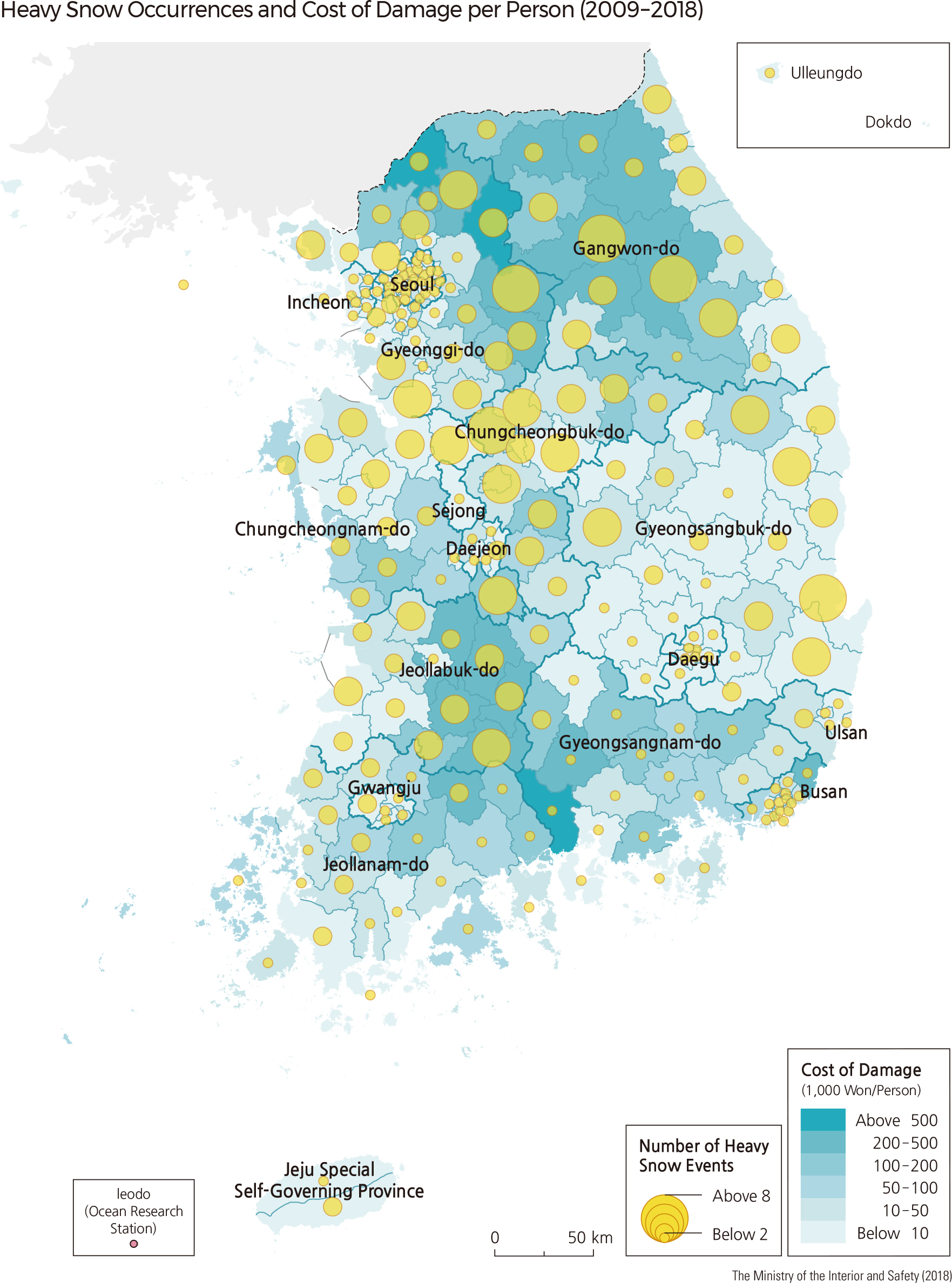
Heavy snowfall is defined, based on spatial and temporal conditions, as an intense snow event with a large amount of snowfall. According to the Korean Meteorological Administration, a heavy snow advisory is issued when fresh snow cover is expected to accumulate to 5 cm within 24 hours. A heavy snow warning is issued when fresh snow cover is expected to accumulate to 20 cm within 24 hours. A warning is issued in the mountainous areas when snow accumulation is expected to be 30 cm or greater. If snow occurs along with a storm accompanied by a cold wave, or falls for a long time, it causes considerable damage to weaker structures such as agricultural farming facilities. In addition, it greatly affects the service sector, including transportation, distribution, tourism, insurance, and society as a whole.
The distribution of atmospheric pressures across Korea and surrounding areas determine the spatial patterns of heavy snowfalls. When isobars run north to south, and a northwest monsoon wind is strong due to a high pressure system in the west with low pressure in the east of the Korean Peninsula, heavy snowfalls often occur in the coastal regions of Chungcheongnam-do, Jeollanam-do, and Jeollabuk-do, and in the mountain regions of Jejudo and Ulleungdo. Heavy snowfalls often occur on the east coast of the Korean Peninsula when isobars run east to west, and a northeasterly is dominant due to a high pressure system in the north, with low pressure in the south of the Korean Peninsula. If troughs form in a north-south direction and cyclones move through slowly, snow can occasionally fall in the central regions of Korea. In this case, if the temperature is quite low, snow can fall in the southern part of Korea. According to records of snowy days between 1974 and 2001, the yearly average number of heavy snowfalls is 2–3 times in the coastal regions of Gangwon-do and 7–8 times in the mountainous regions of Gangwon-do. Heavy snowfalls exceeding 50 cm occur about once a year. More than half of these heavy snowfalls were recorded in mountainous areas such as Daegwallyeong.
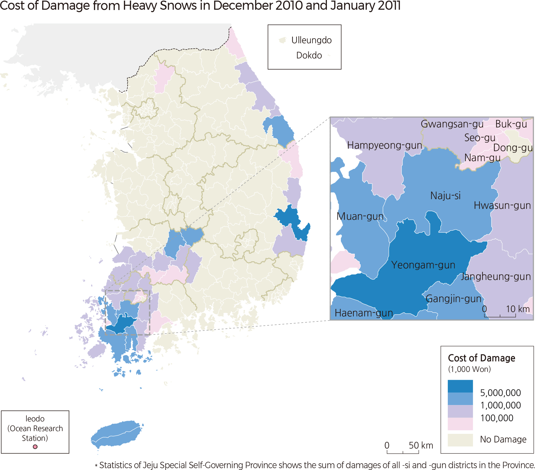
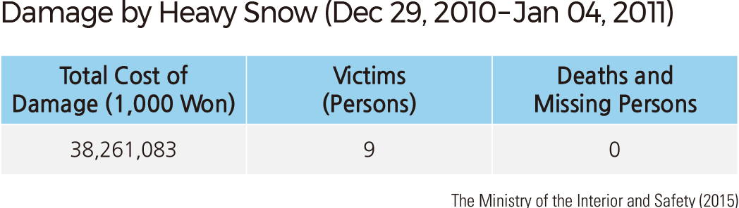
From December 29, 2010, to January 1, 2011, cyclone paths shifted toward Korea from the East-Asian continent, forming snow clouds over Korea, leading to heavy snowfall on the west coast and central region. The continuous, strong, heavy snow greatly damaged greenhouses and ginseng farms. During January 3–4, 2011, cold air with a temperature around -30˚C flowed into the East Sea along with northeasterly winds and met relatively warm air over the East Sea. This atmospheric condition turned a large amount of water vapor into snow. The government declared Special Disaster Zones for Yeongam-gun, Jeollanam-do, which had been damaged by the heavy snow from December 29, 2010, to January 4, 2011.
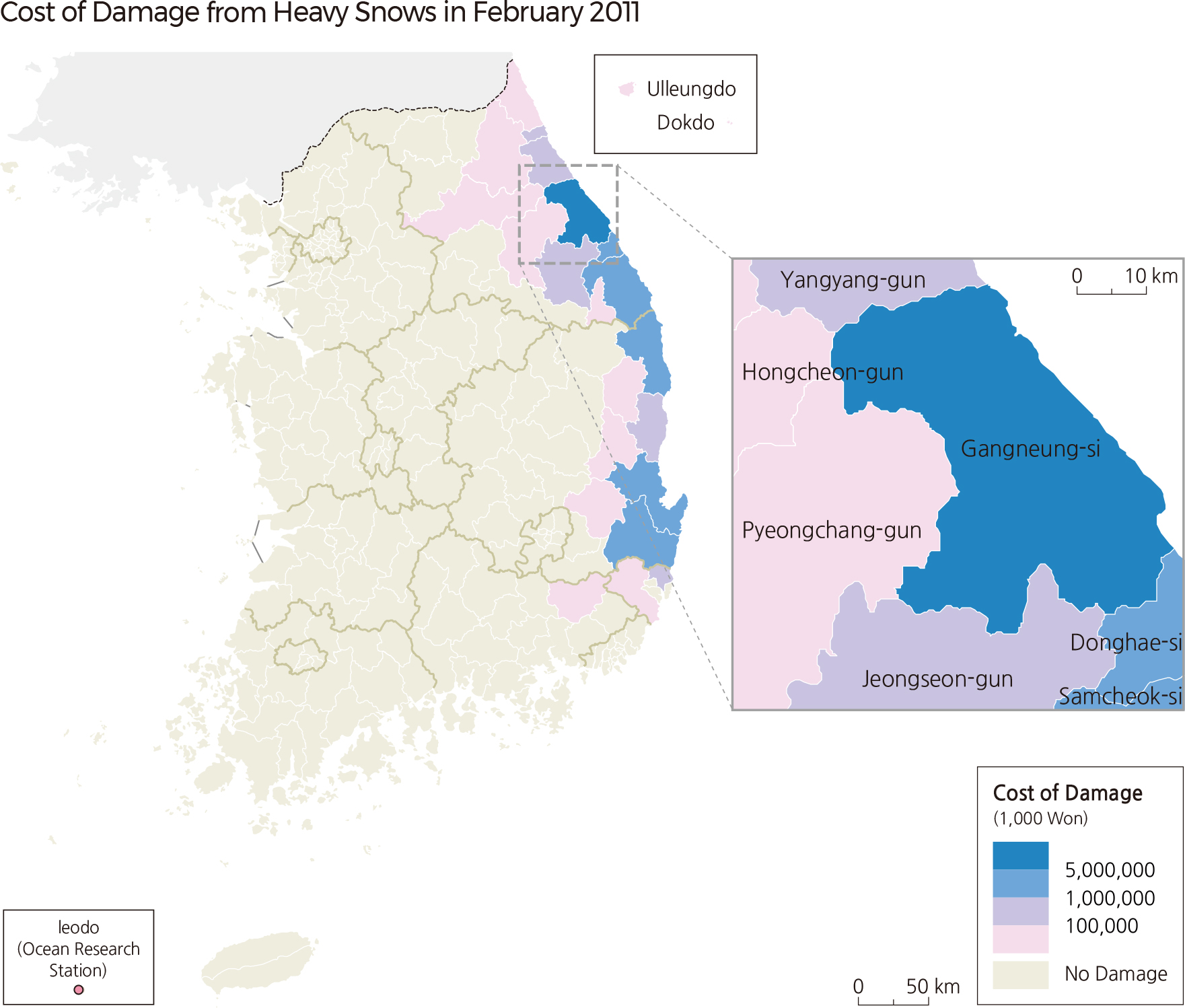
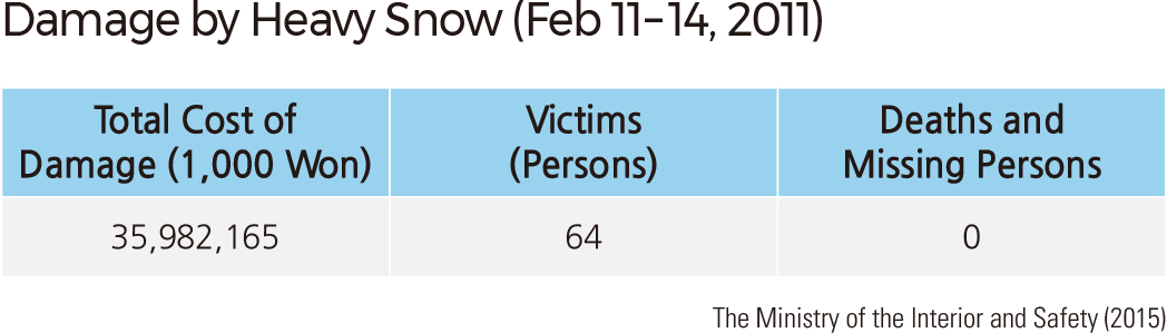
From February 11–14, 2011, due to a trough created by cyclones coming from the southeastern sea of the Korean Peninsula, both the northern region and Yeongdong region of Korea experienced heavy snowfall. Many facilities such as farm facilities and military bases were damagedin Gangwon-do and the eastern coastal region of Gyeongsangbuk-do (the maximum snowfall was 133 cm). The government declared Special Disaster Zones for Gangneung-si and Samcheok-si of Gangwon-do and Uljin-gun of Gyeongsangbuk-do, which had been damaged by the heavy snow between February 11–14, 2011. |