English II 2020
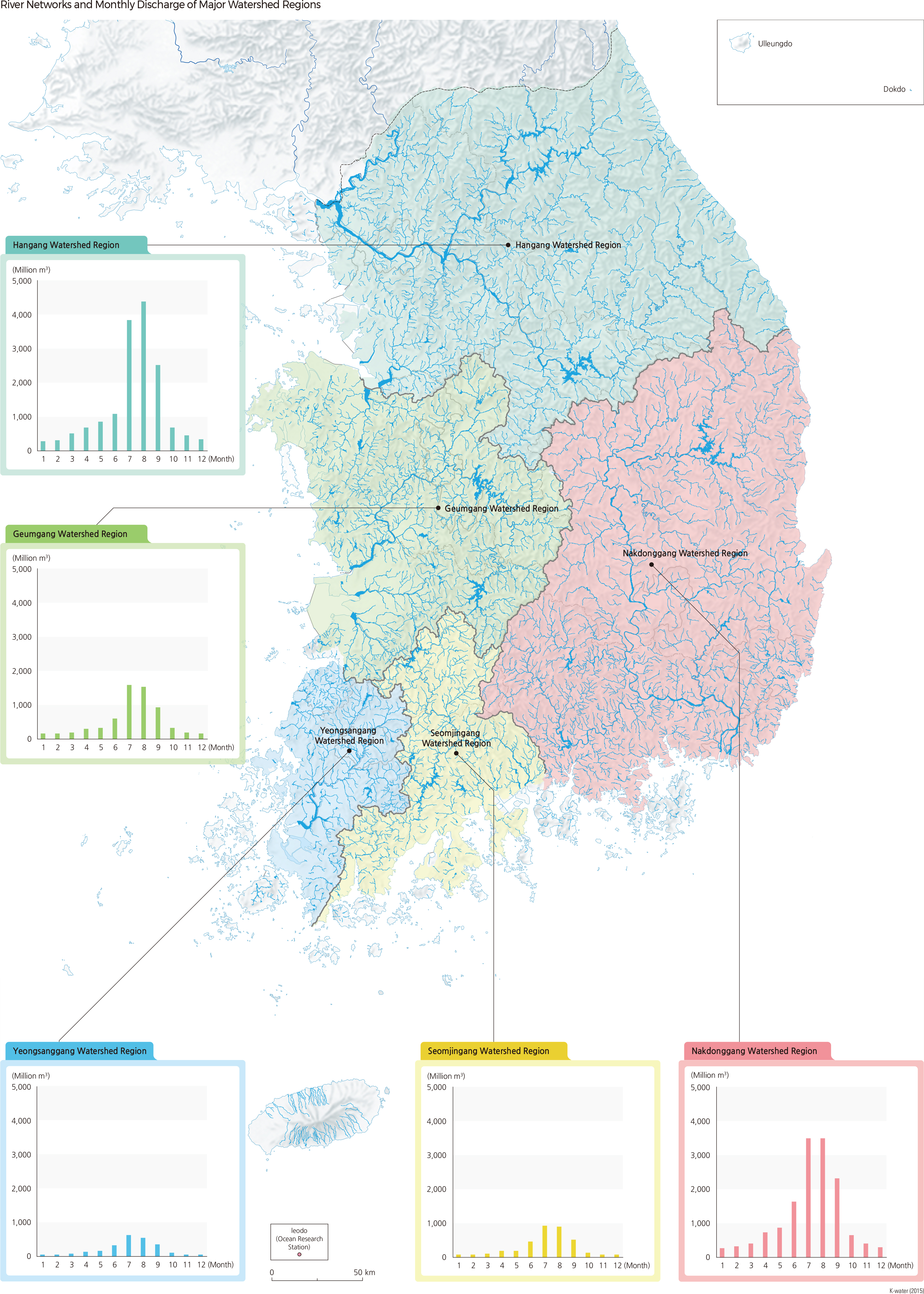
The terrain of Korea is characteristically high along the east coast and low along the west coast. Consequently, most of the rivers flow into the Yellow Sea and the South Sea. The shoreline of the east coast is monotonous and rivers flowing into the East Sea are relatively short and steep-sloped. On the other hand, the shoreline of the west coast is more complex and many rivers flowing to the western and southern coasts are relatively long; they have gentle slopes and wider basins that result in higher flow. In these areas, river sediments shape extensive alluvial plains and alluvial basins, and meandering channels are often formed as well.
In Korea, there are five large rivers: Hangang, Nakdonggang, Geumgang, Seomjingang, and Yeongsangang. Several mid to small-scale rivers are also found in the country, including Anseongchun, Sapgyochun, Mangyeonggang, Dongjingang, and Hyeongsangang. In order to systematically manage river and water resources, the rivers have been divided into 117 sub-basins. Hangang has the largest drainage area of 35,770 ㎢ (including the portion in North Korea). It also has an annual runoff volume of 16 billion ㎥, which constitutes 35.1% of the nation's total runoff volume. The longest river in Korea is Nakdonggang, with a length of 510 km.
From 2010 to 2019, the average annual precipitation in Korea was approximately 1,263.1 mm, which is equivalent to about 1.6 times the world average. This is enough to classify Korea as a high rainfall region, although seasonal variability is extremely high. Due to seasonal rain and typhoons, 620.7 mm of rainfall (49.1% of the annual rainfall) is concentrated during the summer and often causes floods. Furthermore, rainfall has the tendency to quickly collect in the rivers as over 70% of the land is mountainous with an average slope of about 20%. These geomorphological and climatic characteristics cause high fluctuations in the flow rate of rivers throughout the year, often causing extensive floods and severe droughts.
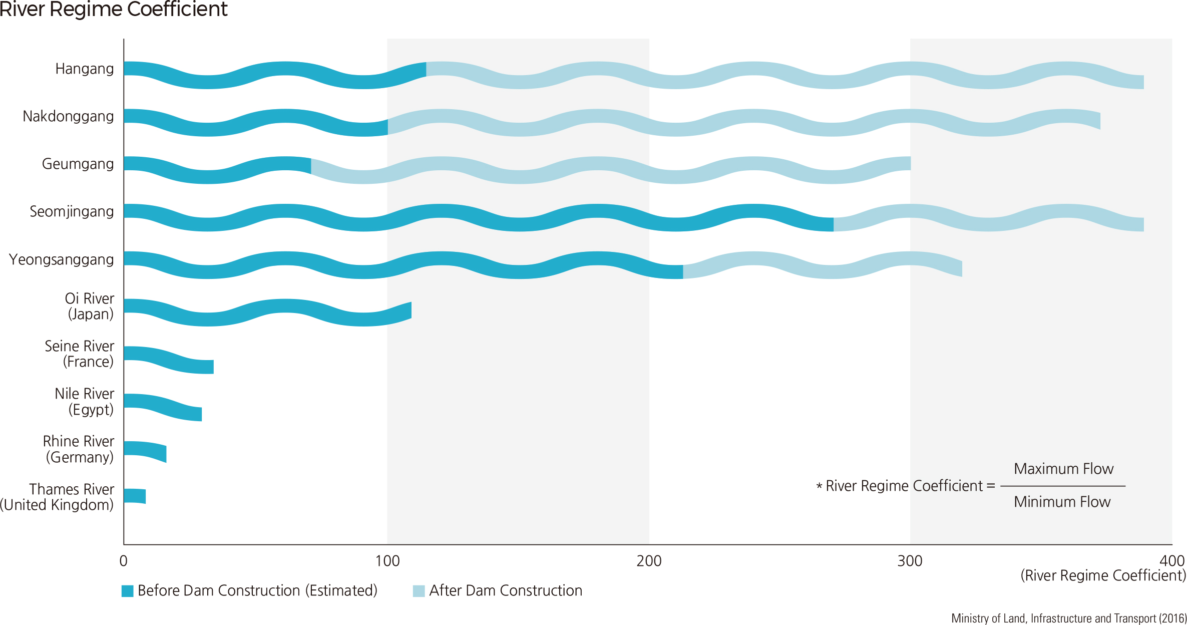
The river regime coefficient indicates the ratio between the maximum and minimum flow of a river. Seomjingang currently has a river regime coefficient of 270, which is the highest among the five large rivers of Korea, and nine times higher than the Nile River in Africa (river regime coefficient: 30). Before the installation of dams, each of the five large rivers had river regime coefficients that were higher than 300. In particular, Seomjingang and Yeongsangang displayed extremely high levels at 390. Consequently, dams and reservoirs were actively constructed to ensure the reliability of water resources, reduce flood damage, and mitigate the effects of drought. Intensive plans were also implemented to conserve river banks and their surrounding areas. |