English II 2020
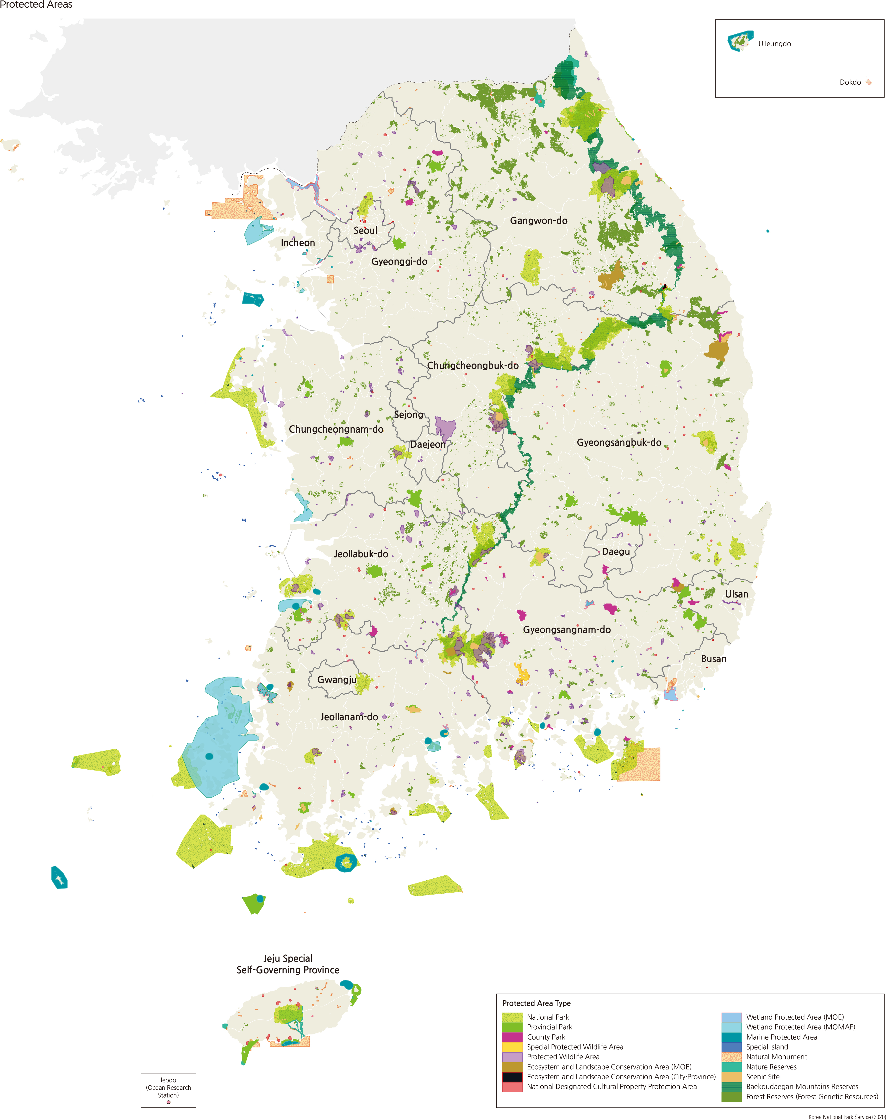
The modern concept of protected areas was primarily implemented in Korea by establishing the Forest Act, Parks Act, and Cultural Property Protection Act in the 1960s. Hongdo and Seoraksan were designated as the first nature reserve in 1965, and Jirisan was designated as the first National Park in 1967.
As of 2017, there are 28 protected areas and 14 related Acts regarding the protected areas in Korea. Three of the 10 Acts, the Natural Environment Conservation Act, Marine Environment Management Act, and Cultural Property Protection Act, deal with general matters of environmental and cultural property protection, regulating relevant provisions for these protected areas. The remaining 11 Acts mainly contain provisions focusing on the designation and management of protected areas.
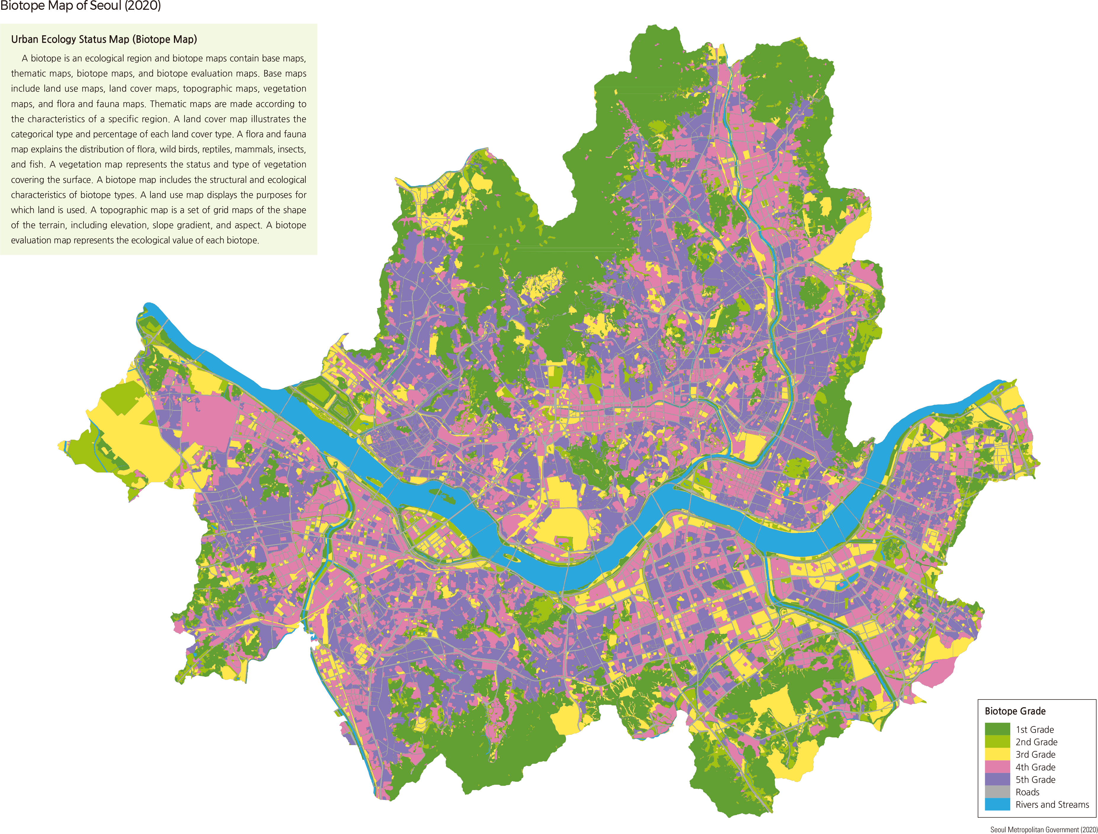
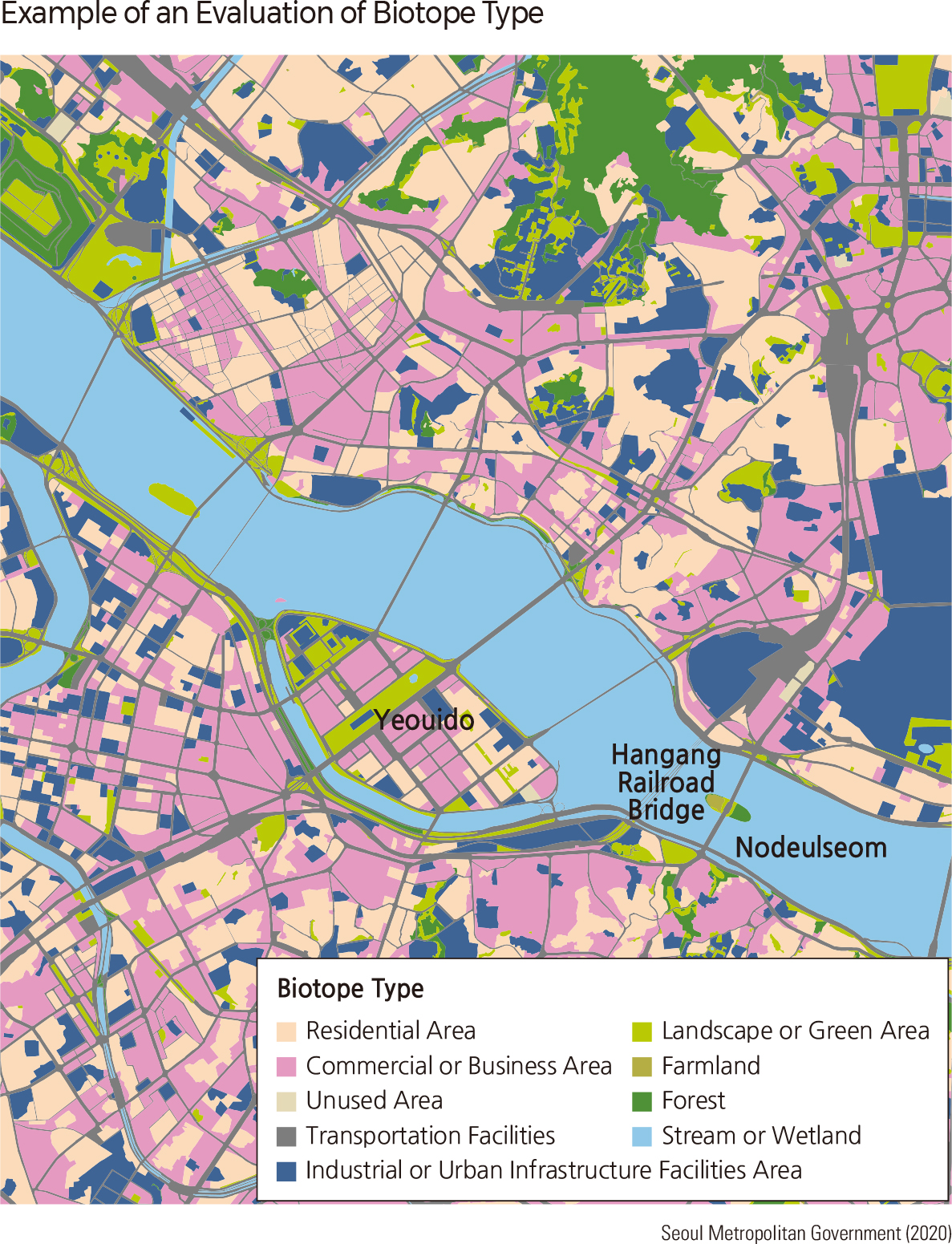
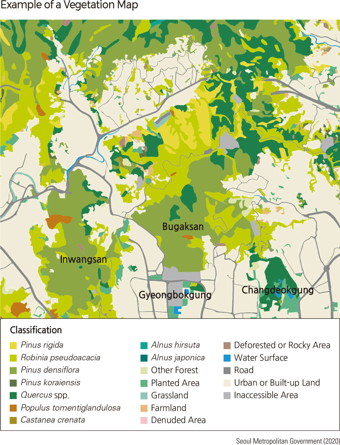
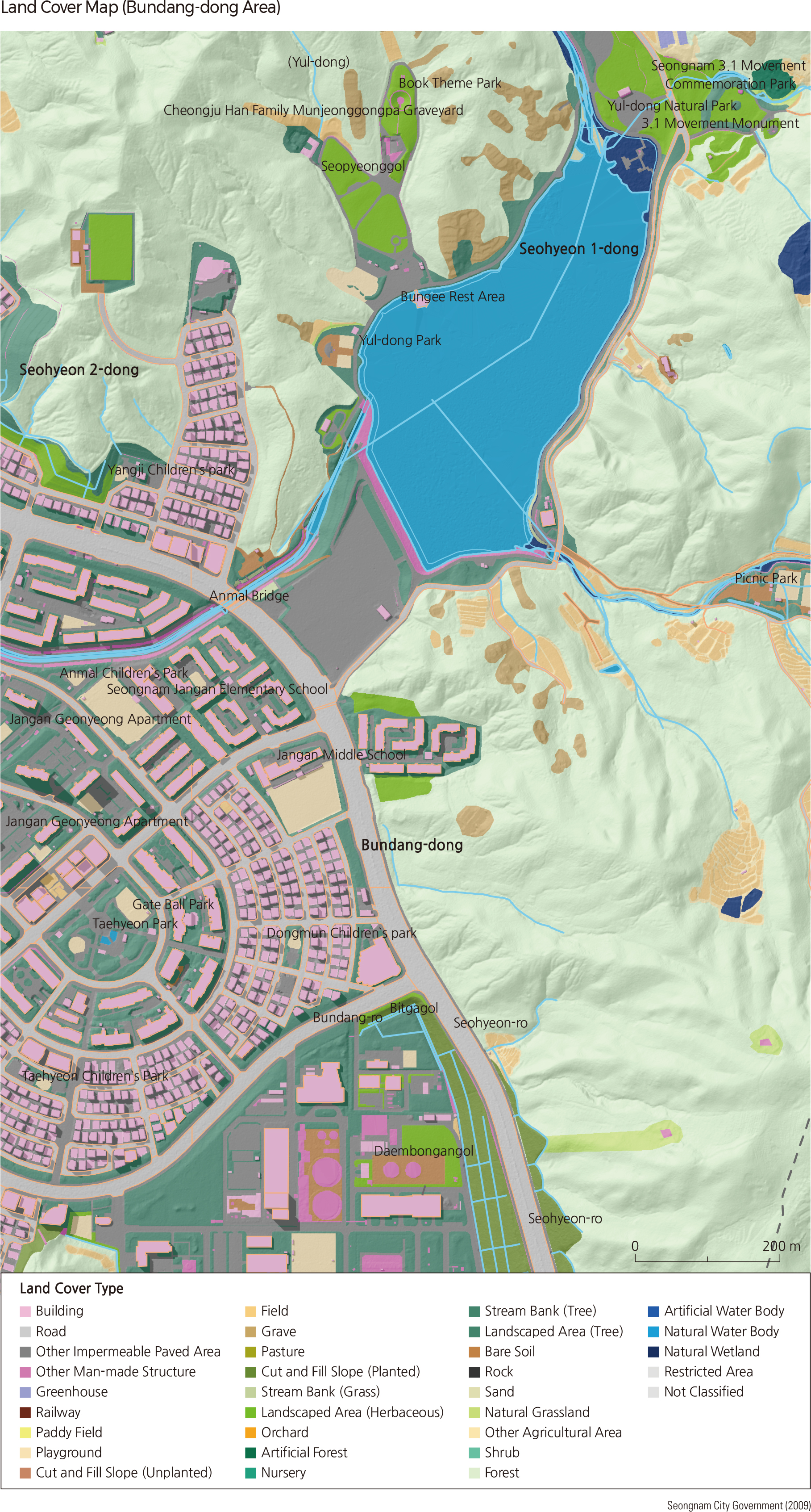
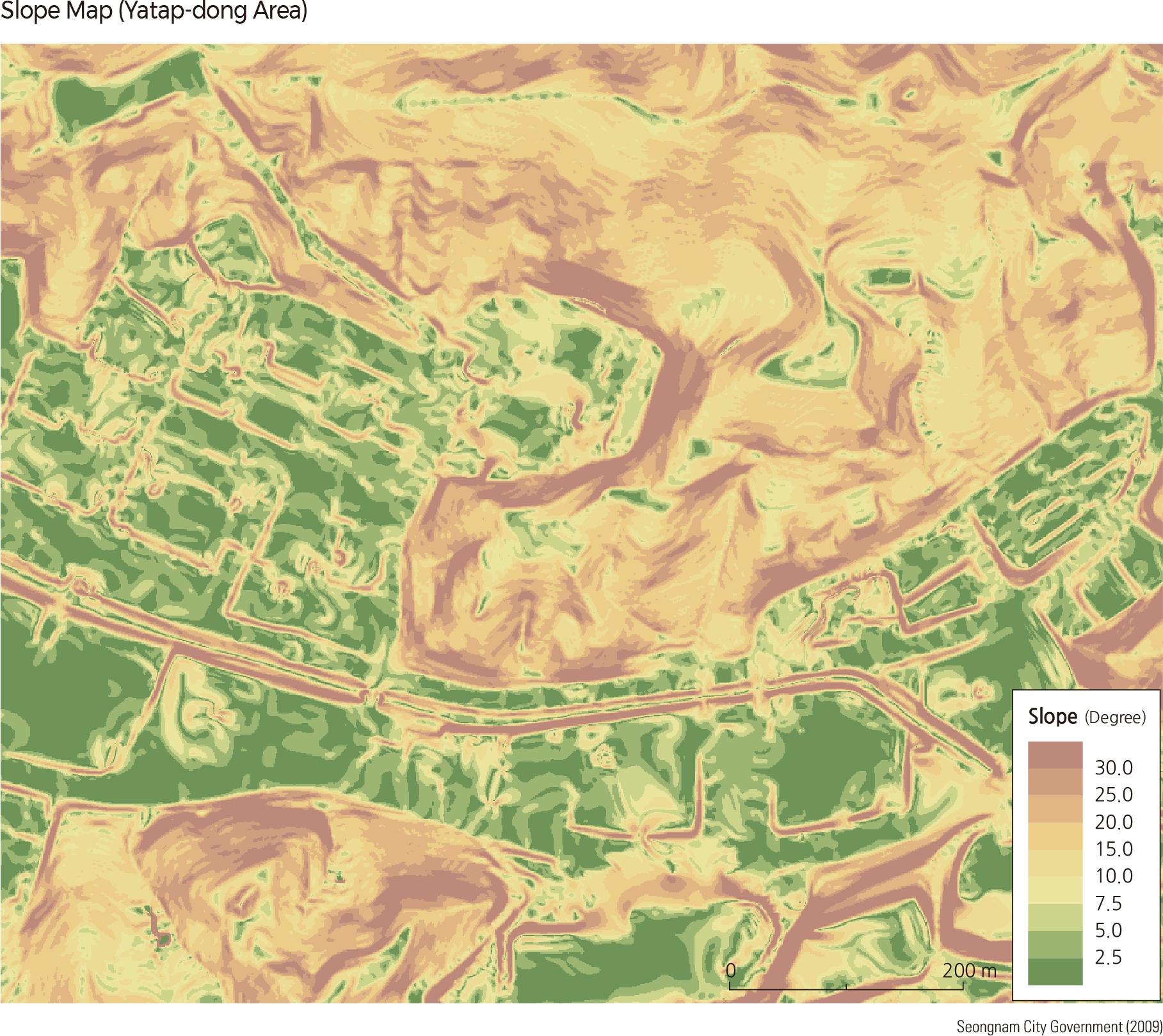
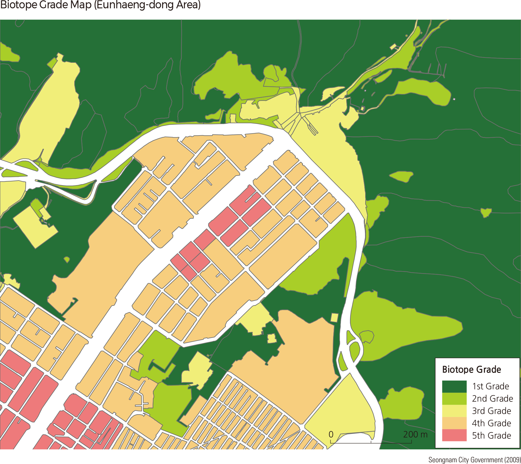
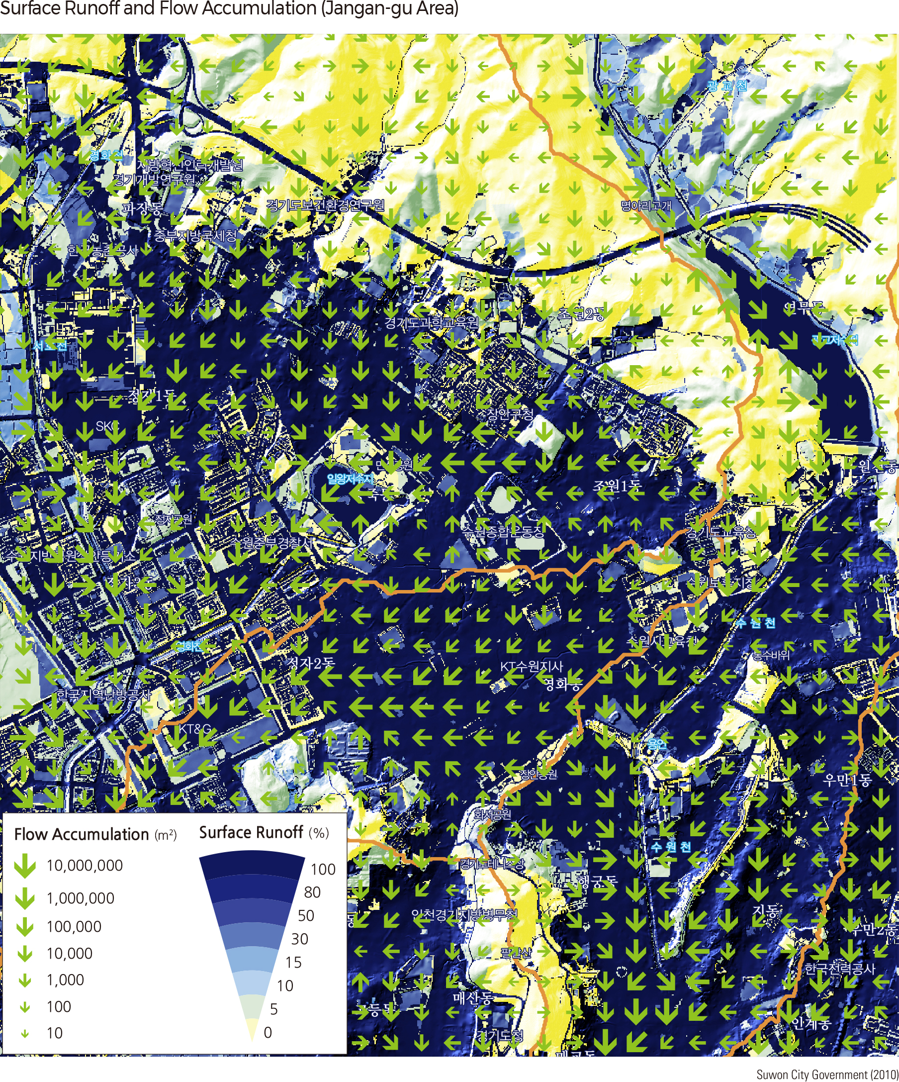
Korea is a highly urbanized country, with as many as 9 out of 10 people living in cities. It is increasingly important to manage the urban areas in eco-friendly and sustainable ways. A biotope map is a map that shows an area's biodiversity status based on investigations performed by local governments to take better action against the problems within their administrative districts. It divides the map area by biotope unit and expresses the biotope type based on the ecological characteristics and the rating of each biotope's value.
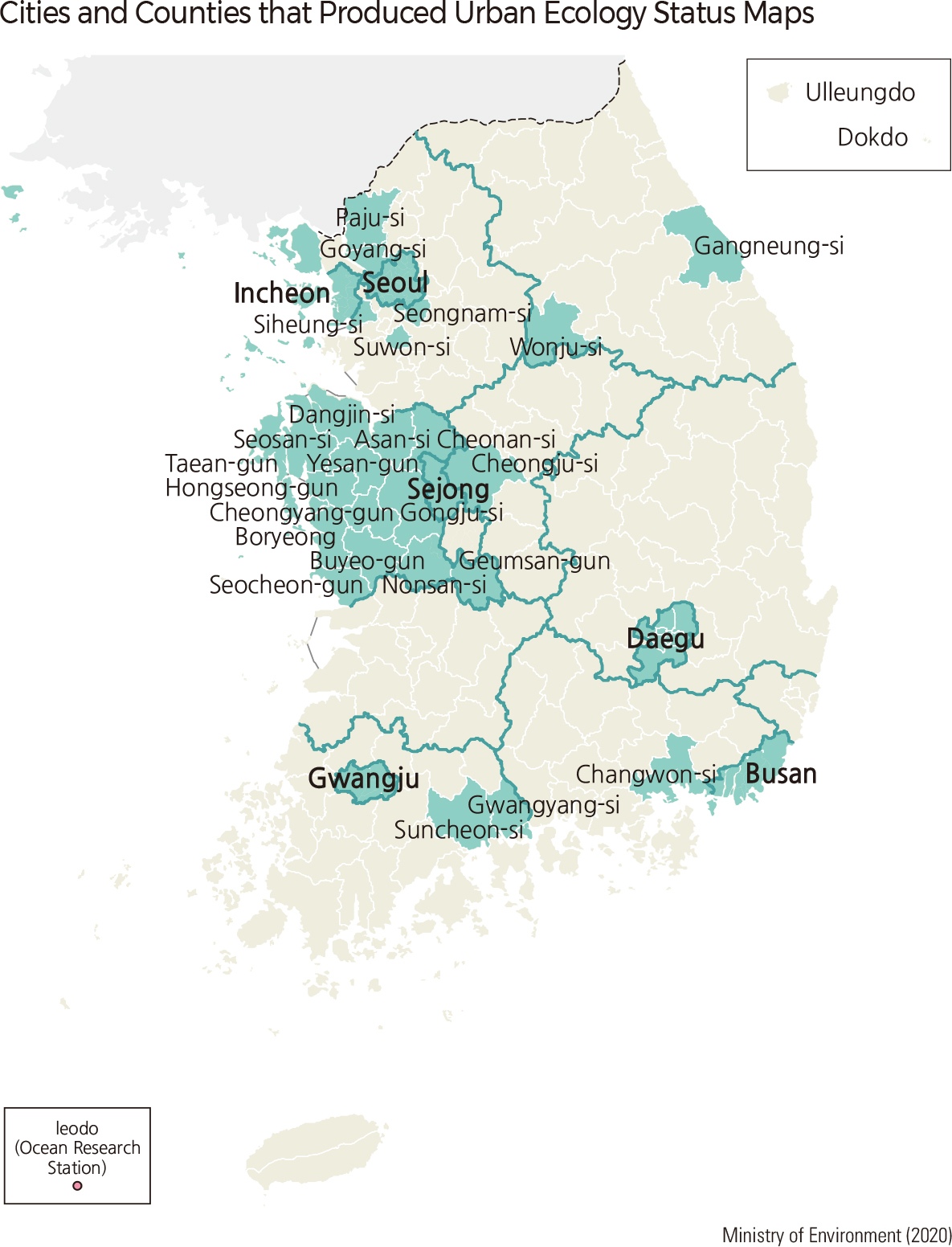
The first biotope map for Korea was created in 2000 in Seoul. Seoul developed a biotope map to serve as the baseline data for eco-friendly urban management and has been updating the map every five years. The Seoul Urban Planning Ordinance specifies the development and the usage of the biotope map for land suitability assessments and several other fields. Since then, local governments, including Seongnam-si, Gwangyang-si, Goyang-si, and Siheung-si, have created urban biotope maps. As of 2020, 33 local governments have completed producing urban biotope maps. Local governments produce urban biotope maps as needed. Since 2007, the central government, the Ministry of Environment, has distributed guidelines for creating urban biotope maps. Due to the amendment of the Natural Environment Conservation Act in 2017, local governments are obligated to produce urban biotope maps. Accordingly, the Ministry of Environment encourages local governments to submit their urban biotope maps by 2021.
Biotope maps are used as referential data in projects such as conservation and restoration of natural environments, the formation of ecological networks, and eco-friendly sustainable urban management. Local governments are currently utilizing these maps for environmental assessment, development permission, urban planning, and ecosystem management, and the scope of the usage is gradually expanding. A land-environment linkage system is being developed to promote appropriate land development in harmony with the environment. Biotope maps are expected to play an important role in this procedure. These maps provide the most detailed data among all available data that represent ecological status. Spatially explicit environmental plans based on these maps are further applied to urban planning processes.
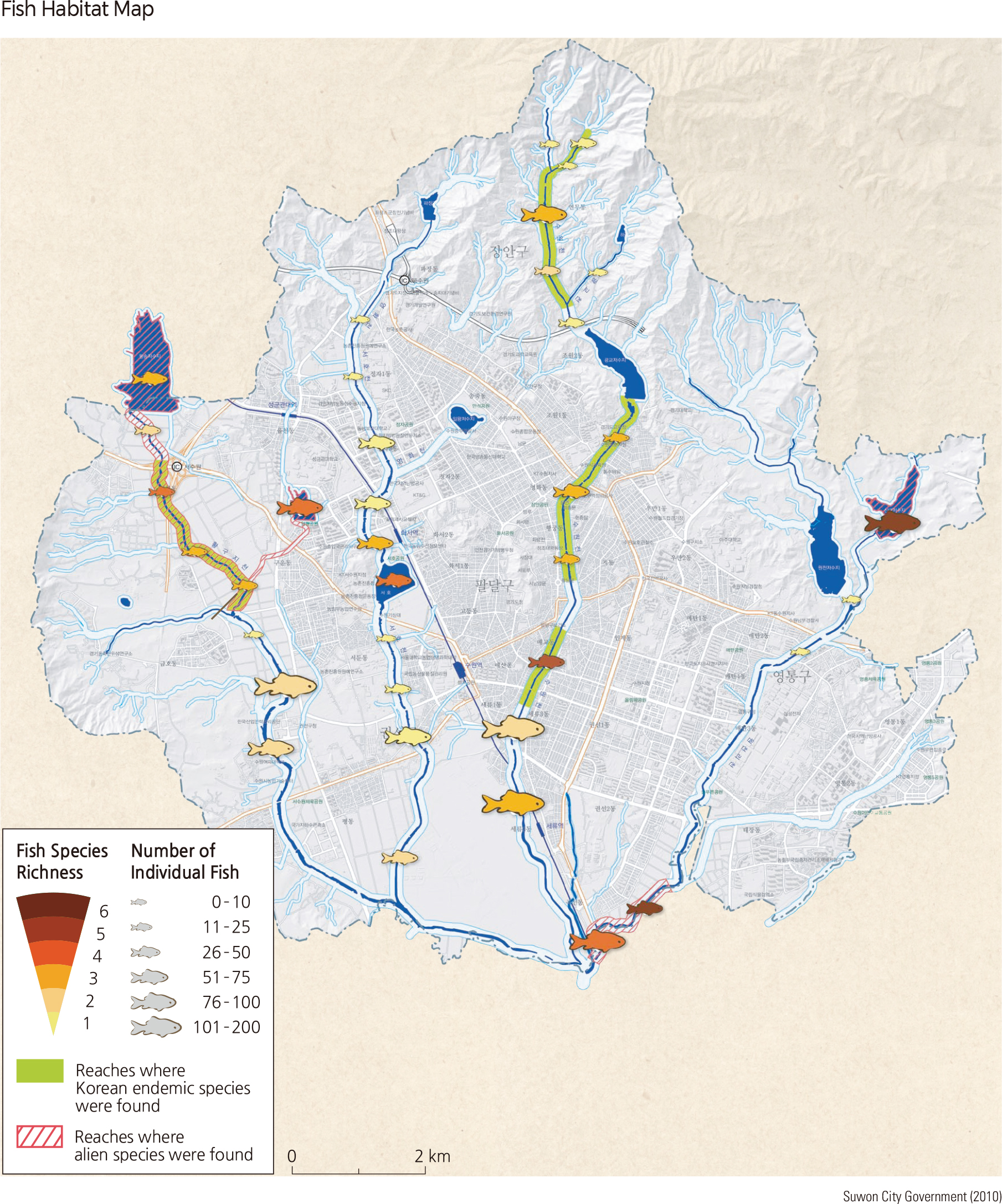
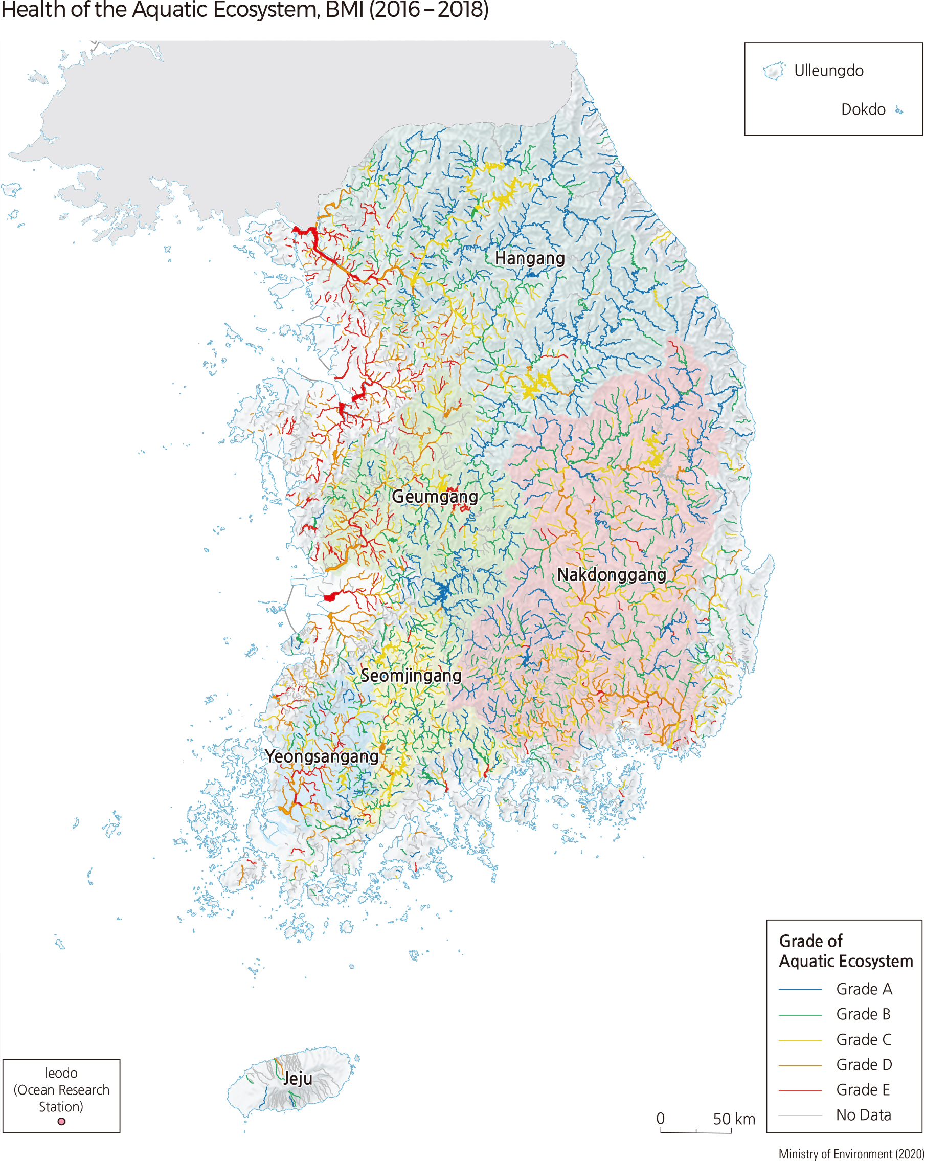
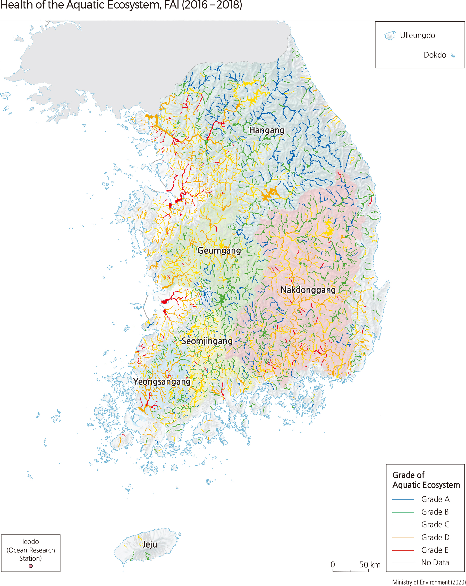
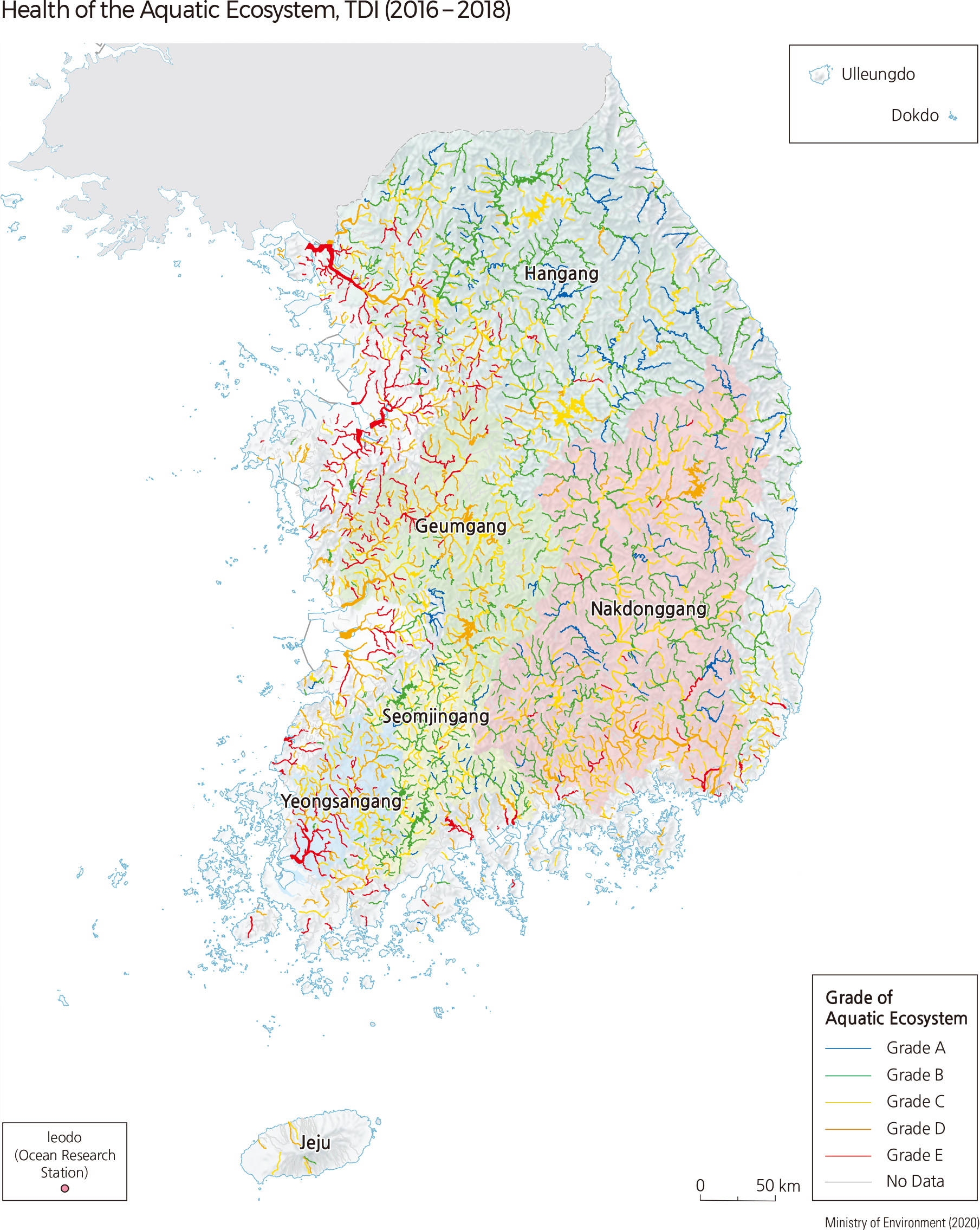
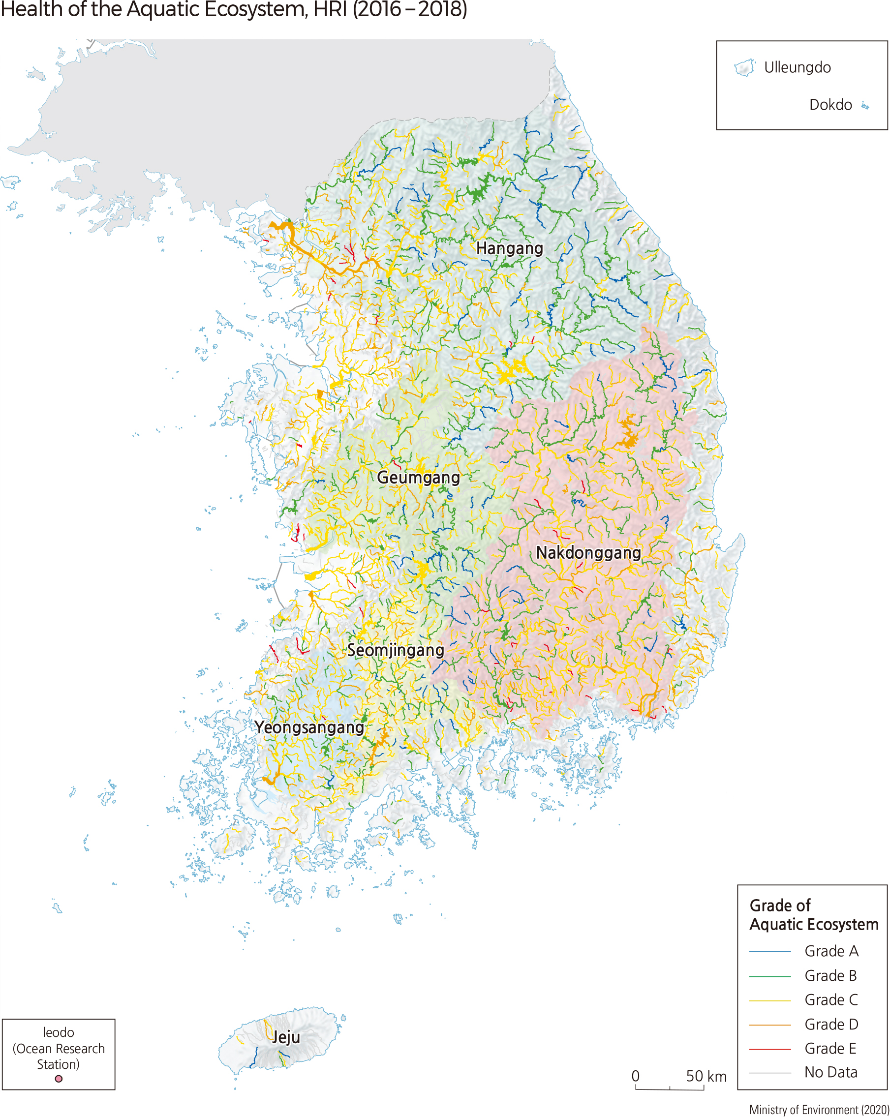
The aquatic ecosystem is an environment in which living organisms, habitats, and water quality affect each other. The aquatic ecosystem is healthy when the physical, chemical, and biological elements that make up the aquatic ecosystem are not damaged and perform their functions. Fish Assessment Index (FAI), Benthic Macroinvertebrate Index (BMI), Trophic Diatom Index (TDI), and Habitat and Riparian Index (HRI) are calculated to evaluate the health of the aquatic ecosystem. Based on the results, the health of the aquatic ecosystem is divided into 5 grades very good (A), good (B), fair (C), bad (D), and very bad (E) considering the diversity and abundance of species and the physical environment. |