English II 2020
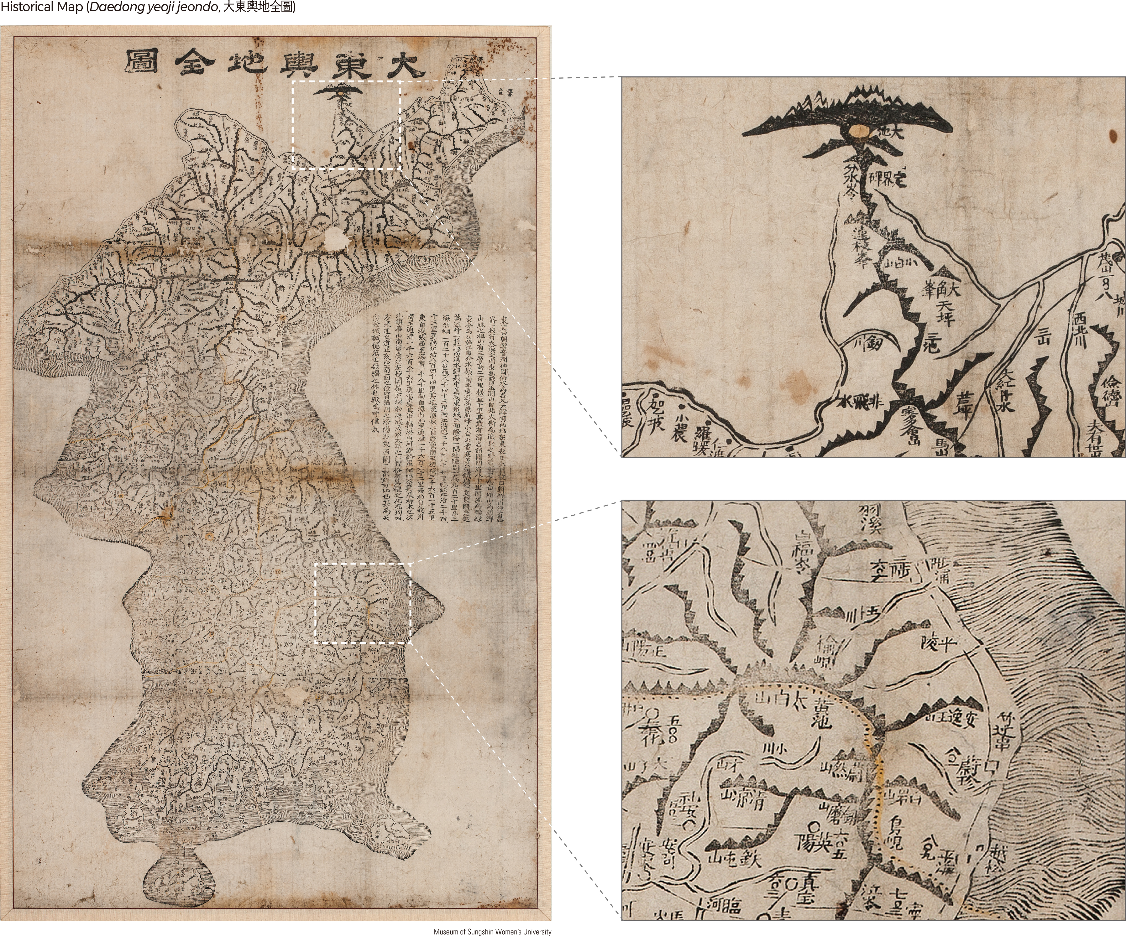
Daedong yeoji jeondo, housed in the Sungshin Women’s University Museum, is a reduction from the original Daedong yeojido to a smaller scale (65 cm by 110 cm) by the great Korean cartographer Kim Jeongho in 1861 (Year 12 of King Cheoljong). Mountains are represented in this map using a chain-like feature–connecting mountain ranges with a line–similar to that used in Daedong yeojido. Famous mountains such as Baekdusan, Jangbaeksan, Geumgangsan, Nangnimsan, and Odaesan were indicated by highlighting the peaks with a rock shape. In addition, serrated crests were expressed in different thicknesses depending on the width and height of the crest topography, with major passes also marked on the map. The original Daedong yeojido (360 cm by 685 cm) covers an area spanning 19 longitudinal by 22 latitudinal lines carved on 121 woodblocks. It included 213 map pages when bound into a book.
The distribution pattern of the royal tombs of Joseon shown in Dongyeodo demonstrates the influence of Pungsu (Feng Shui) and Confucianism on their locations. These tombs are generally distributed from north to south along the mountain chains. Most of the tombs are located within 100 ri (about 40 km) from the royal palace, and the majority (26 tombs) are distributed within 8–16 km. Thirty-two royal tombs of the Joseon Dynasty are concentrated in the northeast and northwest zones of the capital city (Hanyang), and only seven are located to the south of Hangang. The tombs are meticulously designed according to Pungsu principles. Royal tombs are predominantly south-facing, followed by east-facing. Over 70% of royal tombs have a southerly orientation, including south, south-south-east, south-south-west, south-east, and south-west. Some royal tombs are oriented northeast and northwest. Most tombs are located in banded gneiss and granite with thick topsoil.
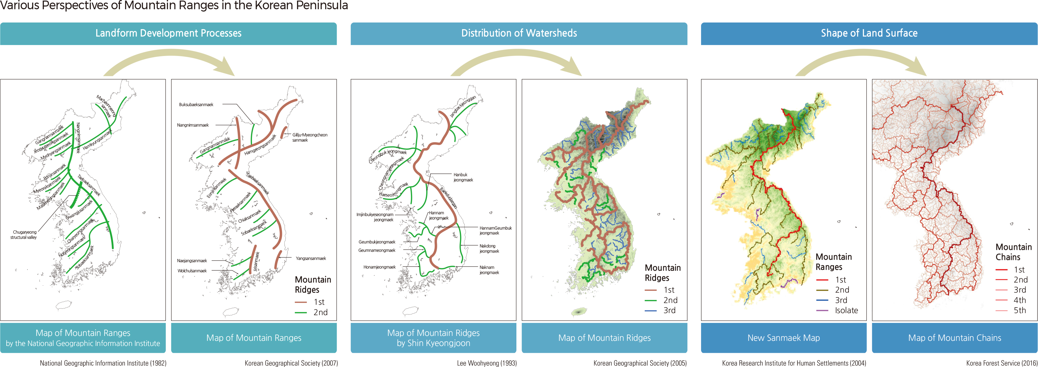
Making up a large proportion of the Korean Peninsula, mountainous regions and their complex distributions are mapped in multiple ways. Three main methods are currently being used to represent mountain distribution: the mountain ridge map, the mountain range map, and the mountain chain map.
The traditional geographical thought of Korea is portrayed in mountain ridge maps, which use lines to express the intertwined relationship of major mountains. A representative mountain ridge map is the Baekdudaegan map, which was published in Sangyeongpyo. The map illustrates 1 Daegan, 1 Jeonggan, and 13 Jeongmaek.
Mountain ridge maps help us visualize the geographical unity of the Korean Peninsula by emphasizing that mountain systems are interconnected just as rivers are continuous. These maps specifically demarcate high peaks and mountain ridges, recognizing their importance as connecting passageways between living spheres and ridges. Even without modern scientific explanations of geological structures, terrain formation, and landscape changes, traditional geography emphasized watershed systems to differentiate human settlement areas. By connecting the mountain ridge of Baekdusan and Jirisan, the Baekdudaegan map provides a sense of unity and order throughout the Peninsula and helps secure the national symbolism of Baekdusan. The full uninterrupted illustration of the watershed further helps to identify rivers and mountain ridges more easily.
The mountain ridge system of Baekdudaegan, proposed by Shin Kyeongjoon, resembles the watershed dividing lines of the ten main river basins in Korea and reflects the connectivity of the mountains. Understanding mountains based on river basins is a unique way of geographically visualizing indigenous nature in Korea. The mountain ridge map enhances the understanding of the natural environment and the distribution of villages.
|