English II 2020
The Korean Peninsula had long been recognized as relatively safe from strong earthquakes compared to other countries such as Japan and Taiwan. However, since the Korea Meteorological Agency (KMA) began to officially record seismic activity in 1978, there has been strong seismic activity, including the earthquakes at Hongseong-gun (a magnitude of 5.0) in 1978, Yeongwol-gun (a magnitude of 4.5) in 1996, Odaesan (a magnitude of 4.8) in 2007, Gyeongju (a magnitude of 5.8) in 2016, and Pohang (amagnitude of 5.4) in 2017. Further investigation using Korean historical records indicates that there were even larger magnitude earthquakes in the past. Thus, this evidence leads to the conclusion that the Korean Peninsula is not a seismically-safe region.
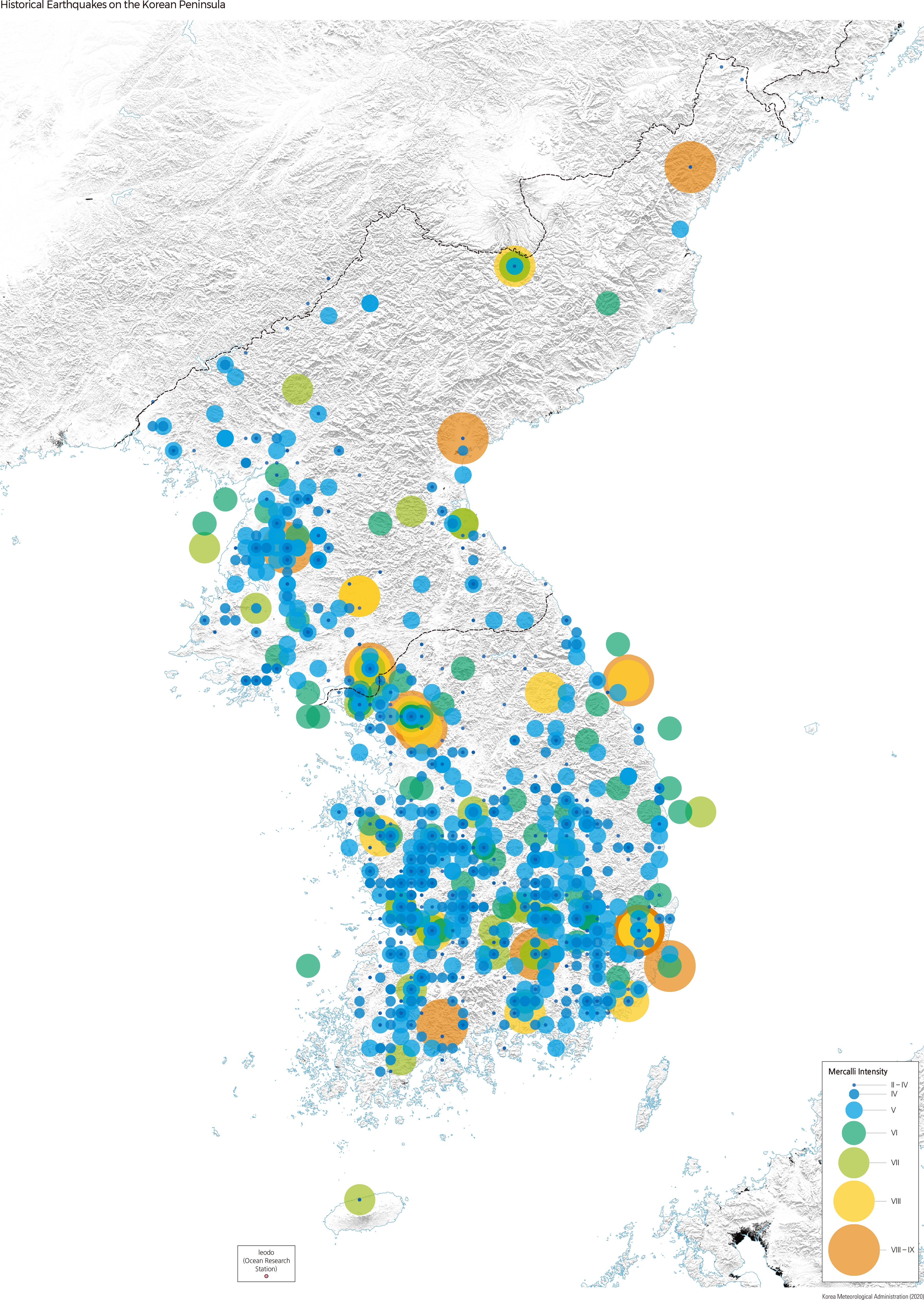
The epicenters of historical earthquakes with seismic intensity greater than a magnitude of 5.0 are mostly located in the south of Chungcheong-do and the western Pyeongan-do. These historical earthquakes caused casualties, damage to castles, and ground ruptures, leading to tsunamis. For example, during the 21st year of the reign of King Injo (1643 CE), a strong earthquake in Ulsan collapsed castle walls and caused a tsunami. Such historical information warns of the necessity of increased preparation for future earthquakes and tsunamis on the Korean Peninsula.
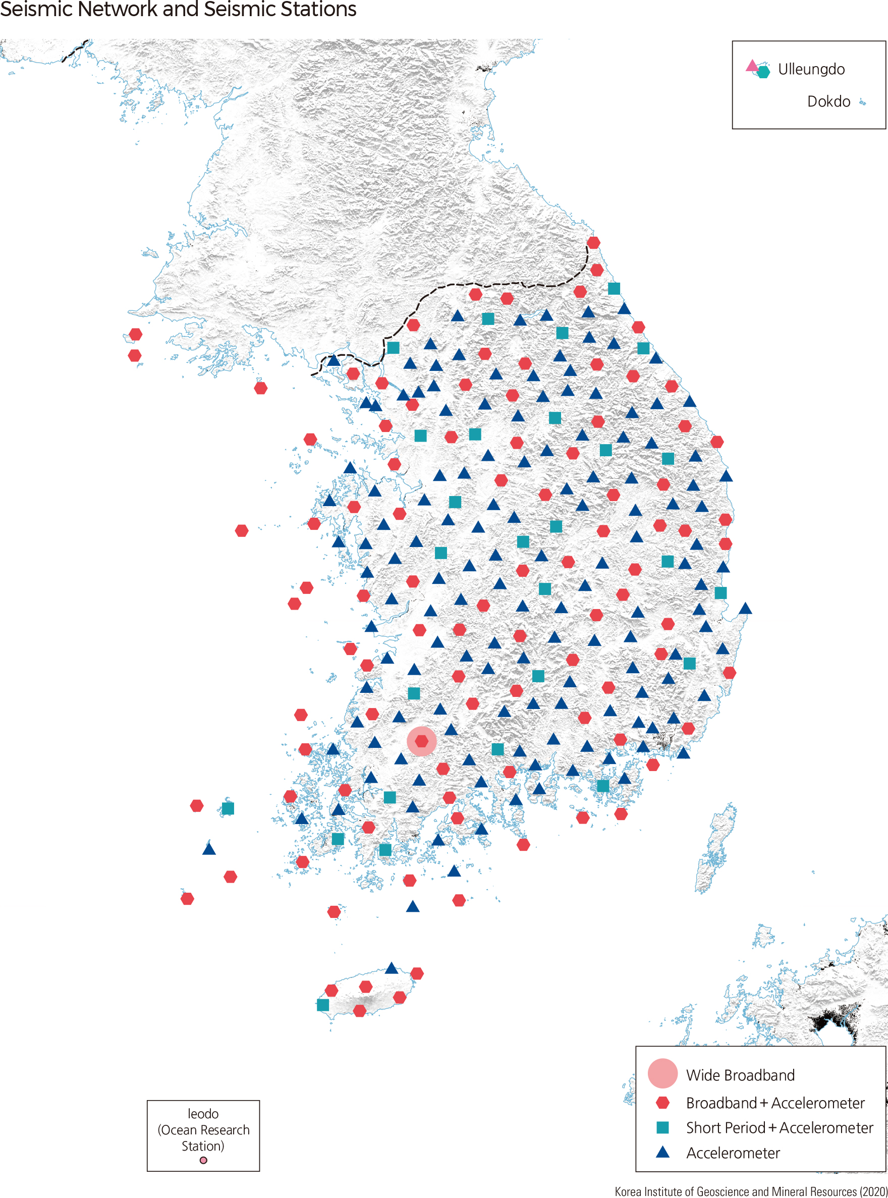
The observation of seismic activity officially began after the installation of a mechanical seismograph at Incheon in 1905; later, seismographs were installed in five more stations in Seoul, Busan, Daegu, Pyongyang, and Chupungryong. In 1937, quantitative seismic observations of seismic activity on the Korean Peninsula began at these six stations. As of 2020, two major seismic agencies, the KMA and KIGAM (Korean Institute of Geology and Mining), are operating 260 digital seismic stations to monitor seismic activity on the Korean Peninsula.
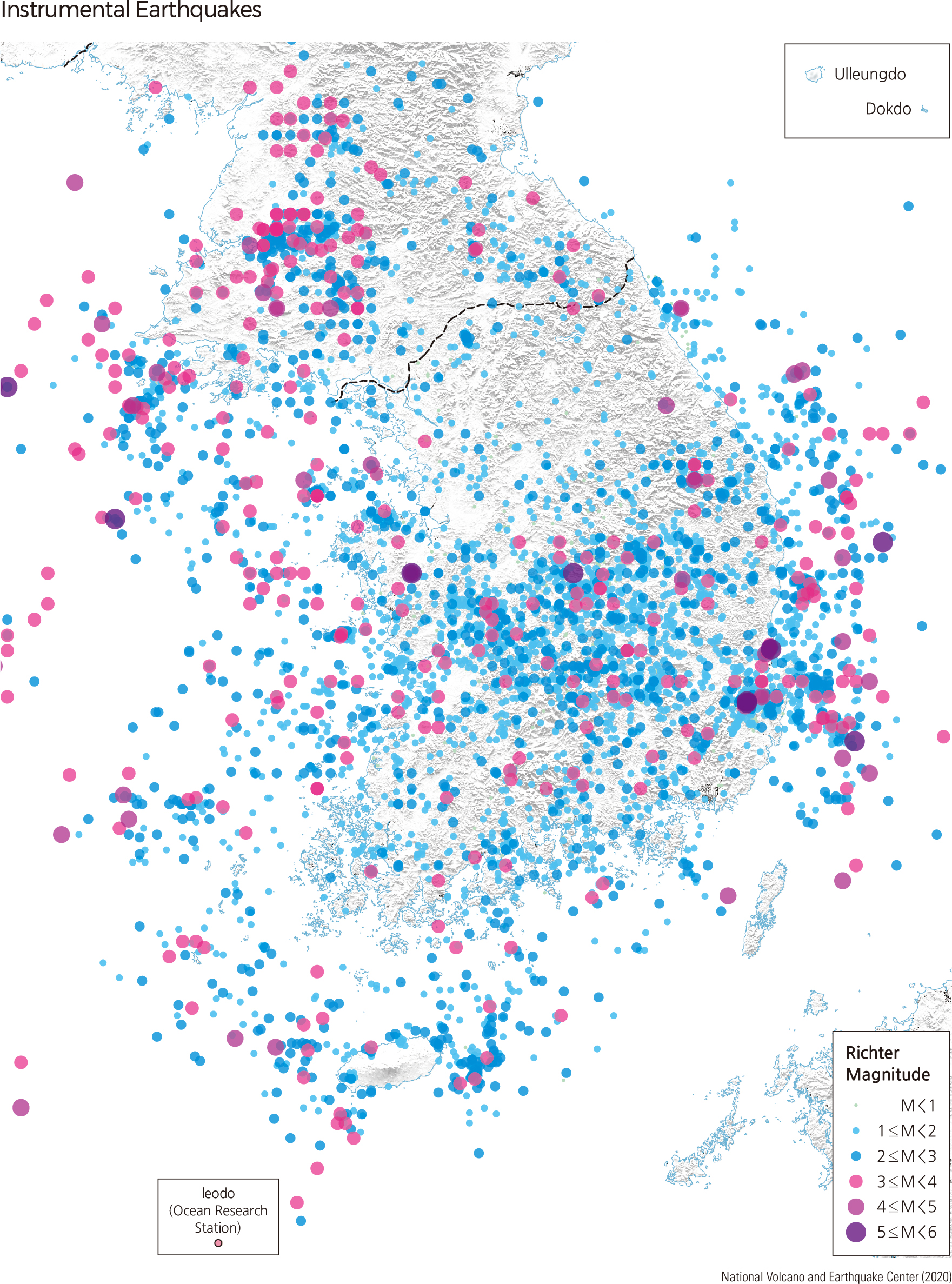
After introducing instrumental seismic observation in 1978, the strongest recorded earthquake (a magnitude of 5.8) occurred in September 2016 in an area located 8 km south-south-westward from Gyeongju. The second strongest earthquake occurred in November 2017 in Pohang, with a magnitude of 5.4. The next notable earthquakes occurred in May 2004 with a magnitude of 5.2 in Uljin-gun, Gyeongsangbuk-do, and in September 1978 in Sokrisan. Unofficially, an earthquake occurred in January 1980 in the Uiju-Sakju-Gwiseong area in Pyunganbuk-do, with a magnitude of 5.3.
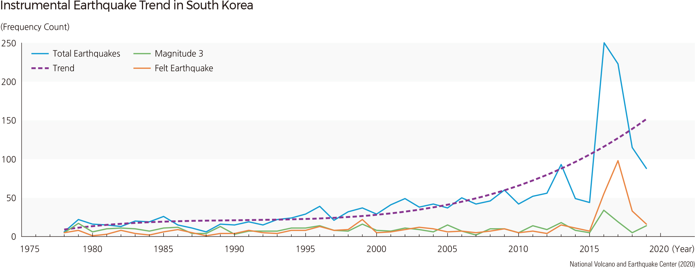
The instrumental earthquake data indicate that the epicenters of most earthquakes are located in seawater around the Korean Peninsula and the regions to the south of western Gyeonggi-do and Chungcheong-do. This result is similar to the distribution pattern of the epicenters of historical earthquakes mentioned above. Since instrumental seismic observation began in 1978, the frequency of seismic activity has increased. If felt earthquakes, those with a magnitude greater than 3, are considered, frequency has remained the same from 1978 to the present. However, the frequency of felt earthquakes increased temporarily between the Gyeongju earthquake in 2016 and the Pohang earthquake in 2017.
Based on both the instrumental and historical data, the probable maximum magnitude of an earthquake on the Korean Peninsula is estimated to lie between 6.9 and 7.5, with a recurrence period of a few hundred years. |