English II 2020
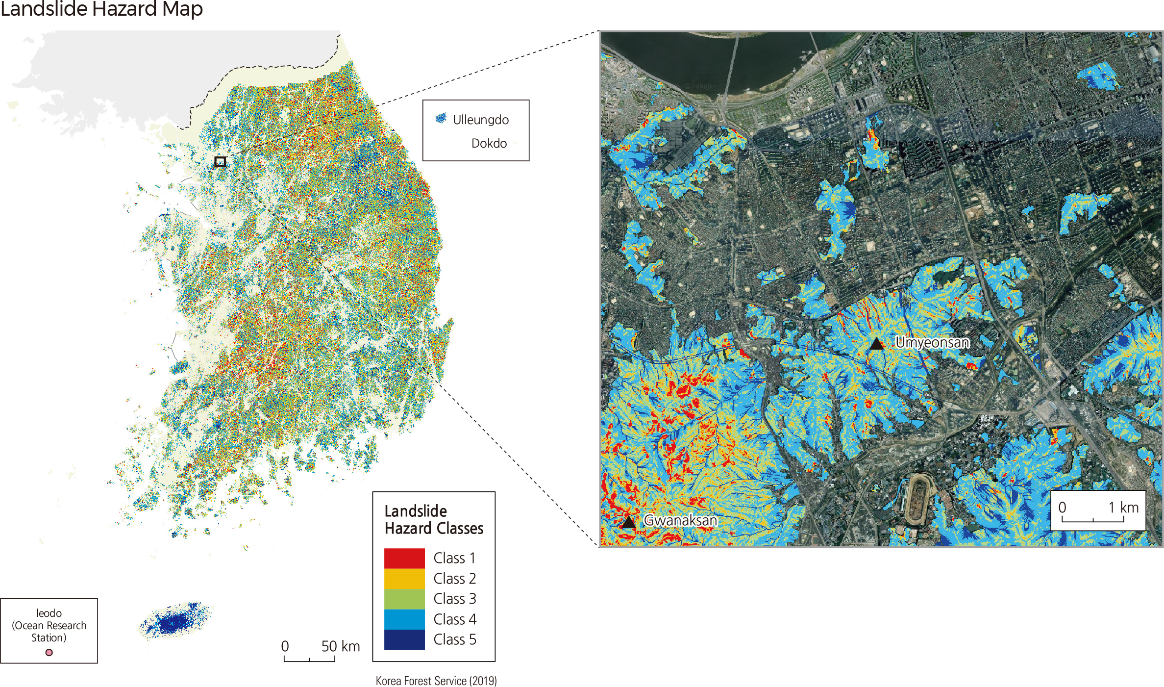
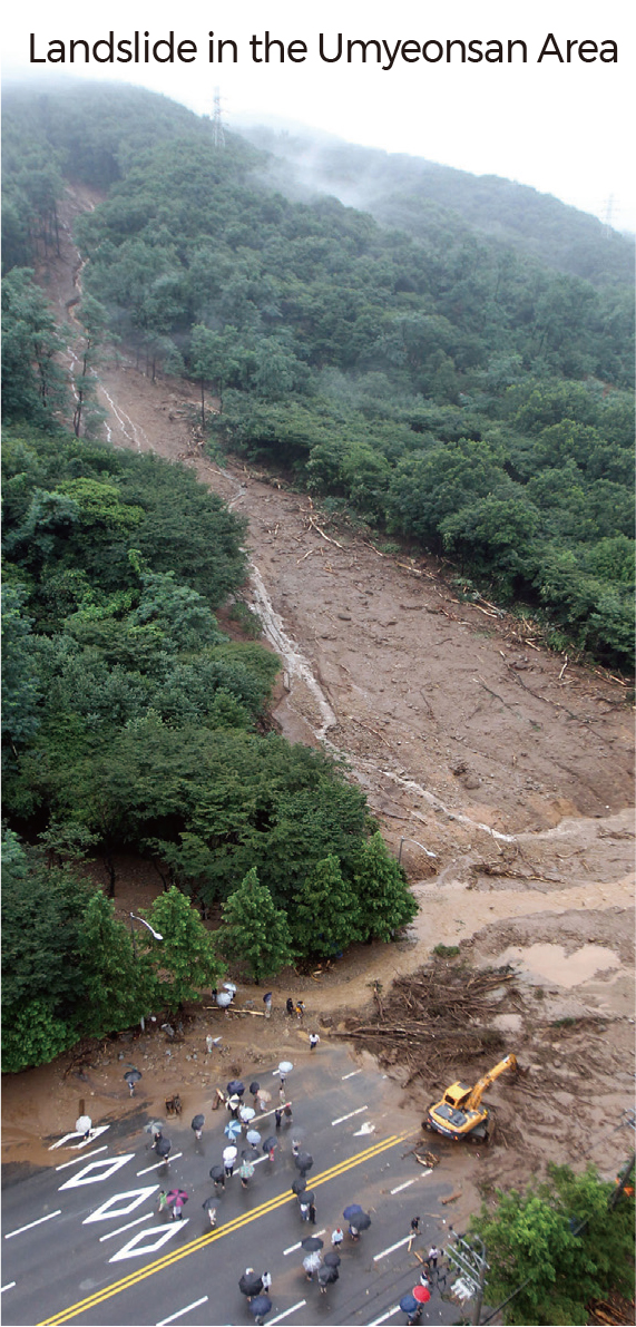
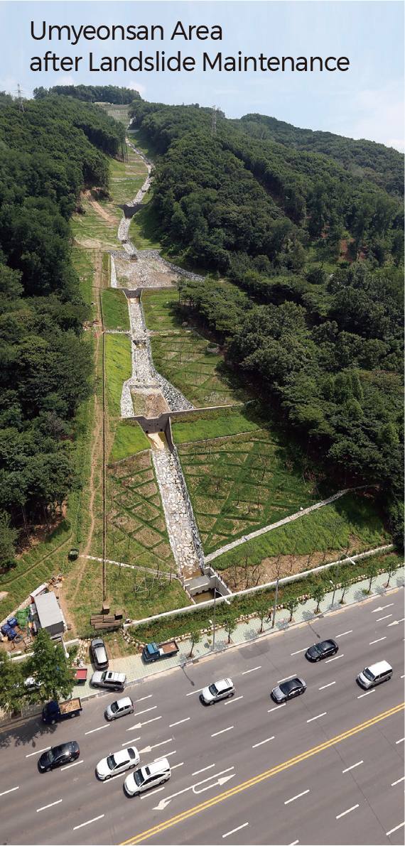
The landslide hazard map shows the landslide risk for all mountains in Korea. The map classifies the risk into five groups with regard to both internal and external triggering mechanisms for landslides. The maps include the landslide hazard map for Korea and the magnified Umyeonsan area in Seoul. The images on the right show a landslide that caused 67 casualties in the Umyeonsan area on July 25, 2011. The image on the right shows the Umyeonsan area when the maintenance work had been finished after the disastrous landslide.
Most landslides are caused by heavy rains or earthquakes, thunder, or volcanic eruptions. Landslides can happen in any place with a slope angle over 30˚, and areas with groundwater flowing are susceptible. Landslides can occur where the slope of the stratum is similar to the land surface and when the land surface changes from concave to convex in shoulder zones.
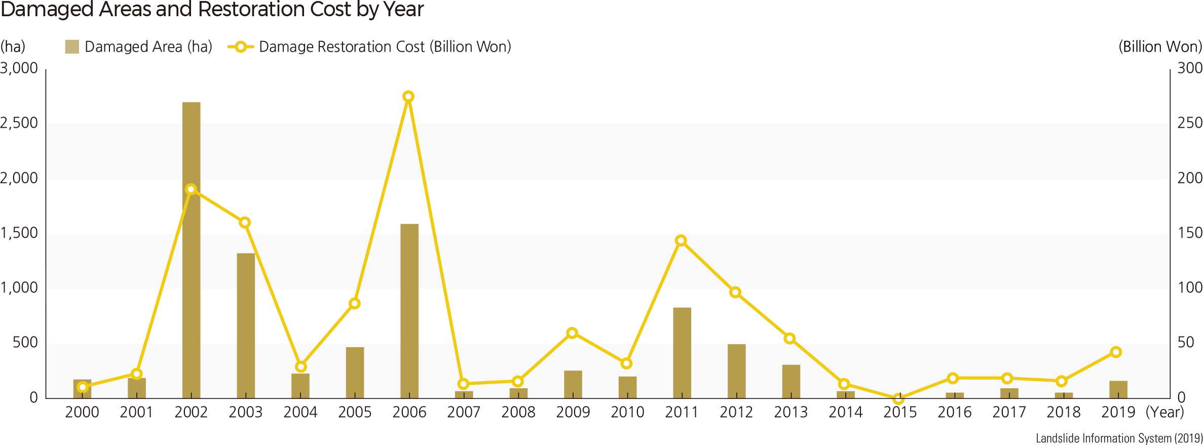
It is difficult to predict landslides because they occur sporadically when heavy rains fall over a short period. Landslides can cause more casualties. When a landslide occurs, a great amount of water and debris mix together, becoming a debris flow that can lead to destructive erosion in valleys. Huge amounts of earth material deposited downstream can lead to secondary damage such as stream flooding due to raised river beds. |