English II 2020
Information on the variety of ore mineral resources used during and before the Joseon Dynasty and their production districts on the Korean Peninsula is summarized in the Chosun Ore Deposits in Ancient Literature published by the Japanese geologist Kawasaki. The literature indicates that the geological prospecting and mining of mineral resources precedes the Joseon Dynasty. The number of ore minerals noted in the ancient literature is substantial—twenty times the number we know of today.
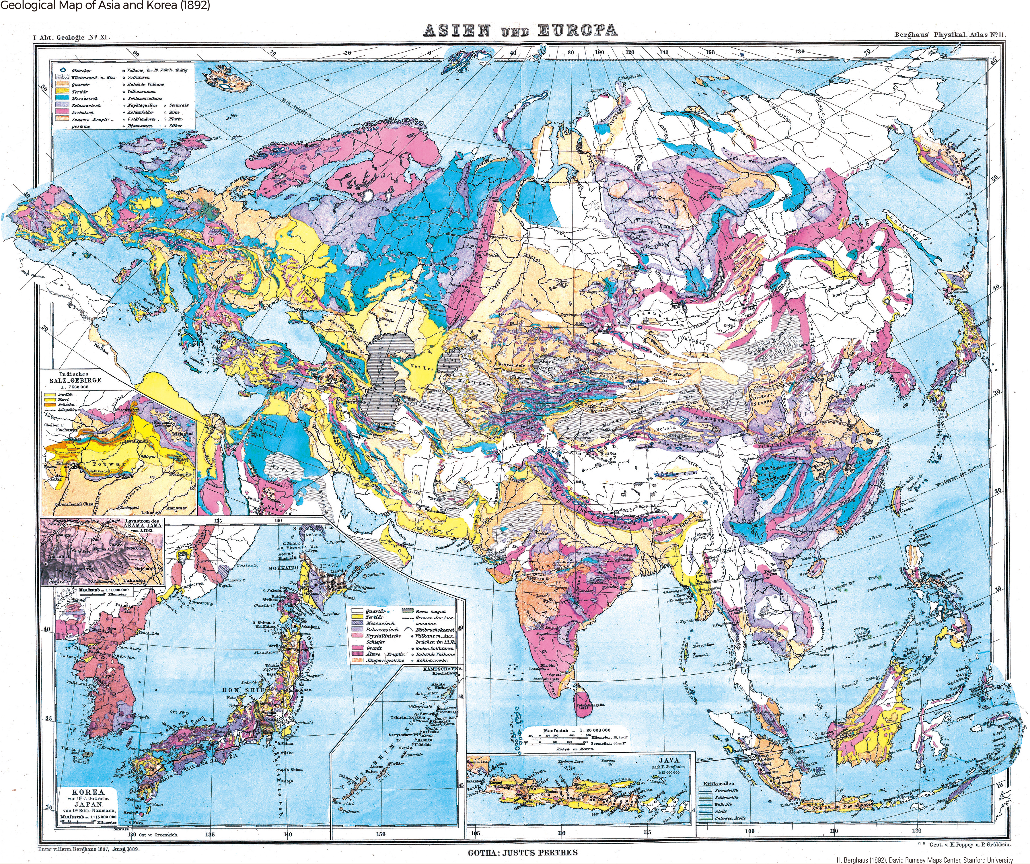
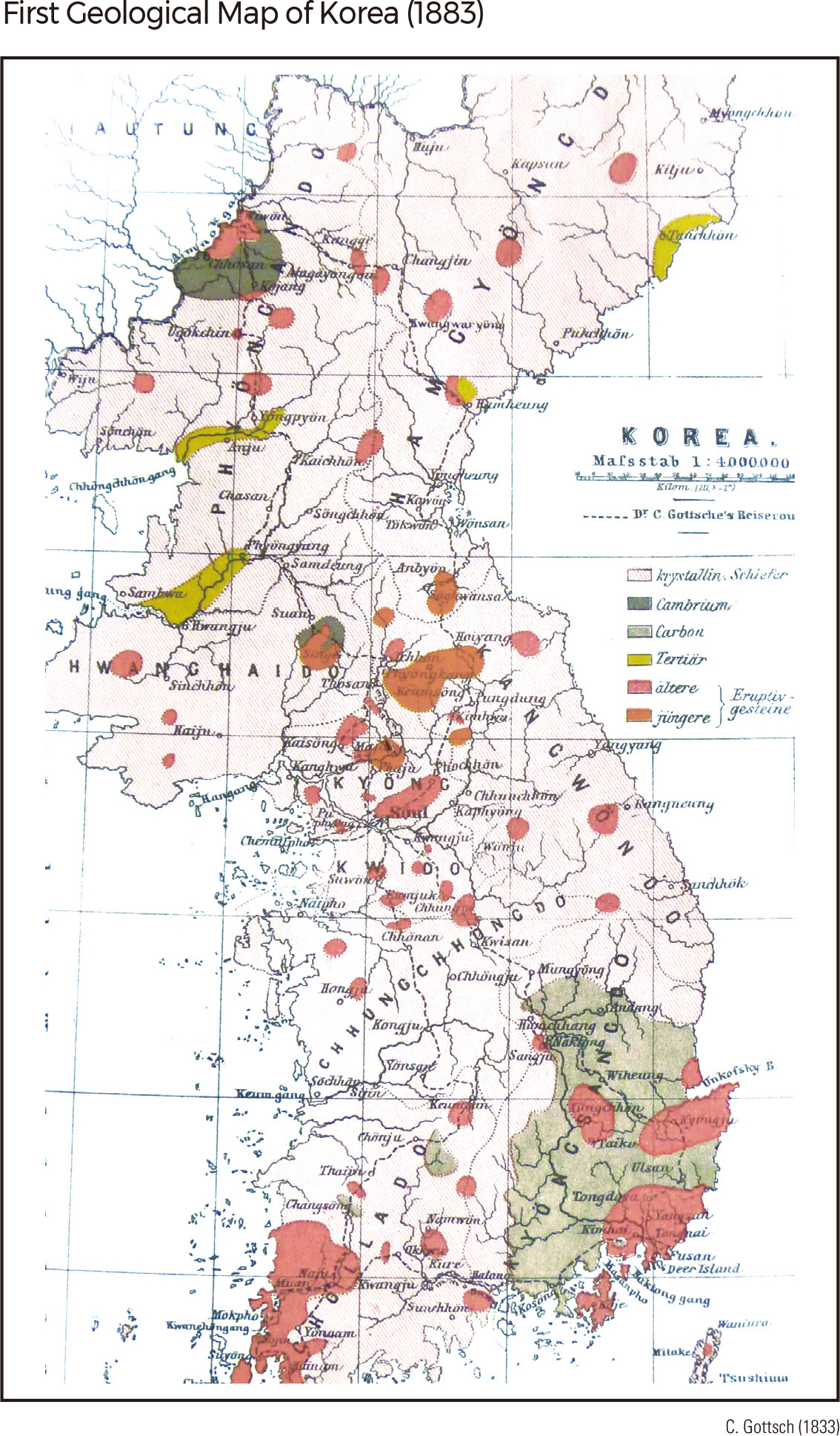
Carl Gottsche, a German geologist, visited Korea on a German diplomatic mission in 1883 and carried out geological research of the Peninsula to publish the first geologic map of Korea in the paper Geologische Skizze von Korea (1886). The geological study of Korea by foreign geologists was intensified with increasing pressure from European powers to acquire mining rights after the First Sino-Japanese War in 1894. In 1903, Goto Bunjiro published An Orographic Sketch of Korea, explaining the structure and origin of mountain ranges on the Korean Peninsula and producing a Geotectonic Map of Korea at a scale of 1: 2,000,000.
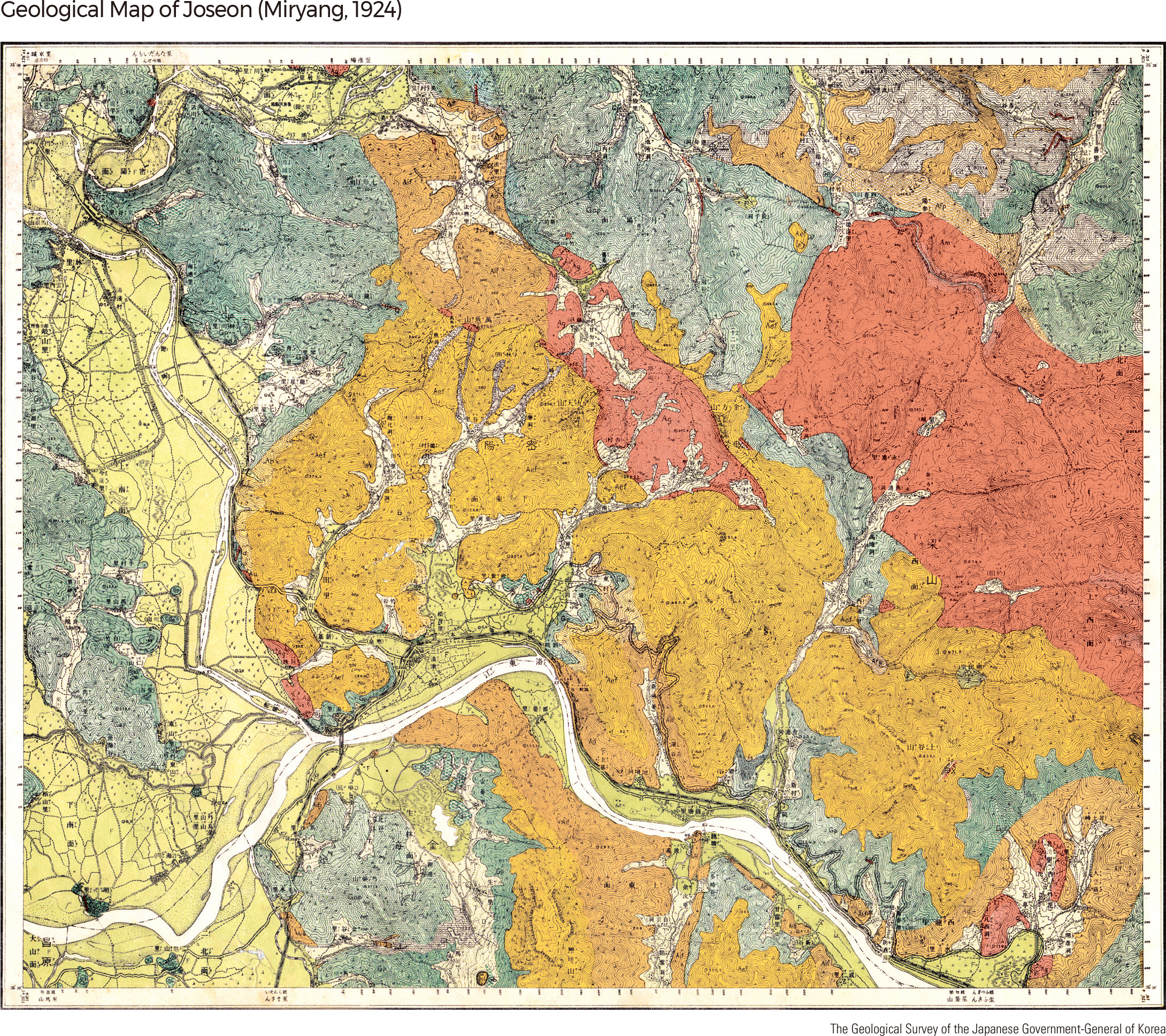
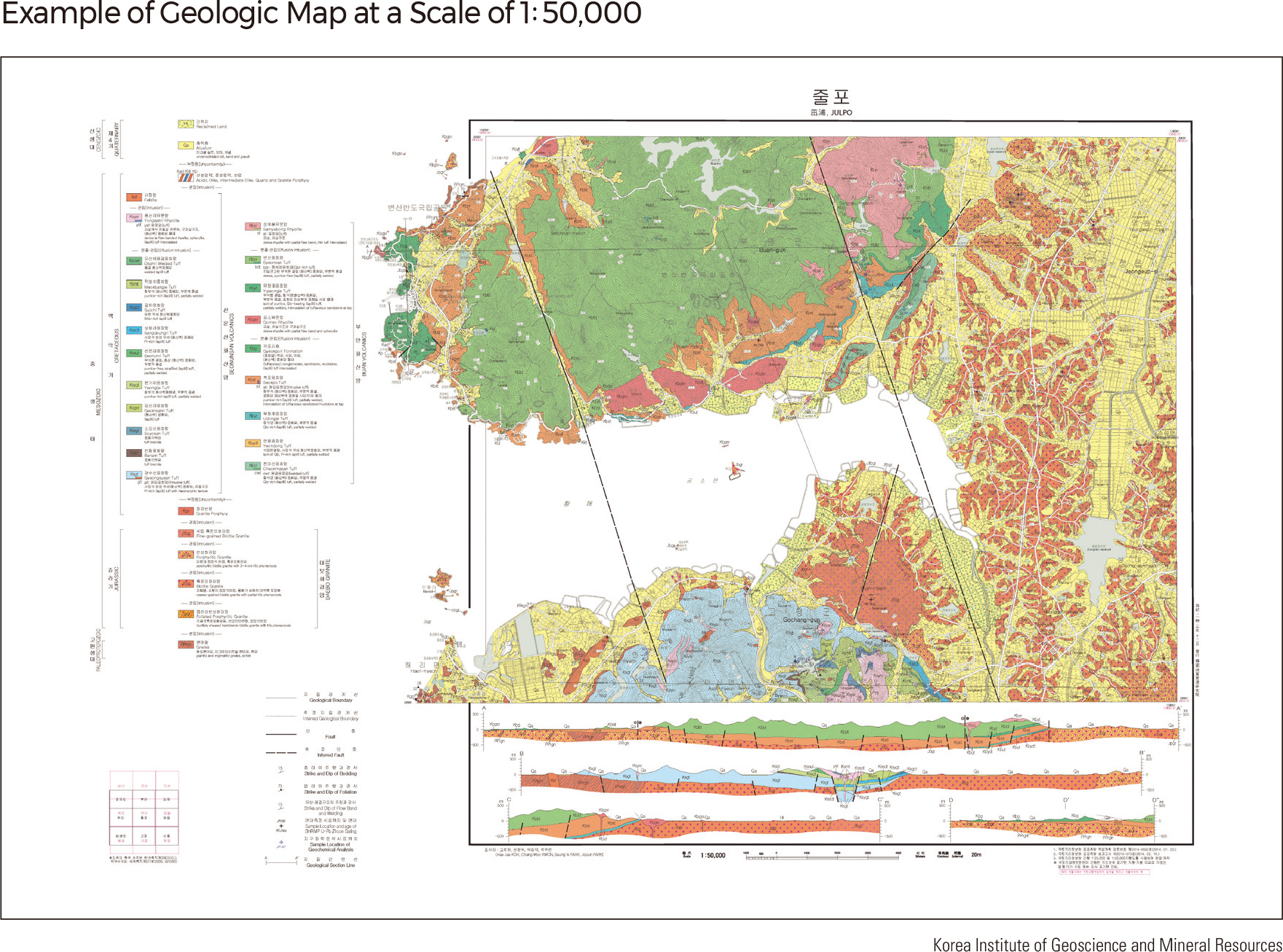
The Chosun General Geologic Map at a scale of 1: 1,500,000 and the Chosun Geology and Ore Deposits Map at a scale of 1: 1,000,000 were published in 1907 and 1919, respectively. In 1928, the Chosun General Geologic Map was revised. During 1924–1938, geologic maps at a scale of 1: 50,000 were made for several areas, including Miryang in Gyeongsangnam-do and Gilju in Hamgyeongbuk-do. Since then, geologic maps at a scale of 1: 50,000 have been made to cover the entire Korean Peninsula.
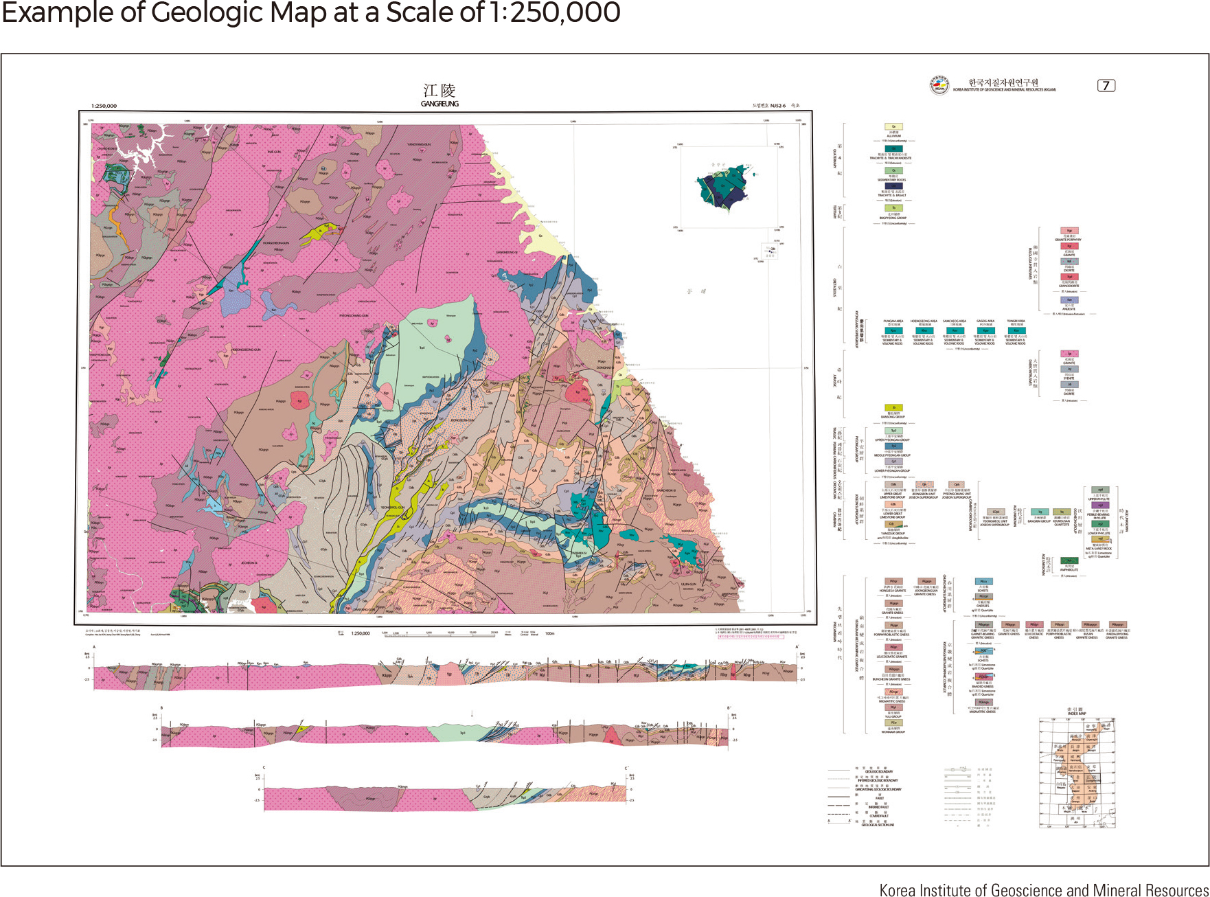
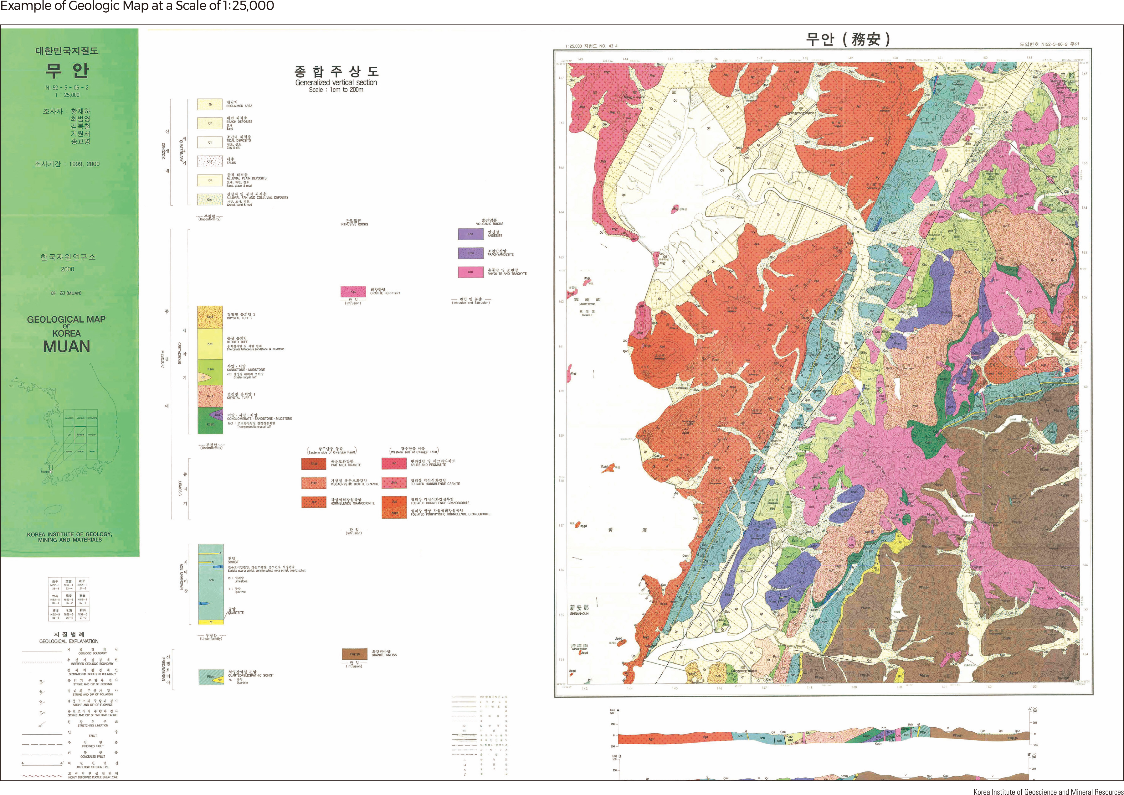
Since the restoration of independence, 1: 50,000 geologic maps for South Korea have been made by the Korea Institute of Geoscience and Mineral Resources (Previously, the Central Research Institute of Geoscience and Minerals and the Korea Institute of Energy and Resources). The Geologic Map of Korea (1: 1,000,000), made in 1956, was the first outcome of a geological study by Korean geologists, and it has been revised several times, with the final version published in 2019. Geologic maps of 1: 250,000 and 1: 25,000 scales have also been published, along with other geologic maps for special purposes, such as the Submarine Geologic Map of the Continental Shelf of Korea, Applied Geologic Map, Isotopic Age Dating Map of Korea, Bouguer Gravity Anomaly Map of Southern Korea, Magnetic Anomaly Map of Korea, Geochemical Atlas of Korea, The Metallogenic Map of Korea, The Geologic Map of Coal Fields, and The Hydrologic Map of Korea. |