English II 2020
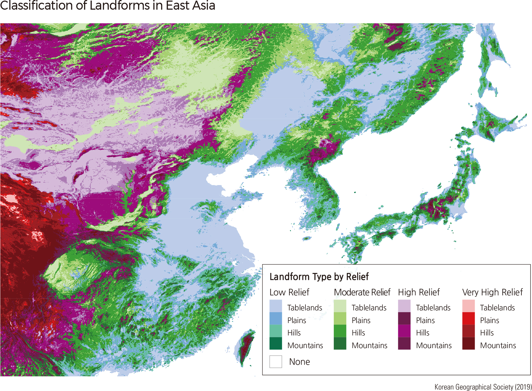
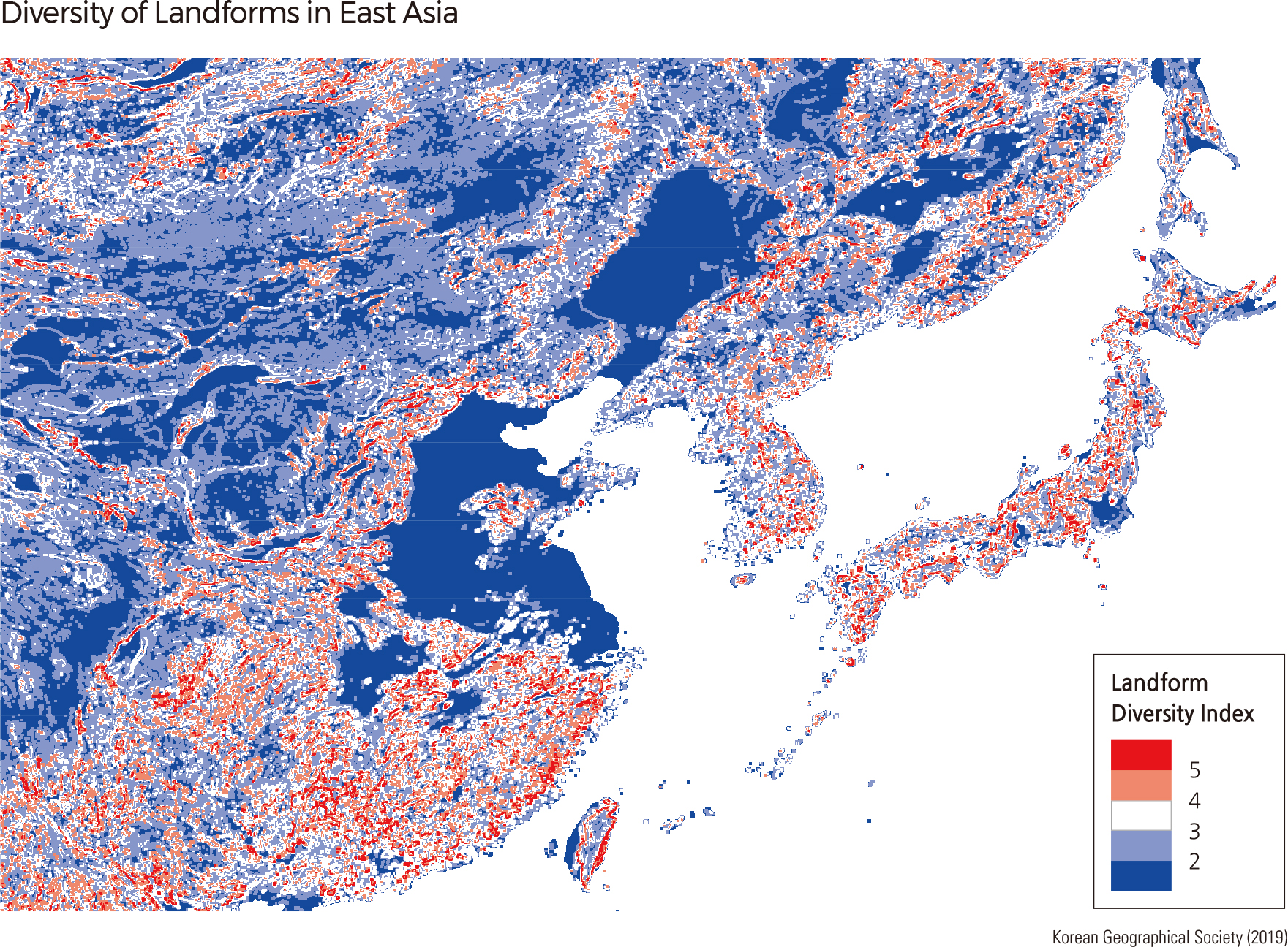
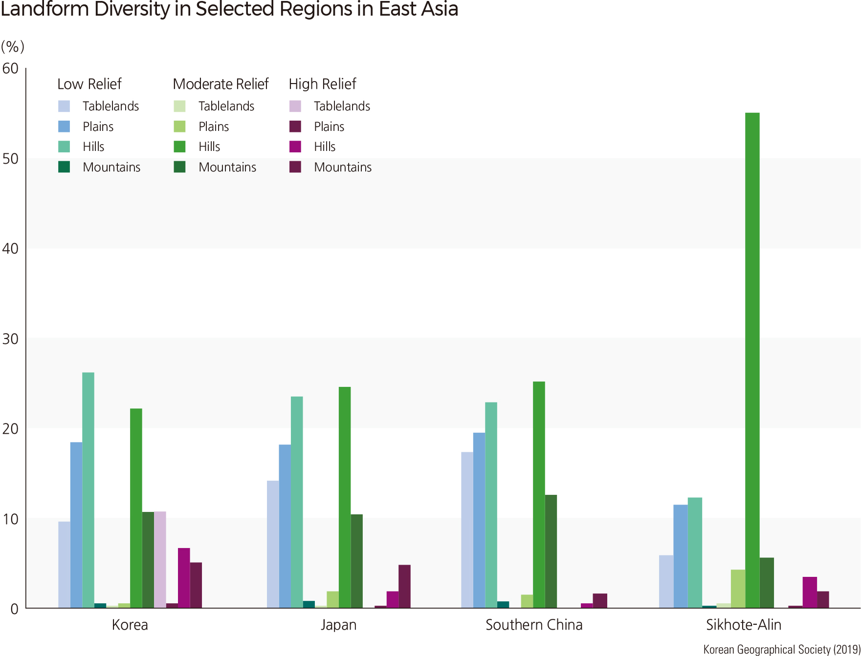
According to the Landform Classification, 77.5% of the Korean Peninsula is comprised of low-level mountainous areas (26.2%), medium-level mountainous areas (22.1%), low-level flatlands (18.5%), and medium-level mountain areas (10.7%). The Landform Diversity Index (the number of different landform units within a 100 ㎢ area) for Korea displays an average of 2.78 with a standard deviation of 0.95. Compared to East Asia, which has an average of 2.27 with a standard deviation of 1.06, Korean landforms exhibit higher overall diversity but have less variation within certain areas.
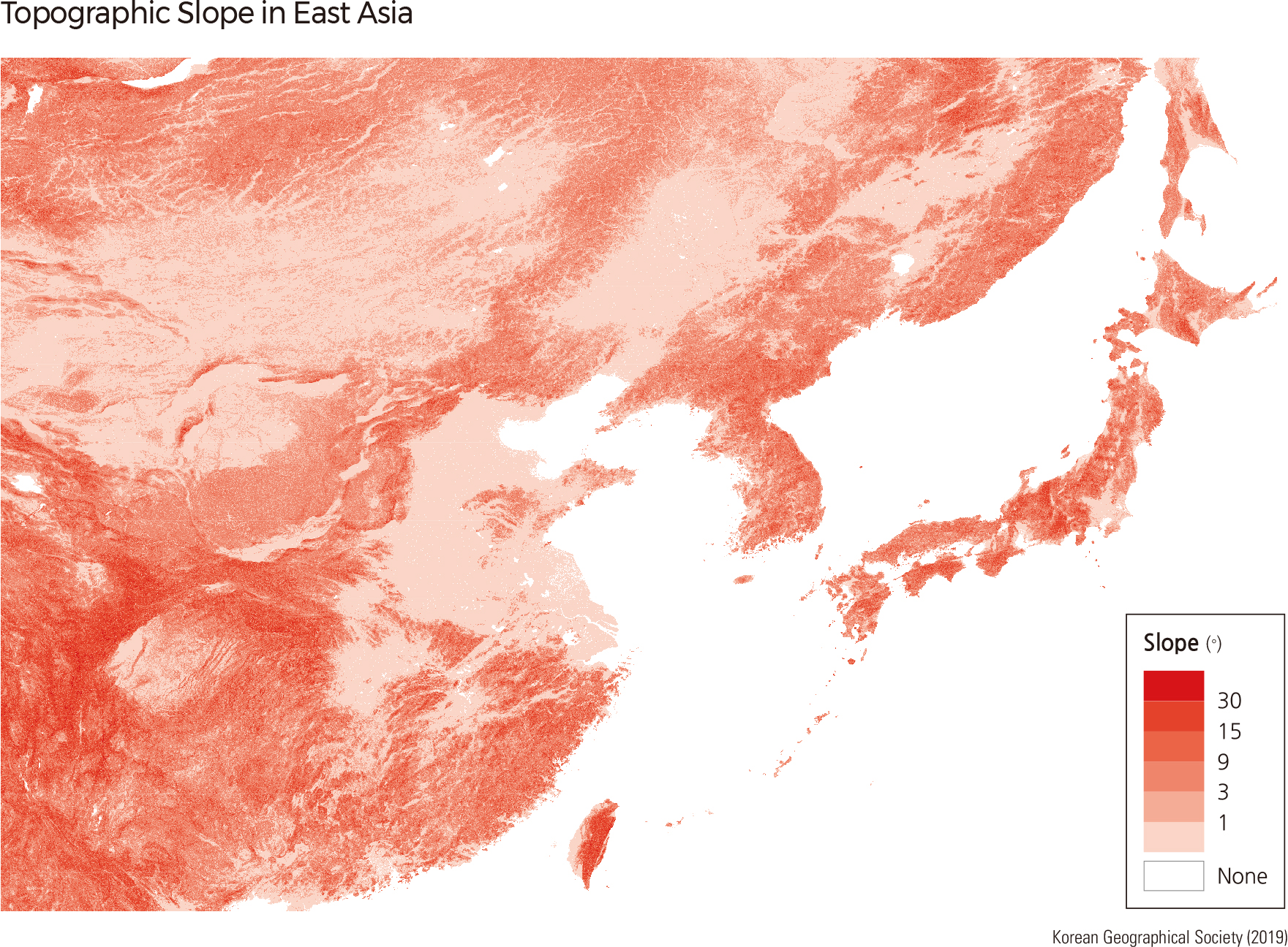
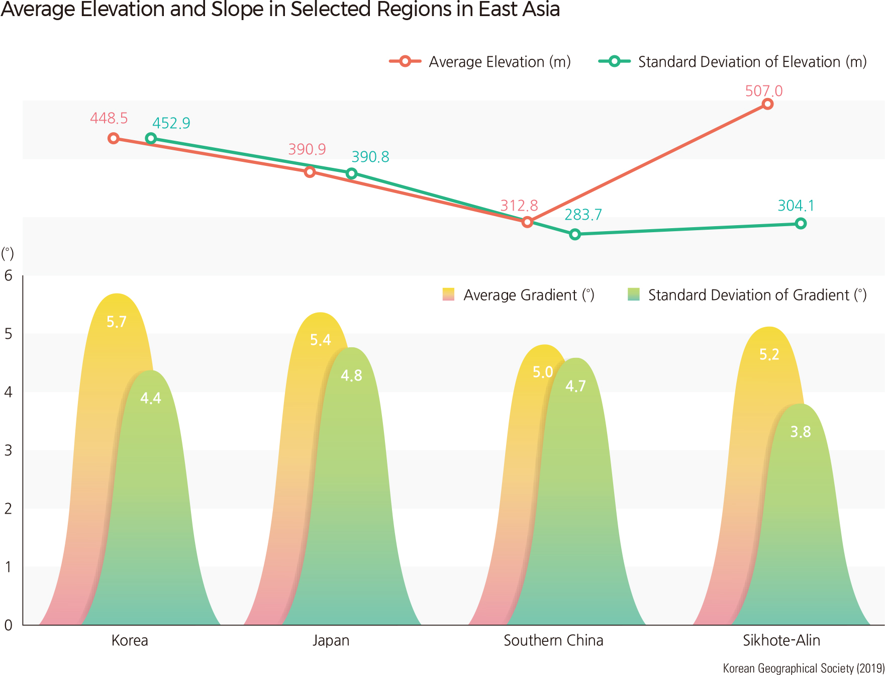
When considering the topography of the Korean Peninsula, the Sikhote-Alin mountain range, Southern China south of the Yangtze River, and Japan, the average elevation in descending order is as follows: Sikhote-Alin (507.0 m), the Korean Peninsula (448.5 m), Japan (390.9 m), and Southern China (312.8 m). However, the average slopes of each area show a different order: Korea (5.7˚) has the highest average slope, followed by Japan (5.4˚), Sikhote- Alin (5.2˚), and Southern China (5.0˚). Landform diversity has yet another order, with Southern China (3.0) showing the highest value, followed by Japan (2.9), Korea (2.8), and Sikhote-Alin (2.6).
Overall, the Korean Peninsula has a high average elevation and average slope but has the least change in slope among the four areas. While Korea has more low-level mountainous areas, Japan and Southern China display a larger percentage of low-level flatlands and medium-level mountainous areas. Abrupt changes in slope are rare in Korea.
Although the geographic features of the Korean Peninsula follow the continental geological structural lines of NE-SW, they also exhibit a perpendicular NNW-SSE orientation. It is assumed that this characteristic resulted from the formation of the East Sea, which was heavily influenced by the geological structure of the continent. The Peninsula also has relatively steep mountainous areas and diverse landform features, even though it does not have high elevations. Another characteristic of Korean topography is that the boundaries between mountainous areas and sedimentary flatlands are rather unclear. This phenomenon can be explained by slow tectonic movement and relatively small sedimentary flatlands across the Peninsula.
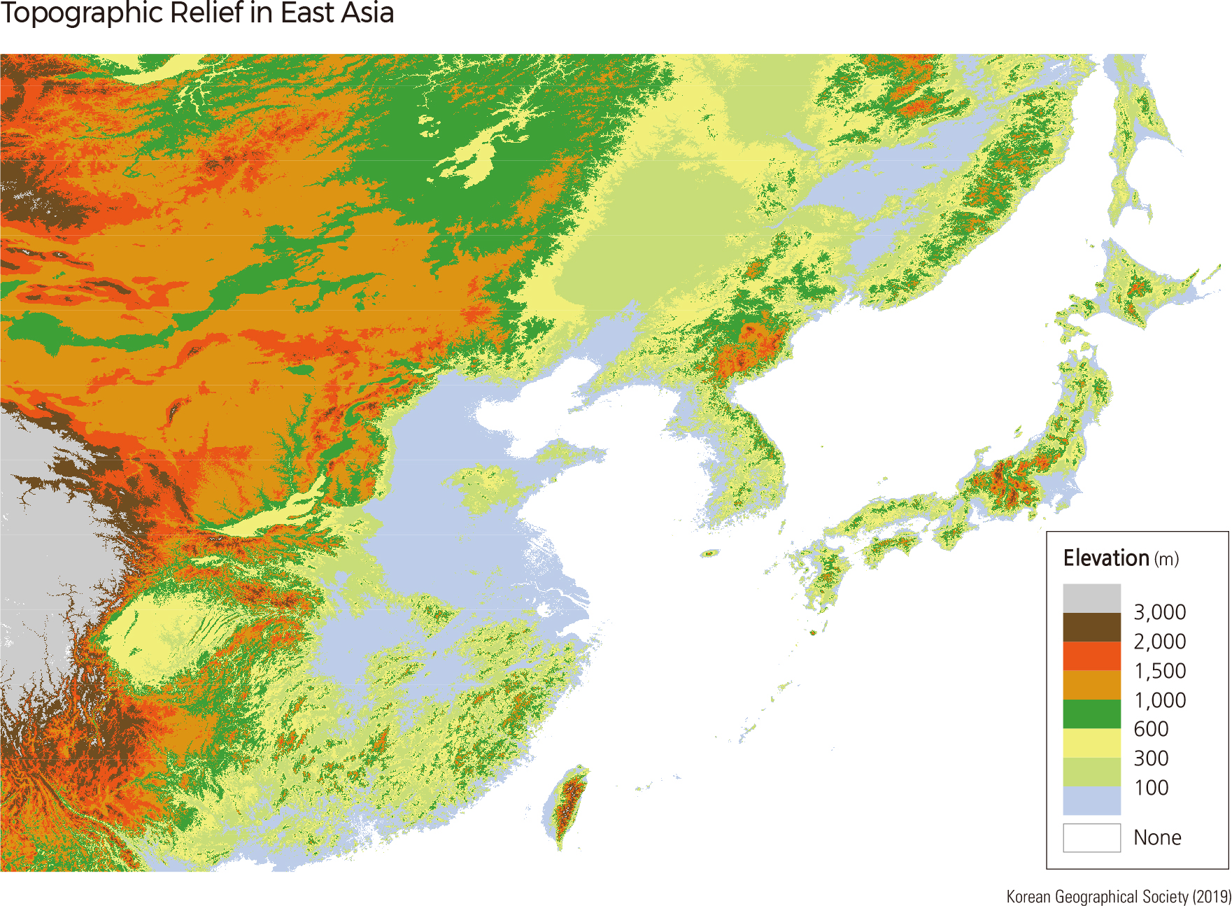
The elevation of the Korean Peninsula ranges between 0–2,744 m, with areas lower than 100 m accounting for 27.8% of the total land area. Fifty-two percent of the total land area is at an elevation below 300 m, while areas above 1,600 m only make up 5% of the total land area. Overall, as the elevation rises, the distribution area is reduced.
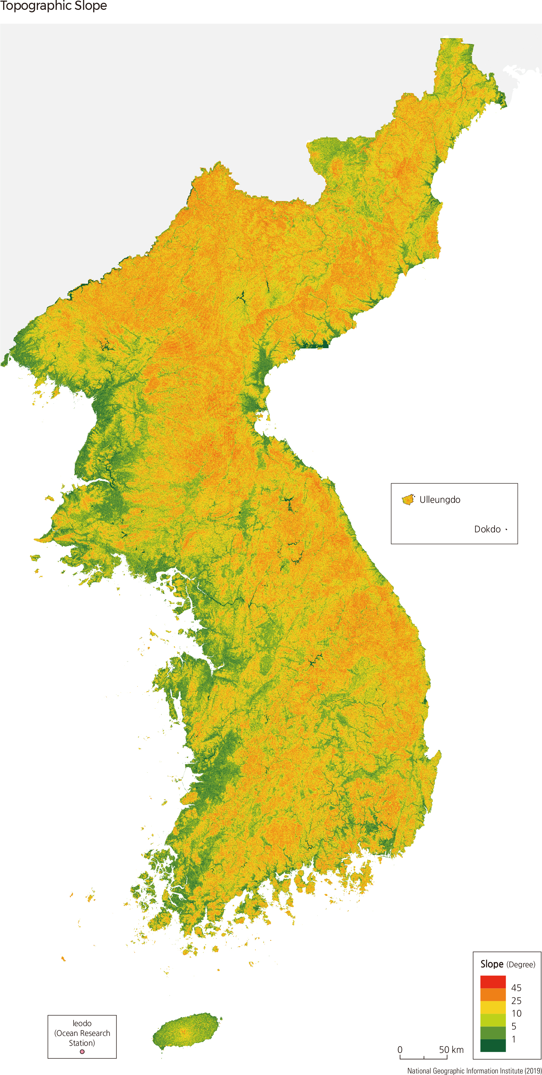
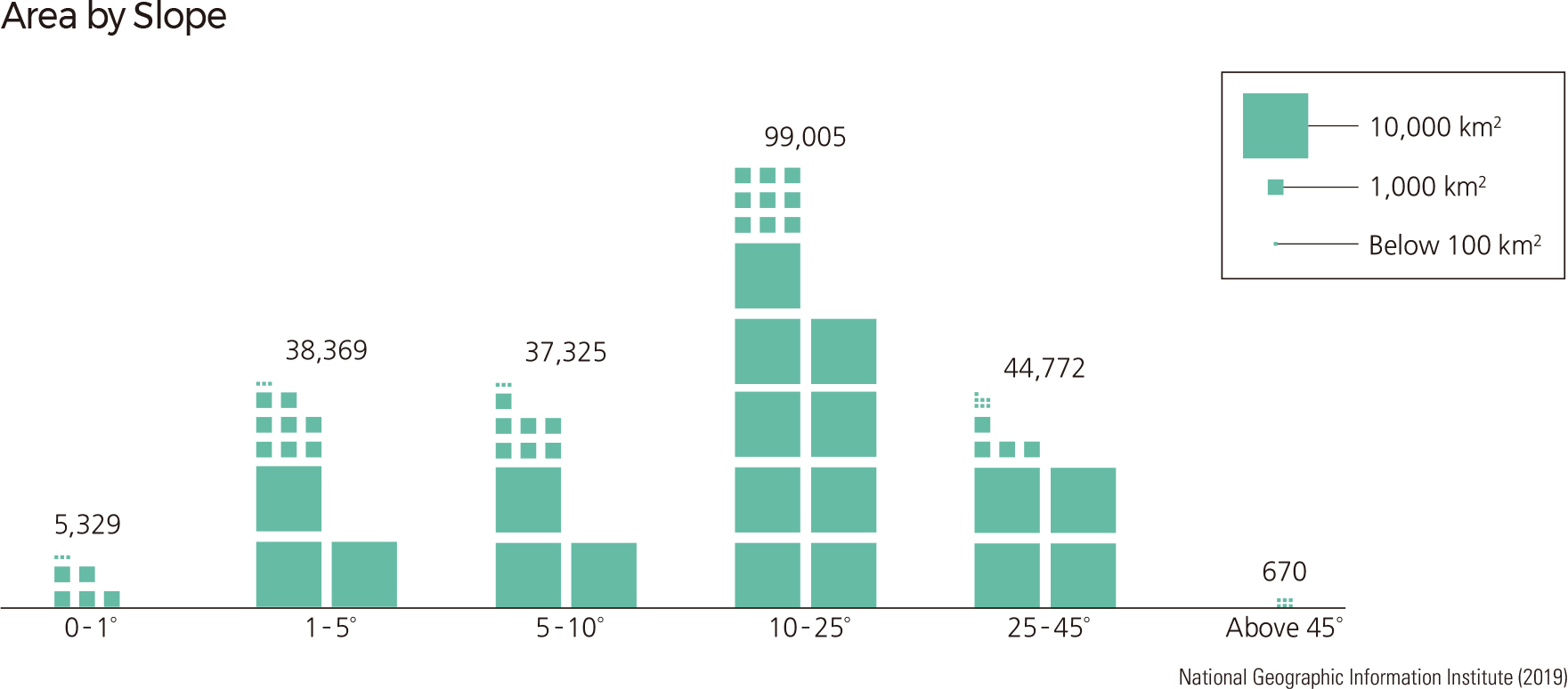
Low elevation areas (under 300 m) are located along the coastal and plains areas, whereas the mountainous regions of North and South Korea account for most of the 300–1,000 m elevation areas. Regions exceeding 1,500 m in height can be found near the Baekdusan-Gaemagowon region of North Korea, accompanied by some of the highest peaks of Taebaeksanmaek and Sobaeksanmaek. As for area distribution according to the slope, 36% of the land has gradients less than 10˚, 44% has gradients between 10–25˚, 20% has gradients between 25–45˚, and 0.3% has an inclination greater than 45˚. The majority of the gently sloping areas correspond to coastal regions. On average, the higher the elevation, the steeper the slope. However, the widely distributed lava plateau of the Baekdusan area is an exception; though the mountain’s elevation is high, the slope is gradual until about 1800 m, where it becomes steep.
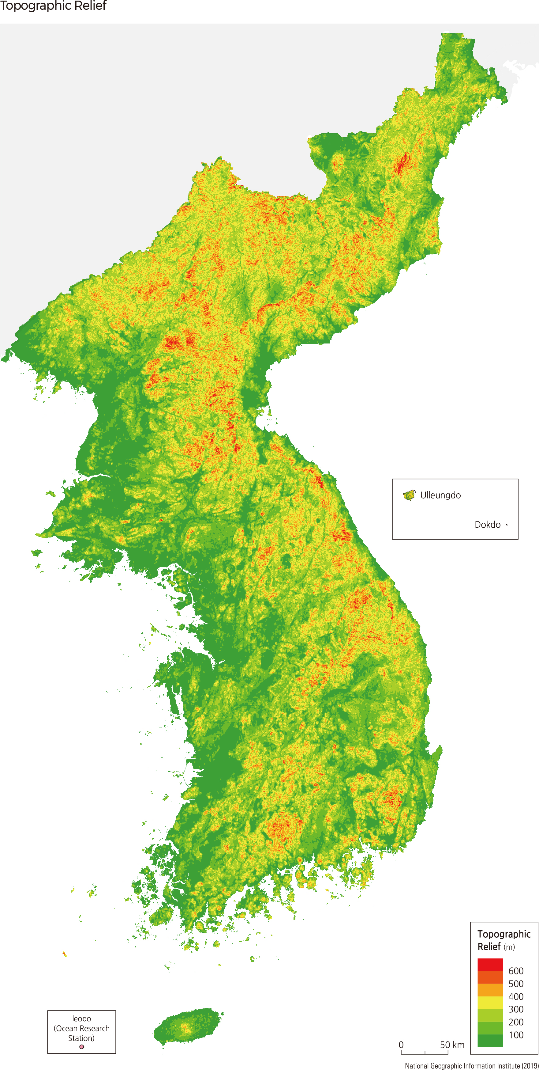
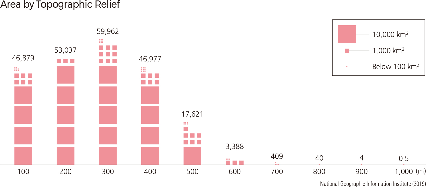
The local relief–calculated by subtracting the minimum elevation from maximum elevation within a 7 km radius–of the Korean Peninsula is between 0–968 m, with an average of 226 m. Most of the Peninsula (98%) demonstrates less than 500 m of relief. Regions with a relief of more than 500 m are distributed among the peaks of Hamgyeongsanmaek, Nangnimsanmaek, Taebaeksanmaek, and Sobaeksanmaek. When separated by 100 m relief intervals, 26% of the area consists of 200–300 m relief, representing the largest proportion of the area distribution; regions between 900–1,000 m relief account for less than 1%. |