English II 2020
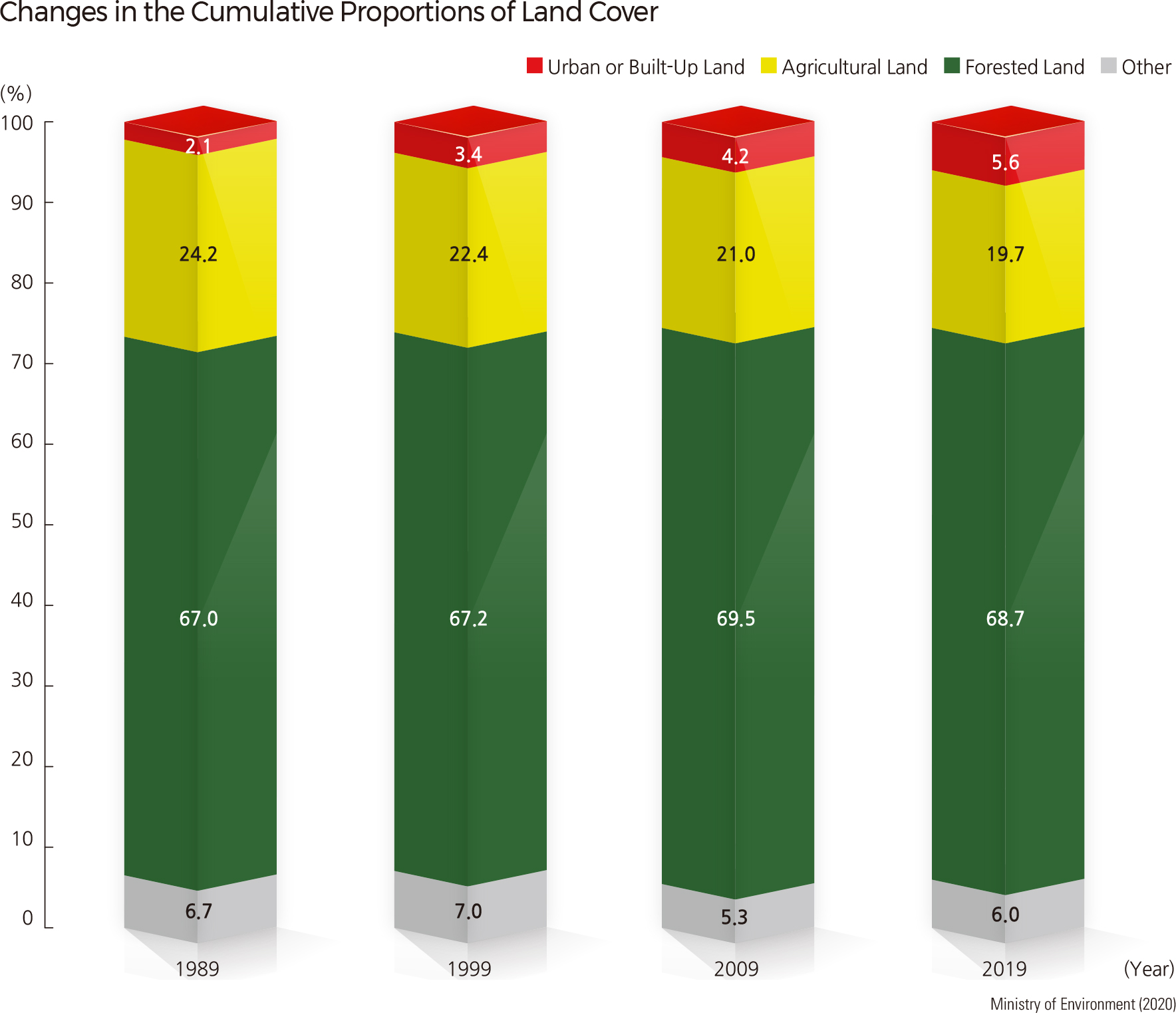
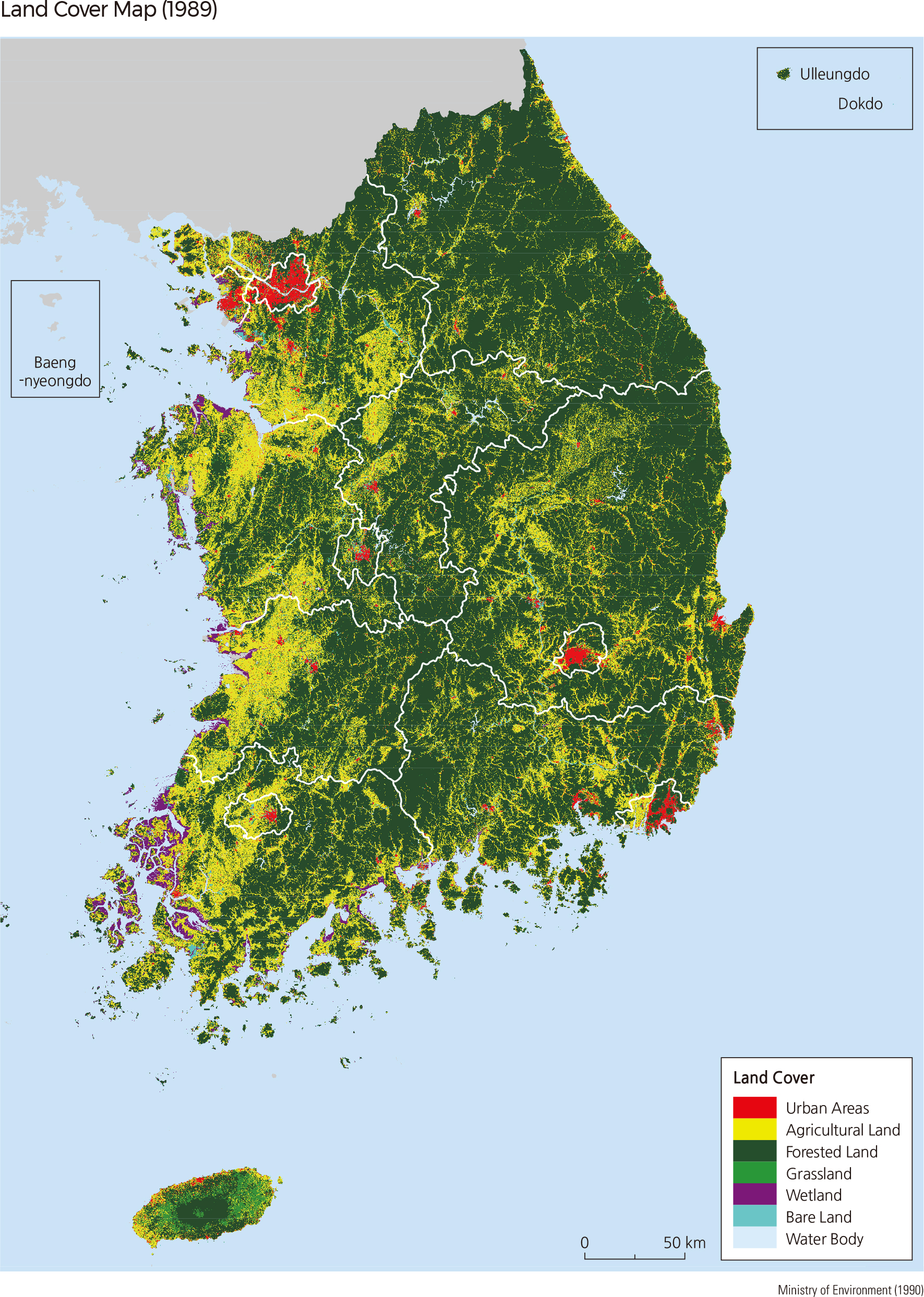
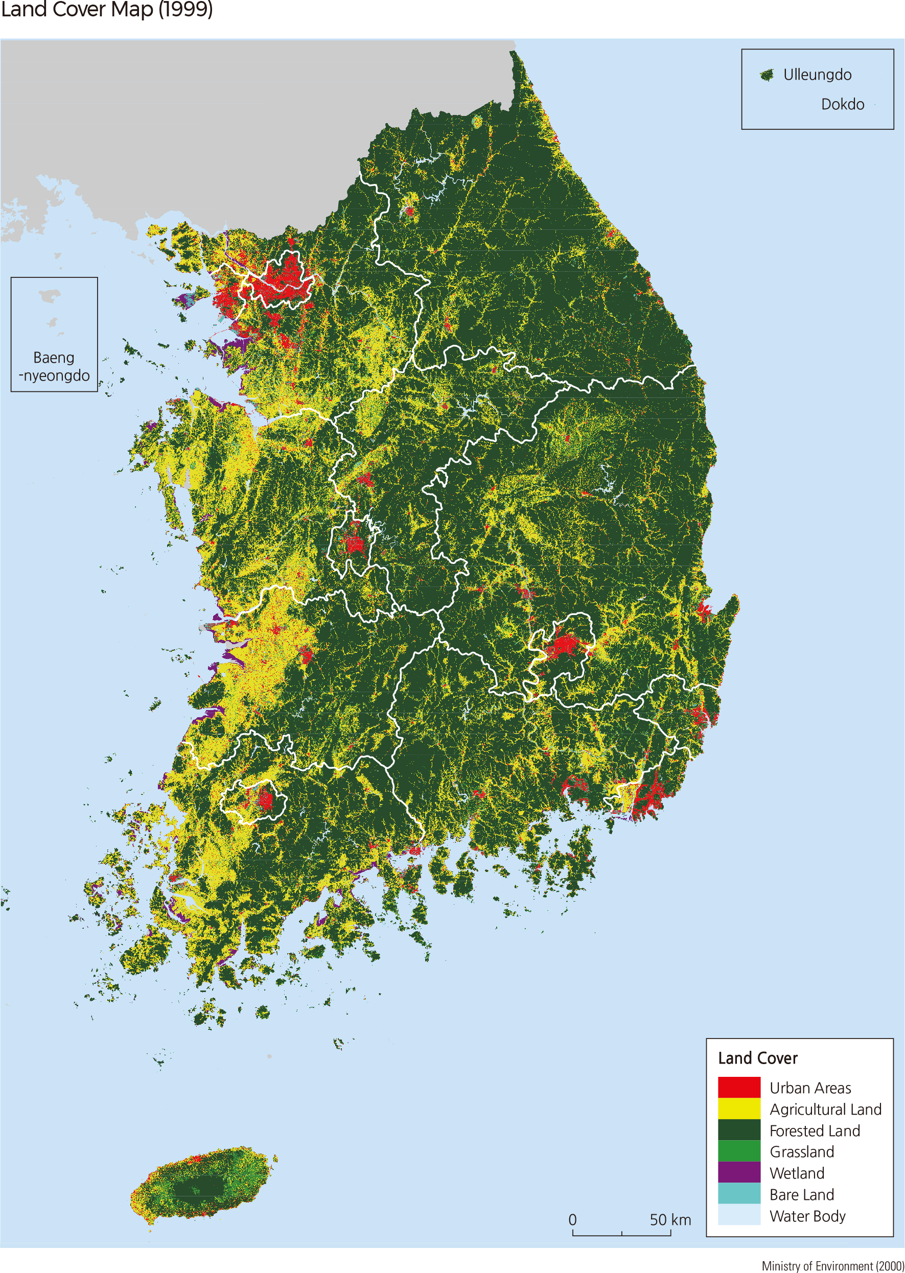
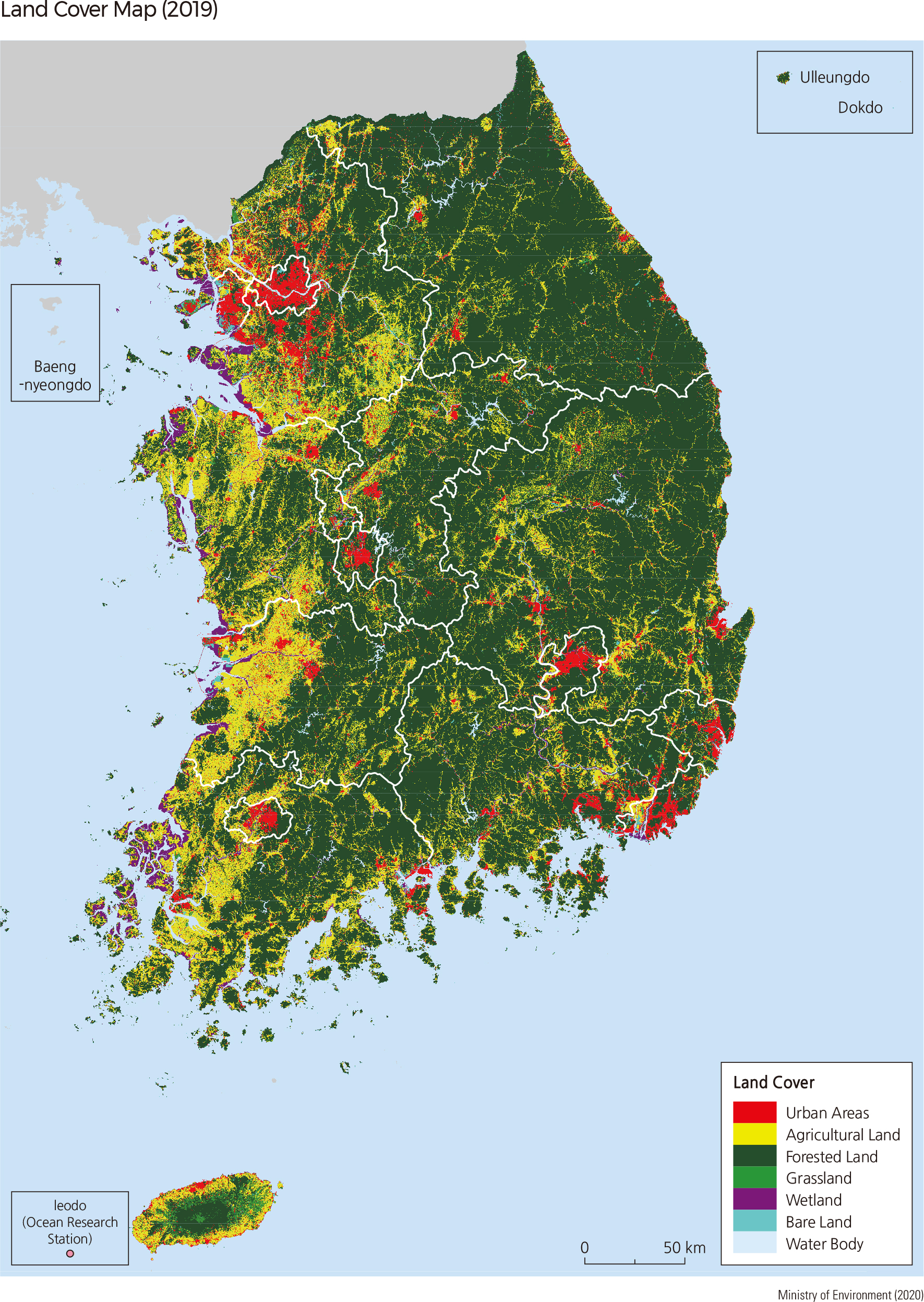
The Ministry of Environment produces land cover maps for Korea. According to the maps, since 1975, the urbanized lands have been expanded around large cities. At the end of the 1980s, urbanized lands accounted for 2.1% of the total land cover, and at the end of the 2010s, they accounted for 5.6%. During this period, urbanized lands increased by 2.7 times. In particular, urbanized lands have remarkably expanded in metropolitan cities such as Seoul, Busan, Incheon, Gwangju, Daejeon, and Ulsan. Areas surrounding the transportation networks between such metropolitan cities have also become increasingly urbanized.
While agricultural lands have shrunk in mountain areas due to a decrease in rural population, they expanded in coastal plains and hilly areas as a result of active land reclamation.
Agricultural lands decreased from 27,000 ㎢ in the late 1980s to 22,000 ㎢ in the late 2010s. Urban and agricultural expansion has also led to deforestation, which can cause various environmental issues such as global warming and flood hazards. Significant efforts are being made to minimize these potential environmental problems and heighten the value of forested areas. As such, forest resources are closely monitored, and forest protection areas are designated accordingly. |