Land reclamation is a process to convert sea areas or river inlets that are adjacent to the shoreline into land areas by filling them with various kinds of earth and artificial materials, thus creating new land. Such new land can be tremendous assets for planned land use. Economic zones, residential areas, airports, industrial parks, agricultural land, transportation infrastructure, and sea ports have all been constructed on extensive reclamation systems in Korea. The most recognized of the reclaimed land is the Incheon International Airport.
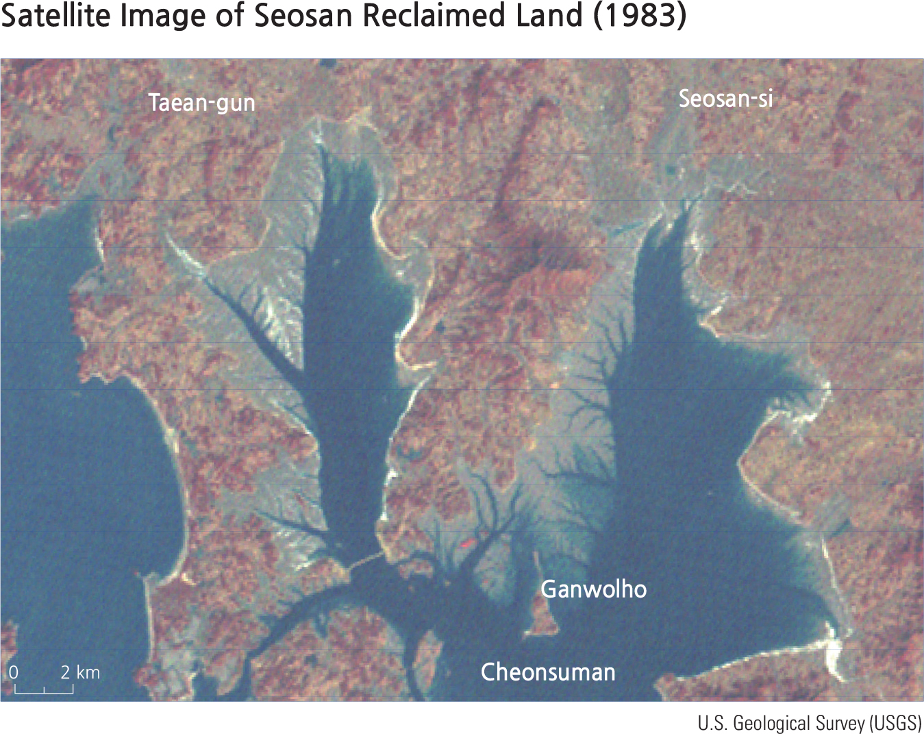
Since the 1970s, Korea has been utilizing private enterprise and new technology to design and build extensive reclamation projects. The Seosan Reclamation Project, launched in 1980 and completed in 1995, was the first large-scale system to be organized by a private enterprise in Korea.
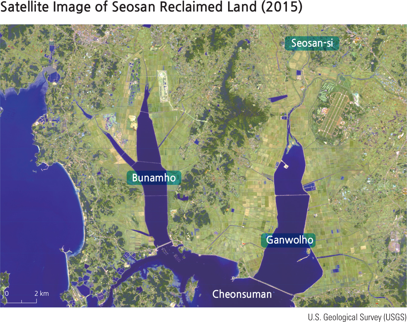
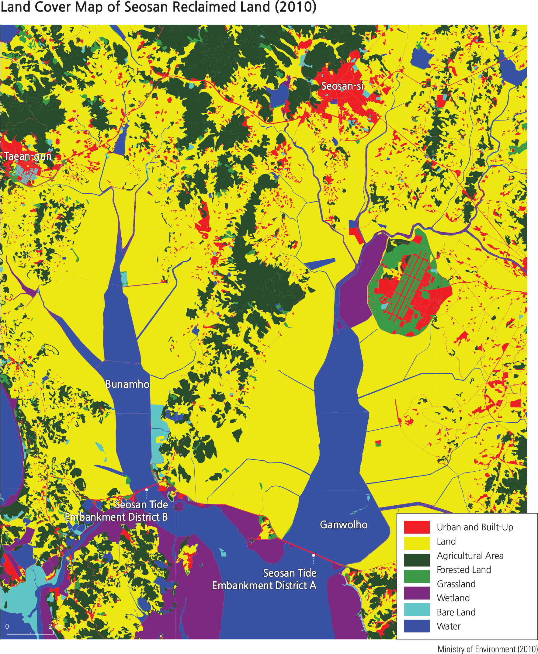
The total length of the breakwater is 7,686 meters (4.77 miles), including both districts A and B (see 2010 Land Cover Map). The reclaimed area is 15,409 hectares (38,076 acres), among which 9,626 hectares (23,786 acres) of land was reclaimed in Seosan District A, while 5,783 hectares (14,290 acres) was reclaimed in Seosan District B. The reclaimed land is mostly used as agricultural land; the rice paddies in Seosan have become the largest administrative district in Korea. This system also created the Ganwolho Reservoir (in District A) and Bunamho Reservoir (in District B). Ganwolho (see 1983 satellite image), which has been connected to the mainland, has become a tourist attraction known for its oyster production.
The Seosan Reclamation Project contributed to the development of Seosan-si and provided a habitat for winter migratory birds. Within a large scale agricultural zone, it was designed for protecting the bird habitat by reducing accessibility to human visitors. In addition, it has lots of flattened grain, making it an attractive location for birds. Typical migratory birds are the Baikal teal, bean goose, and buzzard. However, after the construction of the breakwater, species such as the longbill have decreased and there has been a decline in water quality of the reservoir. Currently, various plans are underway to improve the quality of the water.
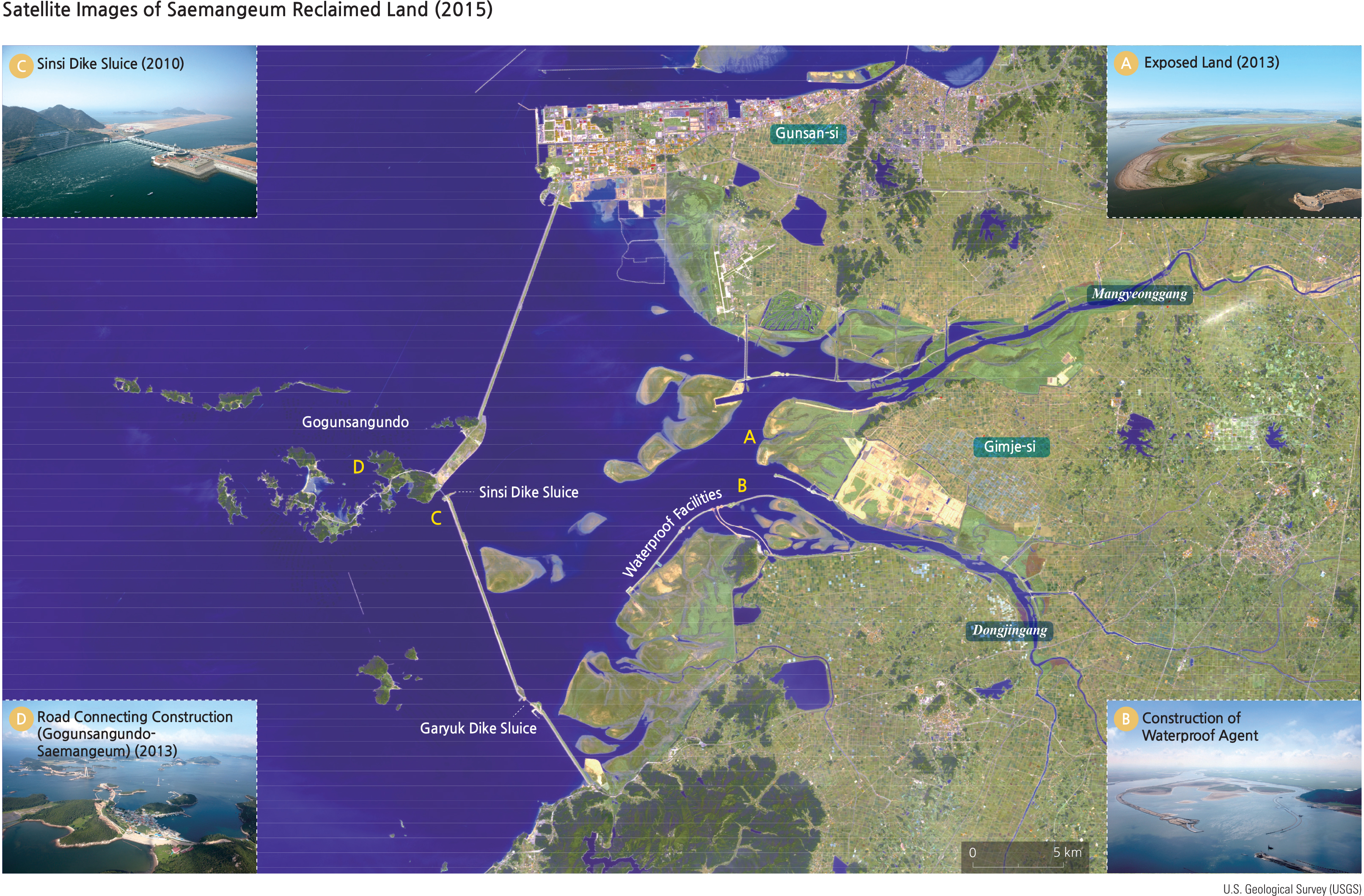
The Saemangeum Embankment Project began in 1991 and was completed in 2006. As the longest embankment of the world, the project has a total embankment length of 33.9 km (21.1 miles). Some 28,300 hectares (69,930 acres) of land and 11,800 hectares (29,158 acres) of lake were created by the system. Saemangeum got its name by combining the first characters of Mangyeongpyeongya and Gimjepyeongya. As such, “aemangeum”refers to the desire to establish new fertile lands that are similar to the Mangyeong and Gimje Plains.
The land use plan of the Saemangeum Project has been modified four times since 1991, with the latest plan being finalized in September 2014. According to this plan, 6 types of land uses are to be developed: industrial/research, international cooperation, tourism/leisure, agricultural, urban, and nature/ecosystem. The Saemangeum Project is expected to help the local economy by extending its land, creating rich agricultural space, securing water resources, and creating a tourism district. However, problems have risen during the development process, including damage to mud flats and water pollution. Mitigation efforts are being considered.
Brief Interpretation of the Map
The western coastline of South Korea is especially amenable to the development of Yellow Sea Coastal Reclamation Projects. This section highlights two especially important and very different systems. The Seosan Project, funded by private enterprise, includes the world acclaimed Incheon airport, agricultural areas, and wetlands, with provisions for wildlife sanctuaries. It must be admitted there has been some degradation of water quality within the seawalls. The Saemangeum Project, funded by the government, contains the longest seawall in the world and was designed with the primary goal of expanding prime agricultural land. However, some unidentified problems have led to a decrease in migratory birds using the area as a stopover on their routes. Local farmers have opposed the project arguing that there is not a need for more farm land because there is a drop in the agricultural sector of the economy. The environmental opposition to the project seems to come more from global groups rather than internal sources.
Another Korean project is the Shiwa Lake Reclamation Project. It boasts the largest tidal power station of the world. (See the section on Korean tides.) It was designed primarily for agriculture and energy.
Most of the reclamation systems in South Korea were designed for uses like agriculture, wetlands and wildlife protection. Human designs rarely take the time necessary for natural processes to develop into balanced ecological environments. This problem tends to create artificial features that lack the stability inherent in natural processes. While developing large reclamation projects, efforts can be made to incorporate “atural”features such as bird feeding areas, or the creation of wetlands to protect sensitive plants and marine life. There are many steps and adjustments to make, to enhance the development of a natural feature to accommodate a species that took generations to adapt to the conditions of its natural habitat. If a human designed wetland was proposed to provide new nesting areas for a bird species, what features would be necessary in the design for a successful establishment of the species?