Industrial complexes play a key role in the national economy. They accounted for 62% of nat ional manufacturing production, 79% of exports, and 42% of employment in 2010. Since the 1960s, Korea has promoted industrial complexes for firms to take advantage of infrastructure and agglomeration effects. They were once called "industrial parks," but the name was later changed to "industrial complexes" to reflect the shift to a knowledgebased economy in the 1990s.
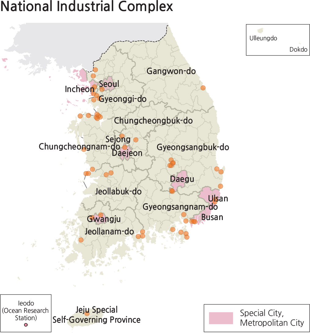
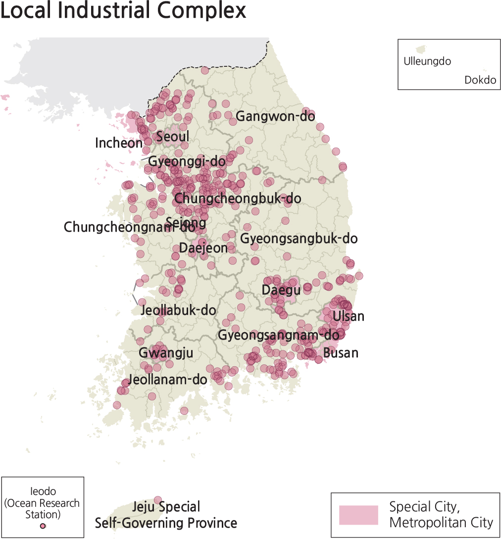
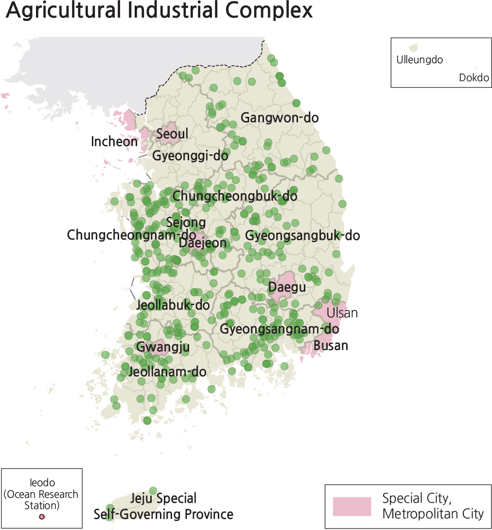
Industrial complexes include national industrial complexes, local industrial complexes, and agriculturalindustrial complexes. Local industrial complexes are further split into urban high-tech industrial complexes and general rural industrial complexes. These different types of industrial complexes reflect different developers and diverse purposes. National industrial complexes are designated by the Ministry of Land, Infrastructure and Transport. Local industrial complexes are designated by local governments. National industrial complexes frequently target developing specialized industrial fields, stimulating underdeveloped regions, or developing areas under multiple government jurisdictions. Local industrial complexes frequently aim at promoting regional dispersion of industries and boosting the local economy. Agricultural-industrial complexes focus on hosting the industries that may help local farmers or fishermen increase their incomes.
By the end of 2013, there were 1,033 industrial complexes. Among these, there were 41 national industrial complexes, 528 general industrial complexes, 11 urban high-tech industrial complexes, and 453 agriculturalindustrial complexes.
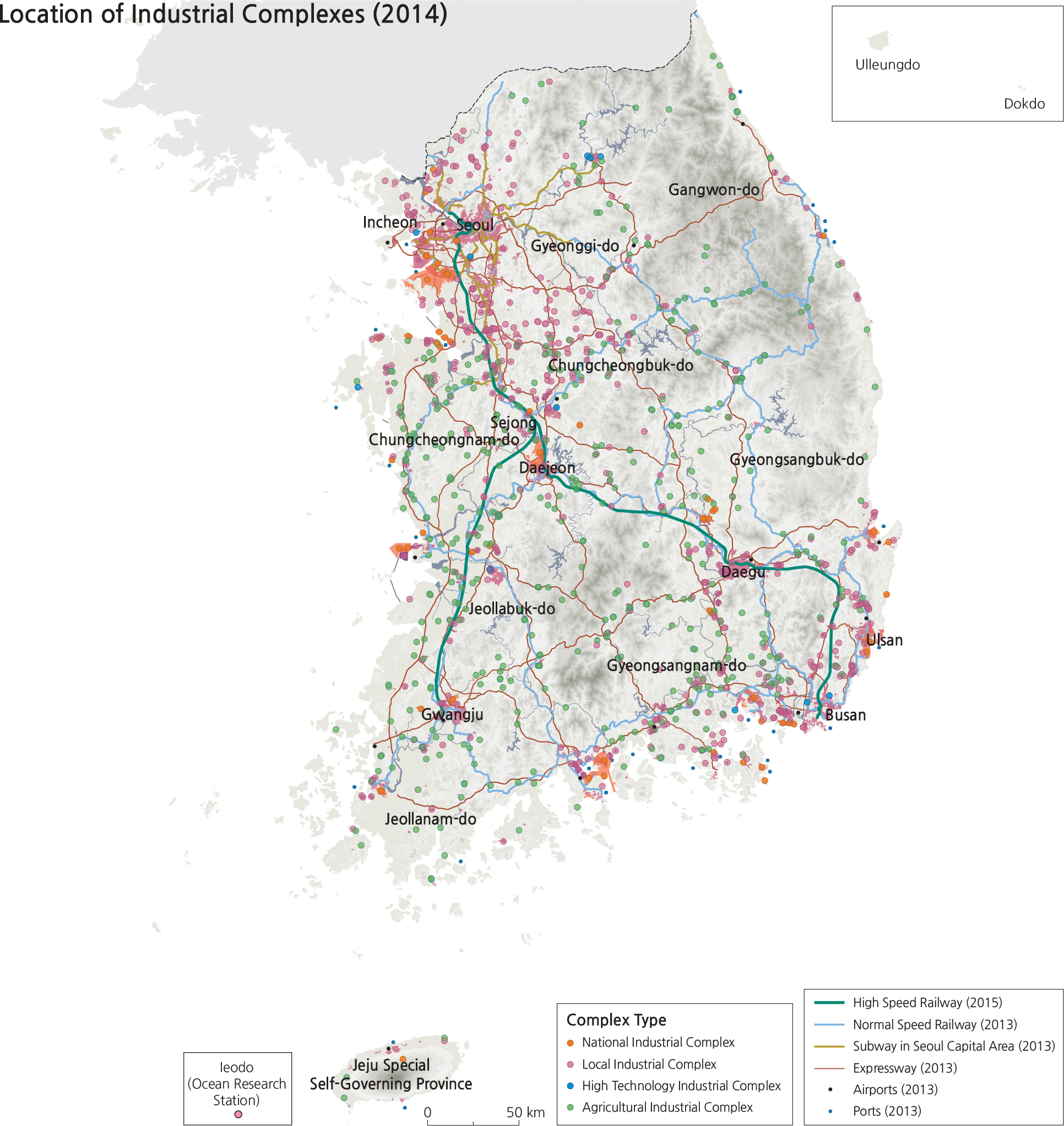
The distribution of industrial complexes remains similar today. The total area of industrial complexes is 484.7 square kilometers with an occupancy rate of 93.9%, composed of 80,547 tenant companies. National industrial complexes are located mostly in the vicinity of the Greater Seoul Metropolitan Area and along the southeastern coastal region. Many of the general rural industrial complexes are located along the Gyeongbu Expressway which connects Seoul and Busan.
One urban high-tech industrial complex is in the development stage. Every industrial zone in Daejeon, Ulsan, Jeju, Namyangju, Gyeongsan, Suncheon, and Chuncheon hosts one or two urban high-tech industrial complexes. There is no agricultural-industrial complex in the Greater Seoul Metropolitan Area as these are mostly located in rural areas with large farming populations. Industrial complexes have contributed to creating jobs and developing domestic industries. They are geographically located adjacent to highways and harbors to maximize accessibility.
Brief Interpretation of the Maps
As noted above, the agricultural-industrial complexes are located well away from the Greater Seoul Metropolitan Area where traditional farming populations are well established. However, the majority of the newer industrial complexes are associated with Seoul; while the transportation links between Seoul and southeast South Korea are centered in the Busan area. The 2014 Location of Industrial Complexes map clearly shows the association of complexes with different types of major transportation routes. Most of the complexes not associated with major transportation are those classified as agricultural-industrial complexes.
The lower four maps display the National, High Tech, Local and Agricultural Industrial complexes against the special and metropolitan cities sub-districts. These maps more clearly identify the number of complexes in the four categories, emphasizing the number in the locally funded category.
It would be expected that the agricultural-industrial complexes be associated with crop growing regions. Do you expect that different types of crop-associated agriculturalindustrial complexes might have different affinities with transportation routes? What kind of crop processing would need railways? Would a different type of crop need an expressway association?