Process of Meteorological Service Weather Forecasting
Korea’ Meteorological and Weather Forecasting Service is a very important entity. It helps to save lives, issuing warnings and advice for preparedness that can minimize the amount of destruction prior to or during catastrophic weather events.
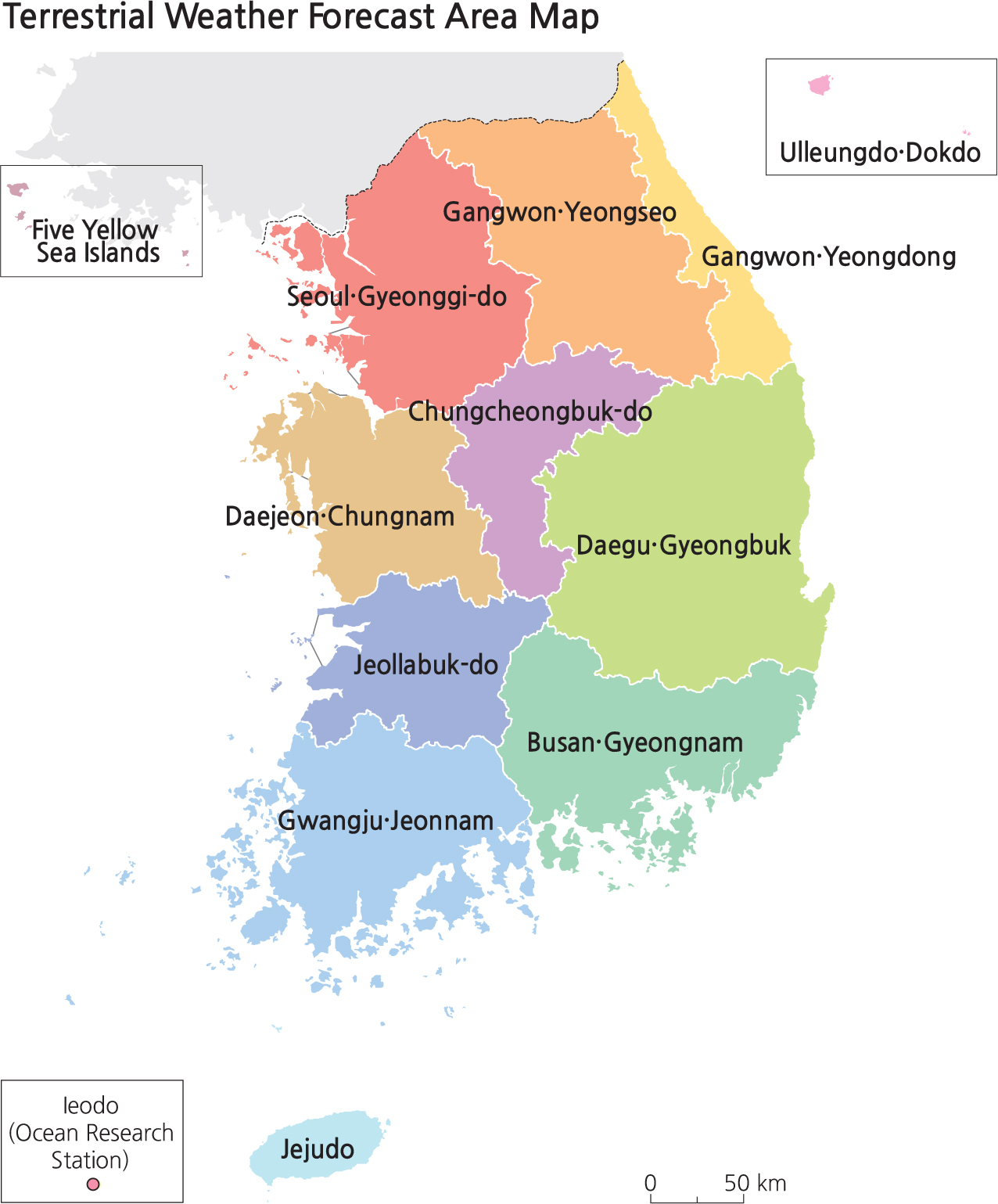
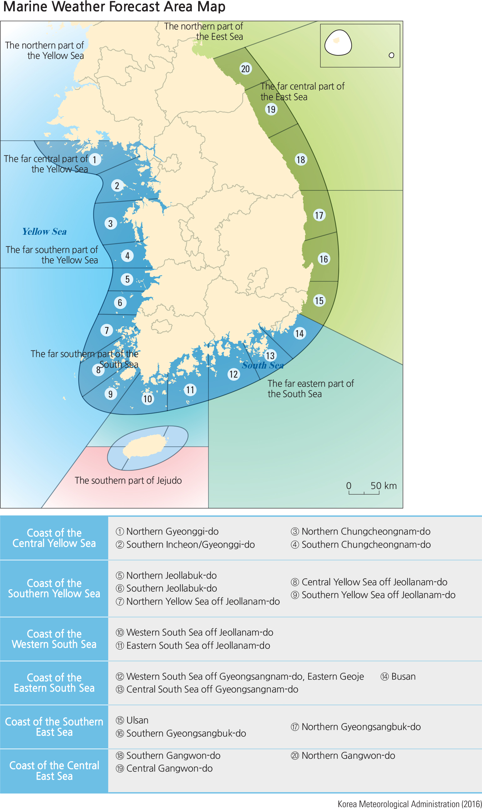
National weather data are collected in a central server of supercomputers and shared with member nations of the World Meteorological Organization in real time. These data are assimilated for the production of various numerical, analytical models through the super computers. Then trained forecasters with expertise and experience examine current atmospheric conditions based on the observations, and analyses of the numerical weather prediction models. Finally, forecasters across the country consult and exchange opinions via videoconference to make a final forecast decision. Area forecasts are provided on both a regional scale (12 overland areas and 14 marine areas) and at the local scale (about 3,500 towns). Special weather reports are issued, as needed, to provide weather advisories for possible natural disasters. The report is issued as either a watch or a warning, depending on the risk level of the following 11 natural disasters: heavy rainfall, heavy snowfall, storm surge, tsunami, typhoon, strong winds, high seas, Asian dust, drought, cold surge, and heat wave. A preliminary weather advisory is issued ahead of a special weather report in order to help people to prepare for meteorological disasters.
Brief Interpretation of the Maps
Both the terrestrial and marine weather forecast area maps do not strictly follow provincial boundaries, especially the marine map since its major concern is over water. Special boundaries are created for these maps that are based on projected weather conditions and specialized local weather variations, such as the long and narrow area along the east coast of Gangwon-do Province labeled as Gangwon Yeongdong. This strip of land is actually the windward side of the eastern mountain chain; thus, its weather conditions are very different from the leeward side. The marine weather forecast map divides the entire coastline of South Korea into 20 different zones plus Jeju Island, giving the nation a more accurate forecast based on localized coastal configurations as well as easier dissemination of weather
conditions to localized fishermen and seafarers.
Because weather forecasting involves a very complex set of weather variables, the accuracy of weather forecasts, even though performed in supercomputers, may not always achieve precise and pinpoint accuracy. Observe and think about the spatial accuracy of weather forecasts around your home to get a sense of weather forecast accuracy that may affect people’ daily lives.