The term “map accuracy” must always be taken as a relative term because some maps are more accurate than others; they can also be more accurate in certain aspects and not in other aspects. Generally speaking, large-scale maps are expected to have a higher accuracy than smallscale maps. Making a map to be as accurate as its parameter dictates is of vital importance. Inaccurate and/or missing information on a map has actually led to transportation fatalities. Legal issues have always surrounded matters of map accuracies. It is impossible to make a general or overall checklist of everything about accuracy or inaccuracy. Nevertheless, map inaccuracies can be so difficult to detect but have real consequences.
Map accuracy is governed by several factors. Maps produced by national geodetic surveys such as the U.S. Geological Survey or Korea’s National Geographic Information Institute tend to be very accurate because they use state-of-the-art instruments to produce reference maps. Databases created by such government agencies can also be used for other purposes. The U.S. Bureau of the Census combines its census-taking techniques with U.S.G.S. geographic databases to form one of the most sophisticated non-military mapping systems in the world.
The accuracy of thematic maps, however, may depend on several other factors, such as the data collection methods, data portrayal methods, and size of mapping units. Variations in these factors may not contribute to errors, but they definitely affect the level of accuracy. The section on thematic maps below shall include more detailed discussions on matters of accuracy specifically relating to thematic maps.
Theoretically, there are always errors on maps. The mere transformation of the three-dimensional earth on to a two-dimensional piece of paper or digital display screen inherently introduces map error. The degree of error for such a transformation depends on the map scale, size of the area of coverage that was transformed, and many other factors. In addition, the mapping process requires such procedures as selection of data, generalization schemes, and other maneuvers by the cartographer. These are also sources of introducing error on to maps. It is up to the map maker as well as the map reader to educate themselves about where and how map errors can occur. Once again, this is a topic on which it is impossible to provide all scenarios. This section is intended to provide only some of the more common examples of map errors in the map-making/map communication processes. For example:
•Temporal error: Using or reading a map that is outdated; a lot of changes could have taken place during an elapsed time period.
•Scale error: using an inappropriate scale for the purpose of the map.
•Displacement error: using a symbol that is too large for the area being covered.
•Symbol placement error: a map symbol being placed in the wrong part of the map.
•Distance displacement error: a topographic map distance is orthogonal (a flat plane as its base, also technically referred to planimetric) while its contours indicate elevation. Traveling from one point to another across contour lines is really traveling up- or down-hill, which has a greater actual distance than the orthogonal or planimetric distance that most people measure from the topographic map. The Pythagorean Theorem should be used to compute the hypotenuse distance caused by height over planimetric distance.
•Factual and data input errors: entering the wrong data or information on a map.
•Instrumentation error: entering data from malfunctioning instruments.
•Data computation error: using the wrong computation methods to derive data.
•Line generalization error: a computerized line generalization routine (such as smoothing) can lead to unintended errors (such as changing the topology of features). There is a fine line between generalization and over-generalization of data.
•Data selection error: selecting the wrong data points or omitting relevant ones can affect the outcome of the map patterns.
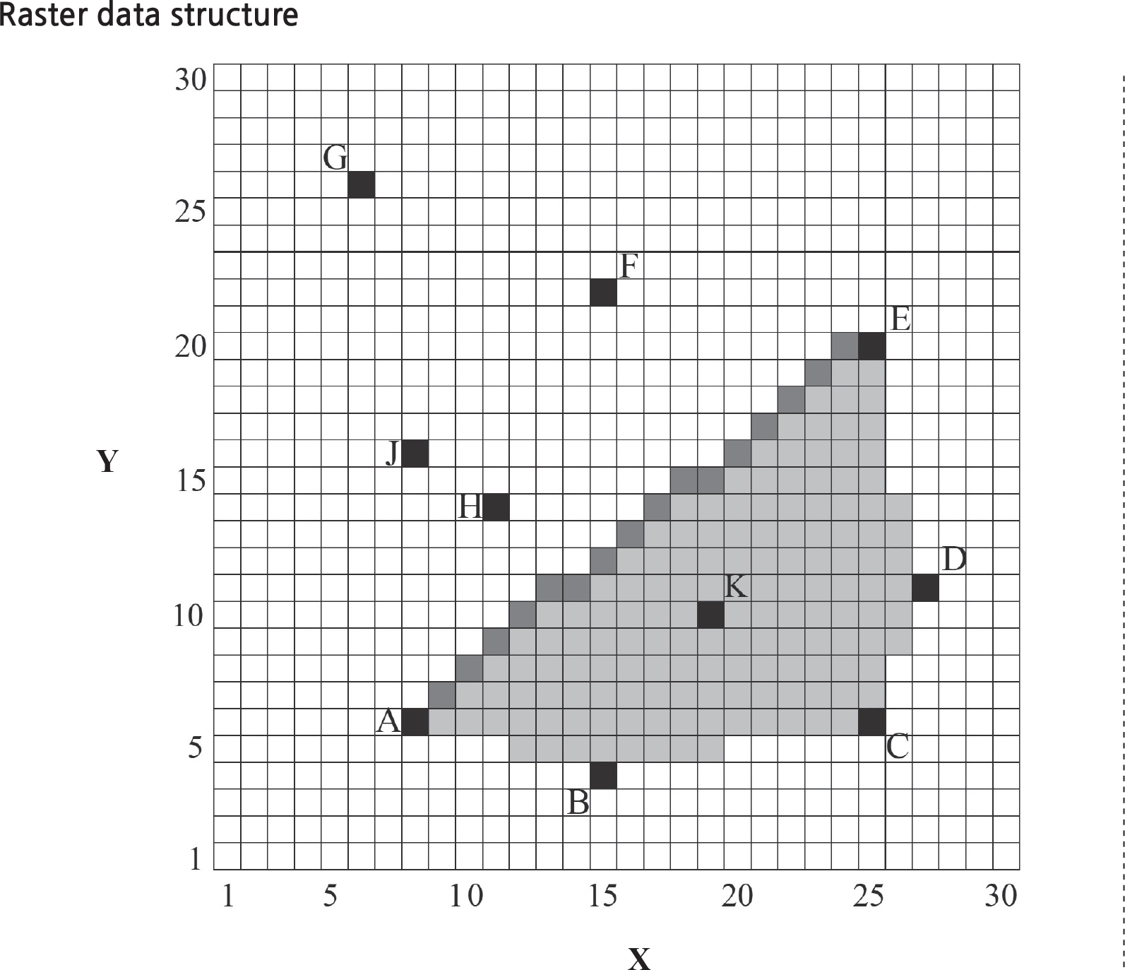
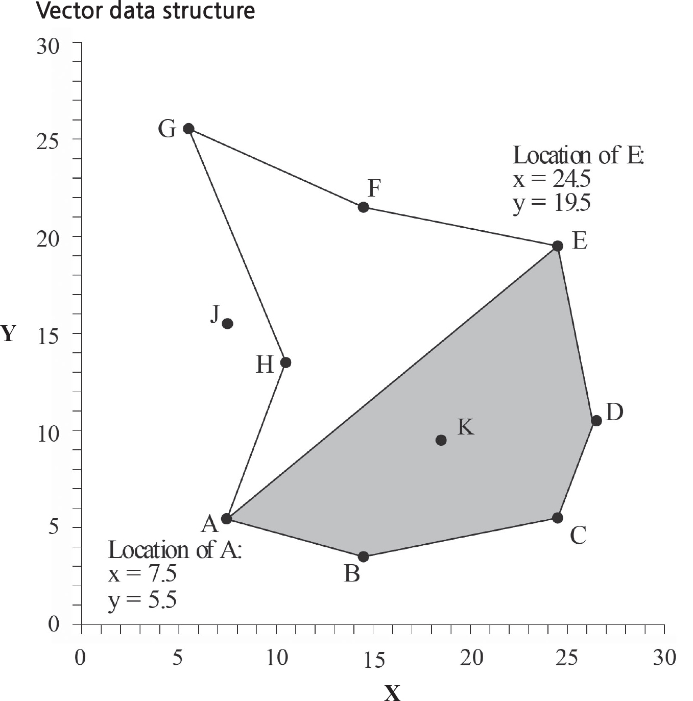
•Resolution change errors: Reducing the resolution of a raster structure can lead to merging of the pixels that can result in data representation error.
•Modeling error: many of today’s maps are based on computer and statistical modeling methods. In modeling a statistical surface (a land surface or a spatial surface filled with continuous statistical data), many modeling methods such as Kriging, Spline, Polynomial, Inverse Distance to the Power, Shepard’s Method, Nearest Neighborhood (and more) can be applied. Each method has its own unique
mathematical formula to perform modeling of the data; each will yield a different result, but some are more appropriate than others. While a viewer may see a television weather broadcast map of wind patterns, these patterns have been “modeled” in the most appropriate modeling methods by the meteorologists. Much of the time, these generated weather maps are quite accurate, but they also have been known to be wrong or distorted on rare occasions.
•Perceptual error: reading off the wrong symbols or map legend clues from the map, or misinterpreting the title and purpose of the map. Just like reading a book, extracting information from a map has to be a careful process.
Obviously, this list is non-exhaustive and there are many more types of map errors. The map reader must exercise some caution and alertness in reading maps and develop at least a sense, if not a variety of techniques, to detect map errors so that a full and overall meaning and intended function of the map can be realized.