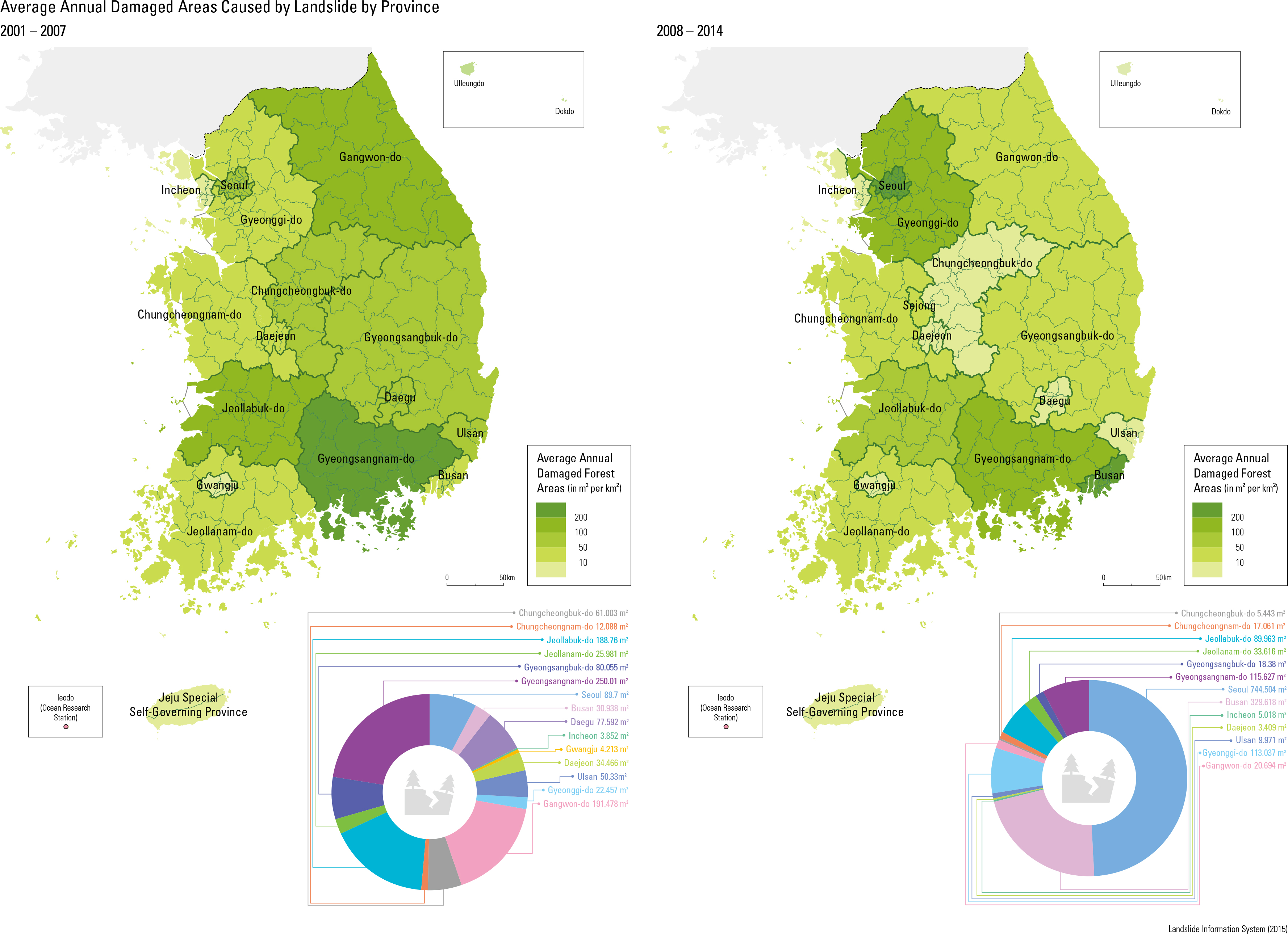
The landslide hazard map shows the landslide risk for all mountains in Korea. The map classi- es the risk into ve groups with regard to both internal and external triggering mechanisms for landslides. The above maps include the land- slide hazard map for Korea and the magnified
Umyeonsan area in Seoul. Above images show a landslide which caused 67 casualties in the Umy- eonsan area on the 25th of July, 2011. The right one shows the Umyeonsan area when the mainte- nance work had been nished after the disastrous landslide.