English II
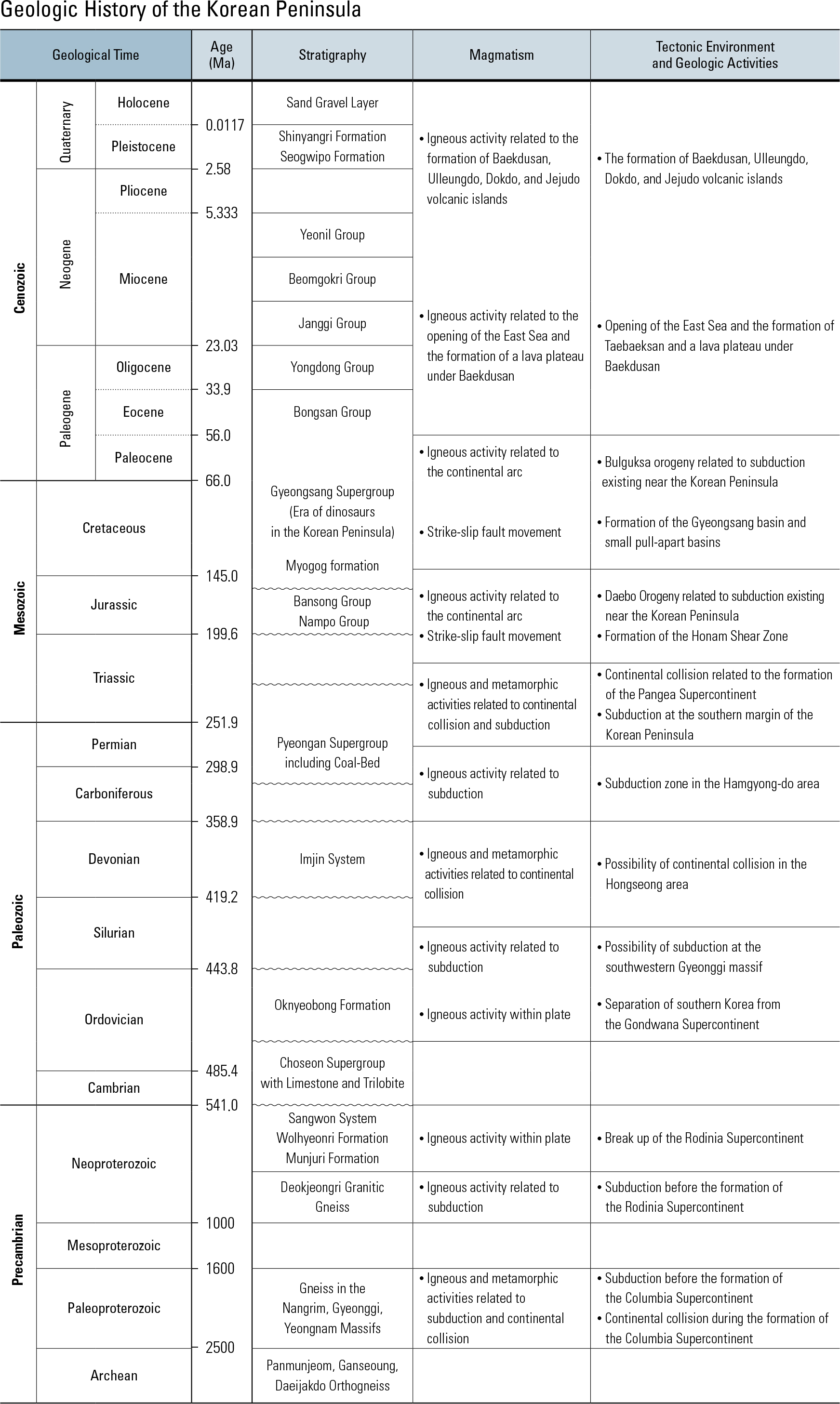
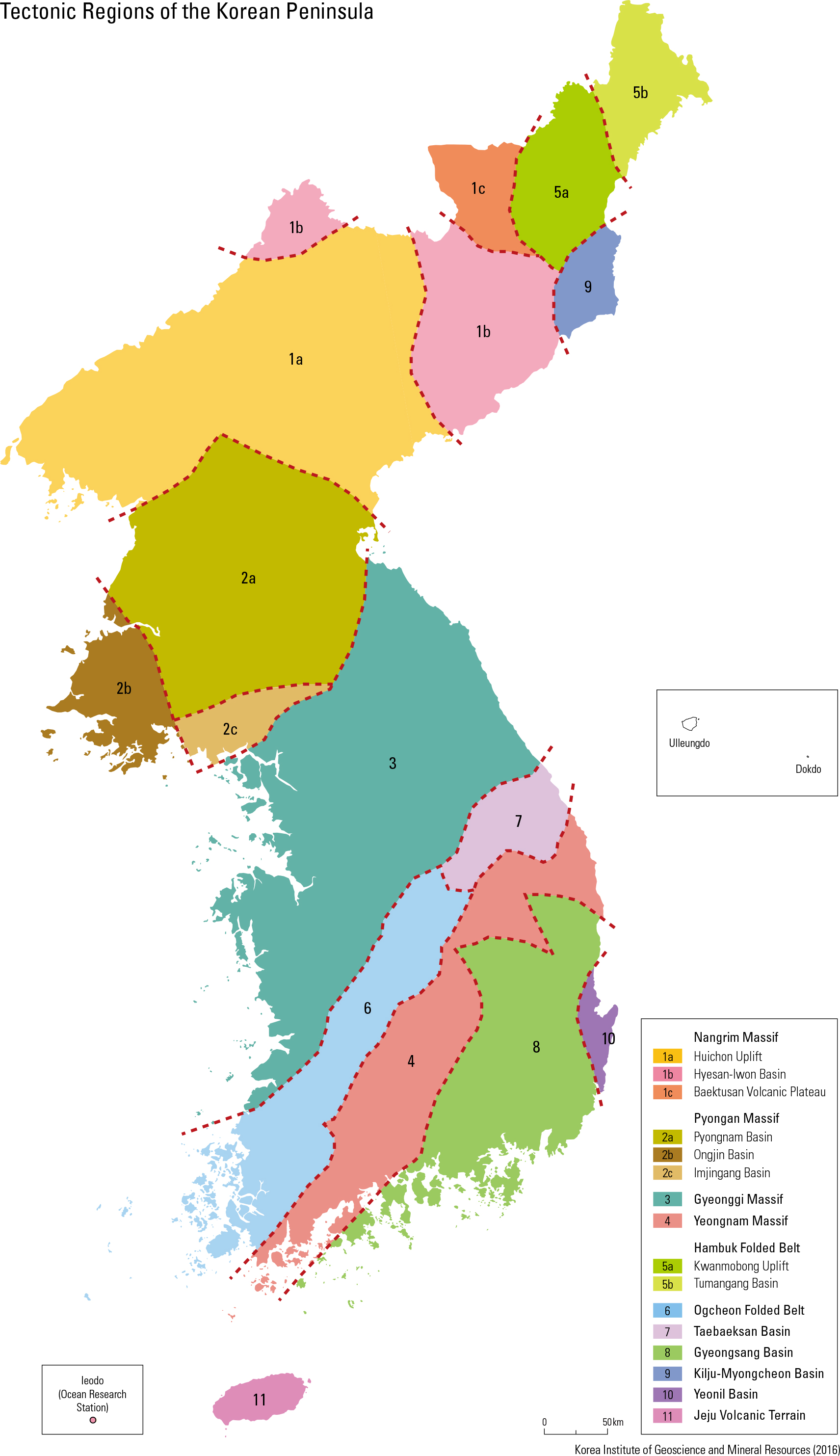
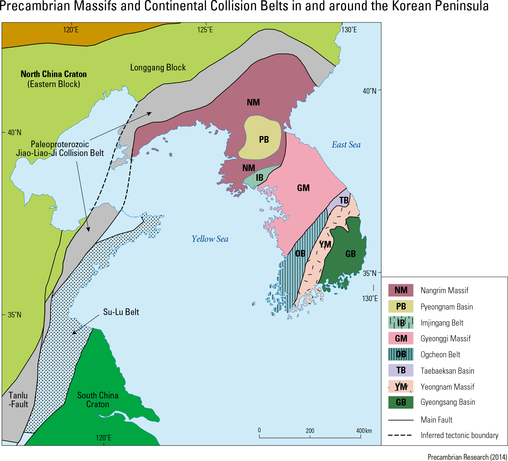
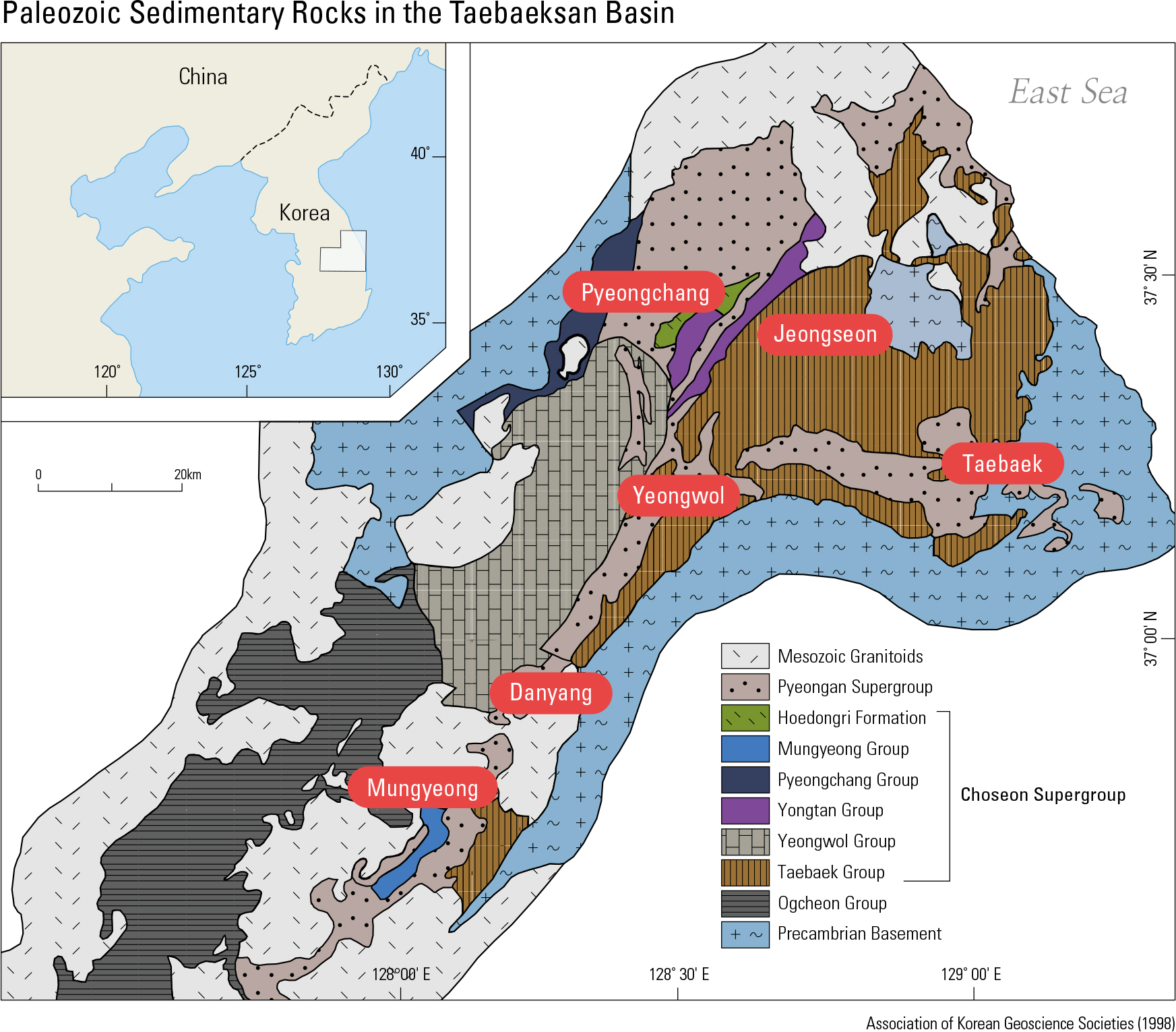
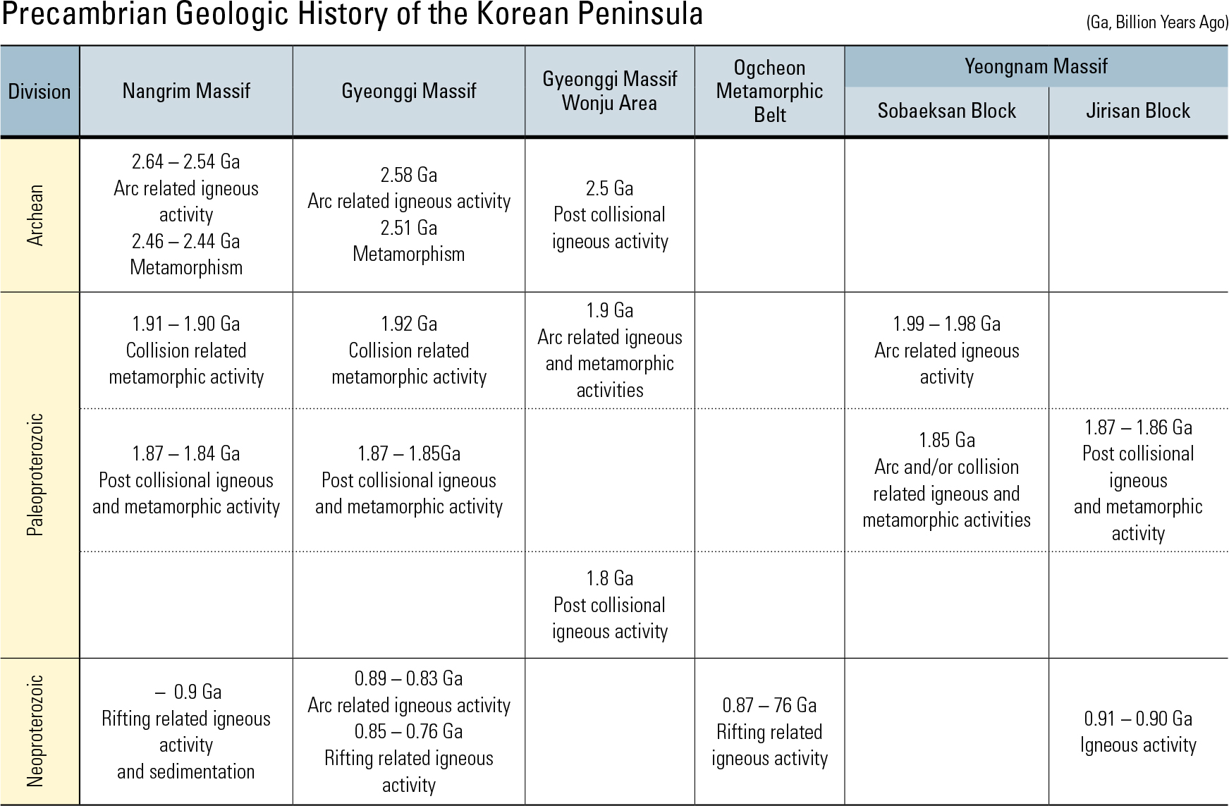
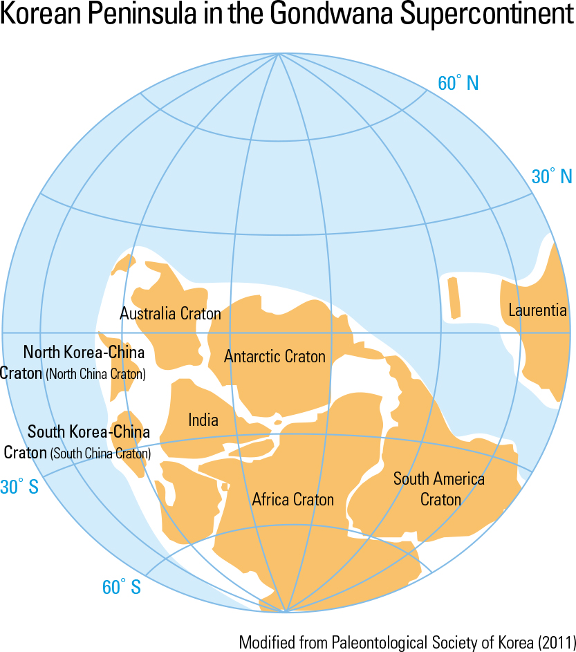
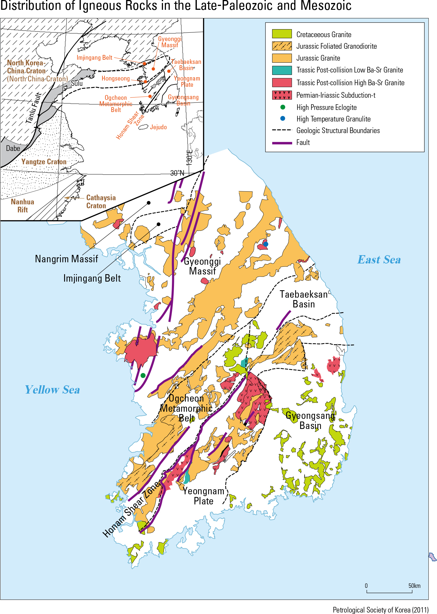
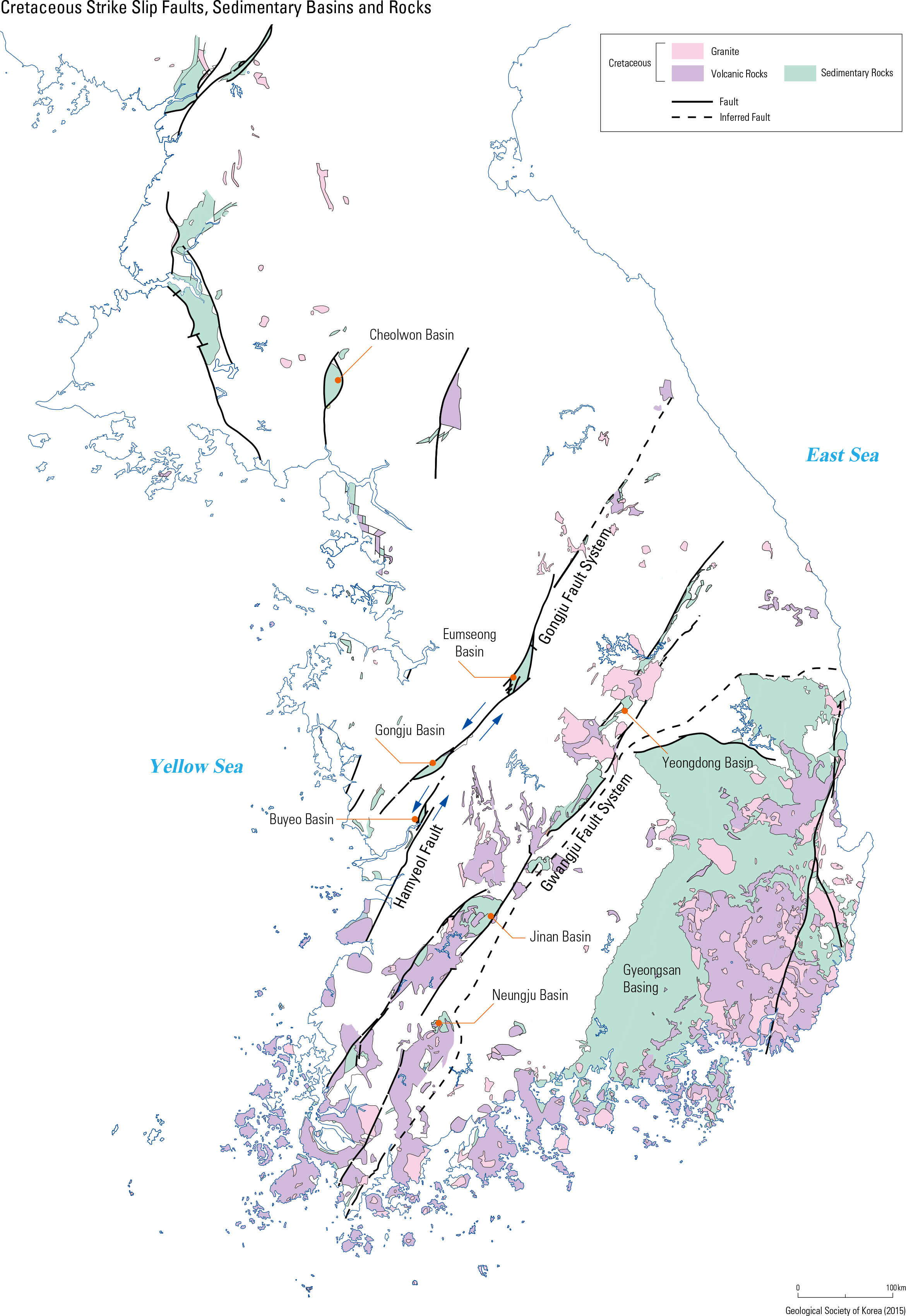
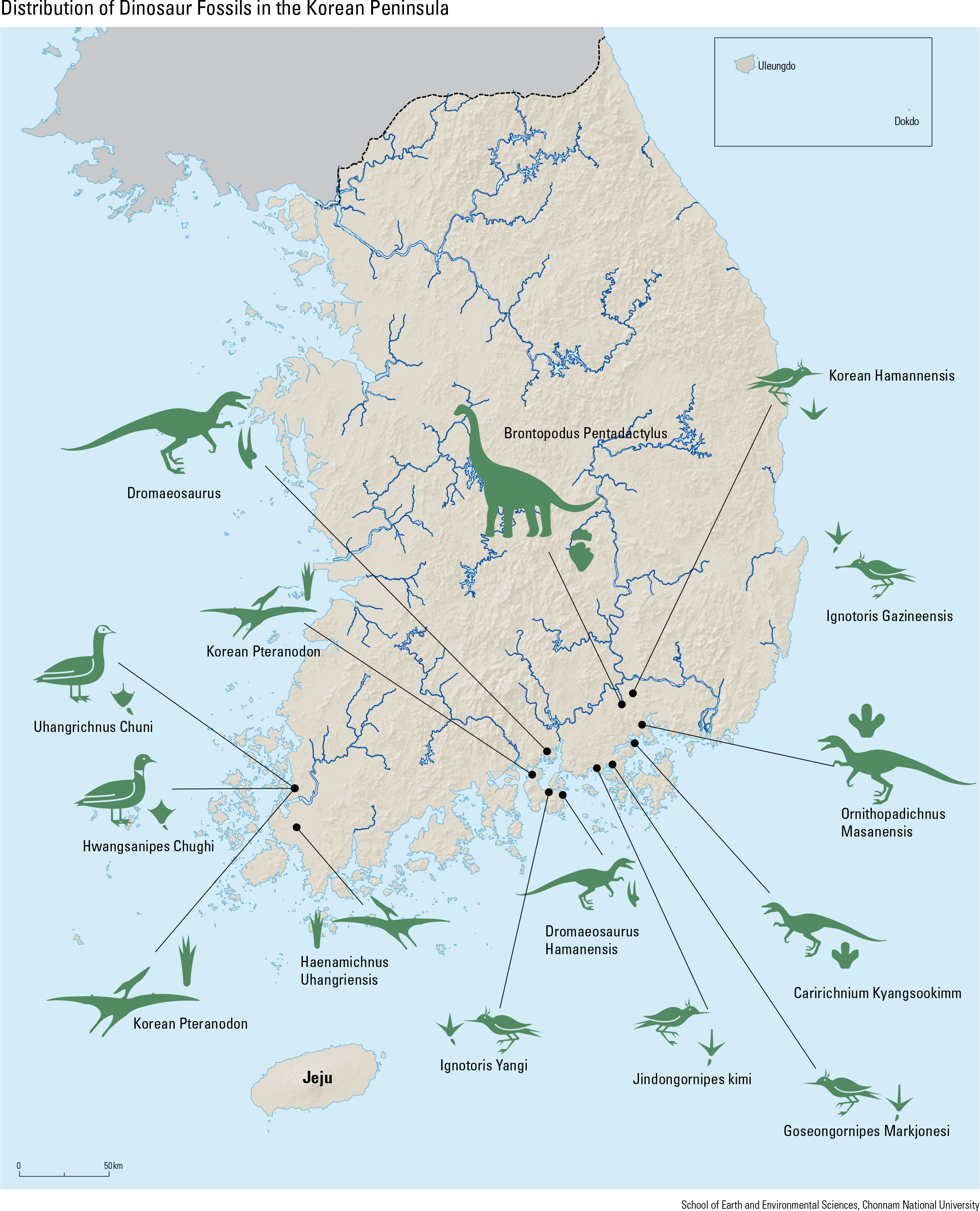
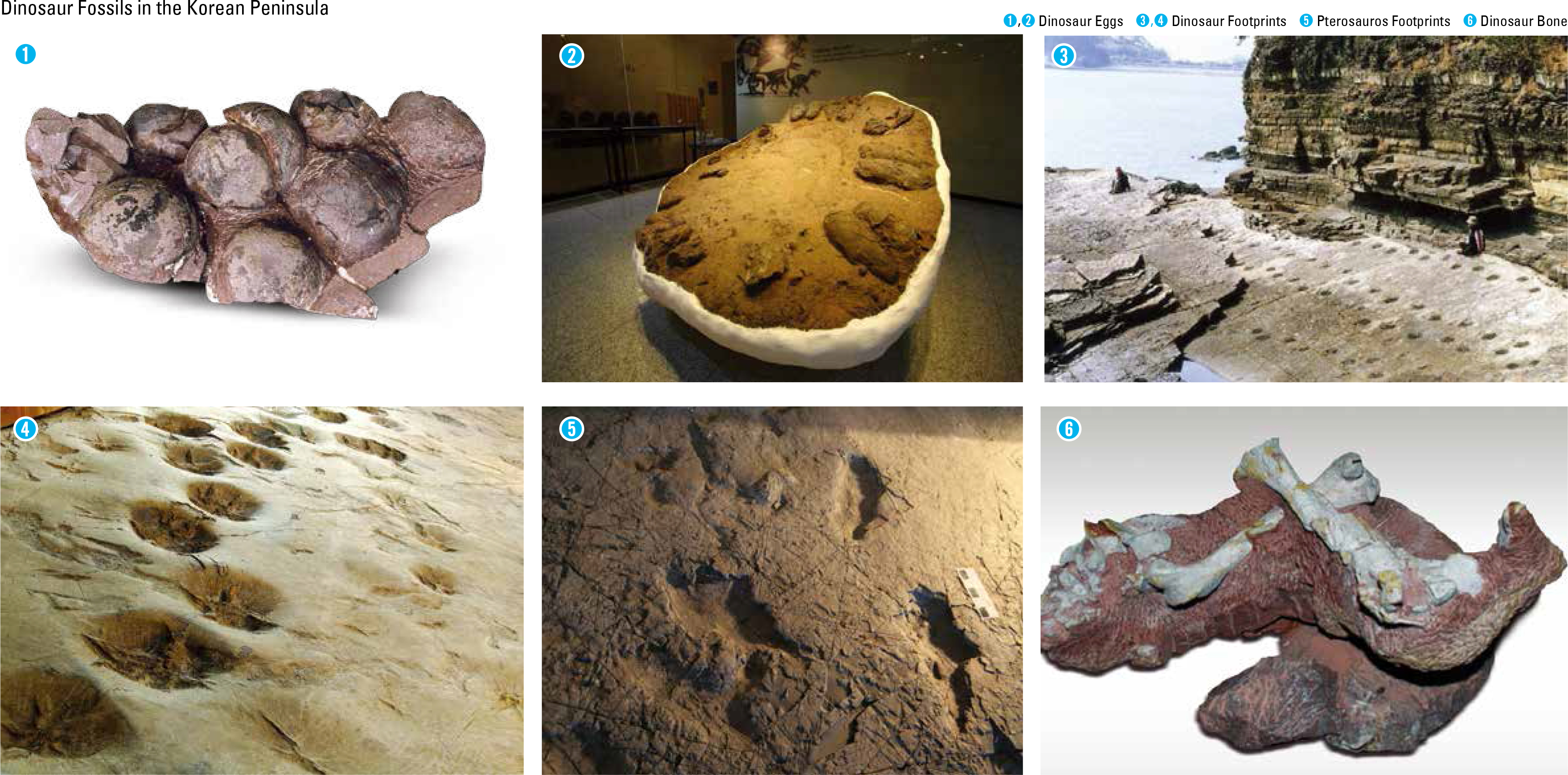
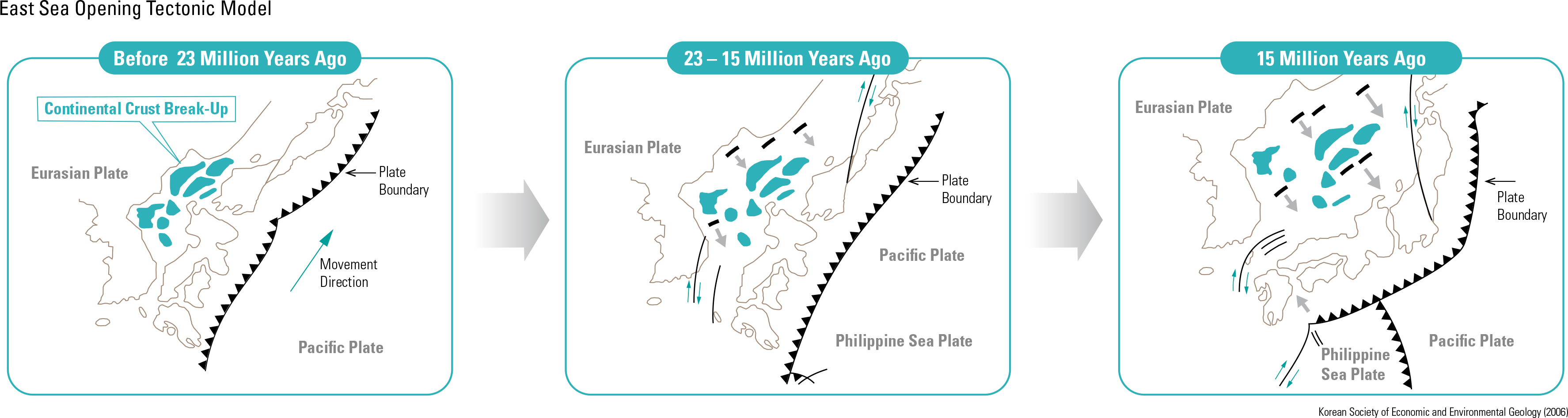
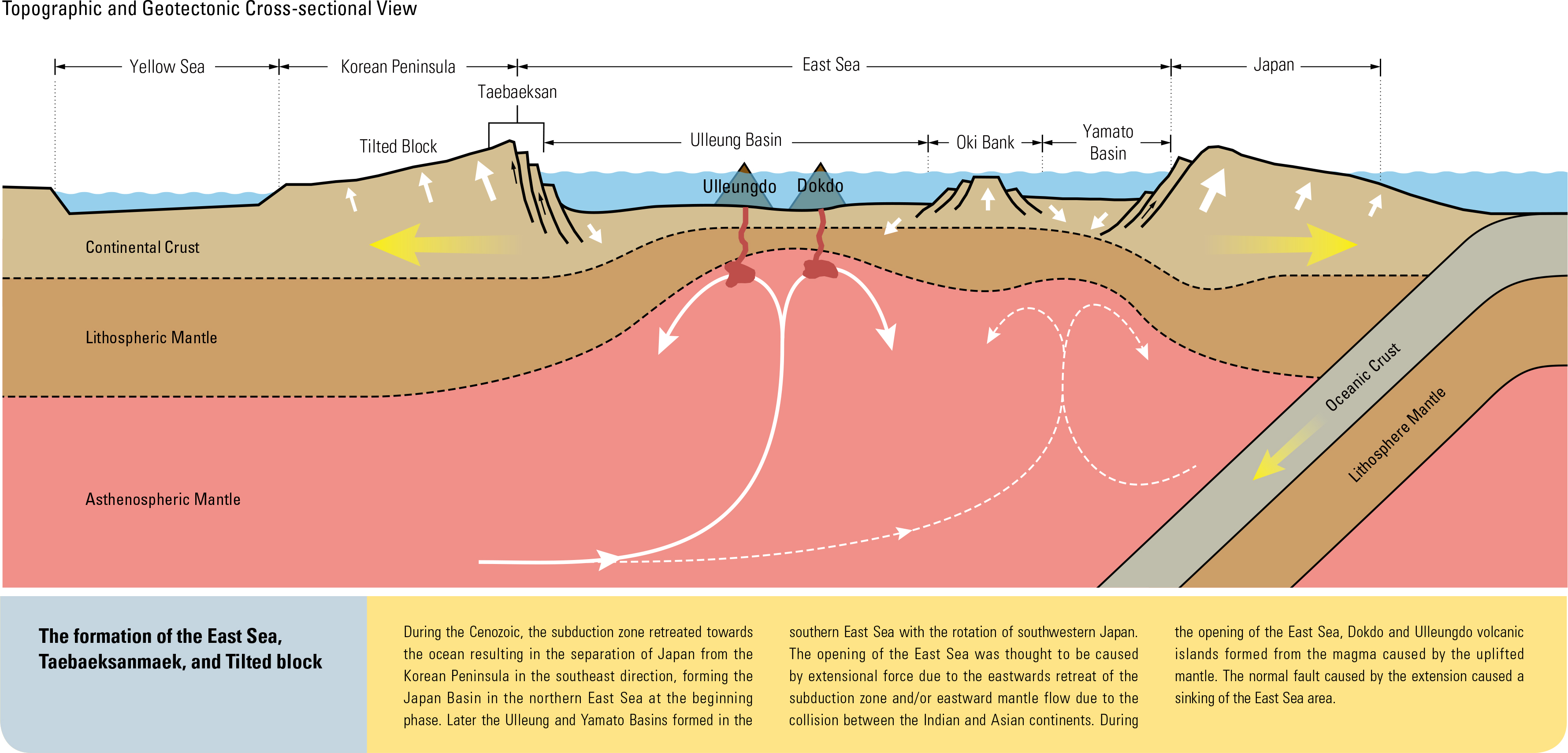
It was once believed that the Paleoproterozoic Nangrim, Gyeonggi, and Yeongnam Massifs were interconnected as one basement formed at ca. 1.9 – 1.8 Ga. Recently, however, it has been con rmed that the present shape of the Korean Peninsula is the result of a continental collision during the Permian-Triassic (250 – 230 Ma). In the area of Hongseong-gun Chungcheongnam-do, the evidence of Triassic eclogite was found that supports the con- tinental collision theory. Additional confirmation of the continental collision is the Triassic post-col- lision granitoid found in the area of Odaesan in Gangwon-do. Although the location of the collision boundary is still uncertain, some parts of the Korean Peninsula is expected to be connected to the North China Craton while other parts to the South China Craton. Therefoe, in this Atlas, the North China Craton and some parts of the Korean Peninsula con- neted to it will be named as the North Korea-China Craton and the South China Craton and some parts of Korean peninsula connected to it as the South Ko- rea-China Craton. From 2.1 – 1.8 Ga, there was the supercontinent Columbia. The Paleoproterozoic igneous and met- amorphic rocks of the Korean Peninsula formed due to the collision of continents that resulted in the supercontinent Columbia and the subduction before that collision. Neoproterozoic sedimentary and ig- neous rocks formed in several areas from 900 – 750 Ma. The Sangwon System (distributed between Hae- jui and Wonju), the Munjuri and Gyeomyeongsan Formations (distributed in the northeastern Ogcheon metamorphic belt), and the Wolhyeonri Formation and Deokjeongri granitic gneiss (in the area of Hongseong) are all Neoproterozoic rocks. The Pa- leoproterozoic supercontinent Columbia began to break into separate continental cratons from ca. 1.8 Ga and then the separated cratons assembled again to form the supercontinent Rodinia at around 1,000 – 900 Ma. Rodinia broke up again into separate cra- tons from 900 – 750 Ma. Most Neoproterozoic rocks on the Korean Peninsula formed during this break- up of Rodinia. After the disintegration of Rodinia, most con- tinents reassembled, forming the supercontinent Gondwana during the late Neoproterozoic, 600 – 550 Ma. At that time, the North Korea-China Craton and the South Korea-China Craton were located on the western side of Gondwana, near the equator. During the early Paleozoic, the North Korea-China and South Korea-China Cratons were separated from Gondwana and moved northward. During this geologic process, the Chosun Supergroup, consisting of Paleozoic marine sediment dated between the Cambrian and early Silurian, was deposited in the Pyeongnam and Taebaeksan Basins. The Pyeongan Supergroup, consisting of non-marine sediments, was deposited on the Chosun Supergroup uncon- formably. Devonian sediments, which are absent from the Pyeongnam and Taebaeksan Basins, occur in the Imjingang belt. Between the Carboniferous and Permian, a subduction zone developed causing subduction-related igneous activity in the Hambuk fold belt in Hamgyeong-do. Recently, subduction-re- lated Ordovician igneous activity was reported in the areas of Hongseong and Mungyung. After the separation of the North Korea-China and South Korea-China Cratons from Gondwana during early Paleozoic, they moved northward, keeping close to each other, and nally collided with each other during the Permian-Triassic, forming the present shape of the Korean Peninsula. At the time of that collision, a subduction zone was initiated along the southern margin of the Korean Peninsula and continued until the Cretaceous. As a result, sub- duction-related igneous rocks regionally intruded the Korean Peninsula; in particular, the intrusion of a Jurassic granite, the Daebo granite, was most extensive, making up the basement of the Korean Peninsula along with Paleoproterozoic metamorphic rocks. During the Cretaceous, many basins were formed on the Korean Peninsula and in the Yellow Sea, and the Gyeongsang Basin is the biggest among them. Lakes that formed in the basins provided good hab- itat for dinosaurs; thus, many dinosaurs were living on the Korean Peninsula during the Cretaceous. During the Cenozoic, the East Sea was opened, separating Japan from the Korean Peninsula and forming the Taebaeksanmaek (Taebaek Mountain Range). Also during this time, volcanic activity re- sulted in the formation of Baekdusan, Ulleungdo, Dokdo, and Jejudo, and sedimentation occurred in the areas of Gilju-Myeongcheon and Yeonil.
page_2 |