English II
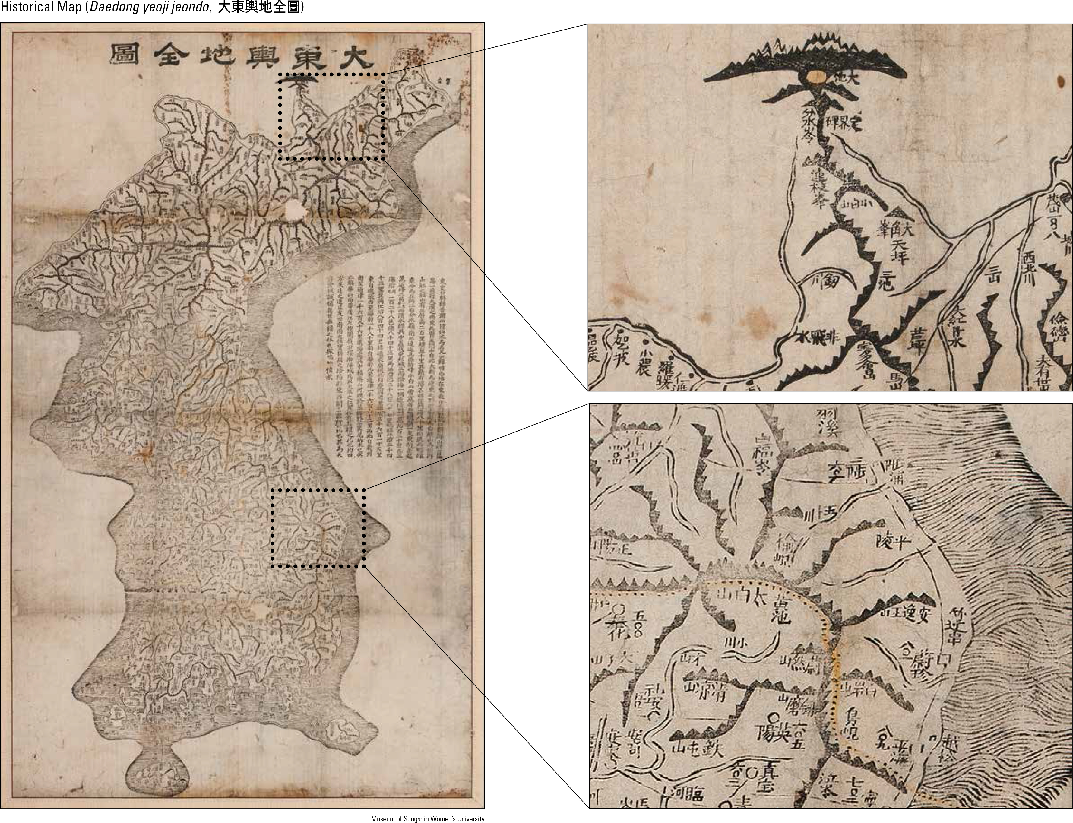
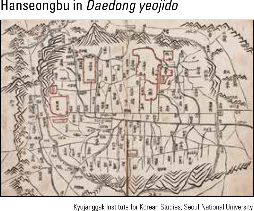
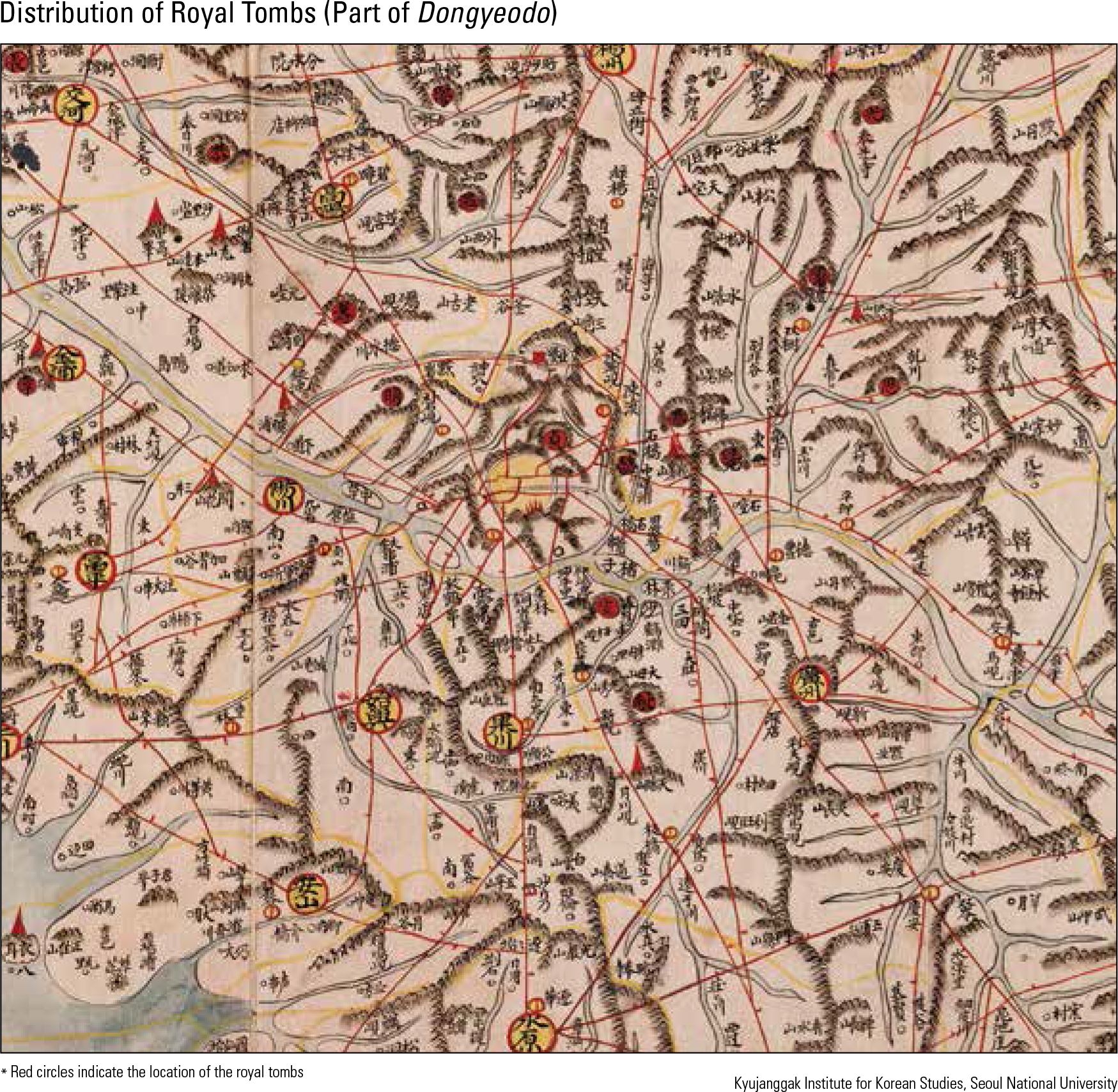
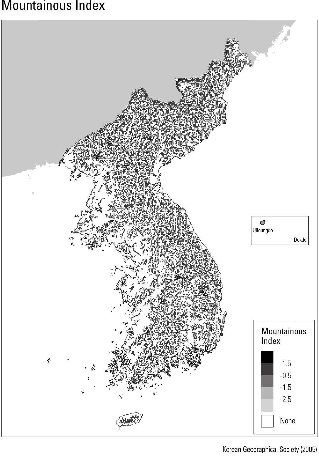
Daedong yeoji jeondo, housed in the Sungshin Women’s University Museum, is a reduction from the original Daedong yeojido to a smaller scale (65 cm by 110 cm) by the great Korean cartographer Kim Jeongho in 1861 (Year 12 of King Cheol- jong). Mountains are represented in this map using a chain-like feature – connecting mountain rang- es with a line – similar to that used in Daedong yeojido. Famous mountains such as Baekdusan, Jangbaeksan, Geumgangsan, Nangrimsan, and Odaesan were indicated by highlighting the peaks with a rock shape. In addition, serrated crests were expressed in different thicknesses depending on the width and height of the crest topography, with major passes also marked on the map. The original Daedong yeojido (360 cm by 685 cm) covers an area spanning 19 longitudinal by 22 latitudinal lines carved on 121 wood blocks. It included 213 map pages when bound into a book. The distribution pattern of the royal tombs of Joseon shown in Dongyeodo demonstrates the in uence of Pungsu (Feng Shui) and Confucian- ism on their locations. These tombs are generally distributed from north to south along the mountain chains. Most of the tombs are located within 100 “ri (about 40 km)” from the royal palace, and the majority (26 tombs) are distributed within 8 – 16 km. Thirty-two royal tombs of the Joseon Dynasty are concentrated in the northeast and northwest zones of the capital city (Hanyang), and only seven are located to the south of Hangang. The tombs face east, northeast, or northwest, and are meticulously designed according to Pungsu princi- ples. Most tombs are located in banded gneiss and granite with thick topsoil. Daedong yeoji jeondo, housed in the Sungshin Women’s University Museum, is a reduction from the original Daedong yeojido to a smaller scale (65 cm by 110 cm) by the great Korean cartographer Kim Jeongho in 1861 (Year 12 of King Cheol- jong). Mountains are represented in this map using a chain-like feature – connecting mountain rang- es with a line – similar to that used in Daedong yeojido. Famous mountains such as Baekdusan, Jangbaeksan, Geumgangsan, Nangrimsan, and Odaesan were indicated by highlighting the peaks with a rock shape. In addition, serrated crests were expressed in different thicknesses depending on the width and height of the crest topography, with major passes also marked on the map. The original Daedong yeojido (360 cm by 685 cm) covers an area spanning 19 longitudinal by 22 latitudinal lines carved on 121 wood blocks. It included 213 map pages when bound into a book. The distribution pattern of the royal tombs of Joseon shown in Dongyeodo demonstrates the in uence of Pungsu (Feng Shui) and Confucian- ism on their locations. These tombs are generally distributed from north to south along the mountain chains. Most of the tombs are located within 100
page_2 |