English II
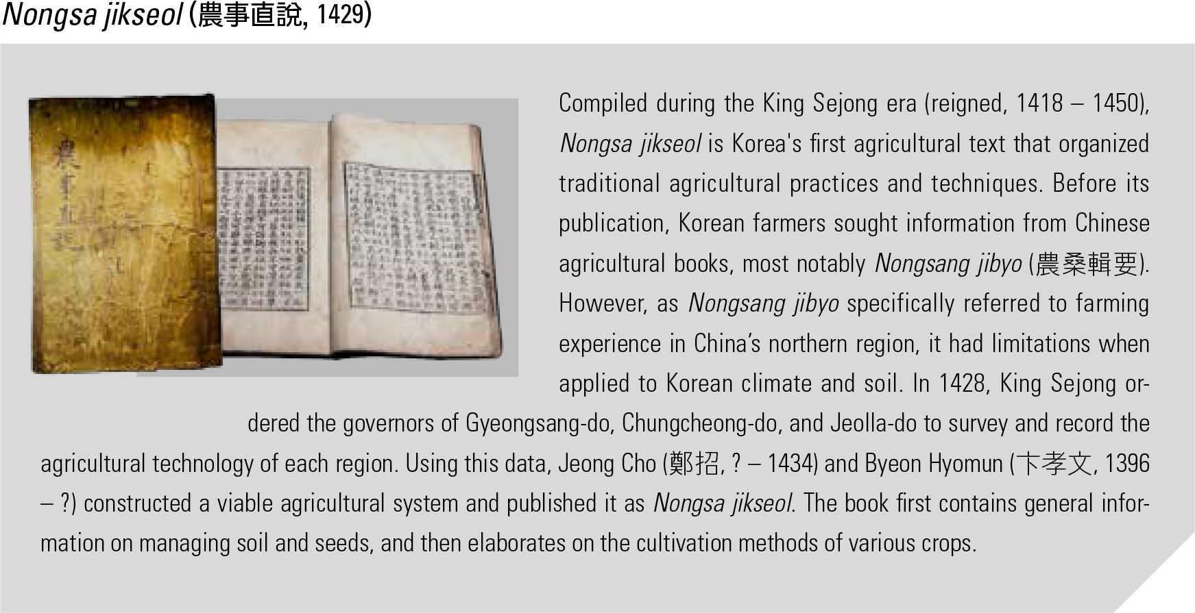
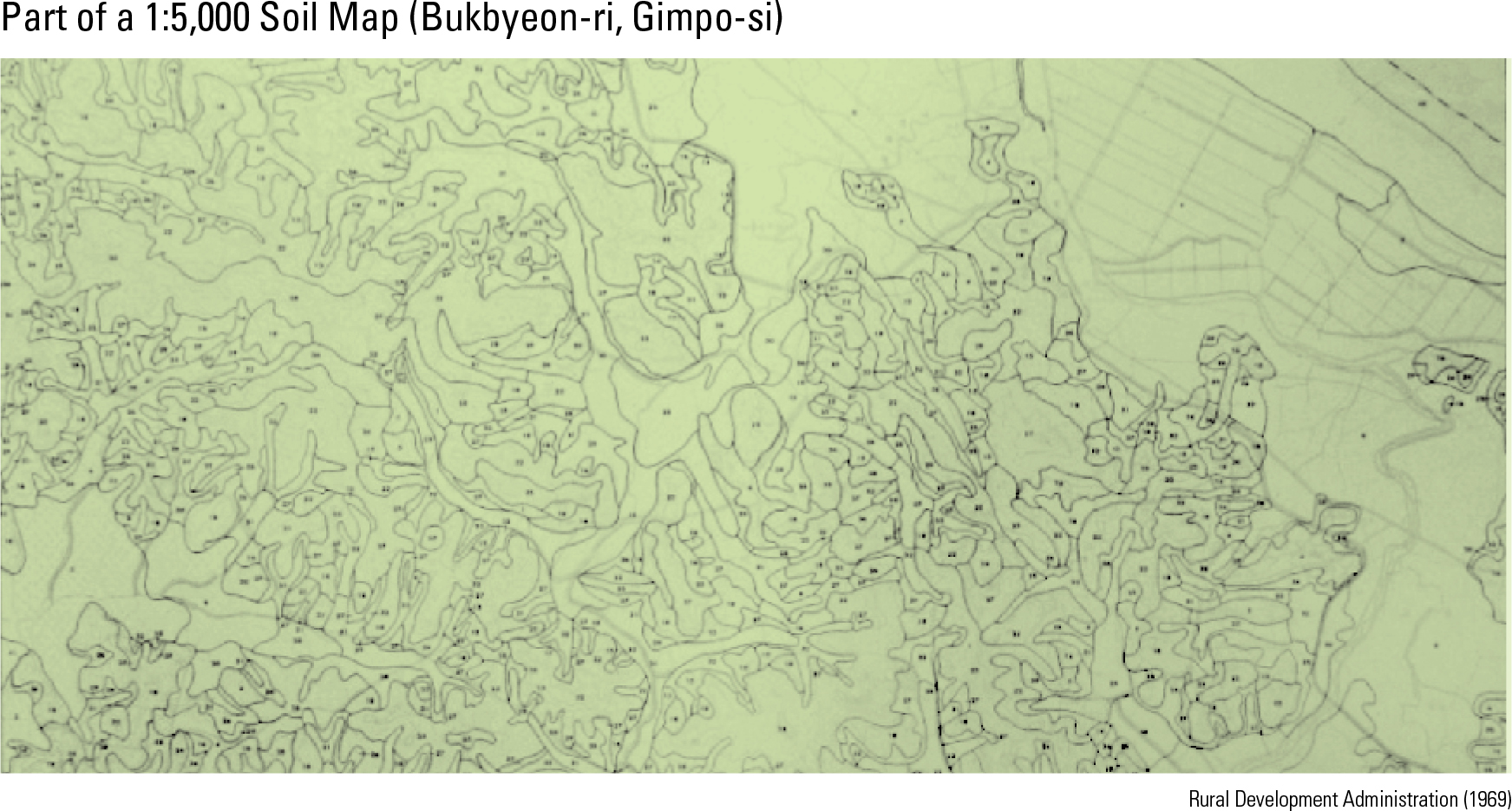
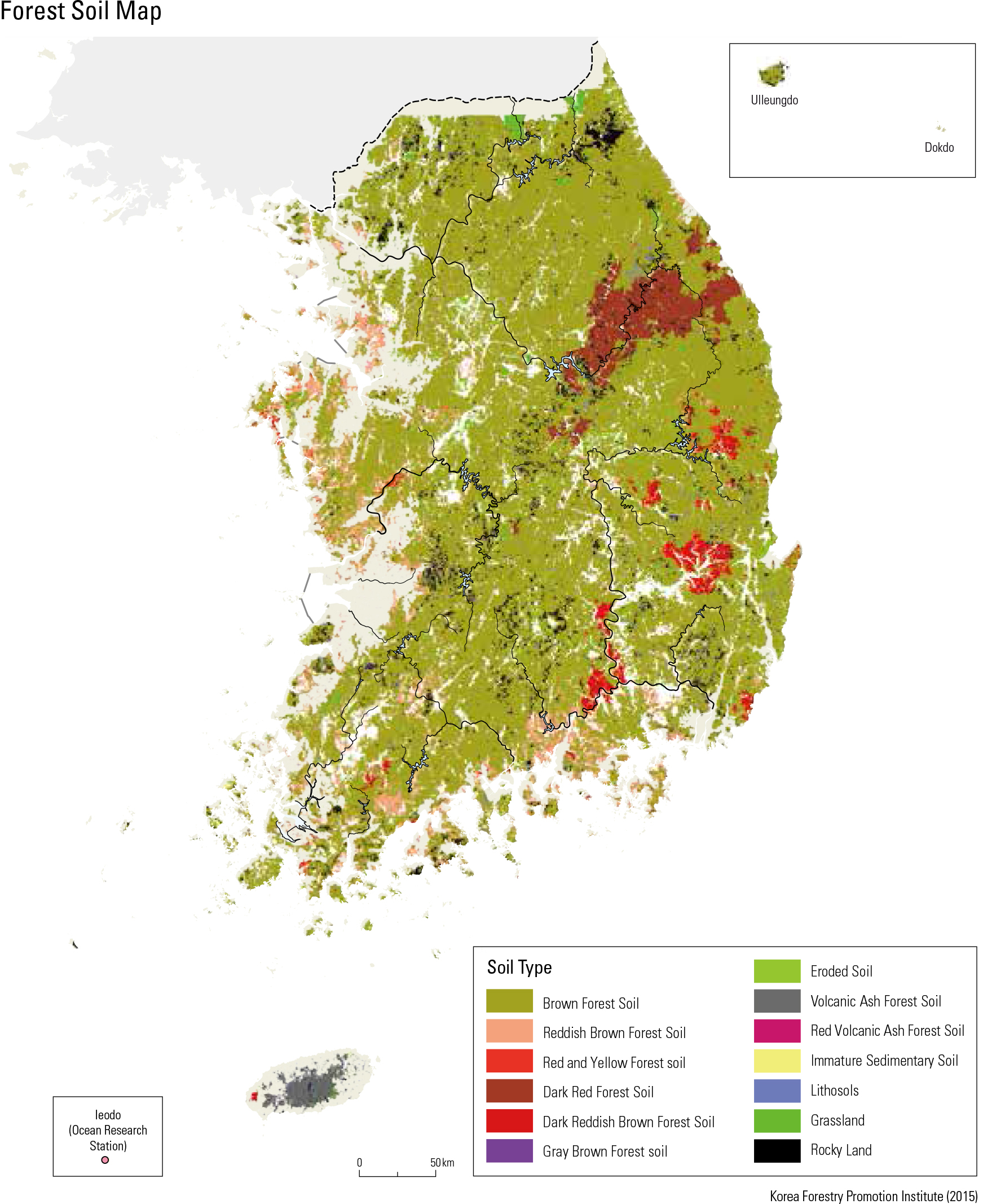
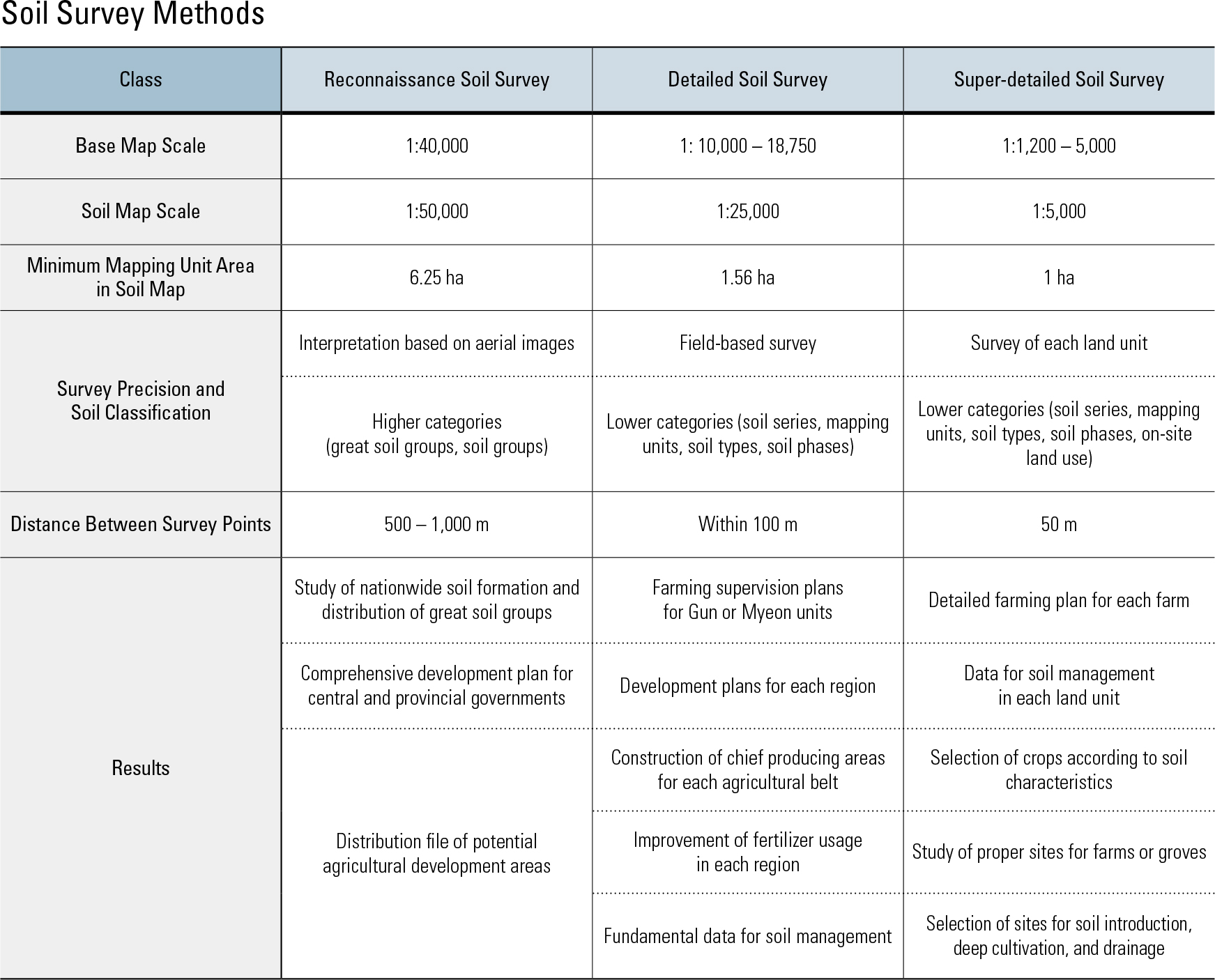
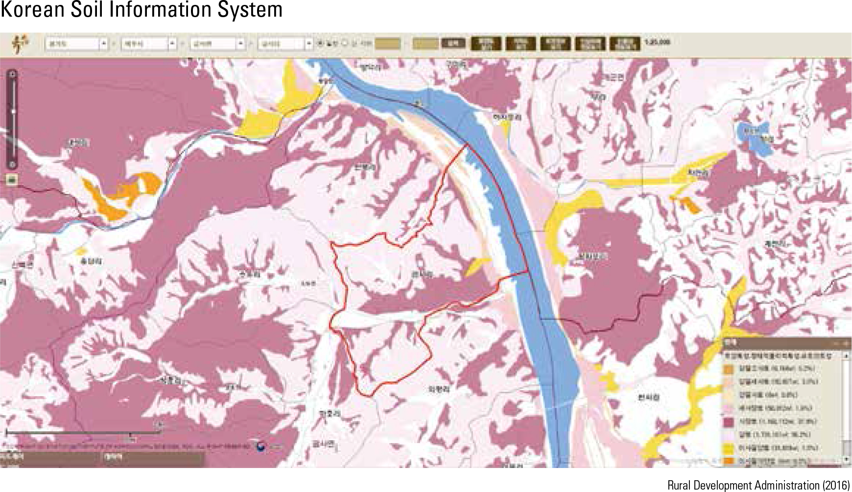
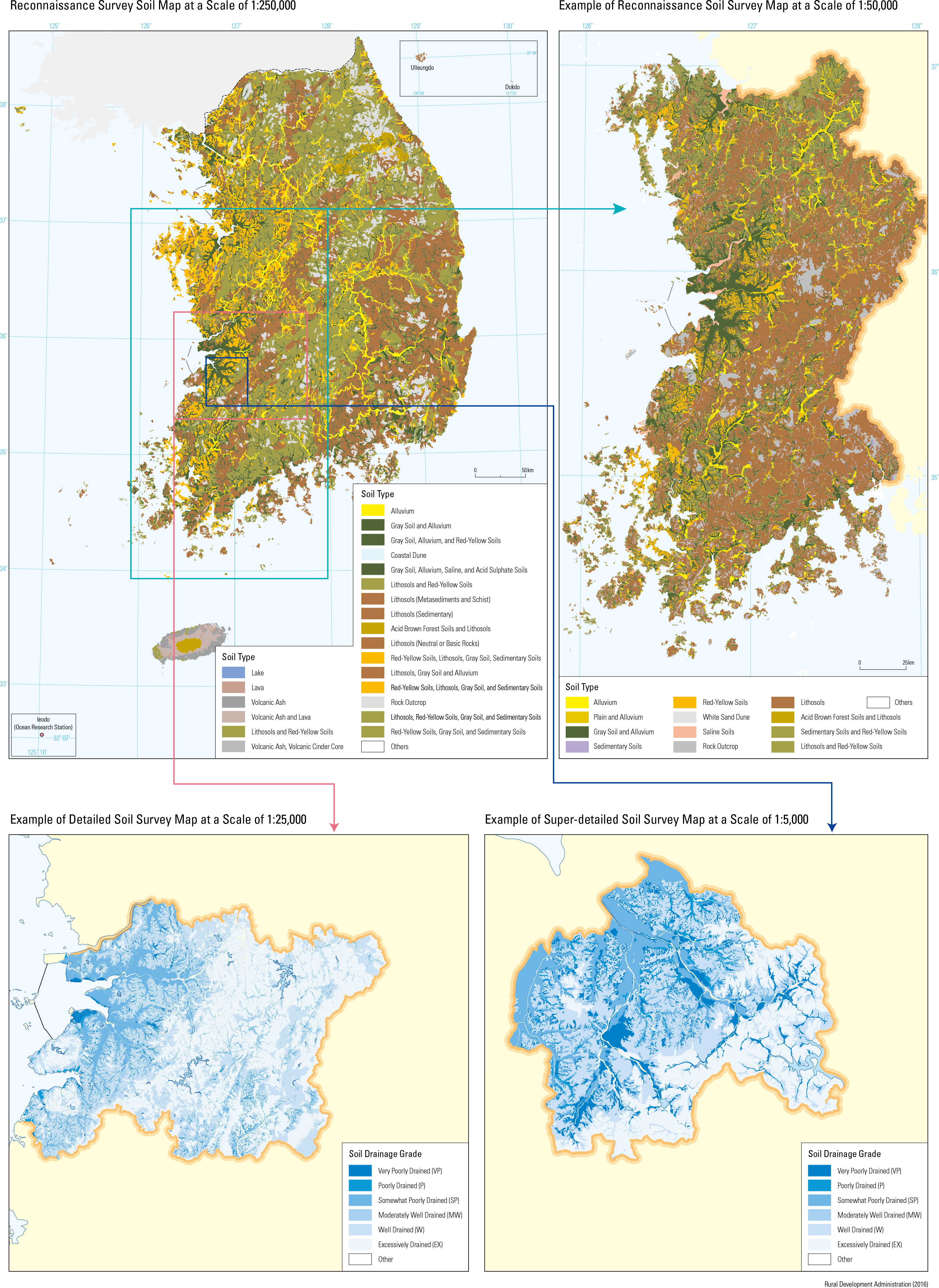
Korea’s mountainous topography and high population density have led the country to have the highest social demand for soil resources. In response to this, Korea carried out an extremely elaborate and sophisticated soil survey, the results of which have been made available to the public through a digitalized soil information system. According to Nongsa jikseol (the agricultural text written by Jeong Cho and Byeon Hyomun in 1429), the taste of the soil served as the standard for soil classification at the time. Records state that the fertility of soil differs according to its taste; sour-tasting soil indicates barrenness, while sweet-tasting soil refers to richness. Modern soil surveys were first conducted in 1905, when Japanese scholars were dispatched to study the climate, geology, and other natural characteristics of Korea. In 1930, an irrigation association conducted a survey in order to set a standard for fertilizer usage. The rst planned soil survey project was launched in 1936 with a de- cade-long plan to study cultivated land. However, it was halted due to the outbreak of World War II and the Korean War. Advanced scienti c soil sur- vey methods were introduced in 1959, when the country received overseas aid to conduct a survey of Daedeok-gun, Daejeon-si under the USDA soil classification system. Between 1964 and 1999, extensive national soil survey projects were carried out as part of the United Nations Special Fund. There are three types of soil surveys: reconnais- sance, detailed, and super-detailed. The catego- rization depends on the survey’s objectives, base map scales, and precision. Reconnaissance soil surveys were carried out from 1965 to 1967 over relatively wide areas. The printed soil map result- ing from these surveys was provided at a 1:50,000 scale with 6.25 ha as the minimum mapping unit. It is being used for various policies such as com- prehensive land development plans. Detailed surveys began in November 1964 with the support of the UN Special Fund. Professional surveyors were recruited and trained to examine potential areas for future cultivation. Backed by the UN and the Korean government, the proj- ects surveyed a total of 9,586,407 ha, or 96.6% of Korea’s total area. As of now, only the areas surrounding the Military Demarcation Line and newly reclaimed lands have yet to be surveyed. A government-led survey of forest soil was first launched by the Forest Service in 1968 in order to find suitable afforestation areas in the river basins of Anseongcheon, Dongjingang, and Sangjucheon. Beginning in 1995, annual soil sur- veys have been conducted to achieve systematic development and management of forest resourc- es. A 1:25,000 scale national forest soil map was completed in 2003, and current projects are aimed towards enhancing this map to be on a scale of 1:5,000 to invigorate sustainable forest and eco- system management, particularly for private for- ests.
page_2 |