English II
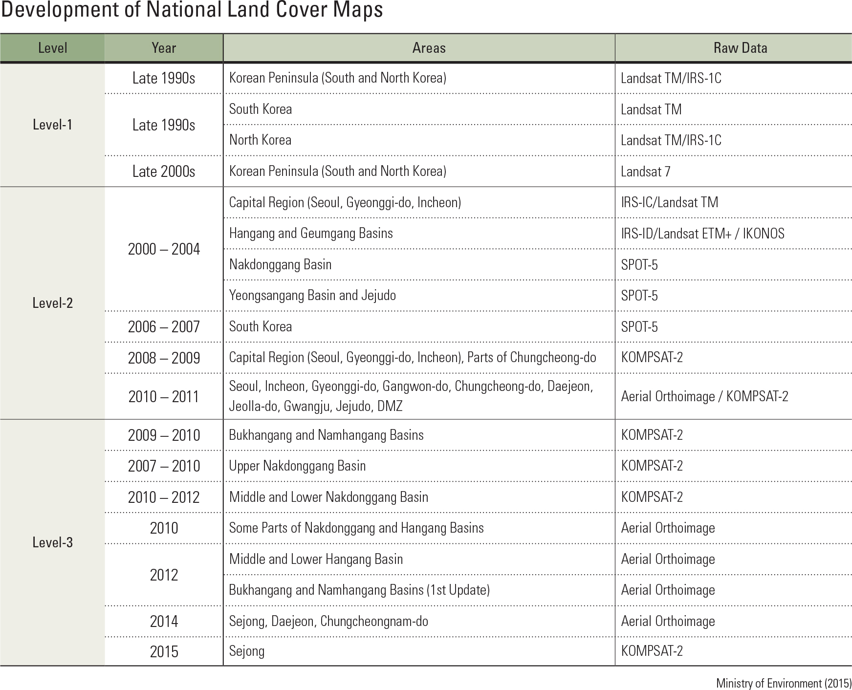
The Ministry of Environment created a national land cover map to encourage effective land man- agement and environment-friendly land usage. The map is constructed with data collected from satellites and aircrafts; in particular, information compiled by the Korea Multi-Purpose Satellite (KOMPSAT) has widely been used for mapping land cover types. Satellite images are also utilized to build a land cover map of North Korea. The national land cover map – which is avail- able to the public through the Environmental Geographic Information Service (http://egis. me.go.kr) – consists of three levels. The level-1 land cover map includes the entirety of the Kore- an Peninsula and incorporates 7 land cover types. It was first created in 1998 and continues to be revised every 10 years. The level-2 land cover map, consisting of 22 land cover types, was rst produced between 2000 and 2004 and underwent revisions in 2007, 2009, and 2013. The latest re- vision completed the entire land of South Korea with the inclusion of the cross-border region be- tween the two Koreas. The level-2 map is useful for identifying the status of land use at a regional scale. It is also utilized for calculating the size of impervious areas and canopies in order to esti- mate stream flow. Additionally, it contributes to research for urban development and expansion, location selection for various facilities, and evalu- ation of potential natural hazards. The level-3 land cover map includes 41 land cover types. Initially created in February 2010, its land coverage continues to be expanded each year. The level-3 map analyzes land use at a local level within cities, districts, and provinces, and is particularly useful for biotope evaluation, as- sessment of green space in cities, and community mapping.
page_2 |