English II
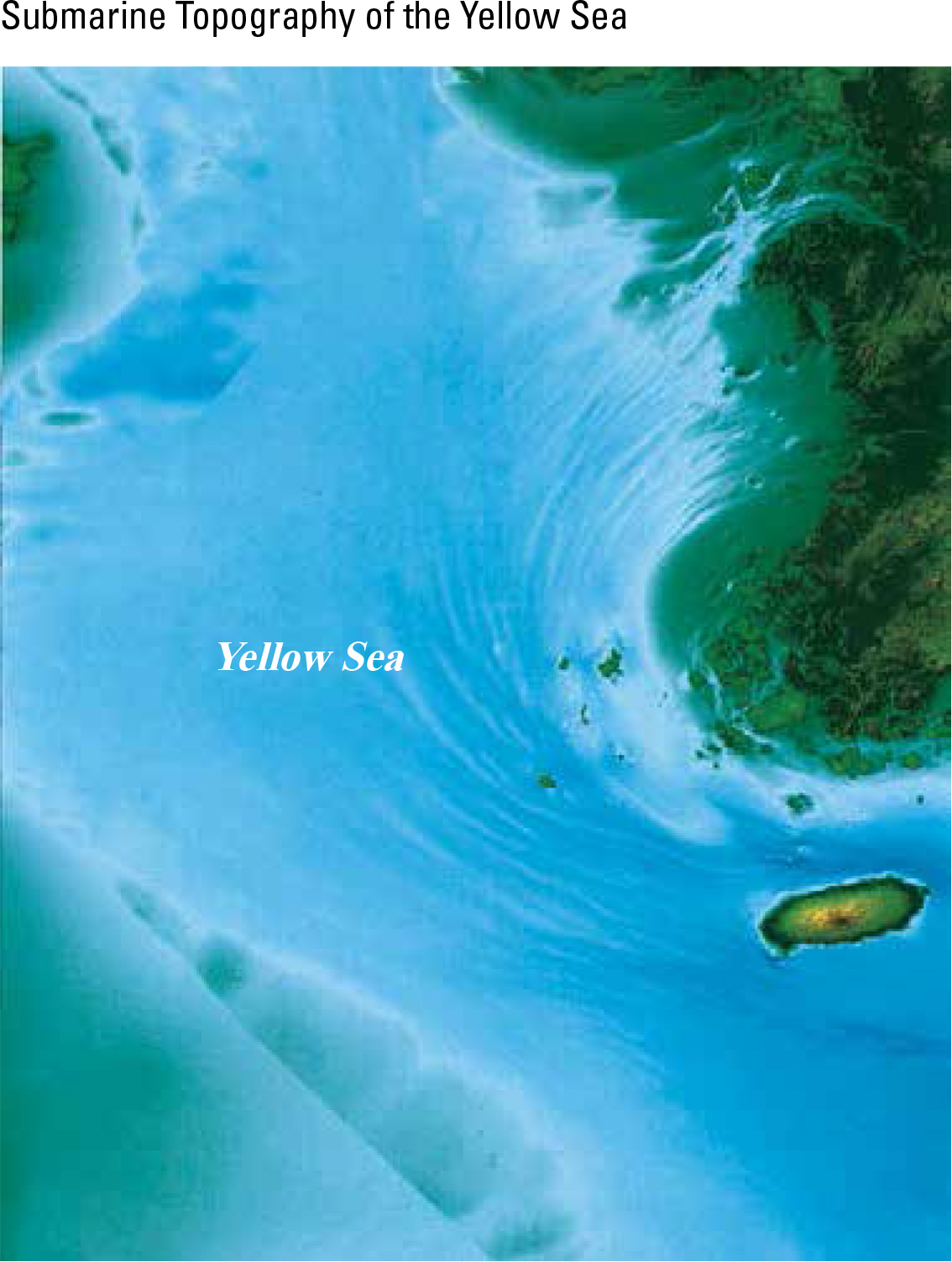
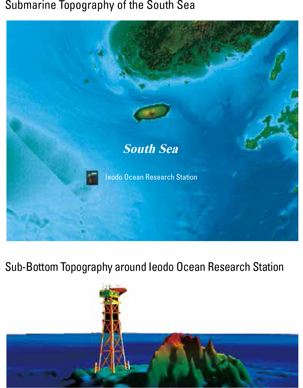
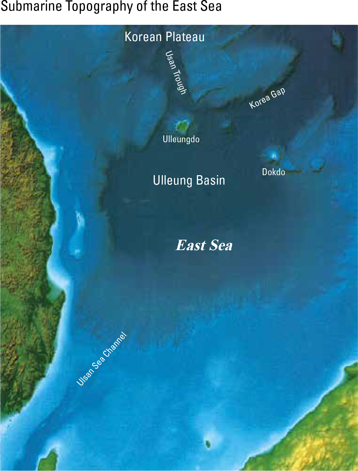
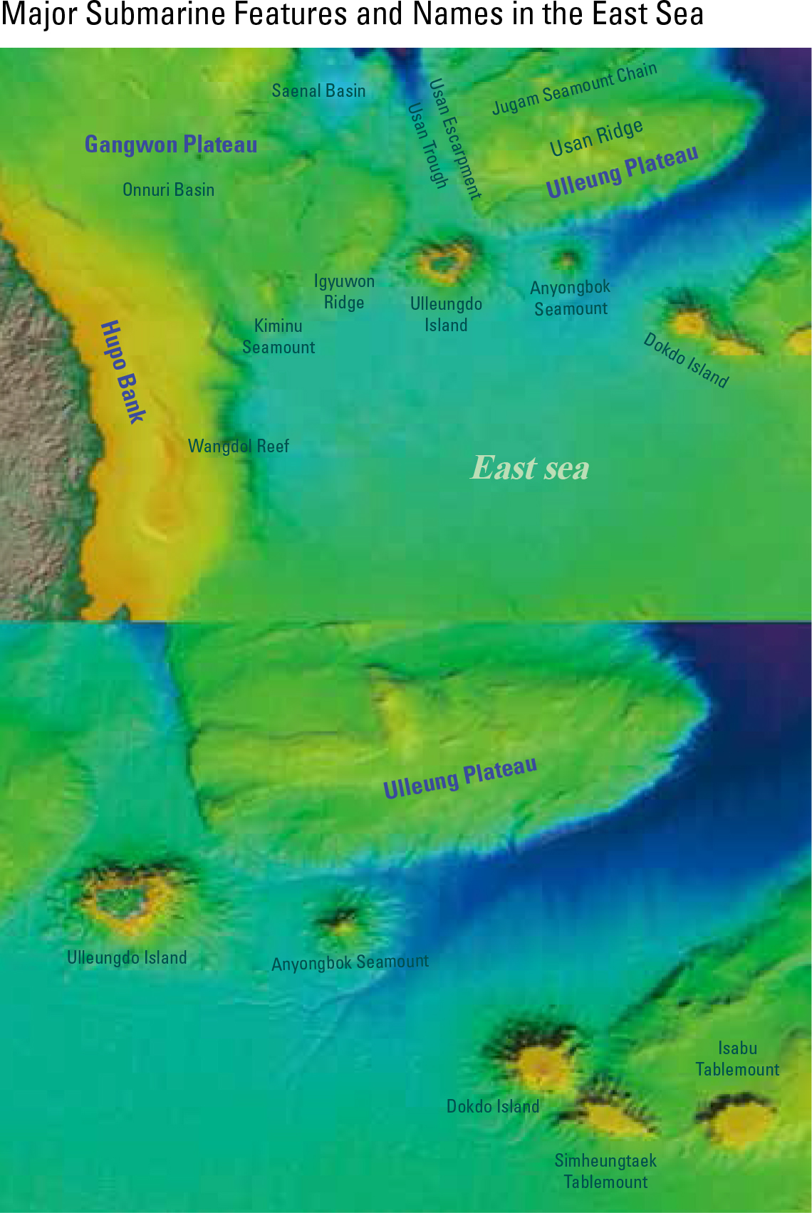
The Yellow Sea, South Sea, and East Sea of the Korean Penin- sula each show different submarine topographies. The Yellow Sea, which is entirely connected to the continental shelf, is characterized by a shallow water depth (an average of 45 m and a maximum of 103 m) and a gentle slope. The South Sea is geographically connected to the Yellow Sea. It generally displays flat topography in the southwestern region around the East China Sea, but becomes deeper from Jejudo to the southeast. It shows a maximum of 198 m and an average of 71 m of water depth. The Ieodo Ocean Research Station is established on Ieodo, which is an island surrounded by rocks located on the south end of Korea's exclusive economic zone. It observes various marine and atmospheric environments. Unlike the Yellow Sea and the South Sea, the East Sea is charac- terized by very deep water and steep slopes in the coastal area. The at terrains of the Ulleung Basin exist at a depth of 2,000 m near Ulleung Island, and the Korea Plateau is located to the north of the basin. The Usan Trough, a submarine canyon, is located to the north of Ulleung Island.
page_2 |