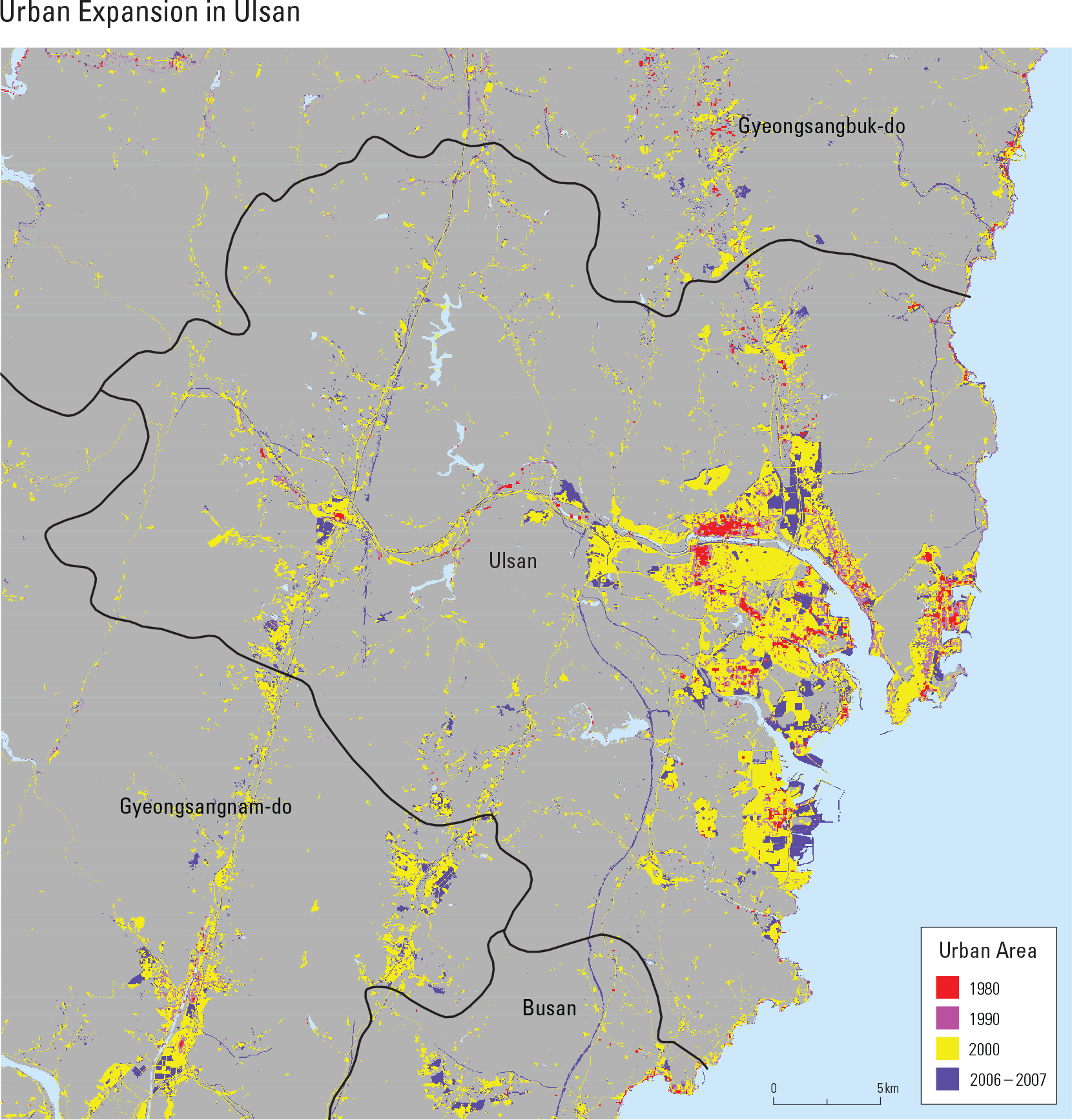
English II
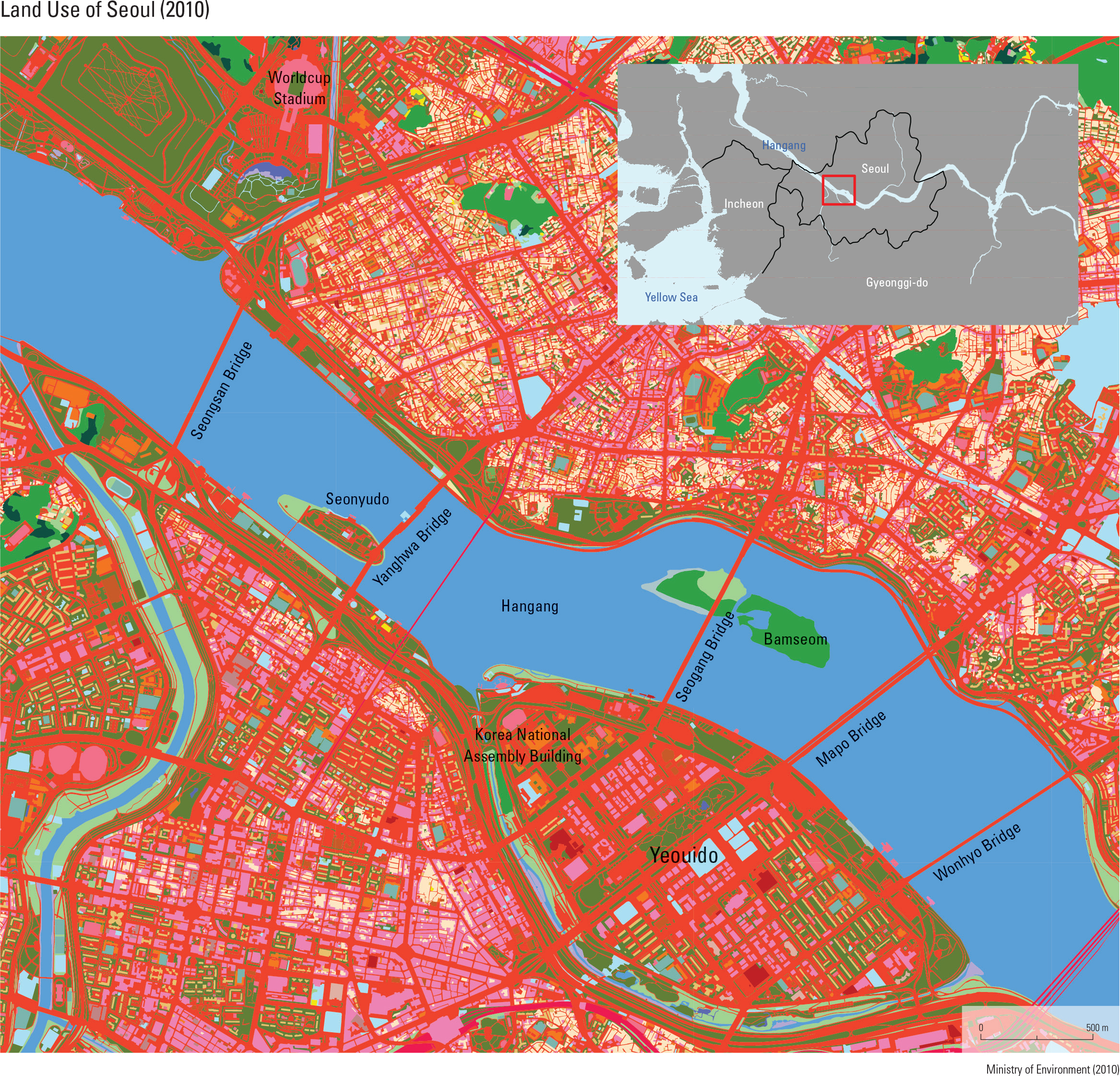
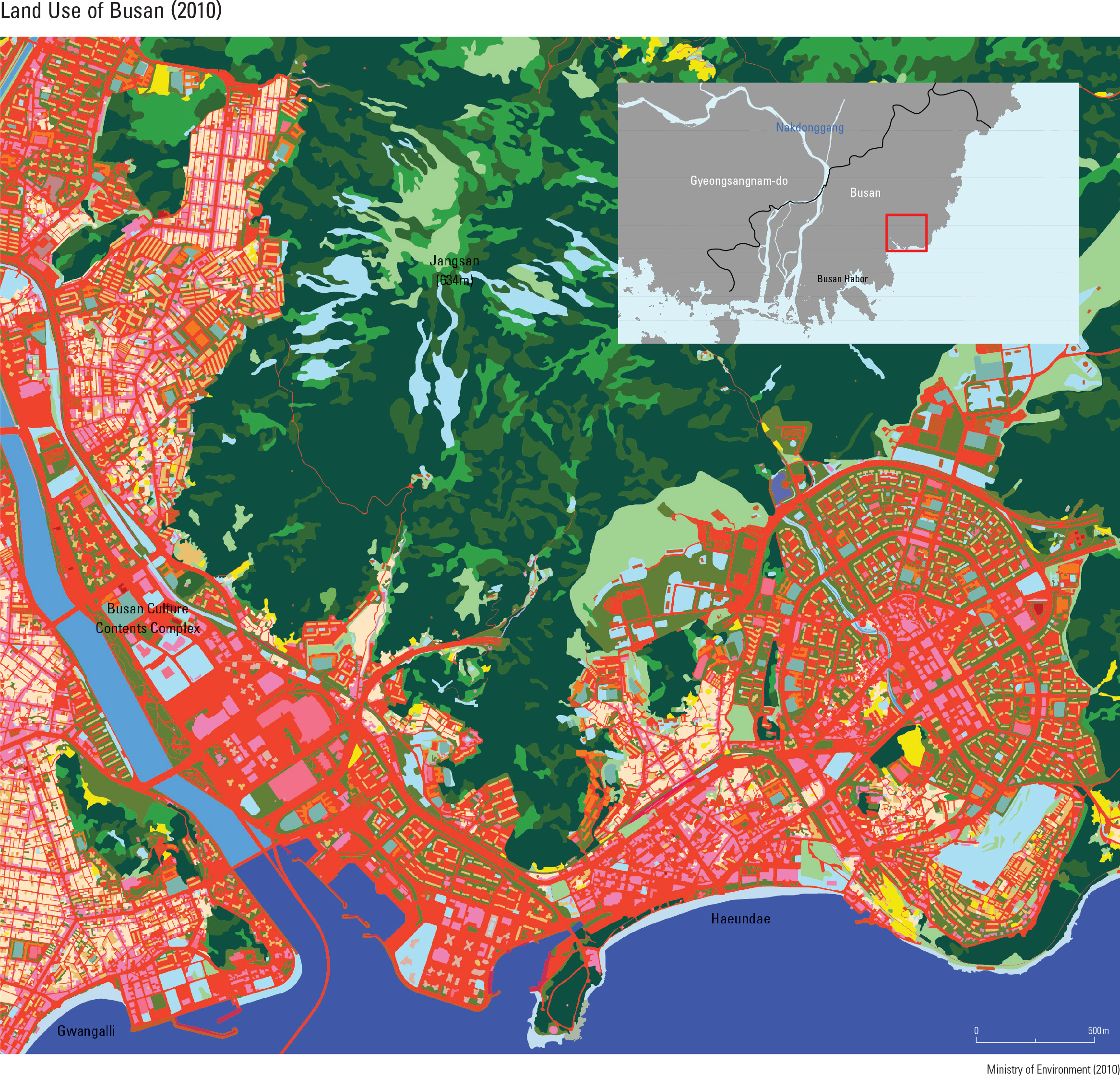
Seoul is located in a basin on the lower region of Hangang. There are more than 30 bridges within the Seoul section of the river that connect the surrounding urban and developed areas. Yeouido is a mid-channel bar of Hangang that was rst developed in the 1960s. Now it has become a major central business district of Seoul that includes the Korea National Assembly Building and the 63 Building. Bamseom, a pair of islets in Hangang, was demolished in 1962 to widen the river and collect materials for the construction of Yeouido. It has since shifted to take the form that can be seen now, and was added to the list of Ramsar wetlands in 2012. Busan was rst established as a port city, and its urban area grad- ually took place and expanded around Busan Harbor. Located at the distal end of Taebaeksanmaek, the region is dominated by moun- tains, narrow plains, and a jagged coastline. These topographical characteristics caused dif culties in the process of building roads and furthering urban development. Consequently, the residential areas of Busan were established on steep slopes along coastlines and val- leys, resulting in a unique landscape. Haeundae is the most recently developed district of Busan; as the rst planned area within the city, it boasts a standardized radial road system. According to 2010 data, approximately 21 million tourists visit Haeundae each year, seeking out the popular attractions of Haeundae Beach, Busan International Film Festival, and Dongbaekseom.
page_2 |