English II
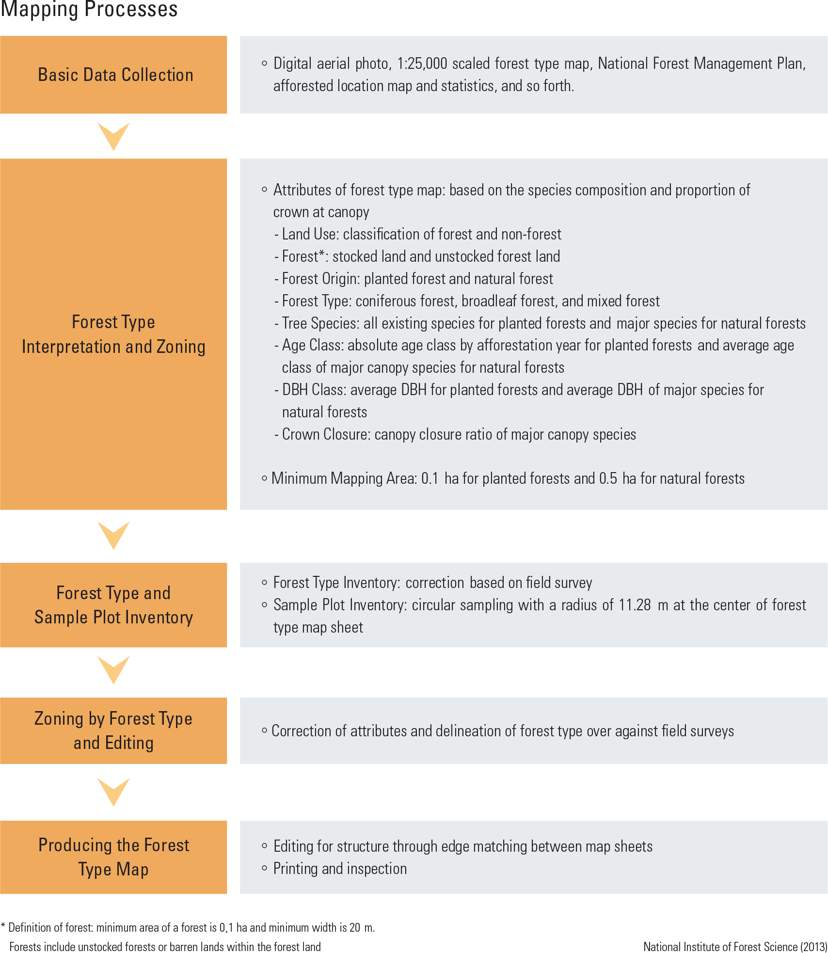
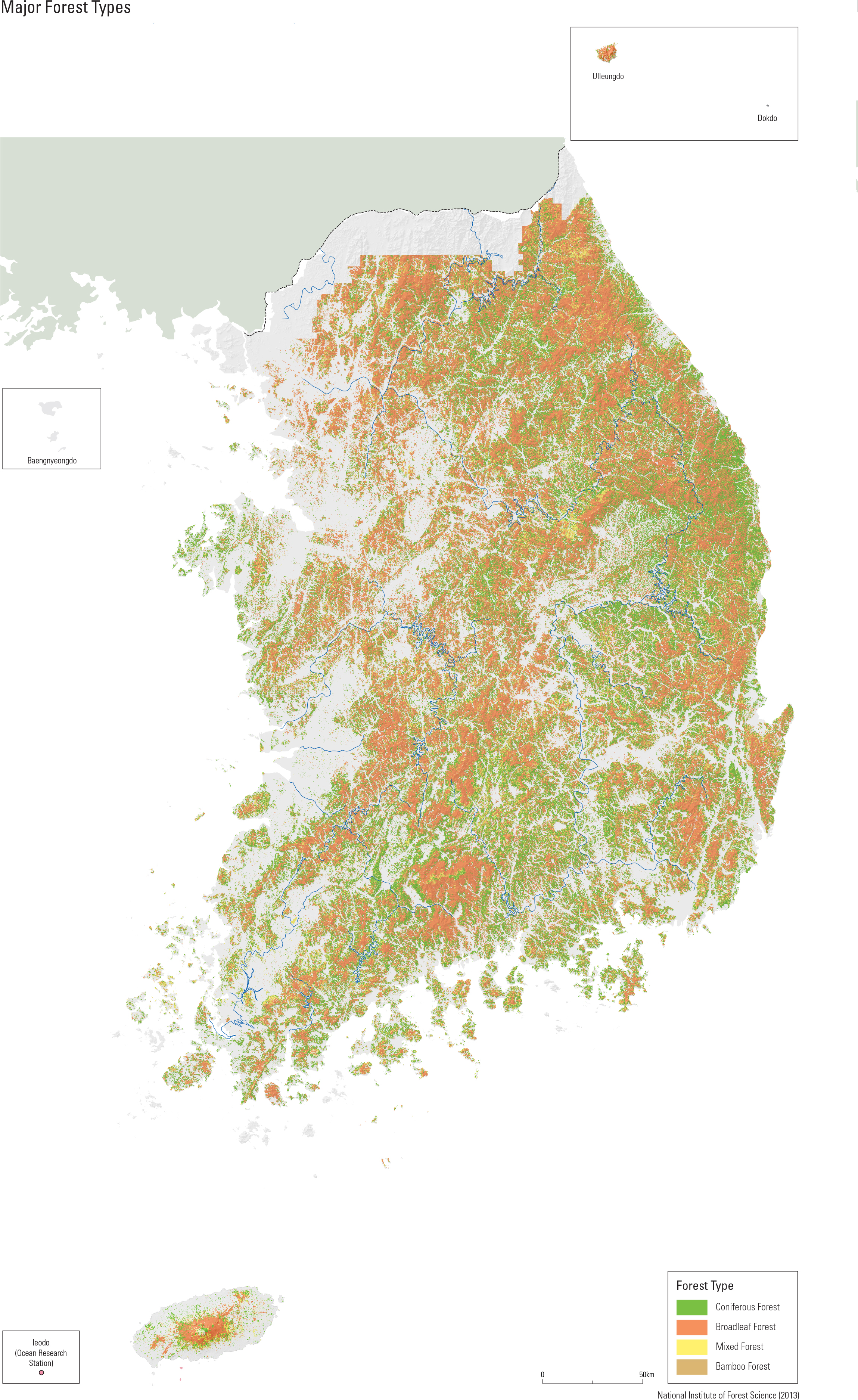
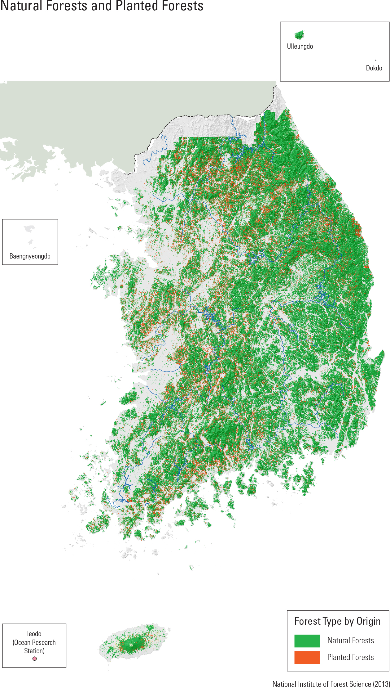
The forest type map shows the distribution of different types of forests and is a valuable source of information that can be used to analyze the changes in Korean forests over the last 50 years. Forest type maps show the classi cation of for- ests into coniferous forest, broadleaf forest, and mixed forest, according to the species composi- tion of the forest. Bamboo forests are classified into natural forests. The forest type maps have been produced at a scale of 1:25,000 with the National Forest In- ventory ve times since 1972. Maps started to be digitized from the third edition of the forest type map (1986 – 1992), and the production system was standardized from the fourth digital forest type map (1996 – 2005). More detailed 1:5,000 scale forest type maps had been produced since 2009 in connection with the National Spatial Data System project. In 2012, 16,270 sheets of forest type maps of the whole territory were completed. Comparing the present forest distribution to that represented in the fourth forest type map (1996 – 2005) reveals that the proportion of coniferous forest decreased from 42.18% to 37.8%, that of broadleaf forest (excluding evergreen broadleaf forest) increased from 25.2% to 46.9%, and that of mixed forest decreased from 29.5% to 11.6%. The increased proportion of the broadleaf forest area can be explained by the increased resolution of the 1:5,000 scale map, which allowed im- proved differentiation between broadleaf forest and mixed forest from the previous map, and by the decline of coniferous forests due to climate change.
page_2 |