English I
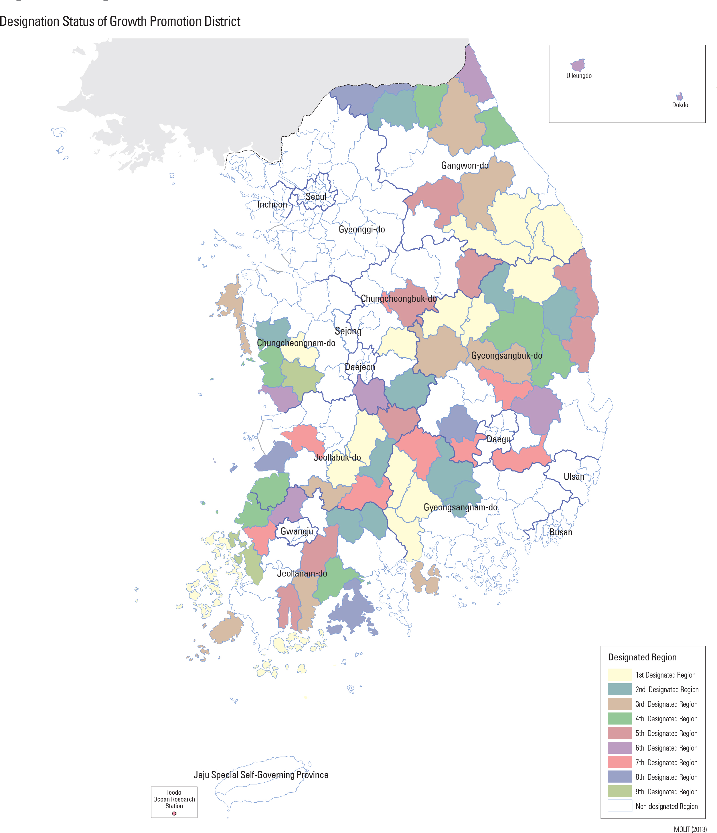
The most recent development plan also identified and designated districts for further development. The districts targeted for accelerated development were provided more support for infrastructure with the intention of strengthening their competitiveness by improving the potential for higher wages and a better overall quality of life. These newly identified districts were classified into three types based on an assessment of current key indicators. Depending on their classification, each district was then developed according to a model tailored to its current status: the backward area model, the balanced development model, and a city-rural-integration model. As of July, 2013, fifty-two districts and 70 cities were designated as befitting the backward area model. The balanced development model was assigned to the regions in which intensive development was needed to attract more private capital. Newer areas close to Bay Asan and cultural area of Baek-je have been designated according to the balanced development models. The city-rural-integration model was assigned when it was deemed necessary to link development of rural areas with neighboring city areas as a means of broadening the region’s economic foundation. Gangneung-si was also designated in 1998, followed by Chuncheon-si in 2001, and Jecheon-si in 2004. page_2 |