The Korean territory is represented on old maps created in the pre-modern era. Although the boundaries of the territory on those maps are not as clear as on maps made in the modern era, these antique maps reflect various and unique aspects of the historic Korean territory and serve as cartographic documentations or evidence for such. Collectively, they represent the territorial perceptions and ownership held by the Korean people that had been shaped over time. These territorial documentations are found not only on maps of prefectures, military maps, and general maps of Korea, but also on world maps made by cartographers both in Korea and from around the world.
Although mapmaking in Korea dates back to before the Three Kingdoms Period, only the maps made in Joseon Dynasty now survive. The oldest existing Korean map today is the Honil gangni yeokdae gukdo jido (Map of Integrated Lands and Regions of Historical Countries and Capitals) made in 1402. This map is commonly referred to in western literature on the history of cartography as the kangnido, and it is recognized as one of the best world maps among those in both Eastern and Western civilizations at the time. On the kangnido, Joseon territory is bigger than the African continent to the west, which reflects the Joseon Dynasty’s pride in itself as a civilized state that is next to China. The Korean territory is most precisely delineated in a series of maps entitled Joseon jeondo’s (The Complete Maps of Joseon). In the 15th century, cartographic efforts at making world maps and general maps of Joseon were largely based on land surveys. Under the reign of King Sejong, the 4th king of Joseon Dynasty, the distances between counties and prefectures were measured and the latitudes of Baekdusan, Manisan, and Hallasan were determined which prepared the scientific foundation for the efforts of the Joseon Dynasty cartographers. Jeong Cheok completed a map of the two border regions (currently Hamgyeong Province and Pyeongan Province) in 1451 and made the Dongkuk jido (Map of Korea) with Yang Sungji in 1463 (the 9th year of King Sejo). The extant Joseon bangyeok jido (Map of the Korean Territory) is a great example of the Joseon jeondo series made in the 15th century. This map features the Korean peninsula, Manchuria to the north of the Amnokgang and the Dumangang. It represents the view of the national territory held by Korean elites and scholars like Yang Sungji who believed the Korean territory extended beyond the peninsula to include Manchuria.
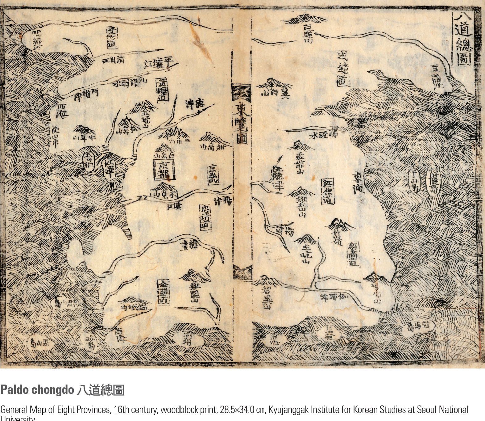
The Paldo chongdo (General Map of Eight Provinces) included in Sinjeung dongguk yeoji seungnam (Complete Conspectus of the Territory of the Eastern Country), which was made in 1530, is one of the most representative maps of the Korean territory produced in the early Joseon Dynasty. This map takes the form of an appended chart to complement geographical description, but its description of the land is rather crude. The purpose of the map is not to delineate the country’s territory in detail, but to express the establishment of the royal authority and the Confucian ideas for governance by means of commemorative rites for the national land. The map indicates noted mountains, large rivers and seas that are included in the ritual codes. It also features some islands in the East Sea and the West Sea such as Ulleungdo, Usando (currently Dokdo) and Heuksando, which highlights the fact that they belonged to the Joseon Dynasty as long ago as the 16th century.
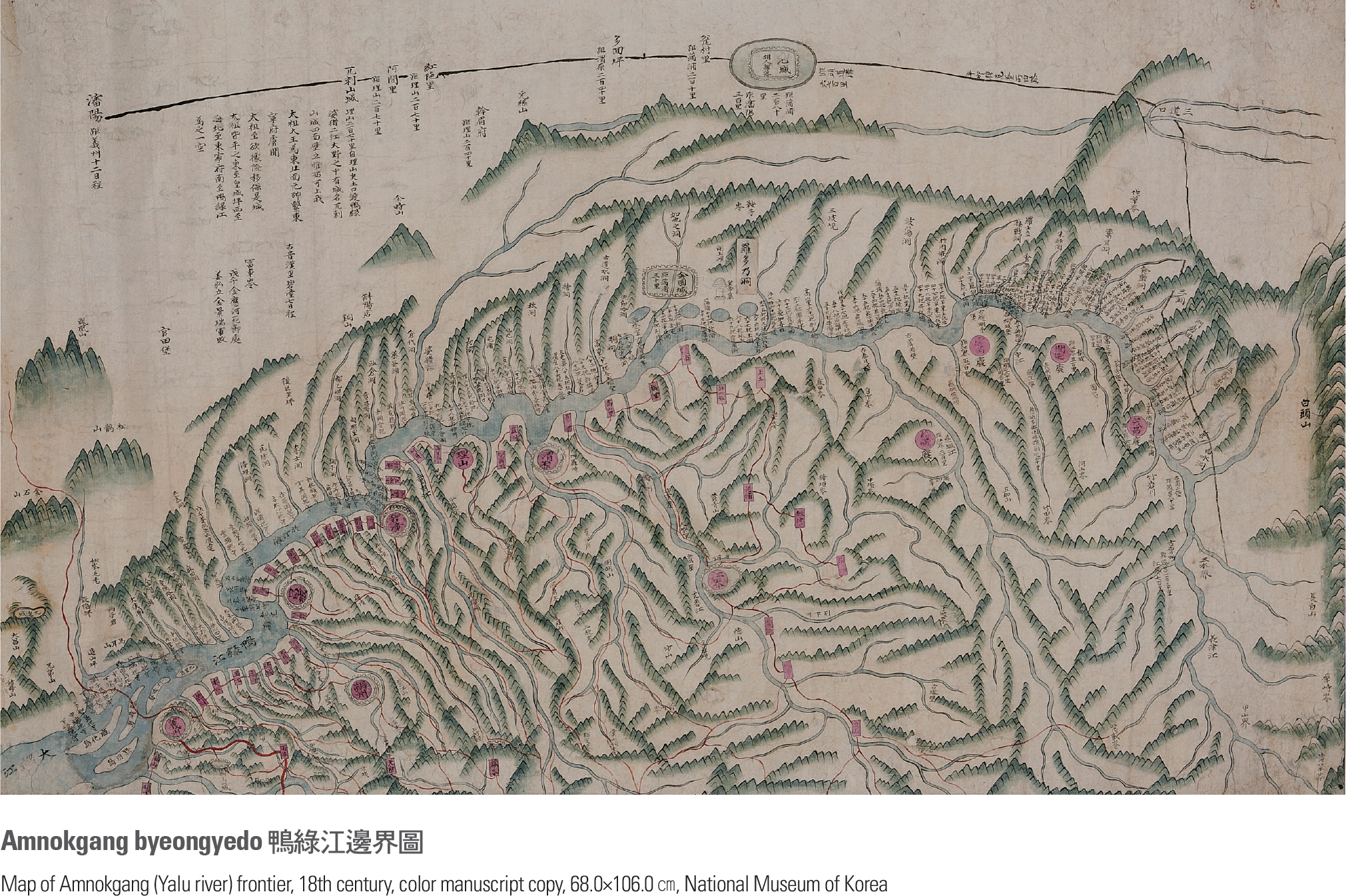
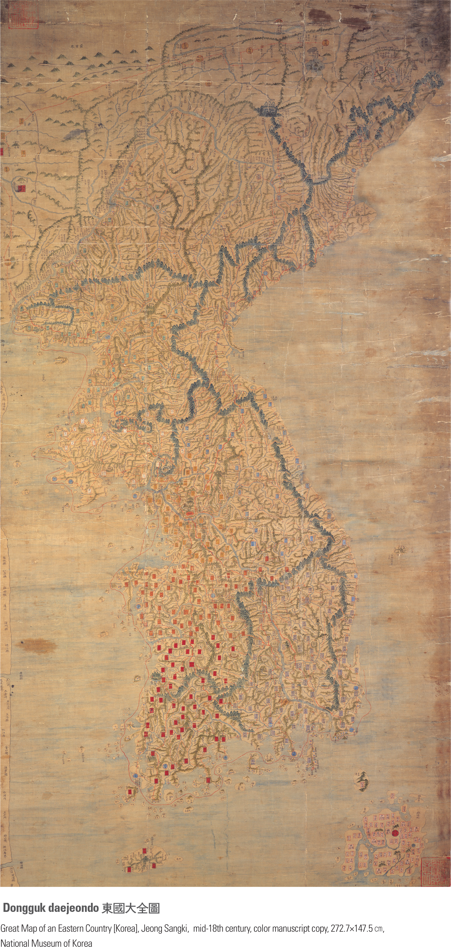
In the late Joseon Dynasty, after the two devastating wars with Japan and Manchuria, various types of maps were made with the specific intention of defining the boundaries of the Joseon territory. The increased awareness of border regions such as the northern part of the peninsula and the coastal and insular areas was reflected in these maps. Military maps like Yogye gwanbang jido (Map of the Yogye Borderland) and Seobuk pia yanggye malli illam jido (Comprehensive Map for Defense of West and North Border) identified the borderlands near the Amnokgang and the Dumangang. Sea path maps that were needed to defend the territorial boundaries and coastal lines were also made. These maps prove that the specified borderlands belonged to Joseon. In the mid-18th Century, the Dongkuk jido (Map of Korea), made by Jeong Sangki, defined a watershed moment in the history of mapmaking in the late Joseon Dynasty. Unlike the maps of the early Joseon period, the scale of this map is large at 1:420,000. It contains the channels of the Amnokgang and the Dumangang, and it describes the coastlines as precisely as their portrayals on contemporary maps.
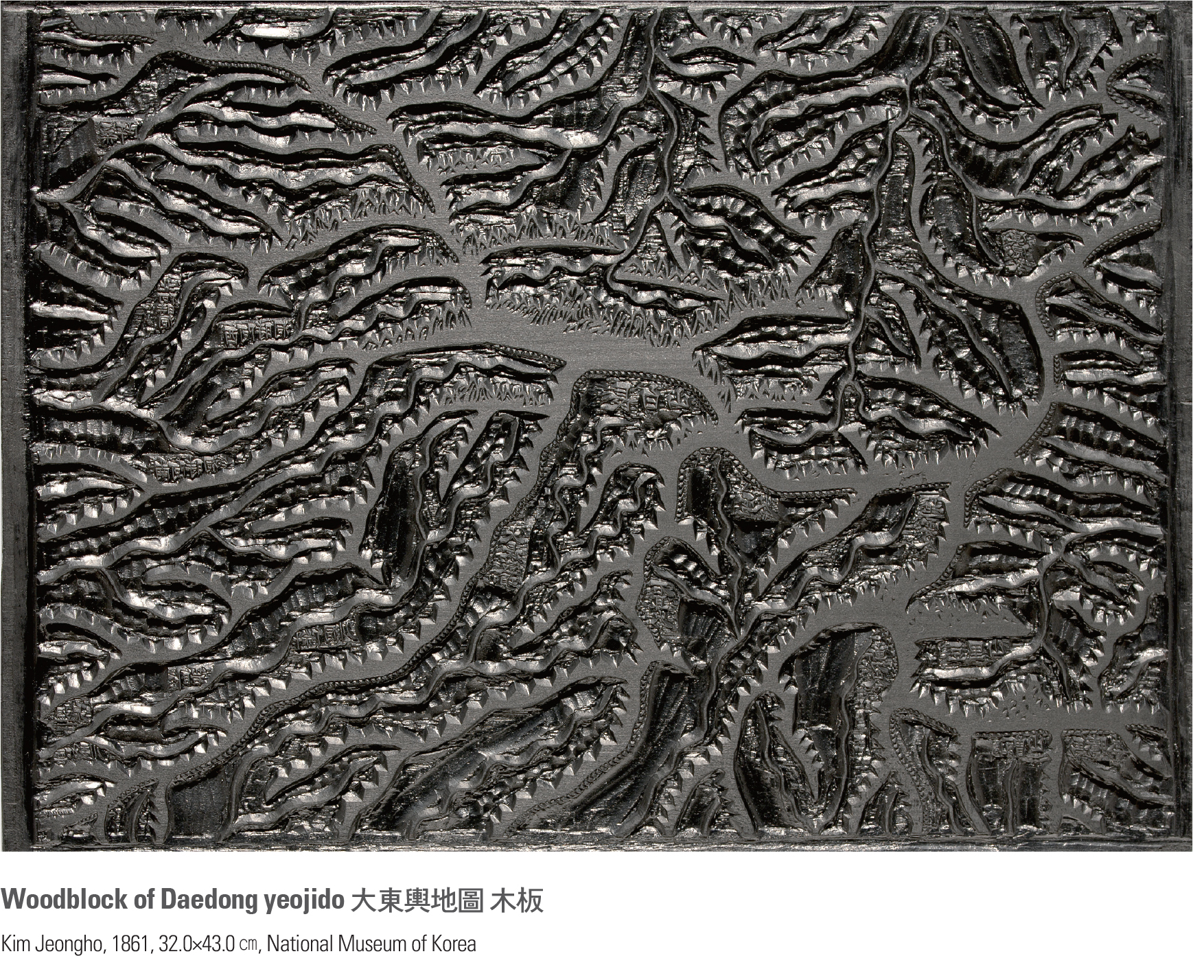
The Dongkuk jido was hailed as the first map to truly describe the Korean territory. It was widely copied and used by government offices and civilians, later becoming the basis for block-printed maps of Korea, such as the Haejwa jeondo (The Complete Map of Haejwa). The territorial boundaries of the Joseon Dynasty were completely and firmly established when Kim Jeongho made the Daedong yeojido (The Territorial Map of the Great East). Kim Jeongho also compiled an atlas entitled the Cheonggudo (Map of Korea) in 1834 based on previously accumulated cartographic knowledge and accomplishments. The Cheonggudo is comprised of two books: Volume 1 includes odd-numbered sections and Volume 2 even-numbered sections;