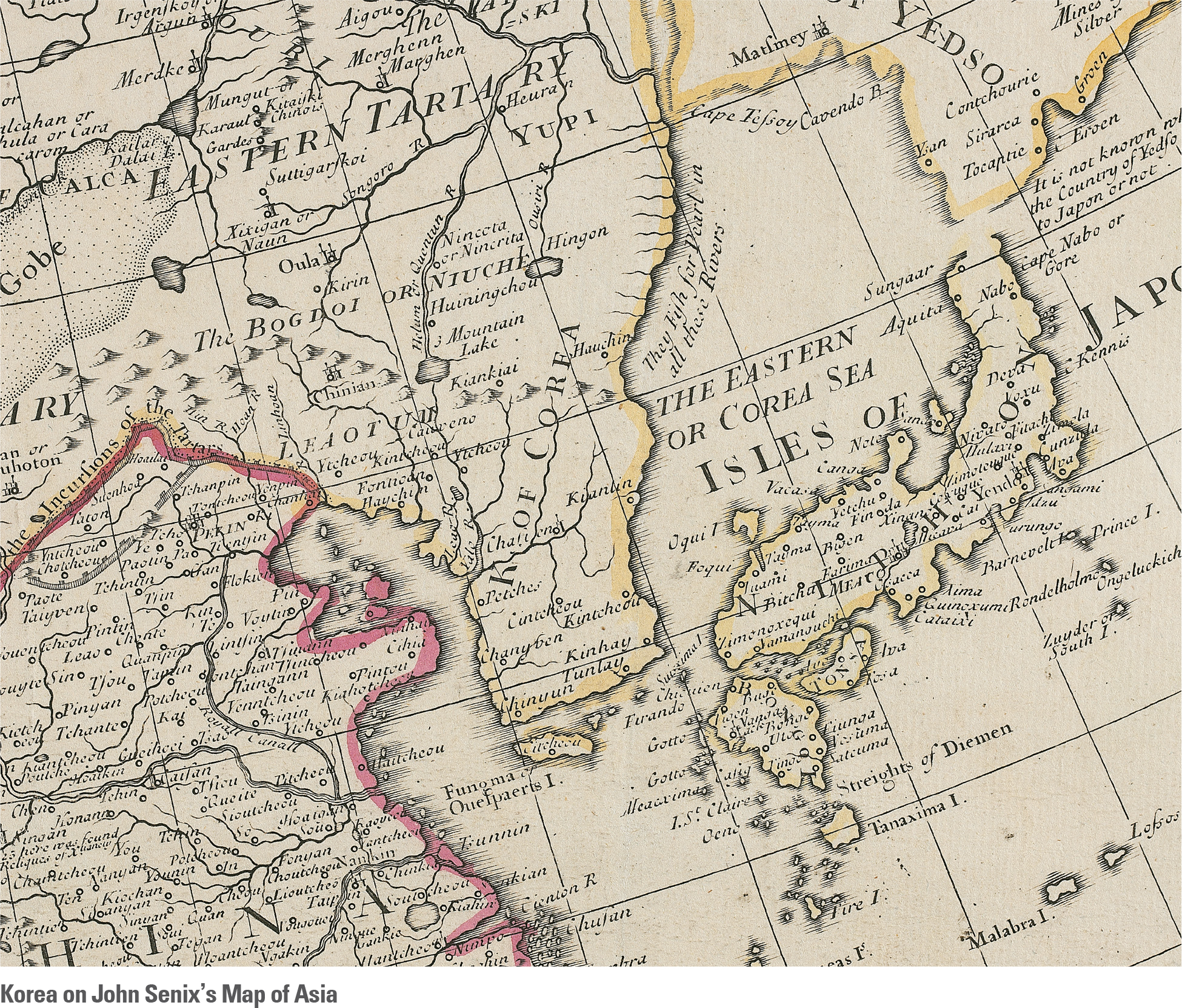
The names of the East Sea and Dokdo are also found on early maps produced by western cartographers. Joseon first appeared on a European map produced after the 16th century. Initially, the country was described as an island on those maps, and only over time did it take the shape of a peninsula. The name East Sea or Sea of Korea appeared on maps to refer to the present-day East Sea. A good case in point is a map of Asia made in 1720 by an English cartographer, John Senex. It is an English translation of a map made in 1705 by Delisle, a French mapmaker. Senex’s map shows a Korea scaled horizontally wider than its actual width. The country name is marked as “K(ingdom) of Corea.” The East Sea is marked as “The Eastern Sea” or “Corea Sea.”
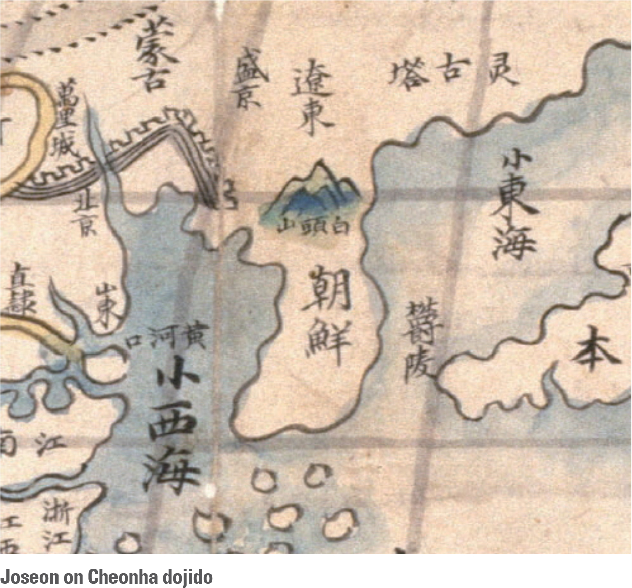
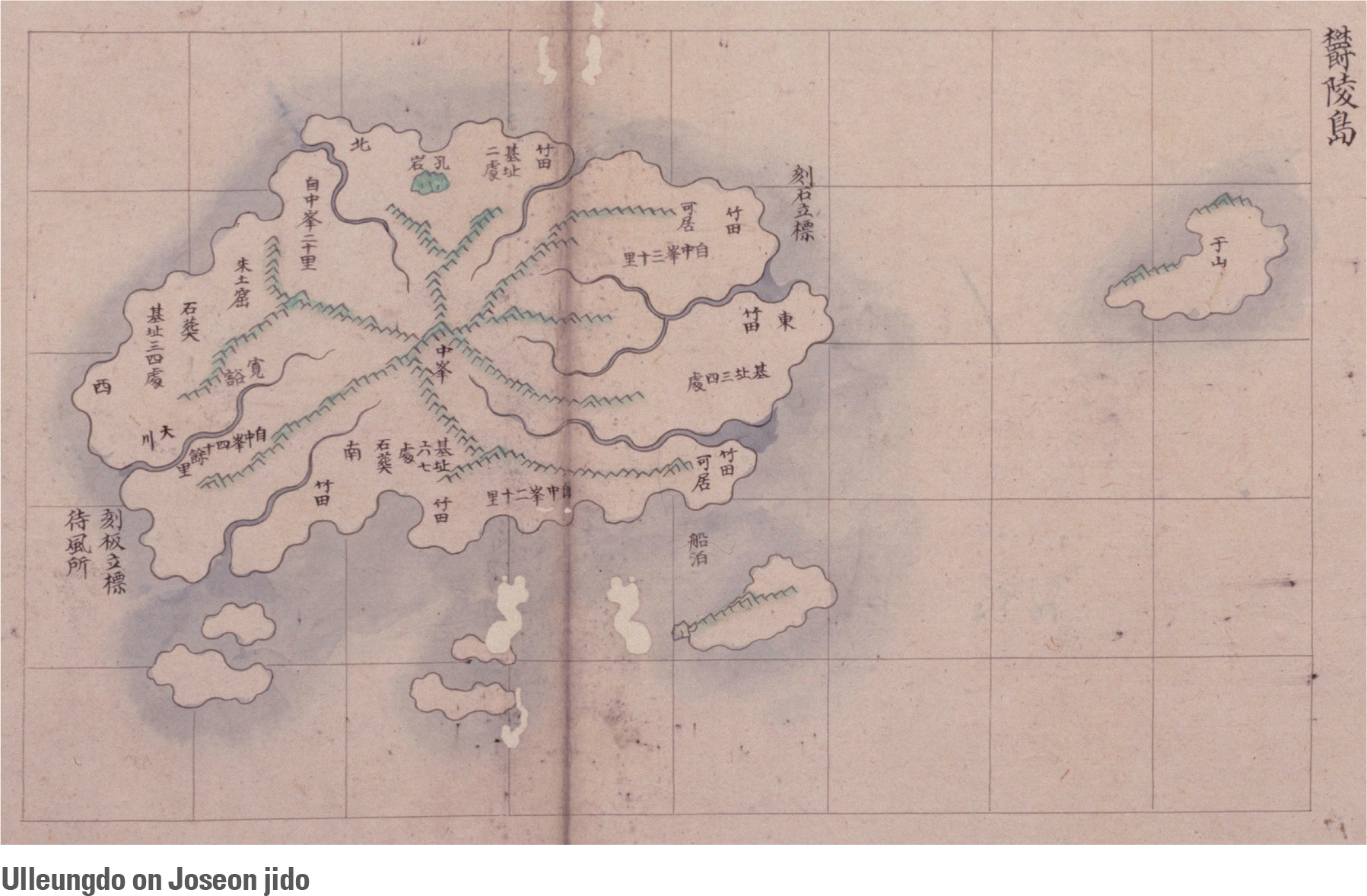
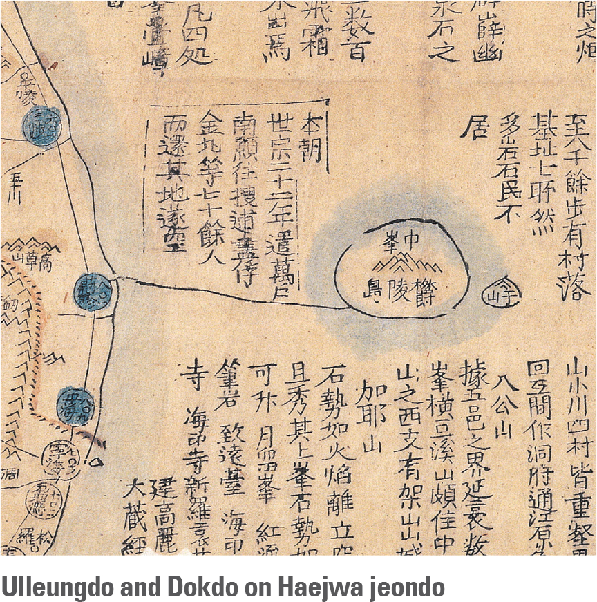
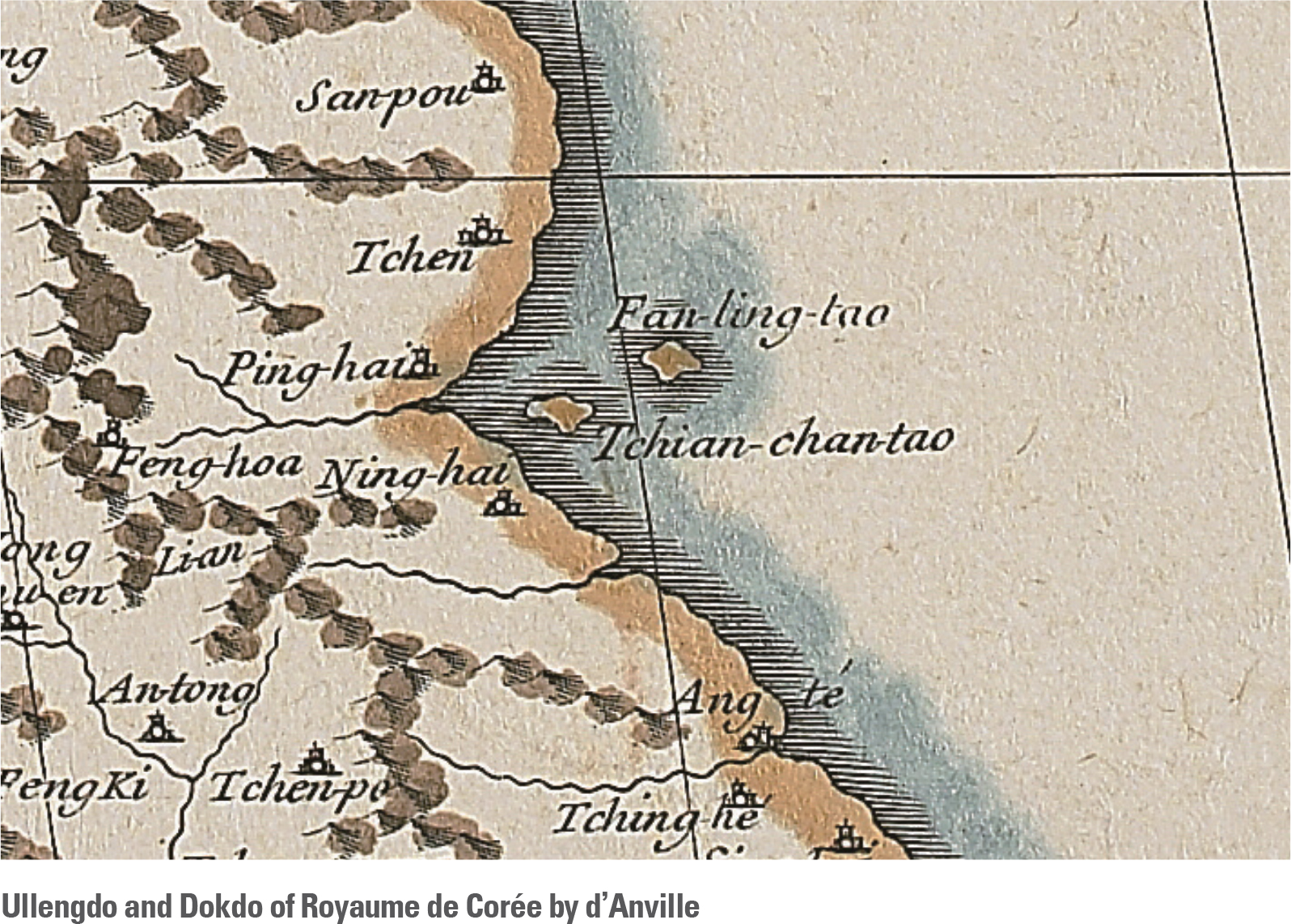
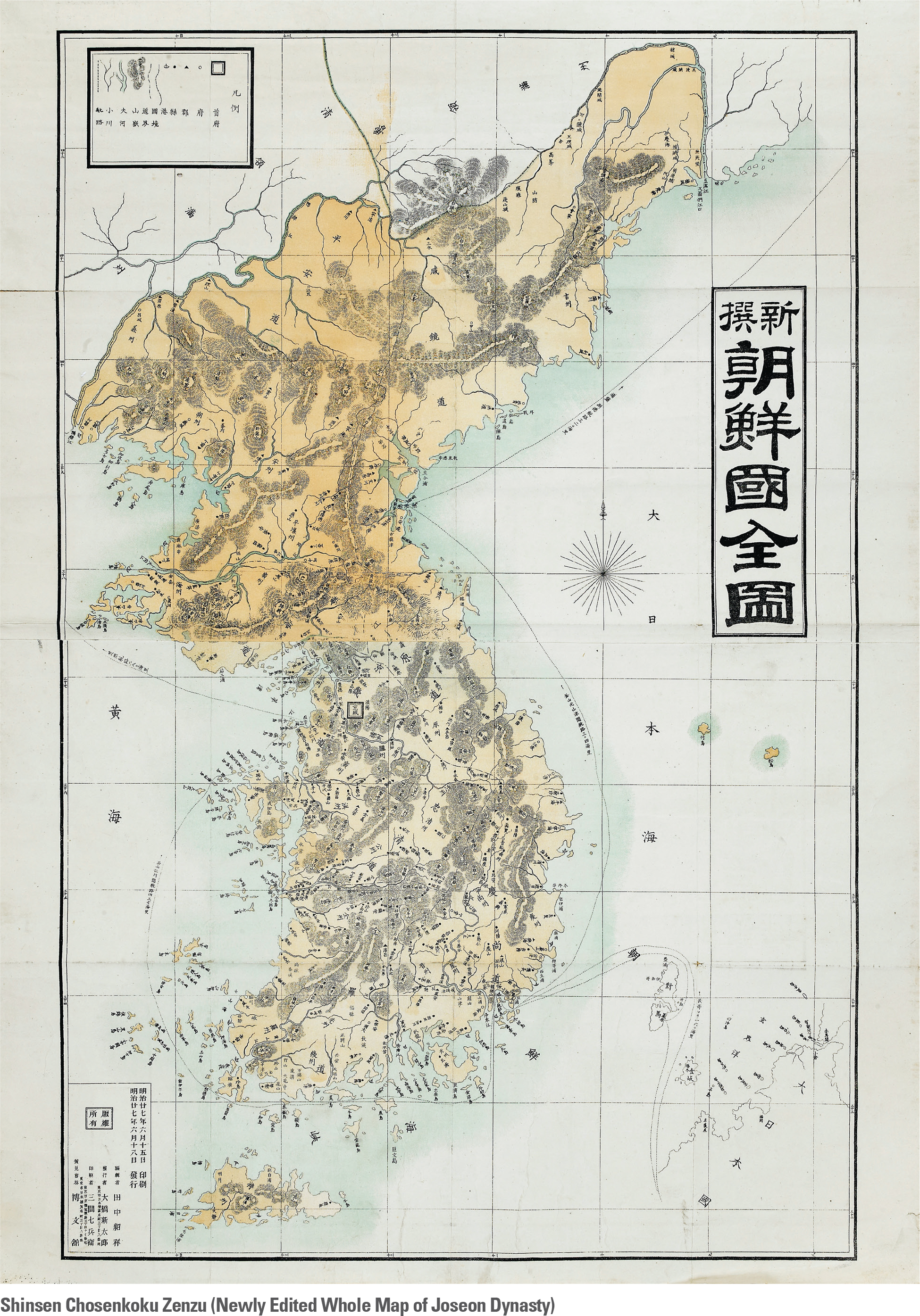
Joseon had not been mapped in great detail on European maps prior to the early 17th century, and this omission meant that Ulleungdo and Dokdo rarely appeared. Later, in 1735, Joseon was described in detail on Royaume de Corée (Complete map of the Kingdom of Joseon) by Jean Baptiste Bourguignon d’Anville, a French cartographer. D’Anville drew Ulleungdo and Dokdo in the East Sea. Royaume de Corée, which was included in Atlas de la Chine, showed two islands labeled as “Tchian-chan-tao,” referring to Usando (Dokdo), and “Fan-ling-tao,” referring to Ulleungdo. This map was greatly influential to successive maps so that many subsequent maps in France, the United Kingdom, and Germany were produced with Ulleungdo and Dokdo properly labeled.The inclusion of Dokdo in Korean territory is also found on maps published in Japan. Shinsen chosenkoku zenzu (Newly Edited Whole Map of Joseon Dynasty) by Tanaka Akiyosi in 1894 labeled Ulleungdo and Dokdo as “Jukdo (Takeshima)” and “Songdo (Matsushima)” in the same color scheme of Korean peninsula, which shows that Japan acknowledged Dokdo as Korean Territory. The name East Sea also appears on Japanese maps. A good case in point is the Nihon Henkai Ryakuzu (A Simplified Map of Japan’s Periphery) executed by Takahashi Kageyasu in 1809. This map was the first Japanese official map on which the Japanese archipelago is placed in the center of Asia. Latitude and longitude lines were included on the map and Japan was described and presented with surveyed measurements by Ino Tadataka, a Japanese cartographer. Maps of Qing Dynasty China, the map of Joseon in Huangyu quan lan tu (Atlas of the Chinese Empire) as well as other Chinese maps were assumed to have referenced Takahashi's Nihon Henkai Ryakuzu; again, the East Sea was labeled as Sea of Joseon, and Ulleungdo and Usando were labeled as Ulleungdo and Cheonsando respectively, indicating that they belonged to Joseon.