English I 2019
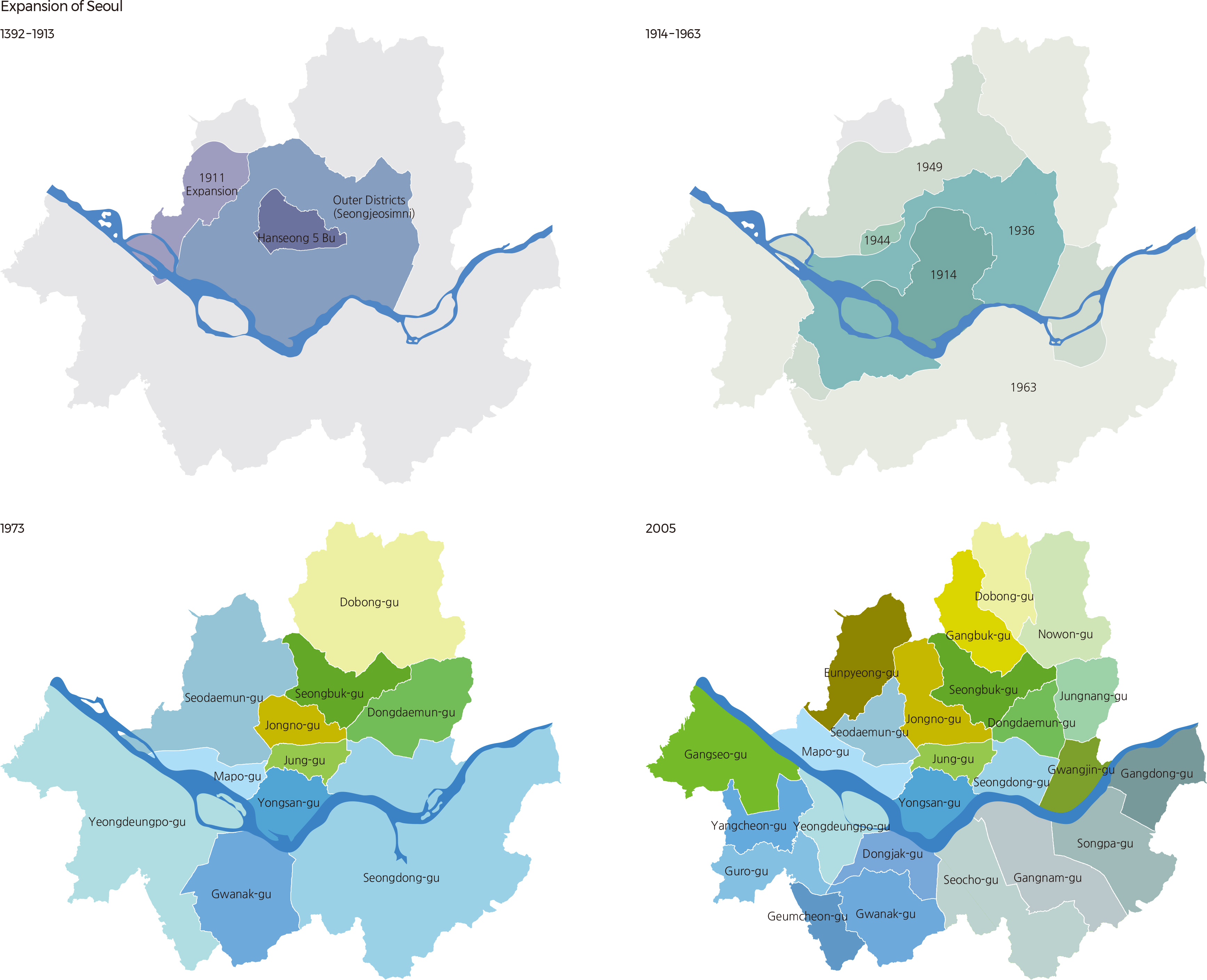
Seoul has experienced a rapid increase both in population and land area in modern times. During the Joseon Dynasty (1392–1897), Seoul was surrounded by a fortress wall and consisted of Hanseong and five bus, which together formed the political and administrative center, its inner districts, and outer districts (Seongjeosimni). The outer districts stretched approximately 4 km beyond the city wall. By the end of the 19th century, the city’s population hovered above 200,000. From the end of the Joseon Dynasty through Japanese colonial rule, the city’s boundaries grew as railroads and streetcar routes were constructed. A massive residential area was built to house Japanese immigrants and farmers who migrated to the city during this period. Following its liberation from Japan, Seoul’s population was close to 900,000 and grew to 1,700,000 before the Korean War, as overseas Koreans returned home.
Seoul has modified administrative areas eight times since the confirmation and announcement of the first urban plan in 1936, including the expansion of urban districts and administrative independence of the surrounding cities. Starting with the organization of the seven gus in 1943, Seoul’s population increased sharply before industrialization, and the rise in population density accelerated as industrialization rapidly grew after the 1960s. The concentration of the population resulted in the development of the outskirts of the city, and the opening of subways further facilitated urban expansion.
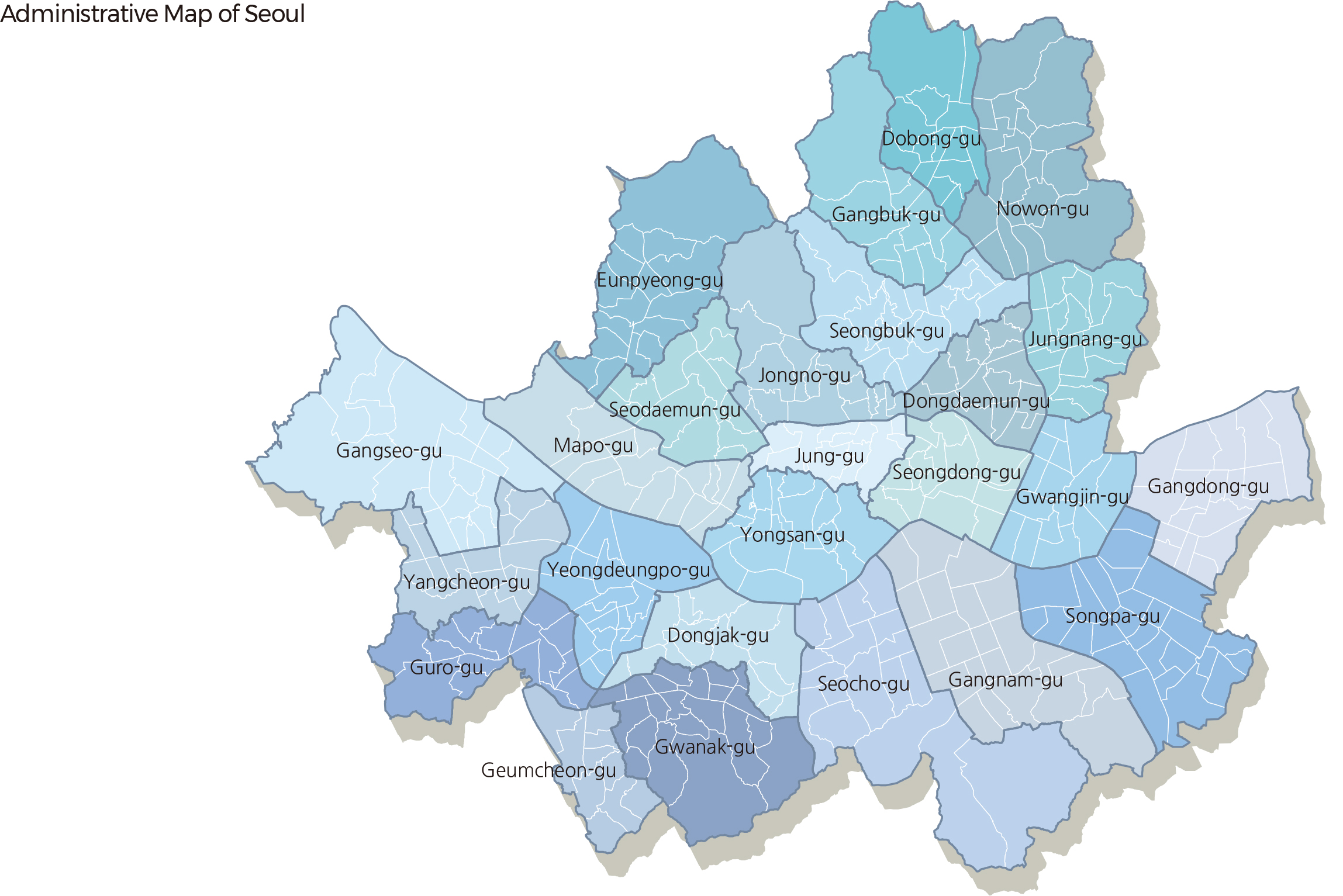
The land area of Seoul city was 135 km² in 1936, which was doubled to 269 km² by integrating the four districts of Sungin, Eunpyeong, Guro, and Ddukdo. In 1963, the urban plan was widely adopted across the nation and Seoul experienced one more land expansion by additionally integrating Shindo-myeon, Gwacheon-myeon, Ojeong-myeon of Gyeonggi Province and Cheolsan-ri (Seo-myeon), Haan-ri, and Gwangmyeong-ri, thus expanding its land area to 713 km². In 1970, the planned population was modified, and Hwajeop-ri, Yangju-gun, Gyeonggi-do, Galmae-ri, Guri-gun, and other surrounding regions were integrated into Seoul to increase the land area to 720 km². However, in 1982, Gwangmyeong-si was separated from Seoul as it became a new city, and in 1991, Gwacheon-si and Bucheon-si were also separated from Seoul, in accordance with the Seoul urban plan. Therefore, the land area of Seoul has been 605 km² since 1995. Seoul takes up 0.6% of the national territory and is composed of 25 autonomous gus and 424 administrative dongs as of 2019.
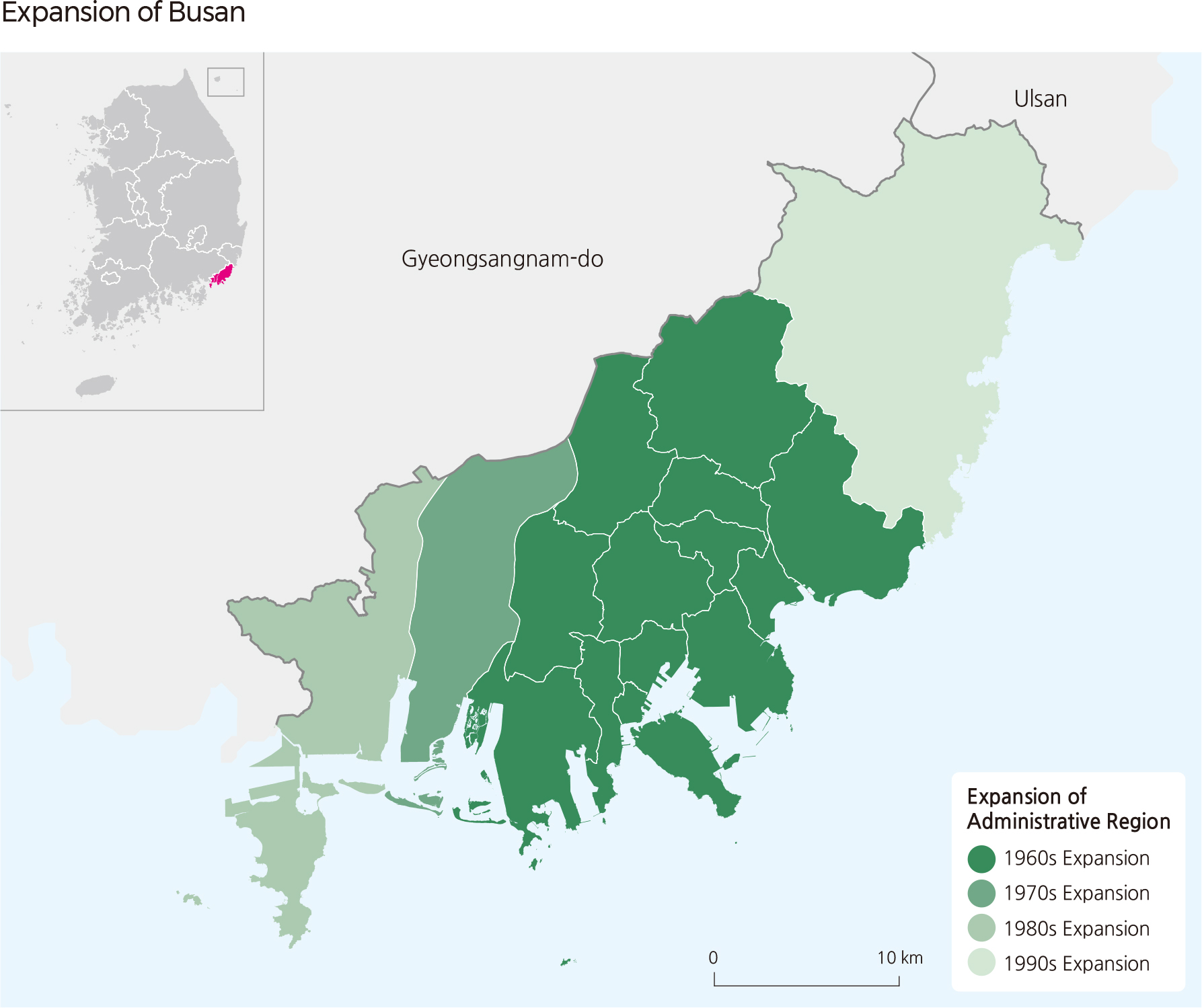
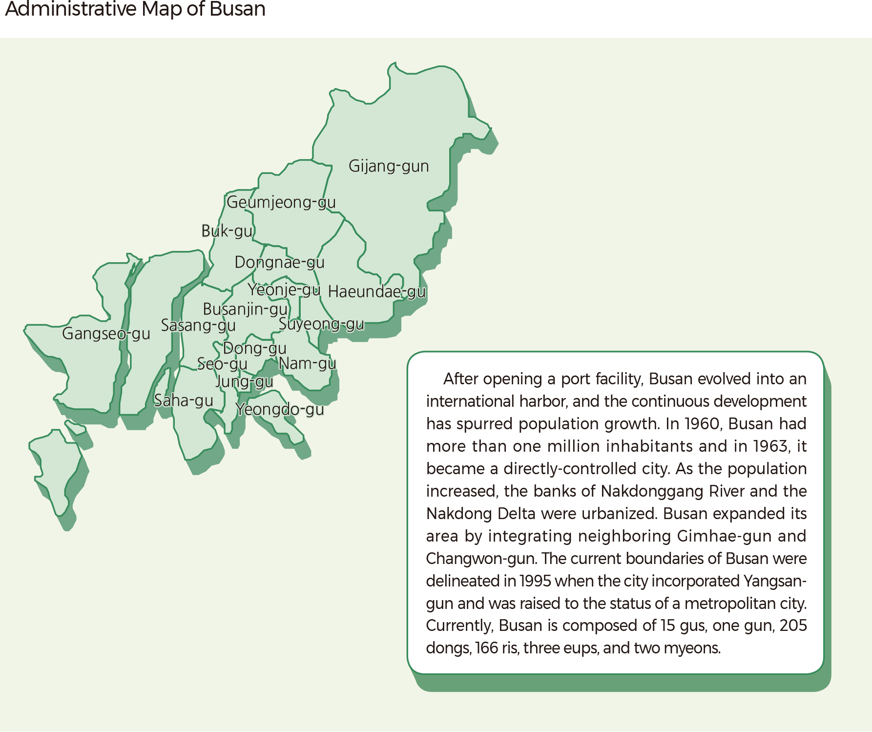
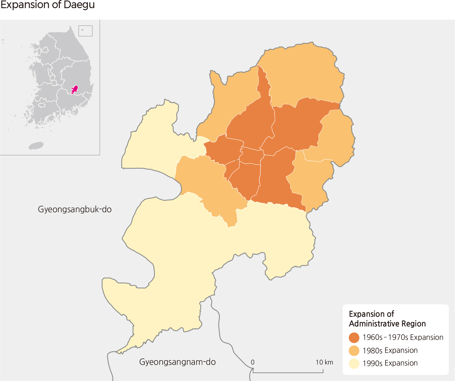
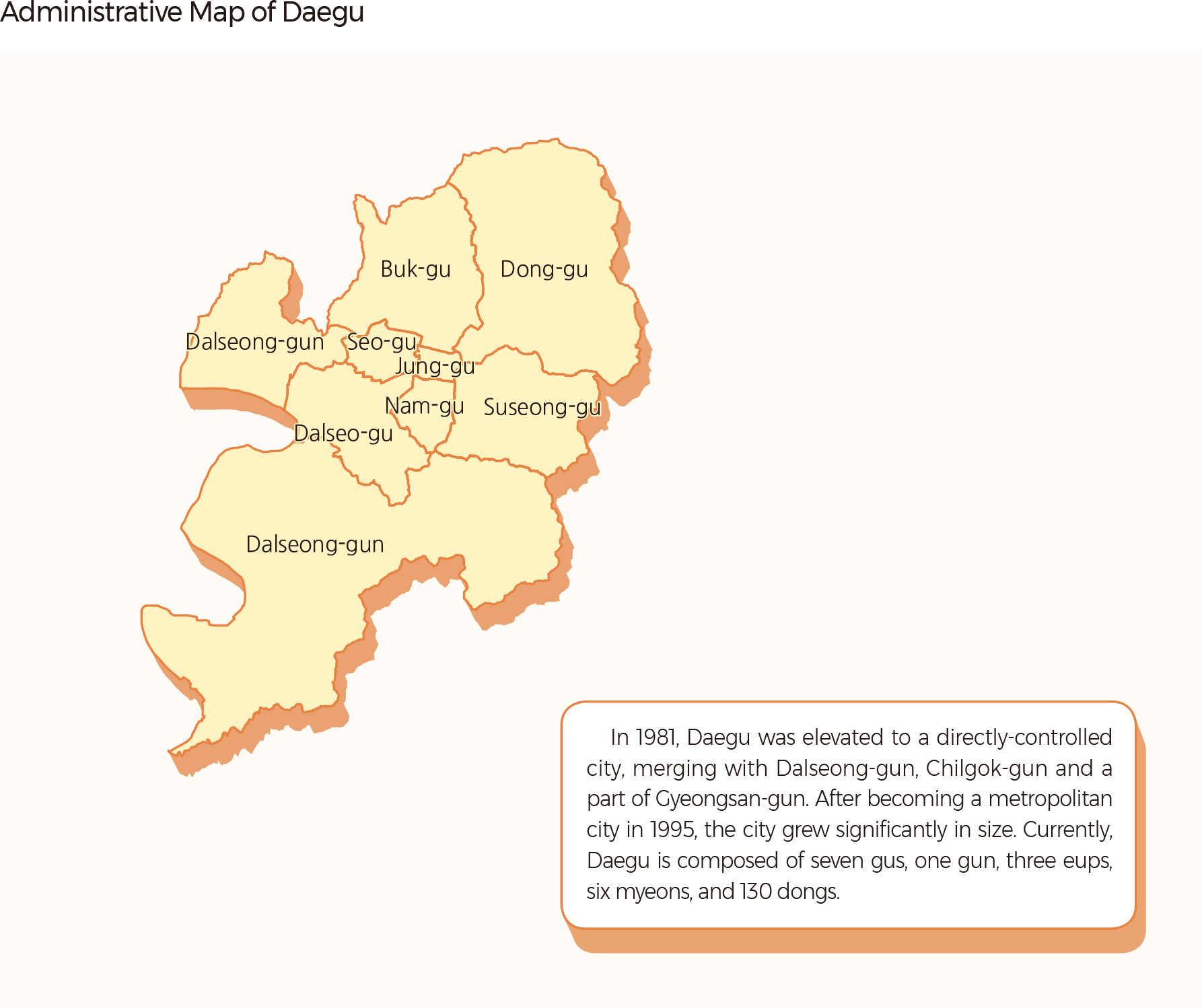
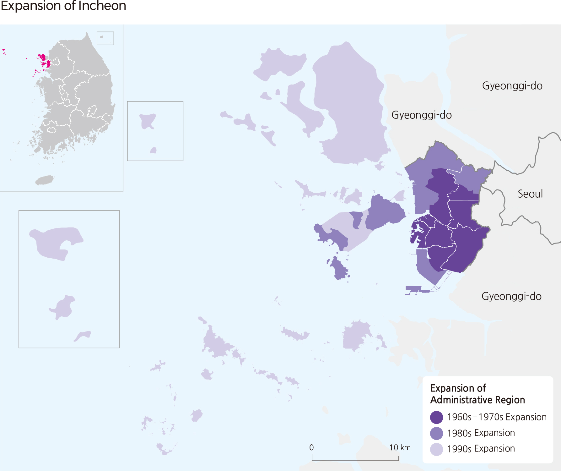
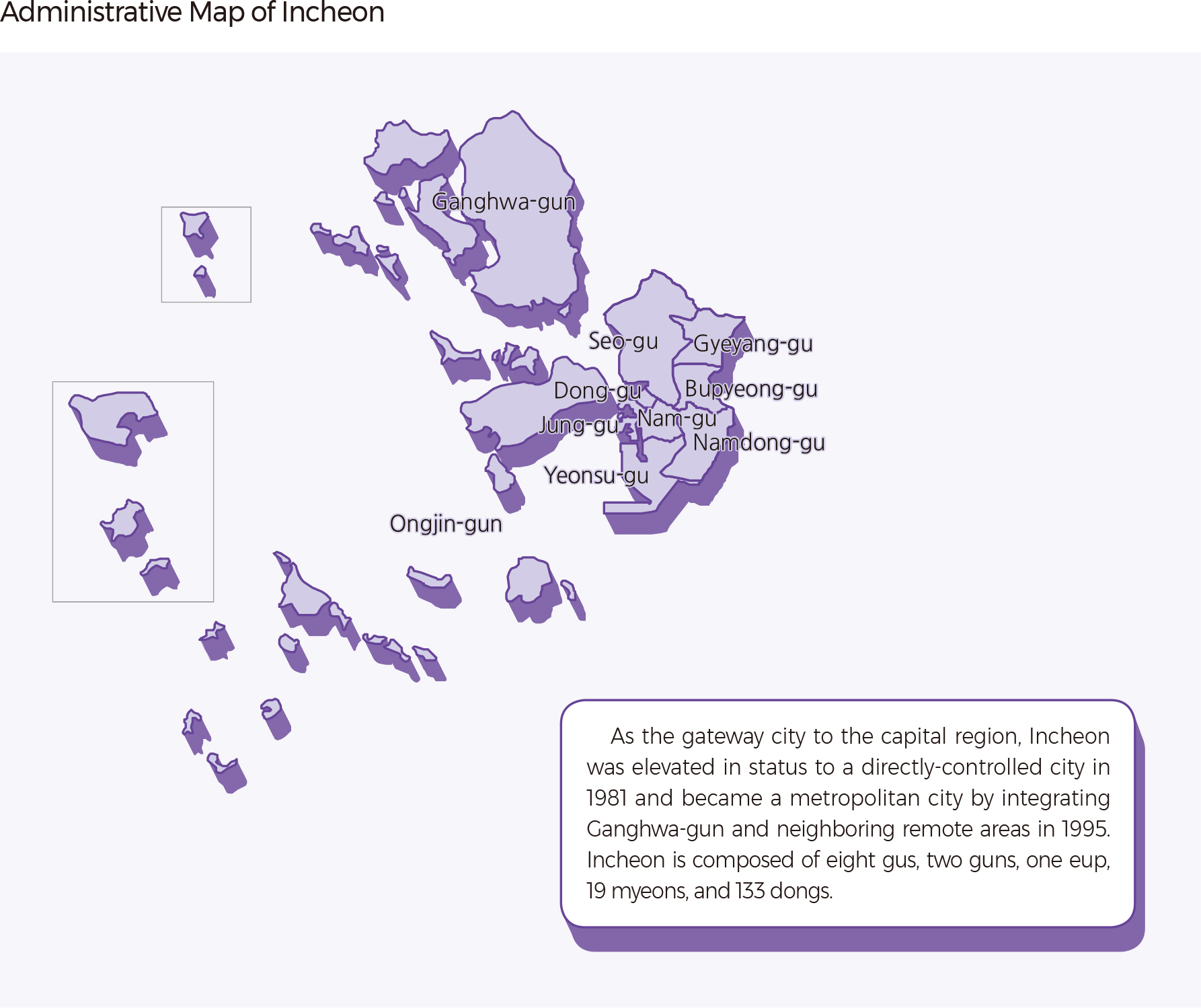
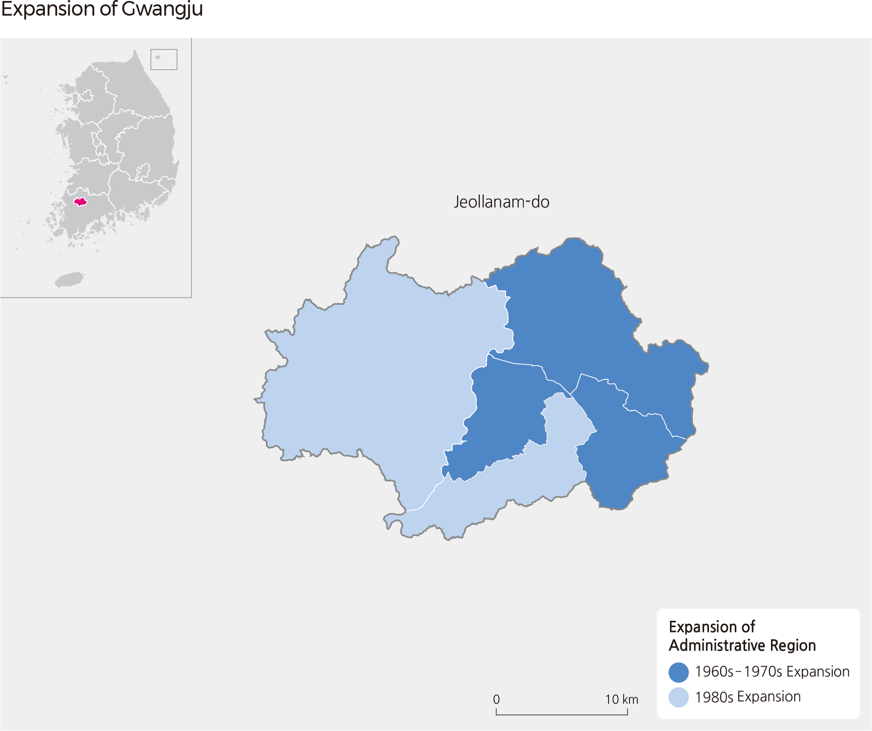
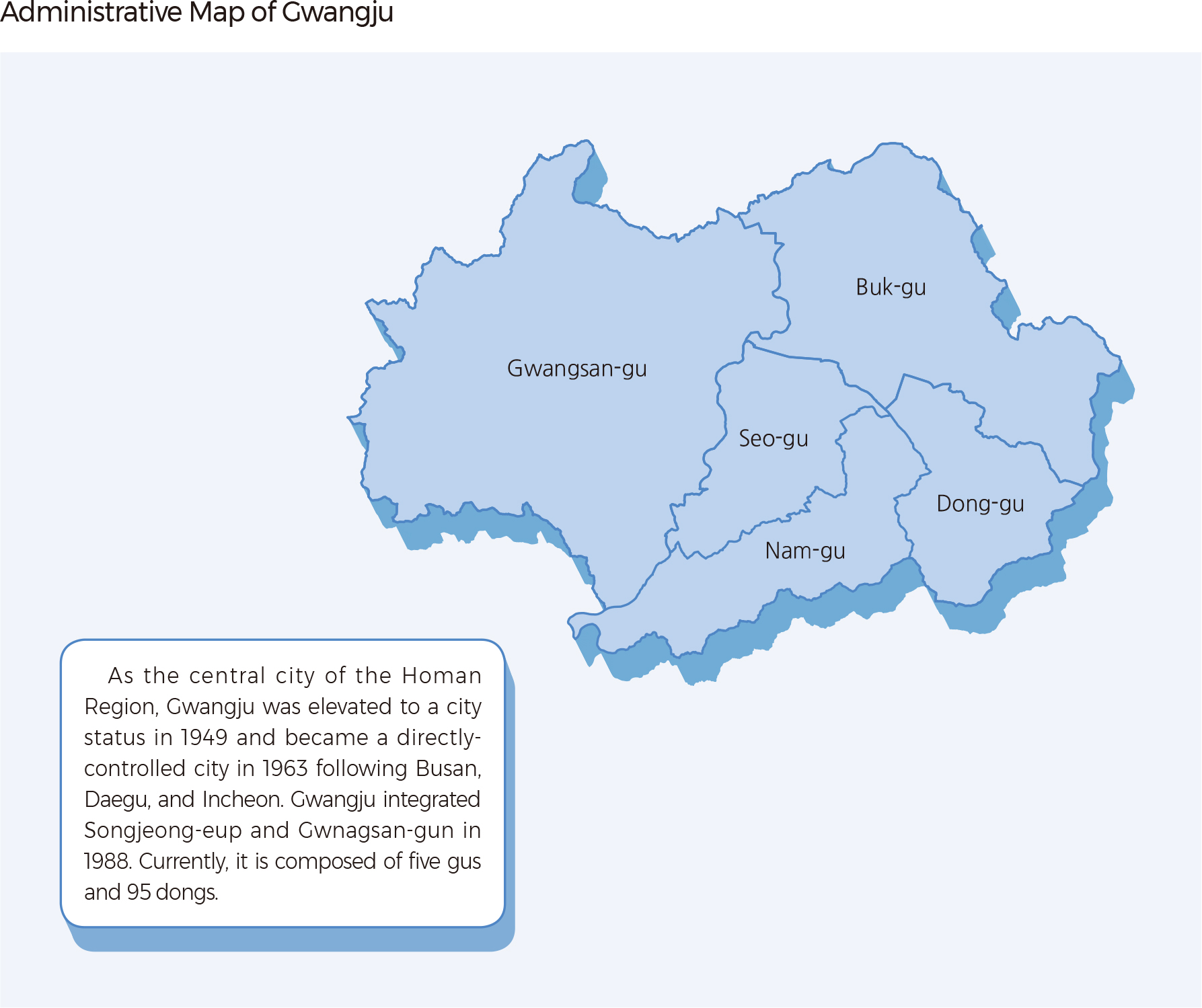
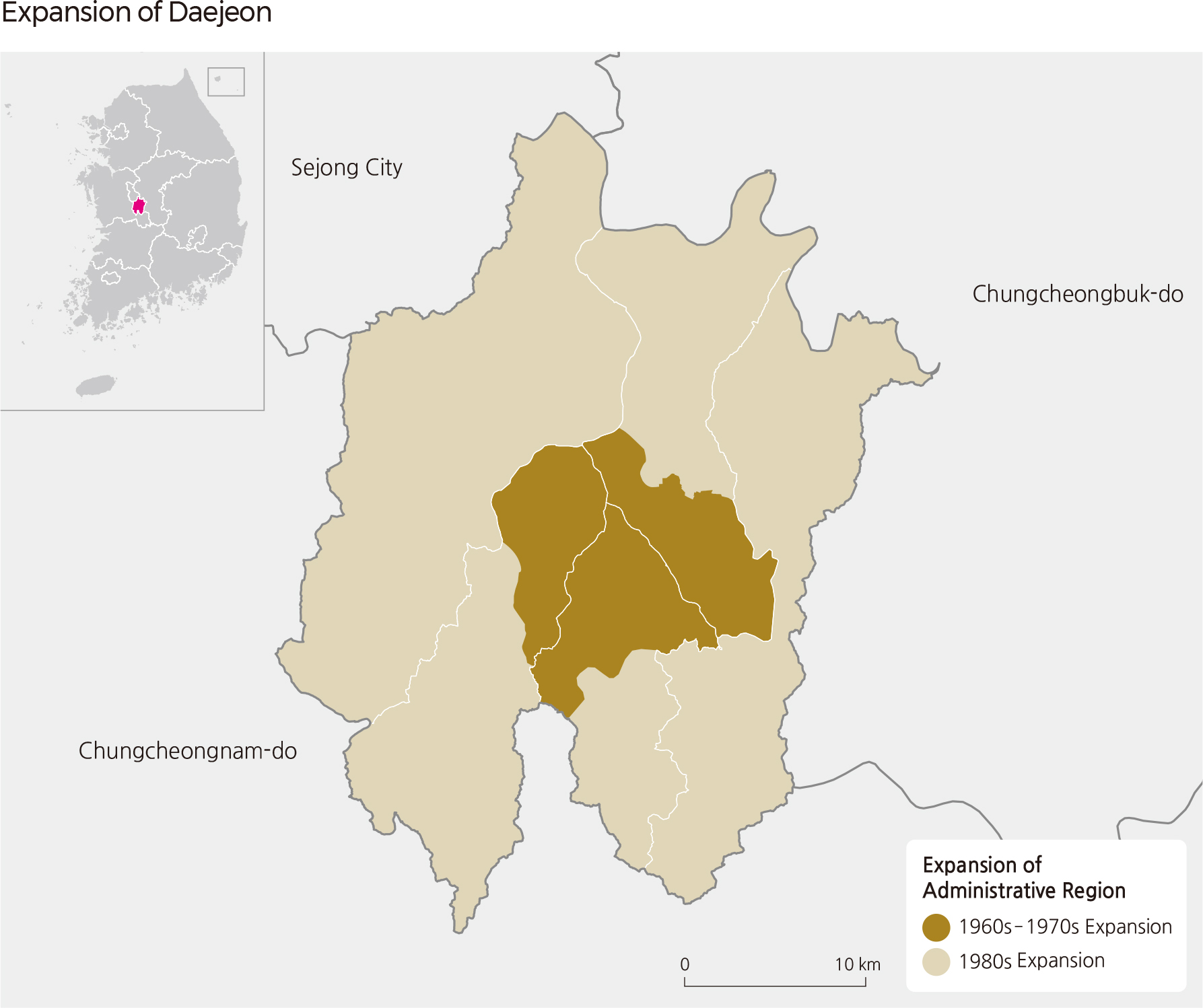
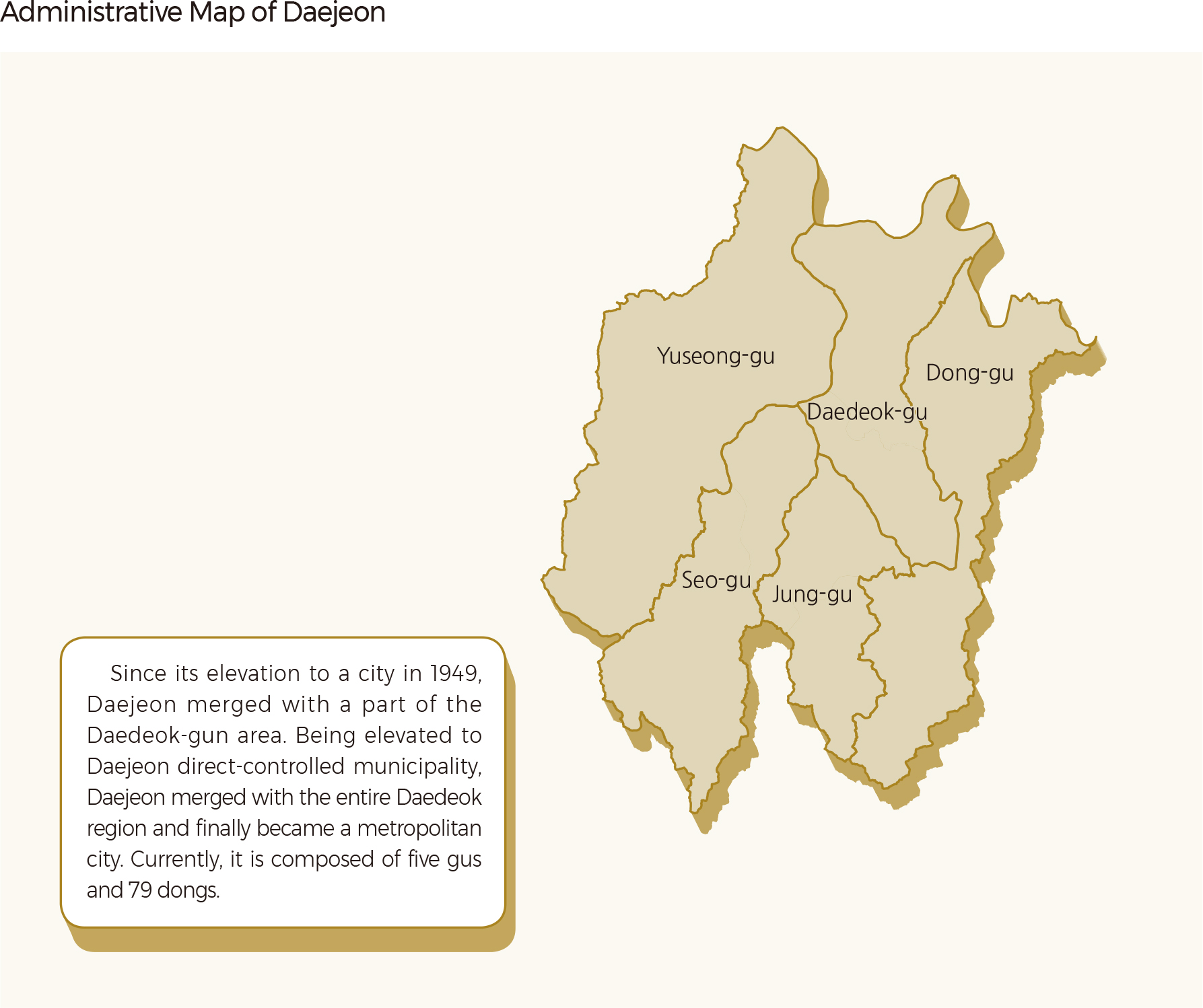
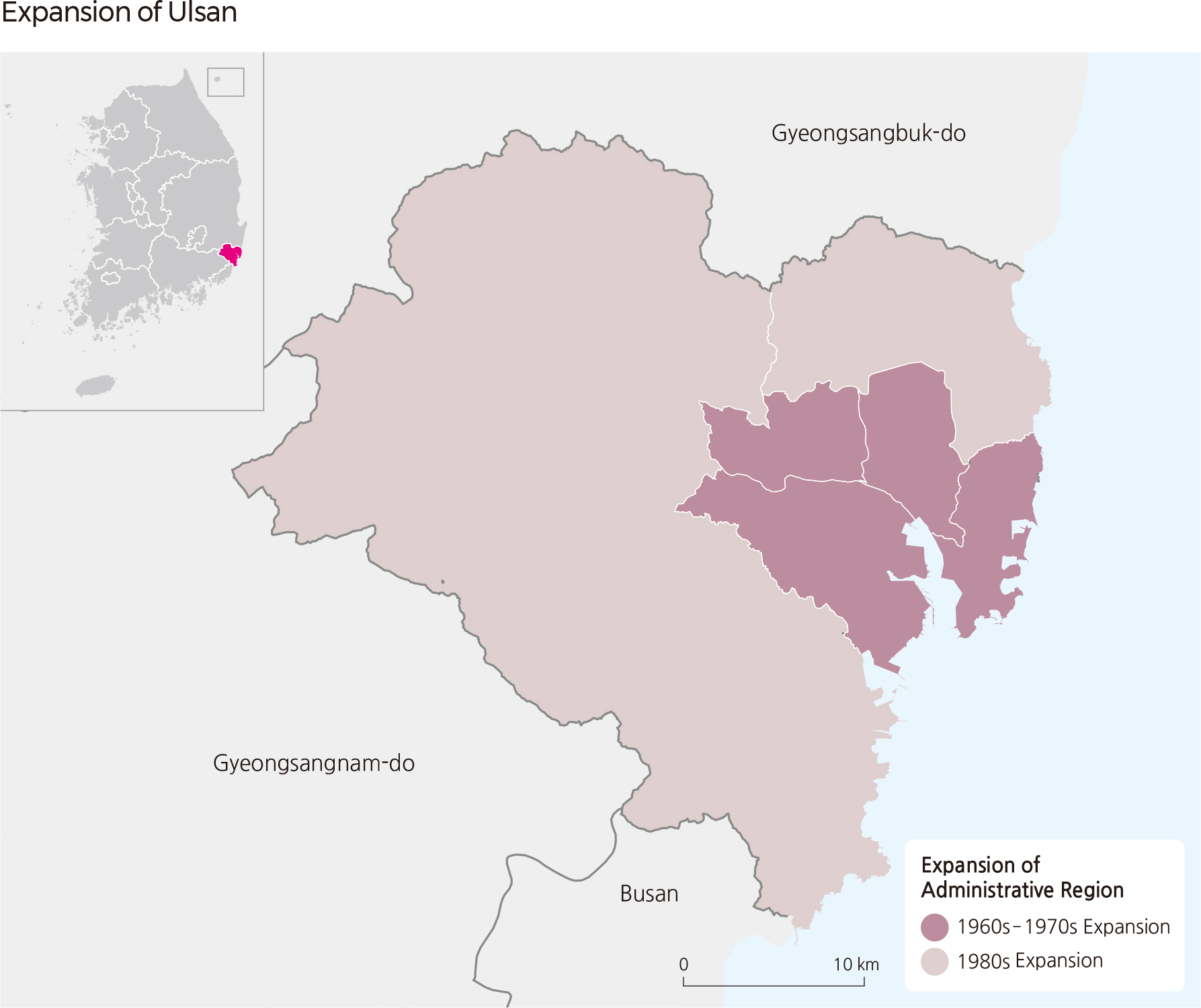
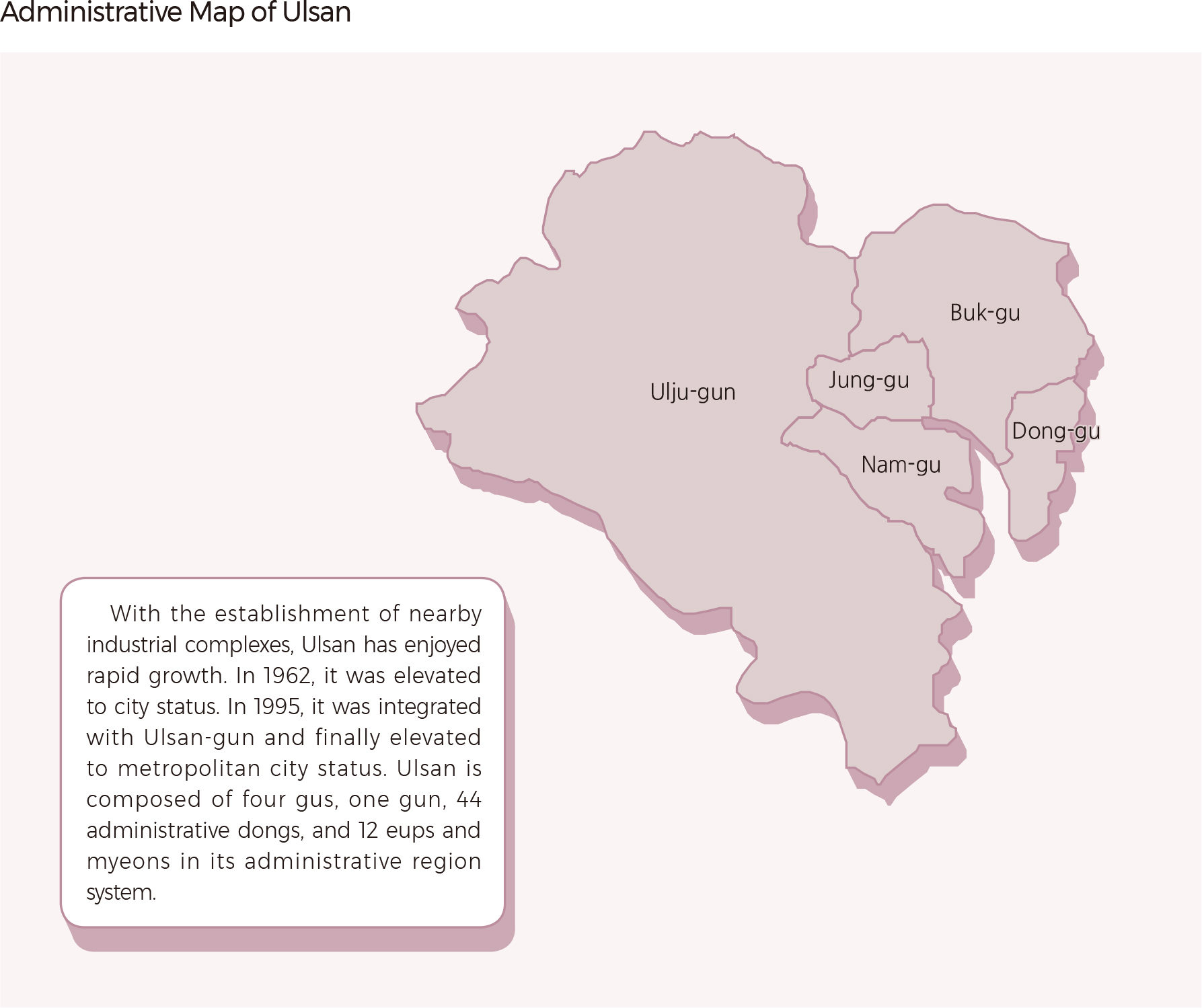
Like Seoul, six other metropolitan cities have gone through increases in population and have expanded their administrative areas. In 1995, metropolitan cities, serving as hub cities in the local area, were reorganized by integrating surrounding areas and became directly-controlled municipalities. |
