English I 2019
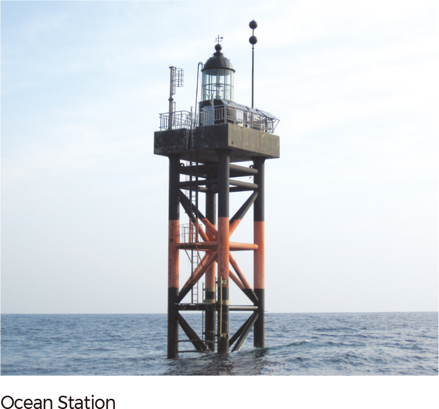
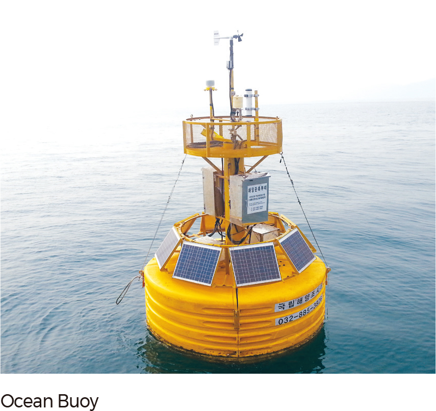
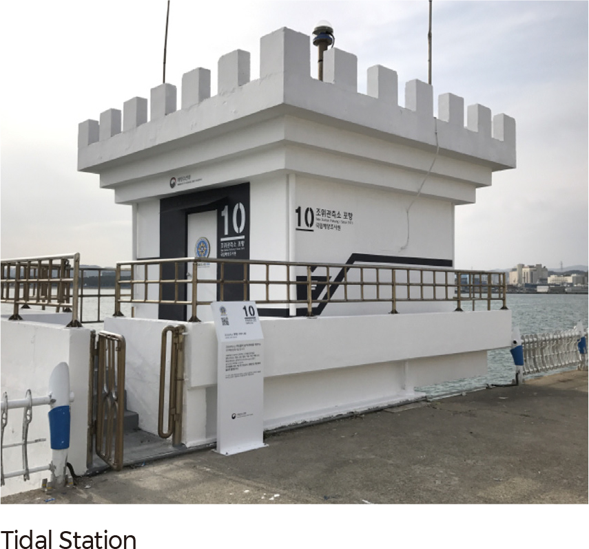
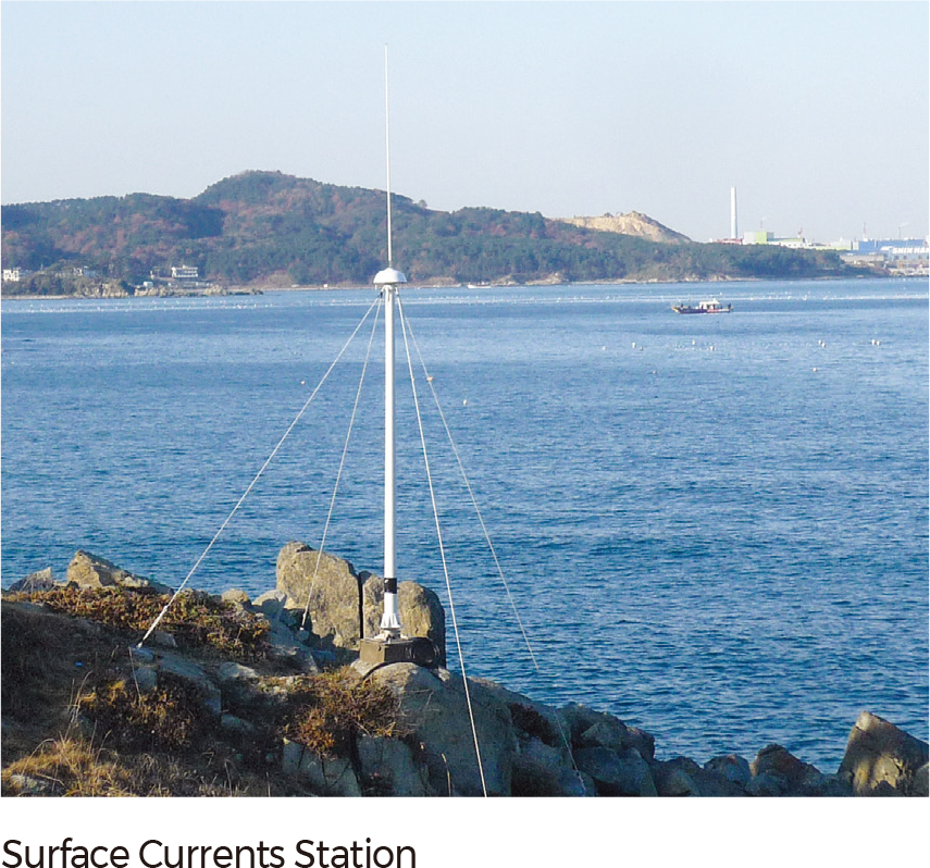
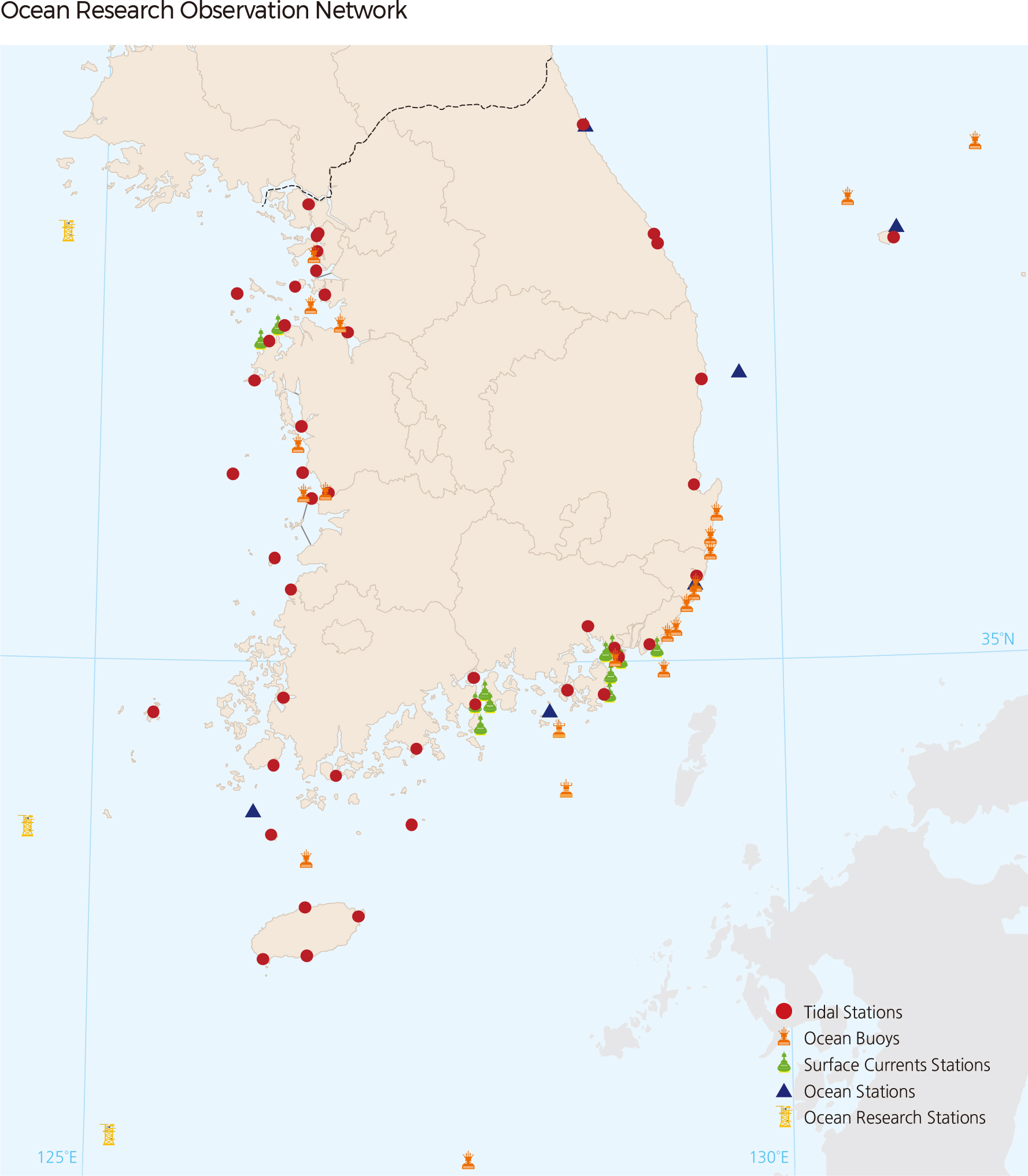
Research on the waters surrounding Korea has significant meaning to the national territory in addition to data collection and research support. Korea has installed its own Ocean Observing Network (KOON) consisting of tidal stations, ocean stations, ocean buoys, surface currents stations, and ocean research stations. All these stations collect, analyze, and transmit various data related to the tides, water temperatures, waves, ocean currents, and ocean weather. This information has been used for the protection of the coastal environment and maritime safety management.
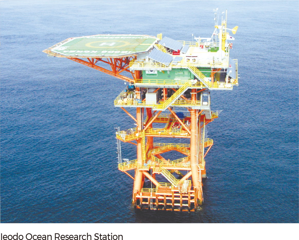
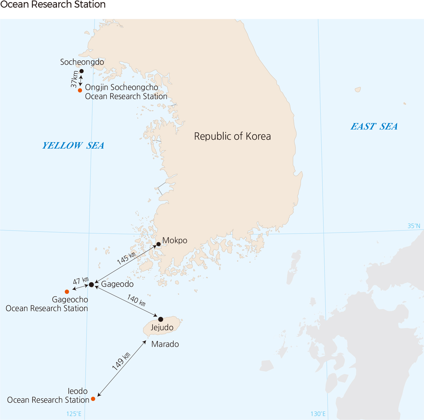
As a symbol of the Korean people’s interest in the Ieodo area, the Ieodo Ocean Research Station was established by the Korea Ocean Research & Development Institute to provide real-time maritime and meteorological information, forecast typhoons, and discover characteristics of climate change and oceanic environments in the Northwest Pacific. Construction was started in 1995 with an investment of 21.2 billion KRW (Korean Won) and was completed on June 11, 2003.
Built on top of a submerged rock 40 m deep, the gross floor area of the station is 1,320 m²; its altitude is 36 m above sea level, and its full height from its underwater base is 76 m. The Ieodo station (32˚ 07' 22.63'' N, 125˚ 10' 56.81'' E) is located 149 km southwest of Marado, Jeju, Korea, 276 km west of Japan’s Tori-Shima (鳥島), and 287 km northeast of China’s Sheshan Dao (余山島). The purpose of the station is to observe the constantly varying conditions of the ocean, the weather, and its surrounding environment. Since more than 60% of the typhoons that land on the Korean Peninsula pass over the Ieodo Ocean Research Station, the station serves a crucial role in the observation, data collection, research, and forecasting of typhoons. Additionally, it functions as a lighthouse that secures the safe passage of vessels, and as a frontier base for search and rescue efforts for marine accidents. Staff members of the Korea Ocean R&D Institute conduct observation device check-ups at the station. The station is equipped with 13 types of high-end meteorological observation equipment, 20 types of ocean observation equipment, six types of environmental observation equipment, and four types of structural safety measurement equipment. It is an unmanned oceanic research station. The observed data is transmitted to the Korea Ocean R&D Institute and the Korea Meteorological Administration in real-time using the Mugunghwa satellite.
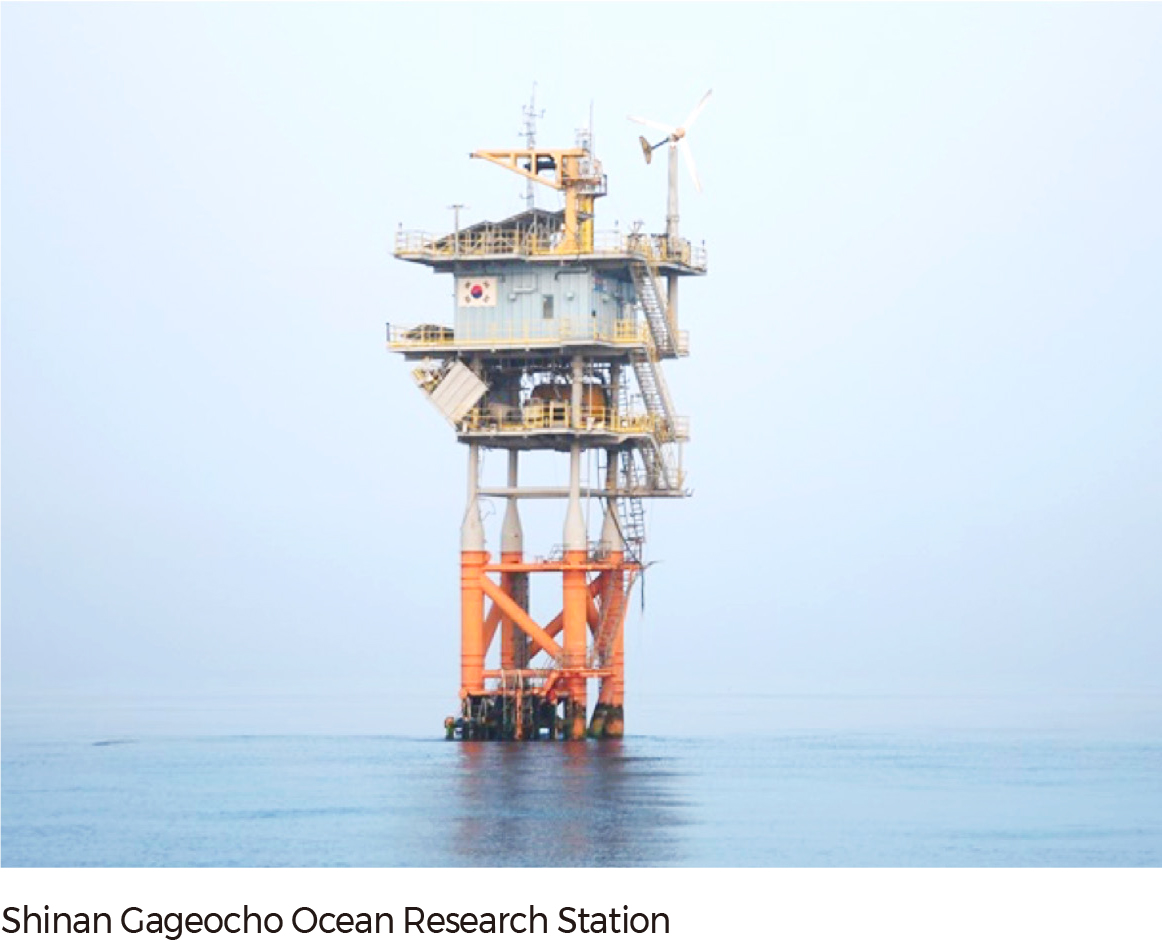
The Gageocho Ocean Research Station was completed on October 13, 2009. Built on top of a submerged rock 25 m deep, the gross floor area of the station is 286 m²; its altitude is 31 m above sea level, and its full height from its underwater base is 46 m. The Gageocho station (33˚ 56' 30.96'' N, 124˚ 35' 34.23'' E) is located 47 km west of Korea’s Gageocho Island. The Gageocho Station plays a role supporting a diverse range of research and data collection activities with observations on the atmosphere and oceanic conditions. It supports relevant oceanic industries such as fisheries, marine transportation, and marine leisure by disseminating real-time oceanic and meteorological data via the Internet. It also play a role in curbing damage incurred by natural disasters by improving the accuracy in oceanic and meteorological forecasts.
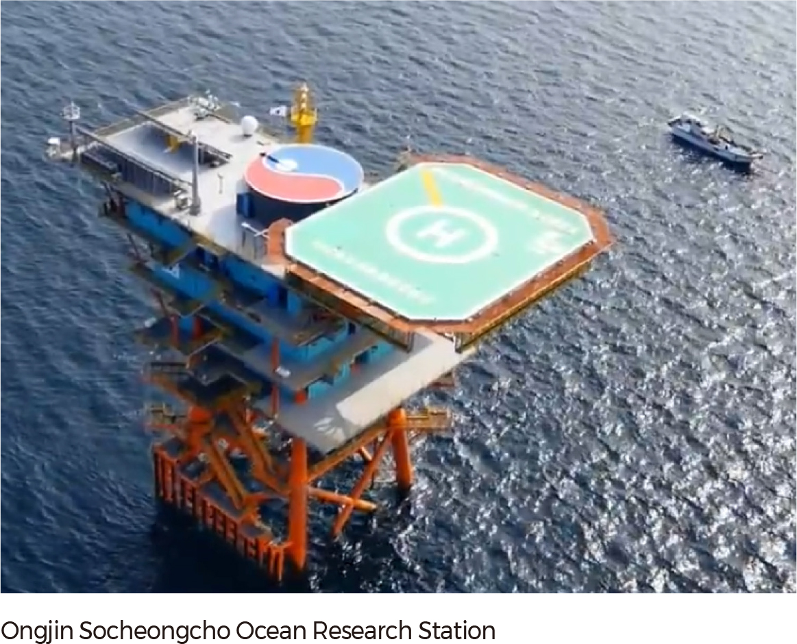
Structures for Ongjin Socheongcho Ocean Research Station were manufactured and installed by the Korea Institute of Ocean Science & Technology (KIOST) from 2011 to 2014. With the pilot operation conducted from 2014 through 2015, the entire facility was transferred to Ongjin Socheongcho Ocean Research Center on January 1st, 2016. The floor area of the station is 2,700 m², and the full height from its underwater base is 90 m. The Socheongcho station is located 37 km south of Korea’s Socheong-do Island and is located at 37.25˚ N, 124.44˚ E.
The Korea Ocean Observing Network (KOON) combines instruments and infrastructure to effectively manage and monitor oceanic conditions within Korea’s sovereign marine areas. It consists of tidal stations, ocean stations, ocean buoys, surface currents stations, and ocean research stations. Oceanic data collected through the network include tidal height, water temperature, salinity, wind speed, wind direction, current direction, current speed, and wave height. The collection and analysis of ocean data have enhanced the understanding of Korea’s sovereign sea areas and have improved the national capability for marine utilization, development, preservation, and climate change and disaster mitigation efforts. The construction and operation of the KOON also have been associated with the building of the ocean surveillance infrastructure for increasing the capability of the maritime defense force. These datasets are disseminated through the Korea Ocean Observing and Forecasting System (KOOFS) website. The results of scientific analyses based on the data are compiled into newsletters, yearly white papers, and abnormality reports, which are then released to 200 relevant authorities.
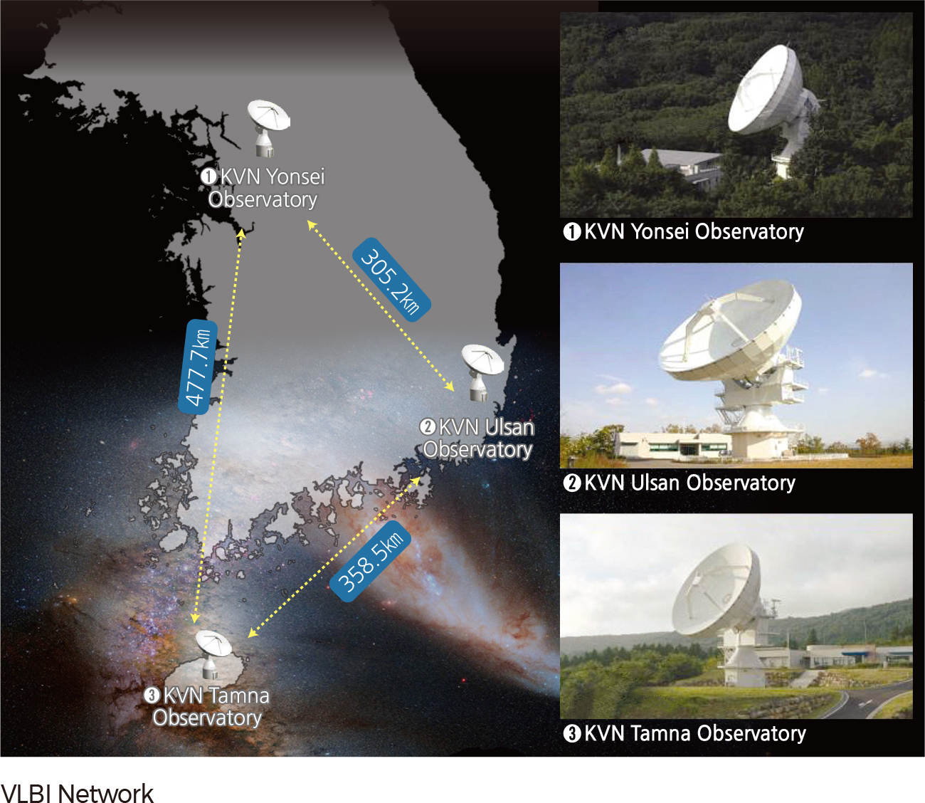
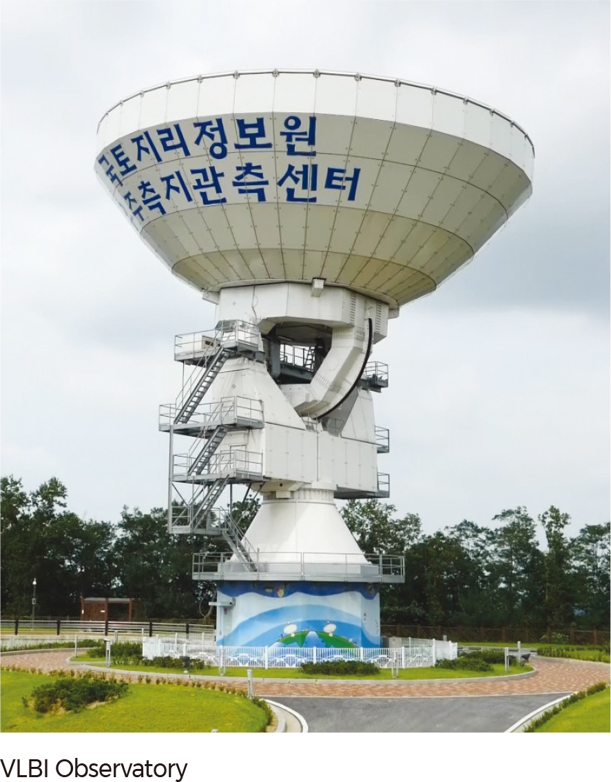
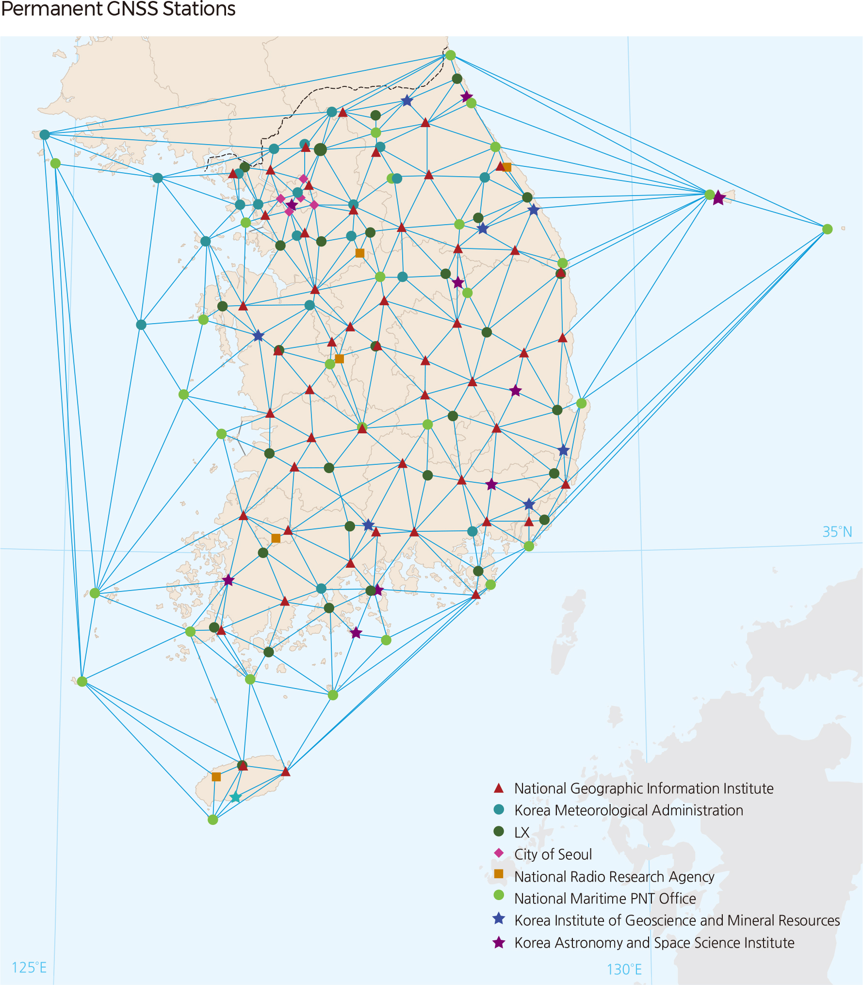
There have been illuminating, ongoing studies in the area of space and geodetic survey. For the purpose of navigation, measurement, and geodetic surveys, a total of 165 GNSS (Global Navigation Satellite System) observatories are operated by eight governmental institutions, including the National Geographic Information Institute, the Ministry of Oceans and Fisheries, the Korea Meteorological Administration, the LX, the Korea Astronomy and Space Science Institute, and the Korea Institute of Geoscience and Mineral Resources. The system provides information on location, altitude, and the speed of objects on Earth using satellites. VLBI (Very Long Baseline Interferometry) technology has been used to measure precise locations of control points and the movement of the Earth from space. There are two kinds of VLBI stations: one type for research (in Seoul, Ulsan, and Jeju) and the other for the geodetic survey (Sejong Metropolitan Autonomous City).
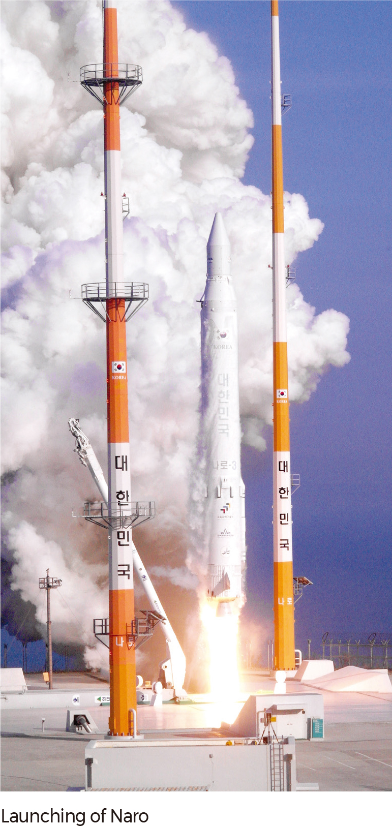
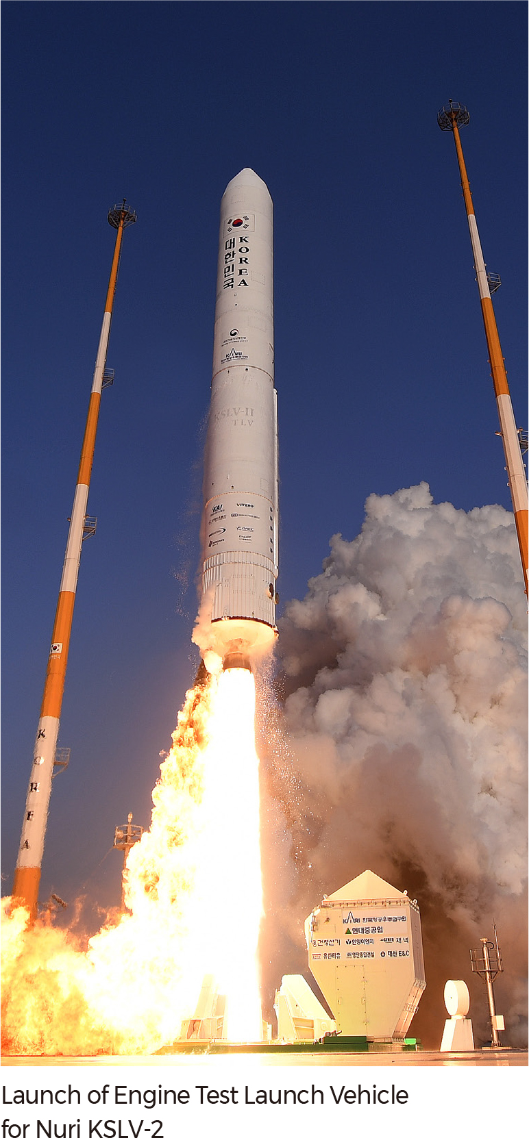
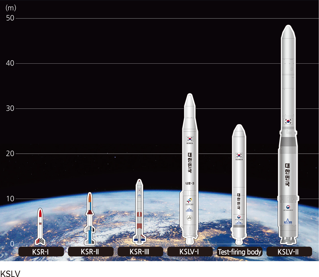
Since the 1990s there have been extensive research efforts concerning space in Korea. To date, seven science and technology satellites, four multi-purpose satellites, and one geostationary satellite have been launched. Eleven satellites, including five satellites that are currently under development, will be launched by 2020. Three scientific rockets have been launched to gain launch capability. A space center was constructed on Narodo in Goheung-gun, Jeollanam-do in 2009. A KSLV-1 (Naro) rocket equipped with a 100 kg-class satellite was successfully launched in 2013. An engine test for the development of the second KSLV was successfully conducted in 2018. Launch of a vehicle that can carry a 1,500 kg-class satellite, KSLV-2 (Nuri) is planned for 2021. |