English I 2019
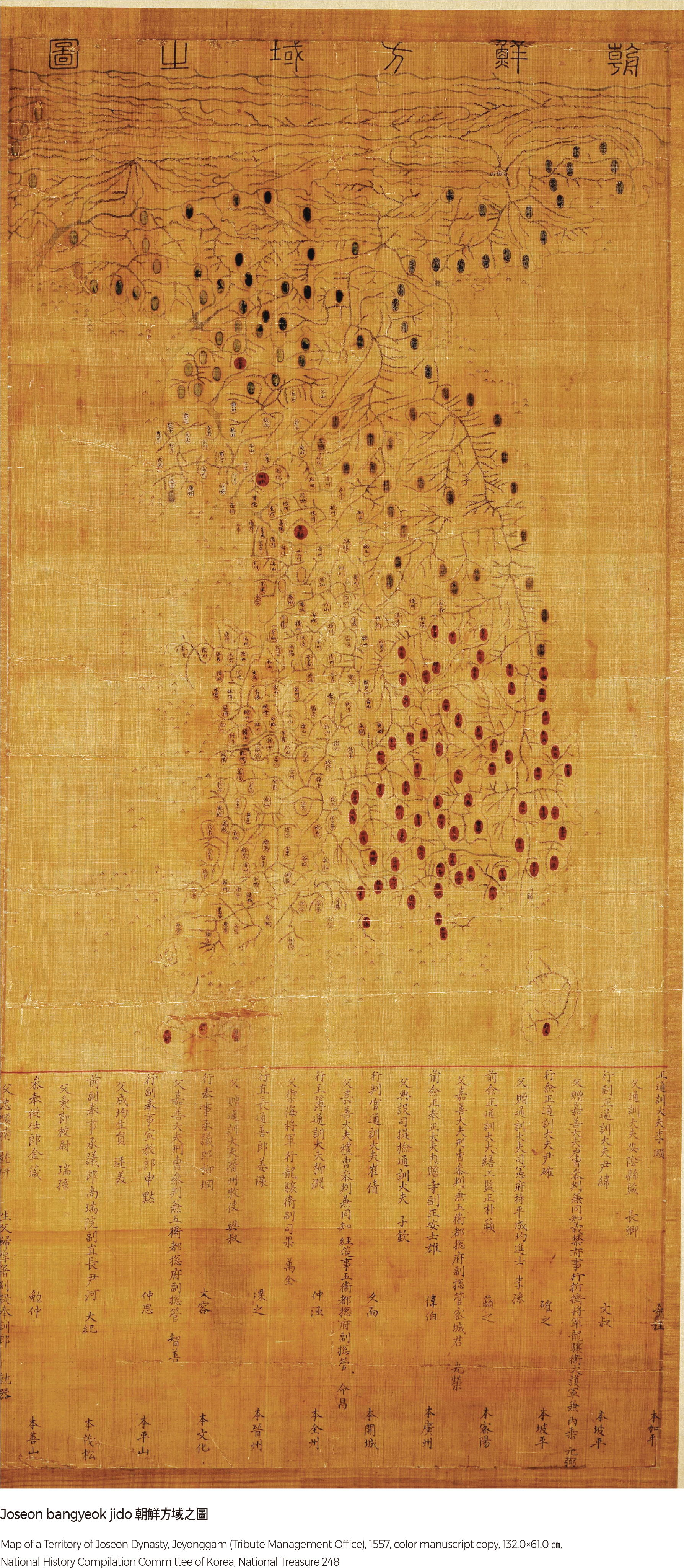
Joseon bangyeok jido
This is a complete map, which contains both a clear identification of the cartographer and the year of its making. It was created by Jeyonggam (the Tribute Management Office), which was in charge of the supply of royal garments and food. Scientific mapmaking projects were initiated in the early Joseon Dynasty during the reign of King Sejong, resulting in the publication of the cumulative geographic knowledge portrayed in the Dongkuk jido (Map of Korea) by Jeong Cheok and Yang Seong-ji. The Joseon bangyeok jido is supposedly a copy of the Dongkuk jido. The name of the map appears at the top, the map itself is at the center, and the list of participating officials is at the bottom. The geographic features of the mid and southern parts of Korea are relatively precise, but those in the north are rather distorted. The drainage patterns are very accurate, except for the Amnokgang River and the Dumangang River; mountain ranges are expressed in the form of mountain chains based on the traditional geomantic understanding of the land.
Aguk chongdo
Resembling the style and design of the Dongkuk jido made by Jeong Sang-ki, the Aguk chongdo presents the beauty of Korean territory in an exquisite manner. This map is notable for its use of vivid color: green for mountain ranges, blue for rivers, and five distinctive colors for different counties and prefectures. Provincial offices and barracks in eight provinces were circled and marked with respective place names to make them distinguishable. Islands off the coasts of Joseon were drawn in detail, implying the growing national interest in the coastal and insular regions.
Dokdo in the East Sea is identified to the east of Ulleungdo under the name Udo, and Tsushima is also portrayed on the map. The marginal spaces were filled with the frontier territory, the respective lengths of east to west and south to north distances to Seoul from the endpoints in all four directions, and the number of counties and prefectures in each province.
Daedong yeojido
The Daedong yeojido, made by Kim Jeong-ho, is a splendid achievement that built upon previous cartographic develop-ments during the Joseon Dynasty. Its scale is approximately 1:160,000. Kim divided the territory from north to south into 22 sections (each 120-ri). Each section is folded at every 80-ri and collapses into a folding booklet. The 22 booklets can be unfolded and pieced together to form a complete map of Korea that measures 410 cm in width and 660 cm in length. The method of description reflected the principles of partition and unity of the mountains and the streams. Various legends were used, and the pathways were marked for every 10-ri. Above all, the map is an impeccable masterpiece with greater artistic beauty than any other map ever produced during the Joseon Dynasty. |