Comprehensive Edition 2022
A monitoring network is used to evaluate the status of water quality and aquatic ecosystems in rivers and lakes, with measurements collected at some 2,249 sites across South Korea. Data on water pollution are publicized through the Water Resources Management Information System (www.wamis.go.kr). To protect the water quality of the water source regions, the Water Supply and Waterworks Installation Act designated a 1,136 km2 water-source protection area. In this zone, discharges of hazardous chemicals, waste, sewage, and excreta are prohibited. As a result of these efforts, the water quality of the four major rivers is gradually improving, while biochemical oxygen demand (BOD) and total phosphorus (TP), which are indicators of eutrophication, are decreasing.
South Korea also regularly monitors the marine environment and sources of marine pollution. The marine environment monitoring network collects information used to establish national management and conservation policies. This network has a total of 425 stations. To monitor coastal pollution, an automatic network of seawater quality monitoring also collects data on the water quality of estuaries and pollution hot spots. The information from these networks is provided through the Marine Environment Information System (www.meis.go.kr).
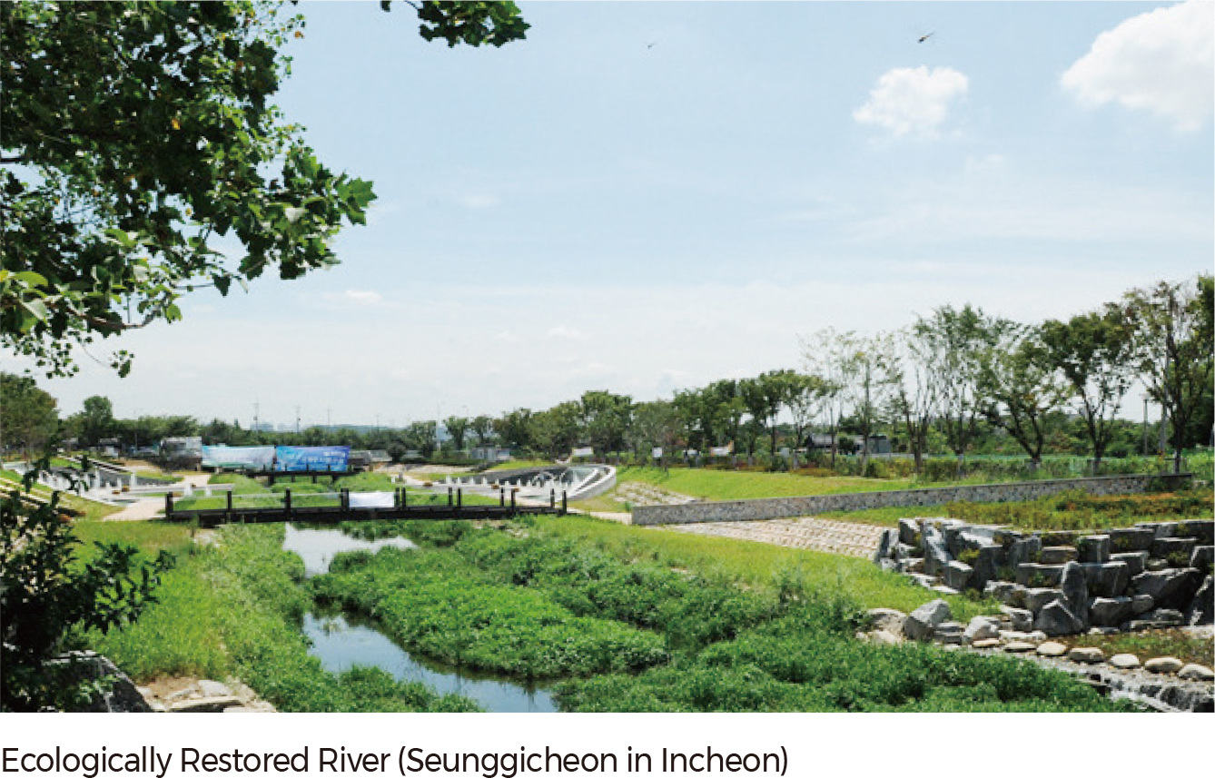
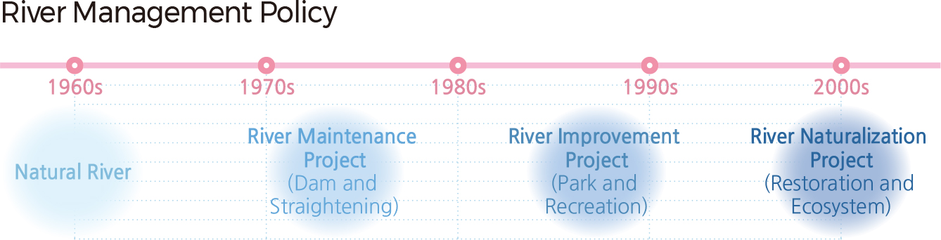
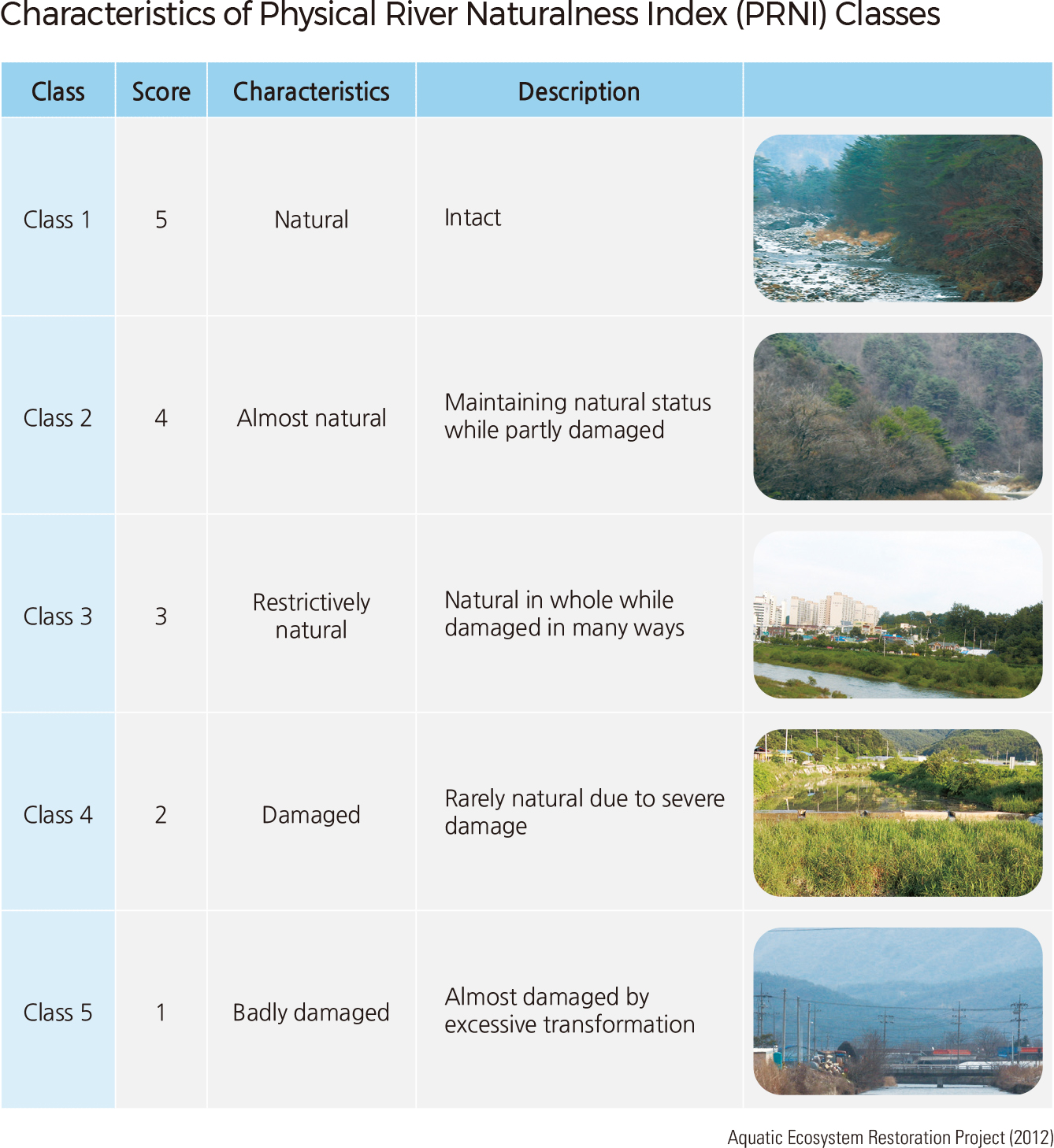
Until the 1960s, most rivers in Korea were in their natural form. However, during the rapid urbanization of the 1970s, many streams were covered or re-routed. In rural areas, many meandering channels were straightened and dams were constructed for irrigation, drinking water, and hydroelectricity. As environmental issues gained prominence in the 1990s, various improvement projects, such as the construction of waterfront parks and promenades, were started in areas near rivers. In the 2000s, as people began to recognize the ecological value of rivers and wetlands, projects were started to restore rivers to their natural form. As an example, the Aquatic Ecosystem Restoration Project developed the Physical River Naturalness Index (PRNI) to help identify streams most critically in need of conservation and restoration. Stream classifications range from badly damaged to natural. Stream restoration efforts improve water quality, decrease flooding hazards, and improve habitat for aquatic animals such as fish. Fish habitat maps are useful for monitoring fish populations and identifying potential threats. |