Comprehensive Edition 2022
The Korean Peninsula spans a large range of latitudes and of altitudes, allowing for a rich diversity of environmental conditions, habitats, landscapes, and human activities. Altitudes range from sea level to over 2,740 m at the highest peak. The peninsula stretches between 33 and 44 degrees north latitude and between 124 and 132 degrees east longitude. This latitudinal position, along with the proximity of the ocean, gives Korea warm, humid summers and cold, relatively dry winters. The peninsula is surrounded on three sides by water and bounded on the north by the nations of China and Russia. The four edges of the territory of Korea are marked by: Bidanseom Island at the westernmost point, Yuwonjin at the northernmost point, Dokdo at the easternmost point, and Marado Island at the southernmost point. These four points encompass an area that ranges 1,145 km north-to-south and 730 km east-to-west.
The map at left depicts the broad patterns of physical features and the marks of human activities that give the peninsula its variable appearance.
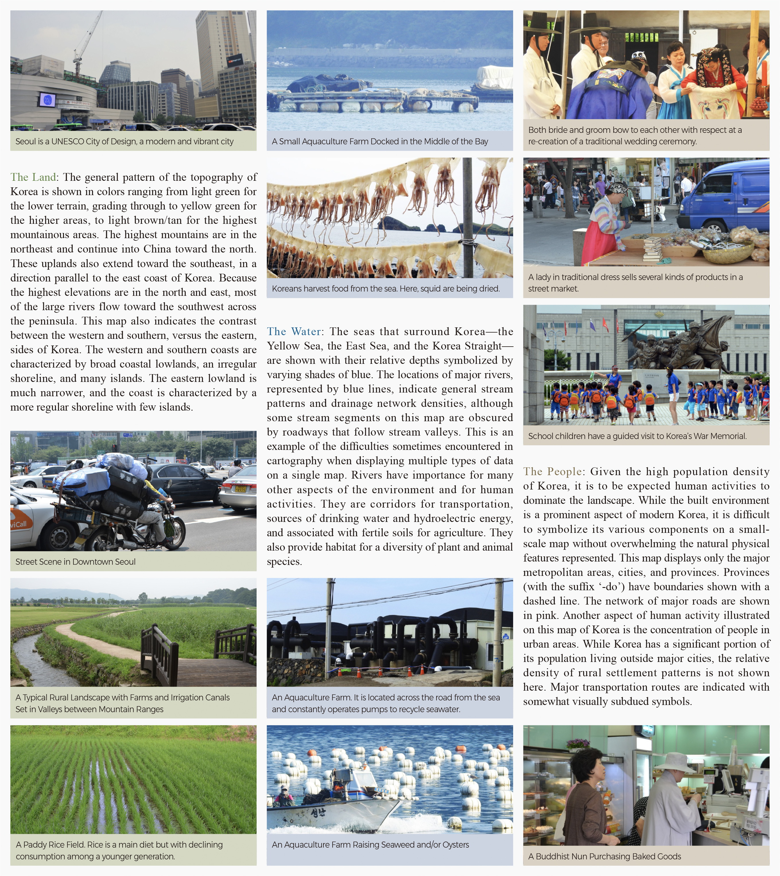
The Land: The general pattern of the topography of Korea is shown in colors ranging from light green for the lower terrain, grading through to yellow green for the higher areas, to light brown/tan for the highest mountainous areas. The highest mountains are in the northeast and continue into China toward the north. These uplands also extend toward the southeast, in a direction parallel to the east coast of Korea. Because the highest elevations are in the north and east, most of the large rivers flow toward the southwest across the peninsula. This map also indicates the contrast between the western and southern, versus the eastern, sides of Korea. The western and southern coasts are characterized by broad coastal lowlands, an irregular shoreline, and many islands. The eastern lowland is much narrower, and the coast is characterized by a more regular shoreline with few islands.
The Water: The seas that surround Korea—the Yellow Sea, the East Sea, and the Korea Straight—are shown with their relative depths symbolized by varying shades of blue. The locations of major rivers, represented by blue lines, indicate general stream patterns and drainage network densities, although some stream segments on this map are obscured by roadways that follow stream valleys. This is an example of the difficulties sometimes encountered in cartography when displaying multiple types of data on a single map. Rivers have importance for many other aspects of the environment and for human activities. They are corridors for transportation, sources of drinking water and hydroelectric energy, and associated with fertile soils for agriculture. They also provide habitat for a diversity of plant and animal species.
The People: Given the high population density of Korea, it is to be expected human activities to dominate the landscape. While the built environment is a prominent aspect of modern Korea, it is difficult to symbolize its various components on a small-scale map without overwhelming the natural physical features represented. This map displays only the major metropolitan areas, cities, and provinces. Provinces (with the suffix ‘-do’) have boundaries shown with a dashed line. The network of major roads are shown in pink. Another aspect of human activity illustrated on this map of Korea is the concentration of people in urban areas. While Korea has a significant portion of its population living outside major cities, the relative density of rural settlement patterns is not shown here. Major transportation routes are indicated with somewhat visually subdued symbols.
The extent of the domain of coastal nations into the ocean can be a controversial point of international debate. On this map, a Straight Baseline and a Territorial Water Line are shown prominently. A Straight Baseline is drawn in coastal areas with irregular shorelines and/or with numerous small, scattered islands. Points are first identified on land or on islands and then joined to form the baseline. Such a baseline can then be used to define or delineate territorial waters. Further seaward lies the Territorial Water Line, which sets the territorial limit of a nation’s sovereignty. Sovereignty refers to the land, sea, and air space that belong to the nation; under international law, these spaces cannot be violated or accessed without permission. Offshore islands that belong to a nation also have delineated territorial water lines to limit that nation’s sovereignty. In the case of South Korea, the Territorial Water Lines are clearly marked for Ulleungdo and the Dokdo Islands on this map. |

