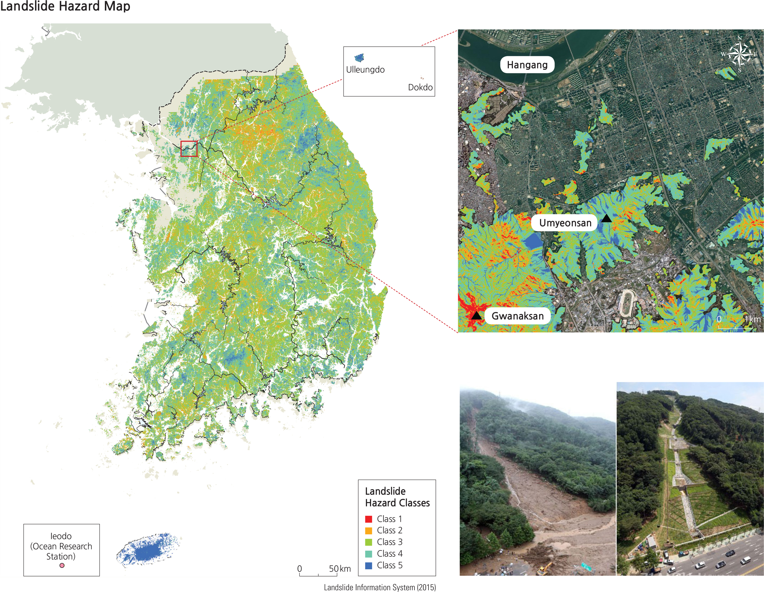
In mountainous regions with slope angles of over 30 degrees, landslides can be triggered by heavy rains, and less-commonly by earthquakes, volcanic eruptions, and even thunder. It can be very hard to predict landslides because they most often occur when heavy rains saturate the soil in a short period of time. Landslides generally cause less total damage to property than floods, because they have a more limited extent, but they can cause more casualties.
A landslide hazard map is used to better anticipate landslides. Five risk classes are determined based on internal and external triggering factors for landslides. Detailed risk maps are useful tools for planning development and emergency response. The photos above show a landslide which caused 67 casualties in the Umyeonsan area in July 2011. The image at right shows the area after it has been repaired and stabilized following the landslide.
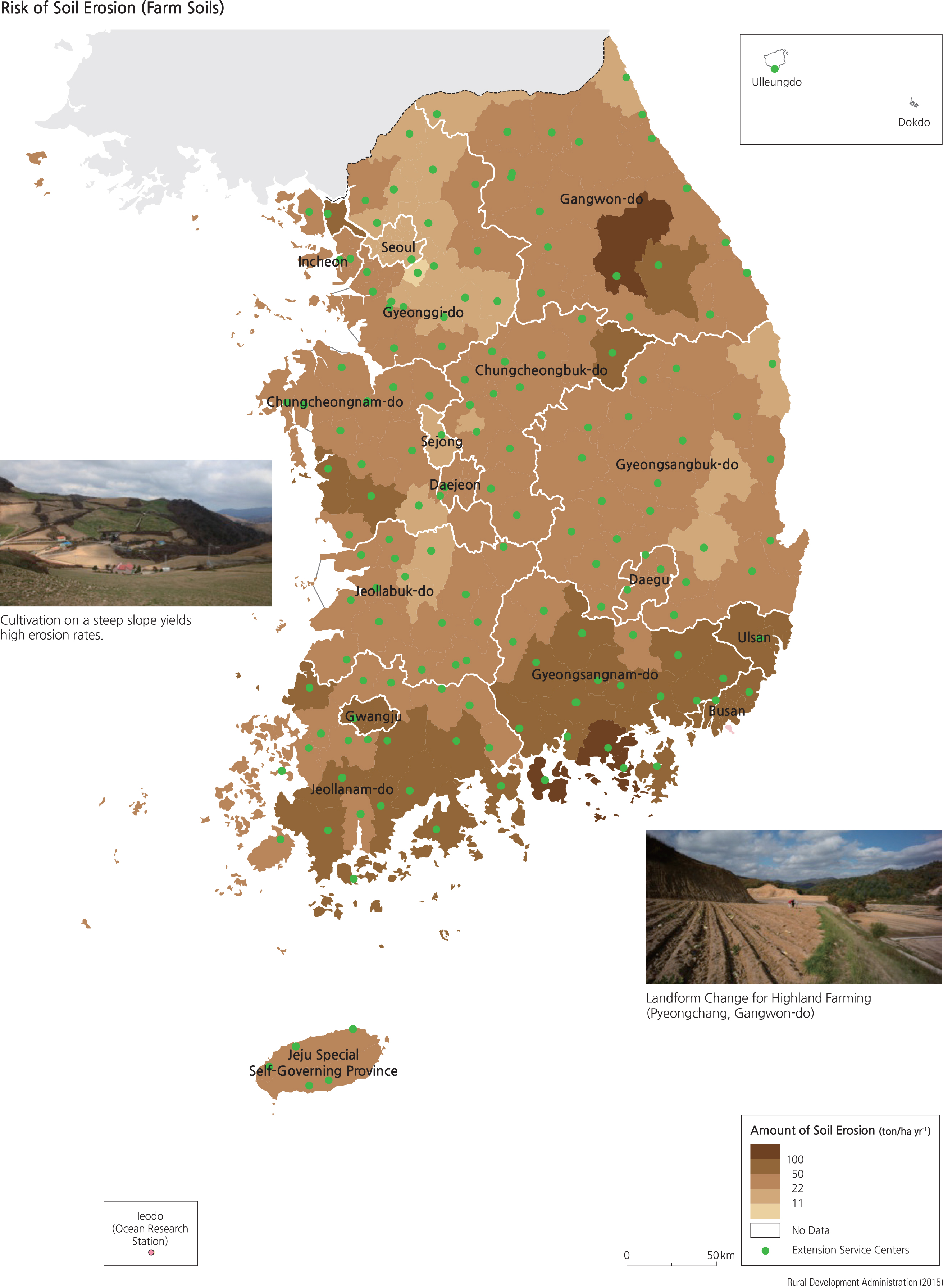
A less dramatic but still costly problem is that of soil erosion. Currently the annual net loss of soil is estimated to be more than 50 million tons, mostly removed from agricultural lands. The total loss is about 37.7 tons per hectare on average from farm fields, about ten times the loss rate from forests. Recent expansion of farms to highland areas has added to the rapid soil loss. Eroded soil eventually flows into nearby streams, impairing water quality and causing difficulties for aquatic organisms.
As with landslides, the risk of soil erosion is greater in areas that receive more intense rainfall and which have steeper slopes. Crop management practices also greatly influence erosion risks. To combat soil erosion, Korea has established agricultural technology centers across the country to encourage proper soil management practices. They develop and disseminate new crop breeds, educate about proper cultivation, and evaluate and treat soils for enhanced productivity.