Although the Korean Peninsula does not lie directly along a tectonic plate boundary, as does Japan, nevertheless earthquakes can occur in Korea. There are historical records of strong earthquakes in the past that resulted in casualties and damage to structures. For example, during the reign of King Injo, in 1643, a strong earthquake collapsed castle walls in the Ulsan area and caused a tsunami.
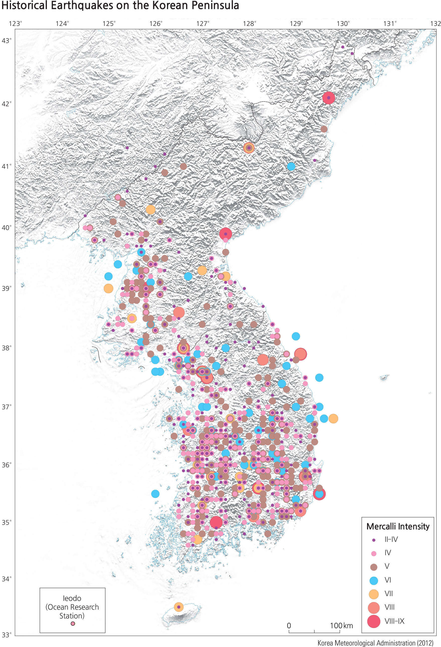
The Korean Meteorological Association and the Korean Institute of Geology and Mining operate 180 stations that monitor seismic activity. The map below shows recent earthquakes with the magnitude (strength) shown by the size and color of circles. In recent times, the strongest earthquake on record occurred in 2016 near
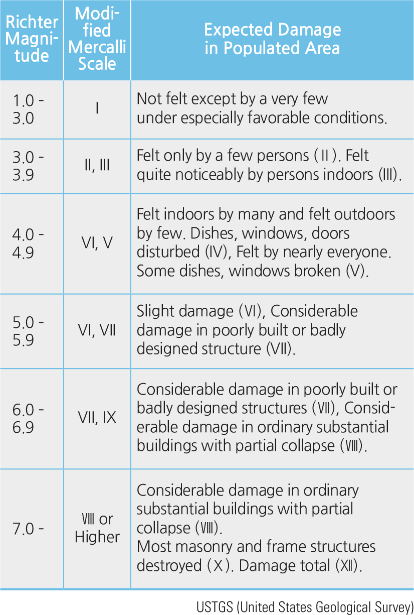
Gyeongju, with a magnitude of 5.8 on the Richter scale (see chart).
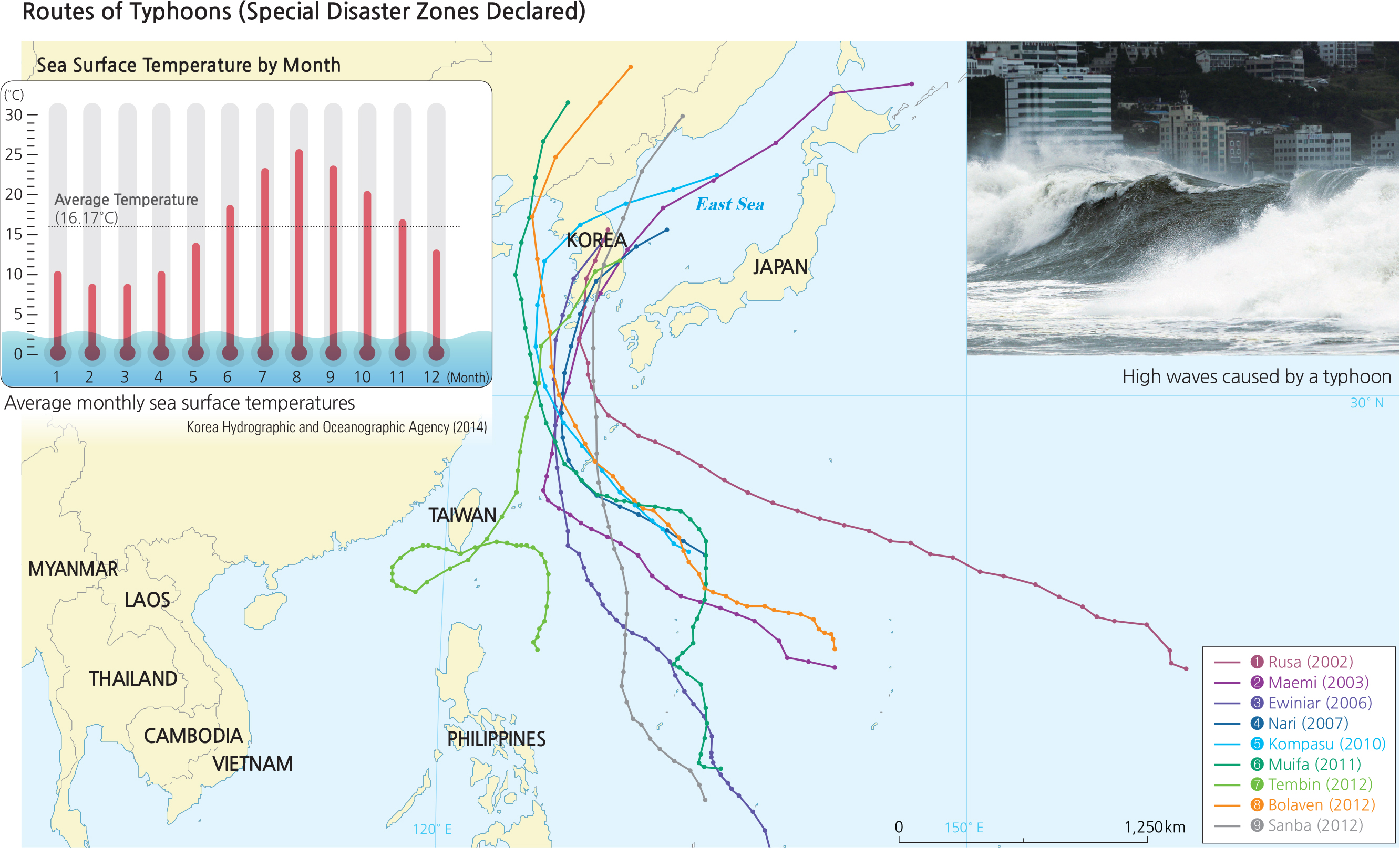
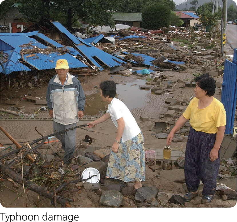
A typhoon is a type of tropical cyclone that originates in the western part of the North Pacific Ocean when sea surface temperatures are high, typically during the late summer and early autumn months. Typhoons have high wind speeds over 17 meters per second and bring with them storm surge, large waves, and heavy rains. The Korean peninsula lies in their normal path and so is at risk for severe damage from typhoons. Over the past 30 years, the worst natural disaster to hit Korea was Typhoon Rusa, in 2002, whose damage cost more than 6 trillion won.
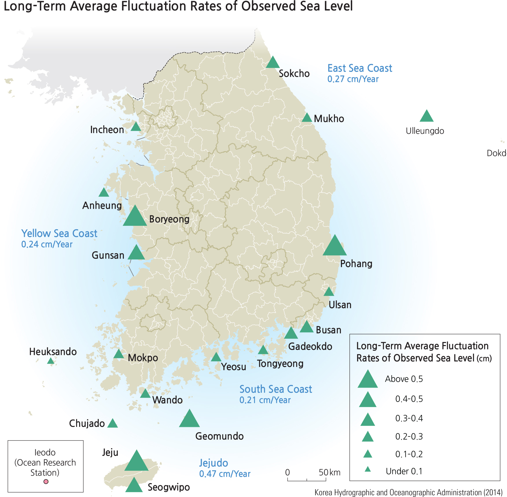
The government has responded by investing heavily in preventative measures and spreading awareness of the hazards. In addition, forecasting technologies have improved over the years, which has played a role in preparing and mitigating damage from typhoons. As a result, the number of casualties and injuries has been decreasing in recent decades. One complicating factor that makes typhoons more threatening along the coast is that sea levels are rising. Monitoring stations along the coast indicate sea level is rising at a rate of up to about half a centimeter per year. Thus the coastal flooding associated with typhoons might be expected to worsen over the next several decades.
