for Children
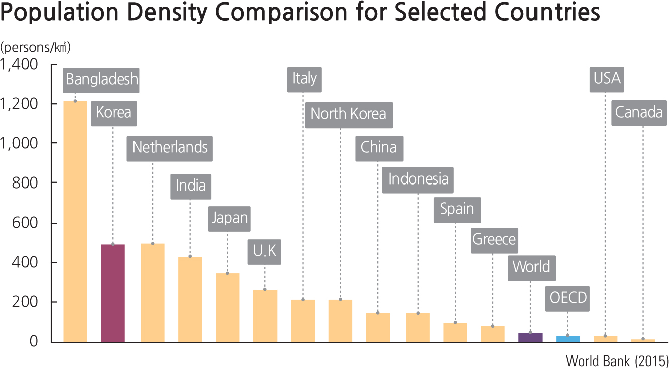
With over 50 million people, South Korea is among the most densely populated countries of the world. Since the land area of South Korea is about 100,000 square kilometers, the population density—i.e., the number of people per square kilometer—s over 500 people/㎢. (50,000,000 people / 100,000 ㎢ = 500 people / ㎢). Cities have a high population density and are very crowded. Rural or wilderness areas have a lower population density; they are more sparsely populated. Most South Koreans live in and around big cities, especially Seoul. Among large countries with over 10 million people, Korea’ population density is second only to that of Bangladesh.
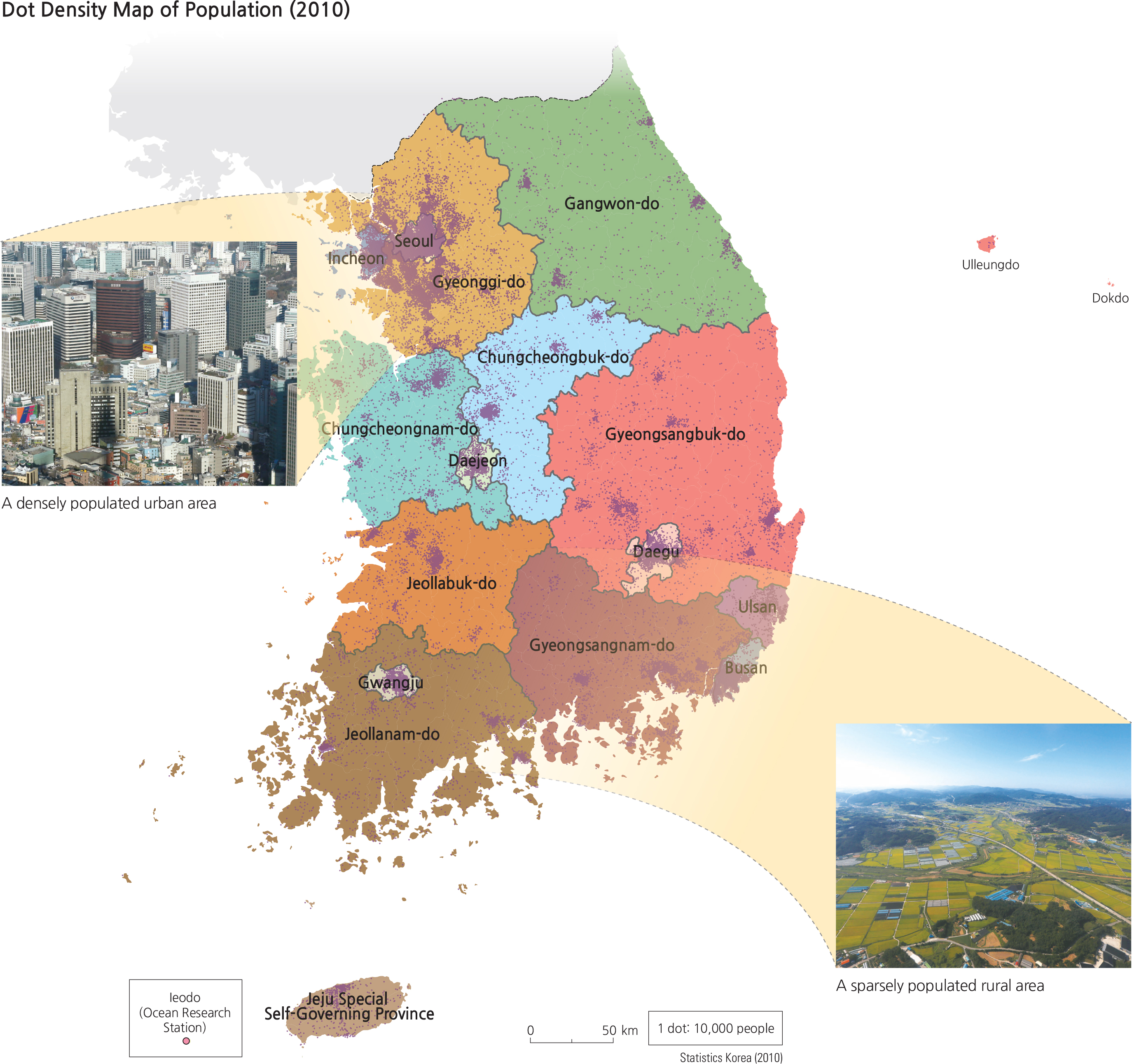
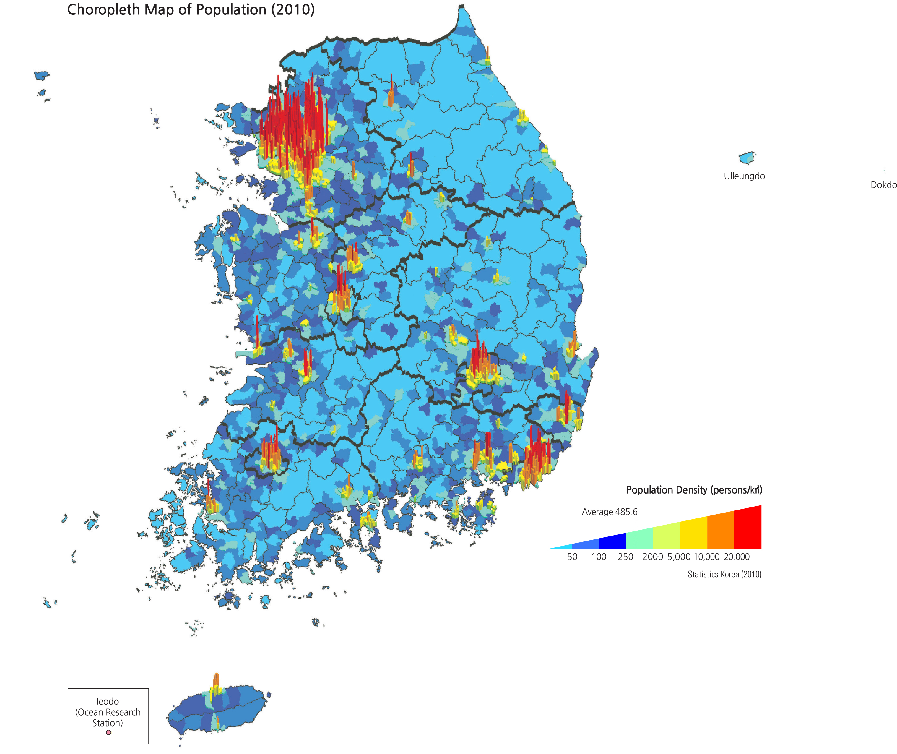
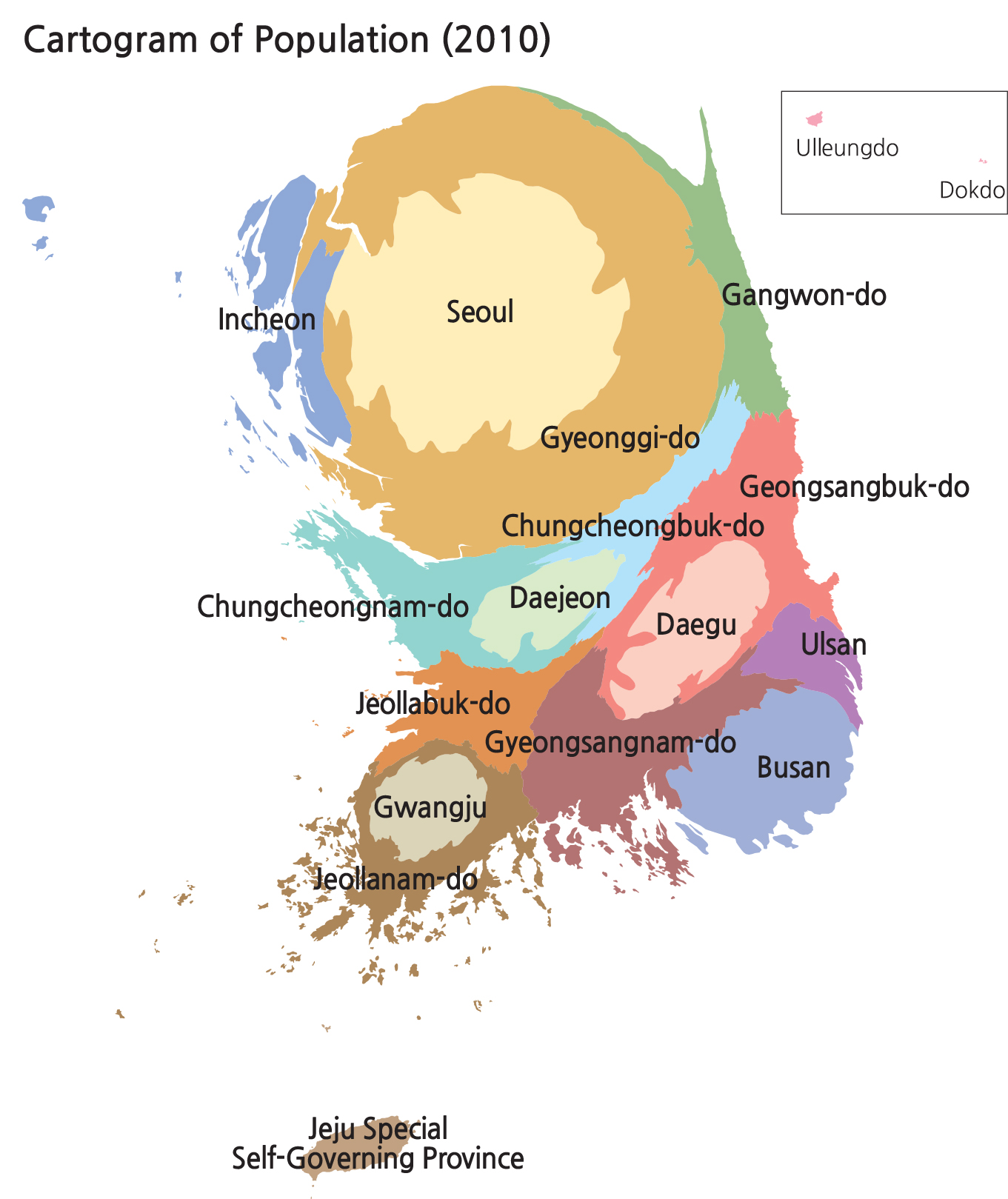
The maps on these pages show three ways to visualize population. The dot density map at left represents people with small dots. If each dot symbolized one person, there would be too many dots and they would all merge together on the map. So each dot on the map symbolizes 10,000 people. A choropleth map (above) uses color to represent population density. On this map, the warm colors (oranges
|