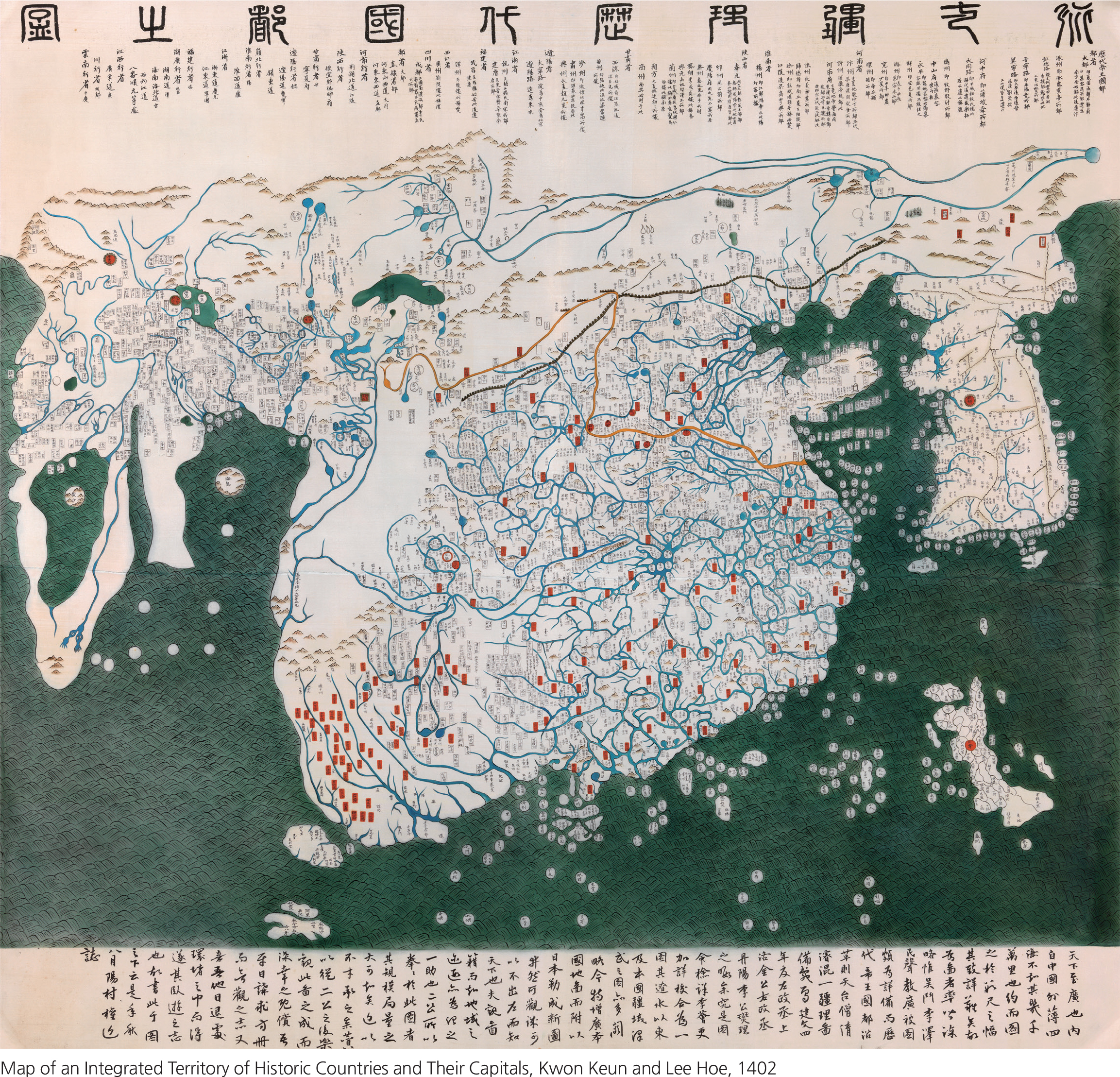
For thousands of years, Korean culture has placed great emphasis on learning and scholarship. Korea has an especially long and distinguished tradition in cartography—he art and science of making maps.
The map above was drawn by Korean cartographers in 1402 and indicates the advanced knowledge of Korea at an early age. The Korean peninsula is depicted in great detail on the right of the map. China and India are shown as a large, combined land mass at center. Japan is the island at the lower right. Though greatly distorted, Europe and Africa are drawn at far left. In general, lands farther
from Korea are more distorted and less accurate, with fewer details represented. This map was one of the best of its time and indicates the global outlook and cultural exchanges of the Joseon Dynasty (1392–910) of Korean history.
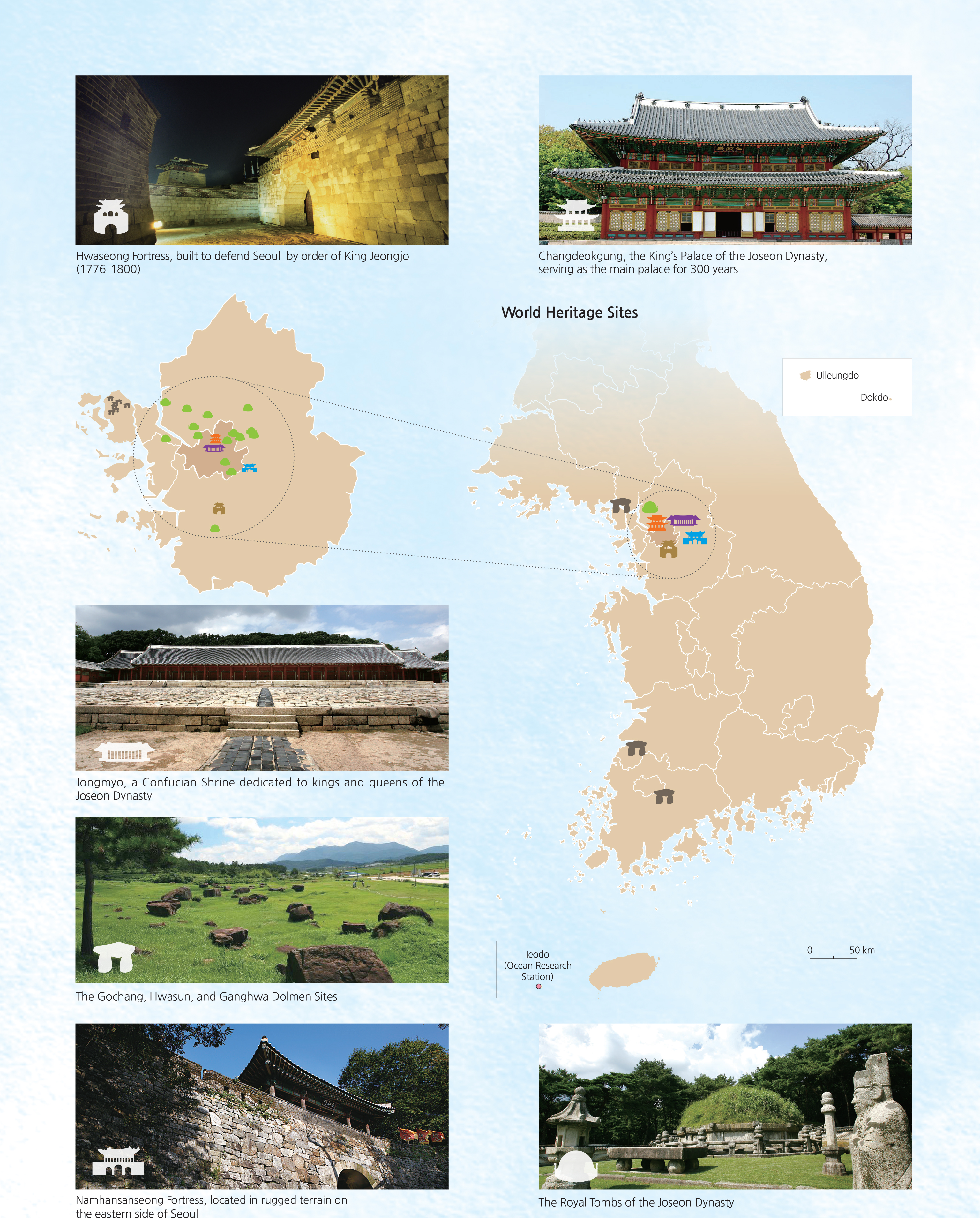
Ancient historical and prehistoric features can be seen across the landscape. The United Nations (UN) has designated many of these sites as World Cultural and Natural Heritage Sites. Some sites feature dolmens—arge, stacked boulders linked to the bronze age culture of Korea. Some dolmens served as burial markers. The impressive Royal Tombs of the Joseon Dynasty are found across 18 locations in Korea and signify the worldviews and rituals of the time periods when they were built. Other interesting sites include a palace, a Confucian shrine, and several fortresses. Scattered across the Korean landscape, these cultural monuments attest to the long and continuous nature of one of the most ancient civilizations on Earth.